
The cloud stayed blanketing the Mournes for the rest of the day but Legananny was clear and bright and fantastic.
Image credit: ryaner

The cloud stayed blanketing the Mournes for the rest of the day but Legananny was clear and bright and fantastic.

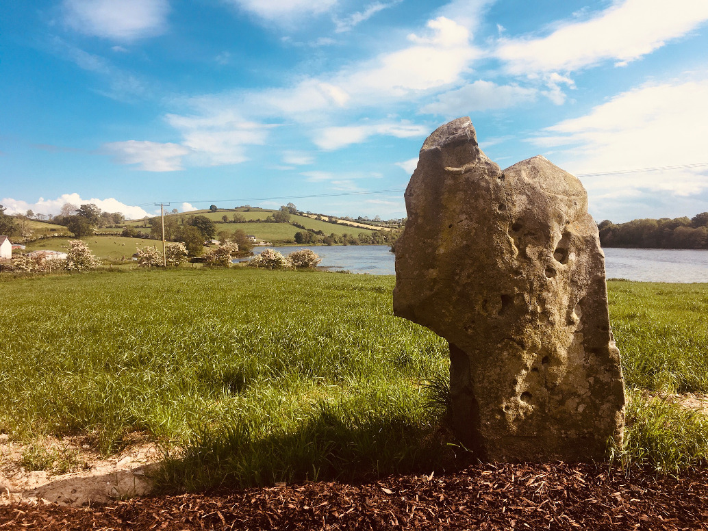

I knew this would be bad but not this bad. Two stones remain standing on one side of a gap between two fields. On the other side is a pile of boulders, one of which is said to remain in situ. What evidence that any of this is the remains of a megalithic tomb is beyond my understanding. I’m glad I stopped by but I won’t be back.


This was most definitely the highlight of a mixed bag of a day. Things had started out sunny and warm but by the time we found Clyhannagh it had been raining for about 4 hours. I’d been at the bottom of the track that leads to Clyhannagh three times before, never knowing that it’s actually publicly accessible. I knew, sensed, that the place would be special, but had always retreated.
The area has Marble Arch caves and the Stairway to Heaven walkway up Cuilcagh and can be quite busy but it’s still otherworldly. We passed by again and bounced over to Belcoo, beaten by the lack of a parking place on the very narrow road. I felt deflated, disappointed after the success at Doohaty Glebe. We saw the bullaun at Templenaffrin and decided to give it one last shot. Arriving back at the track the two visible gates were open. Ah, the joys of a 4 wheel drive.
Two hundred yards up the track we met some locals and asked their permission to go visit the megalithic tomb. The what? Yeah, well it’s a five thousand year old burial tomb. Don’t know it but sure go on ahead, you can keep going all the way to the other side. Right – thanks. See yez. Three more field gates across the track and we’re in Burren-like territory – in fact the Cavan Burren is only about 2 kilometres west of here. It’s nowhere near as eroded and grykey here as it is in Clare and the area around the tomb is farmed – bullocks roamed and there are a few old farm buildings – but the place is wild.
The tomb was only re-discovered in 1970 and the archaeological survey says that it’s covered in hazel scrub – the good news is: not any more. Who cleaned it up and why matters little – I’m just glad they did. What remains is a dual court tomb aligned almost north south. There is little, if anything, remaining of either court but both galleries retain plenty of character – though there is no stone separating them, their distinctiveness is clear with a gap in the sidestones midway along their 8 metre length. The southern gallery is the better preserved.
You could be a million miles away from so-called civilisation up here, yet Blacklion and Belcoo are only a couple of miles to the north-west. Almost directly west of the tomb is an unnamed mountain, an outlier from the Cavan Burren hills further west, separated from it by the meandering Marlbank road, the long horseshoe that wends its way up from the Florence Court Road, past the Caves and various other attractions before diving north again past the Marlbank viewpoint above Lough Maclean Upper. It’s a strange prominence with cliffs and corries but very climbable in places, and for the life of me, I can’t find its name anywhere [edit 2-3-23 – Knock’s Hill]. It dominates the terrain around the tomb and, it would seem to me, was an important consideration in the placement of the monument by its builders.

Looking north-west over the northern gallery. No dividing stone or backstones from either of the two galleries survives.

Fallen sidestone on the western side of the first chamber of the northern gallery – surviving jambstone to its left.

The matching jambstones of the northern gallery entrance. The chambers behind them haven’t fared too well.

Looking south-east over the tomb. The Cuilcagh mountain massif is try to emerge from the clouds in the distance.


Looking south-east over the first chamber of the southern gallery. Most of the reports say this is overgrown with hazel scrub – not anymore, though there is the lone whitethorn tree sentinel.

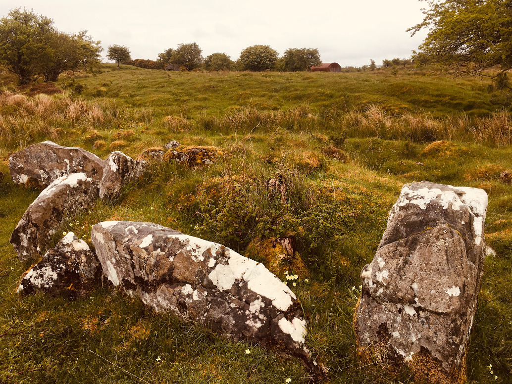


Looking north along the 8 metre long double gallery. The stone in the foreground is the remaining entrance jambstone of the southern gallery.

About a kilometre east of Belcoo, on the Belcoo to Enniskillen (or, expanding out a bit, the Sligo to Belfast) road, close to the northern shore of Lough Macnean Lower, on a damp and dreary late May day, we looked north across the rushy fields and wondered how to traverse obstacles of ditch and fence and fast traffic.
Ah maps, don’t you just love them? Where would we be without them? Take the next left here – there’s a track that skirts around at the back of the fields. We might get to it from there. Templenaffrin (Teampail nAifreann – the mass church) has, unsurprisingly, a medieval church and graveyard. And surprise, surprise it’s tended to, which we discovered after we’ve headed up the track and crossed the meadow.
But nice and all as it is (inklings here of another christianisation as the church is built on a mound), it’s not why we’re here today. Separating the field with the church from the field with the bullaun is a small wood with some very large deciduous trees. A fence runs through it and there is some dense undergrowth. However, heading south, the wood runs out and the fence is easily traversed. Heading back north-west and through the wood I got the sense that we’re not the only visitors this stone gets. The place reeked of hippiness, a not unwelcome vibe. We disturbed a grazing deer as we emerged from the wood.
The ground around the stone, and especially to its east, is marshy. We’re in limestone territory and were it not for the nearby swallow hole this would probably be impassable. My companion, not hugely experienced in the megalithic, suggested as we stood and listened to the water disappear underground that maybe this was why the carvers chose this stone. I wouldn’t disagree.
The stone is a sandstone erratic about 1.2 metres tall. The three very visible basins are satisfying. I did the old wash my hands in the water trick to ward off warts. I prefer this idea to the alternative locally named ’baptismal font’. Arriving back and checking the reports it seems I missed a fourth basin, 31cm in diameter and 3cm deep (no wonder). You can see this in one of the shots I took.

Magic little spot here, though the main road is at the tree-line off to the right.


Three obvious basins, with the beginnings of a fourth at the top.

Supposed glacial erratic, like a collapsing Yourshire pudding.

Three clumps in the middle distance – the stone is the left one.
Third time lucky? No such thing. Third time I knew exactly where the tomb is because of the excellence of the mapping at the NISMR which I hadn’t got the last two times I was here. Start at the forest track on the Ulster Way where it crosses the Swanlinbar to Enniskillen road. There’s a place to park that doesn’t block any farm gates and it’s over a stile and along a field track.
Benaughlin is prominent to the west as you start to rise out of a small valley bottom. It’s not at all strenuous and after about 1,200 metres you take a left turn, off the Way. Another 300 metres in a south-westerly direction, the dot on the OS map could mean that the tomb is well in to the left off the track. It isn’t. The central chamber of a sprawling, ‘star-shaped’ cairn is 20 metres in amongst the scrub. In fact, some of the cairn almost reaches the track itself.
It was excavated by Wakeham in 1882. It was he who first described a ’starfish-shaped’ cairn or a star-shaped cairn. This is now thought to have come about by, according to Estyn Evans, ‘the accidental result of pillage.’ Whatever about all that it’s evident that someone cares enough to come here and cut back some of the under/overgrowth and stop it completely inundating the gallery and chambers.
We mooched around for a bit – it’s not the easiest on the eye nor on the ankles. There’s a large amount of cairn rubble in both the small northern chamber and the larger southern one. Herbage of various sorts obscures the small arm at the south-east of the gallery. Vibes-wise I would say for the completists only, or maybe for those who still want to bear witness to the burial rites of the ancestors.

The central chamber is in the centre of the shot. The terrain here is difficult, to say the least. Fortunately it’s only 20 metres in from the forest track.

Looking south along the central gallery’s larger chamber. Pity about all the cairn rubble.

The larger, southern chamber with sillstone visible centre left.


Looking north at the northern chamber of the central gallery with the dividing jambstones prominent.

Looking north over the two chambers of the central gallery.

I’ve called this a kerbed cairn but there ain’t no cairn here anymore. There are, however, 67 boulders in a circle of 35 metres diameter. Alas, late May is probably not the best time to visit them. I’ve seen other photos of the site and they show some quite massive stones, only 10 of which are still in situ.
So it seems, according to historical reports, that this was probably a passage grave, or possibly a bronze age multiple-cist cairn, the central material of which went into the creation of the roads and other infrastructure in the locality. Which is a shame really, because this would be one hell of a fantastic site. As it is it’s not bad either, just neglected and overgrown and frustratingly unloved and uncared for. So what’s new?
I approached from the north, from the quaintly named Wattlebridge Road, just beside the bridge. The turrets of Crom Castle were visible in the distance to the north-west. It was a bit of a climb through marshy grass until I reached the circle. There is no access to the site from here but some of the stones are visible in the hedge. I skirted over two fences and around to the southern arc and gained access from here.
Sadly, as I said above, there’s precious little to see – however, the place still retains some power and dignity. Once upon a time there were supposed to be views all around and all with water. Now with all the growth, including some large ash trees, that’s mainly restricted to the south. There are some stones visible on the ground in the less overgrown western and southern arcs. I could have stayed a lot longer than I did, rooted around a bit more, but my companion for the day was waiting below at the bridge and we had more sites on our agenda.

Two more fallen kerbstones on the western arc of the ring.

South-east over two fallen kerbstones towards an unnamed lake, part of the Upper Lough Erne waterway system.

Two of the larger, upright stones on the northern arc of the ring.

Follow the line of the white fence down to the bottom of the field. The overgrown mound is where the tomb is.
I knew this was going to be bad but had hoped that maybe the lintels over the entrance and segmenting jambs might be visible. Alas no. The site is in a disgraceful condition and there is not even a glimpse of what are the substantial remains of a fine dual court tomb. I understand the amount of work that running a farm entails and the time it takes to keep things viable and though I’m reluctant to, I can’t help but say it – the owners of the site should be ashamed of themselves. In the unlikely event that they come across this I’ll make them an offer – I will volunteer to clean up the site, cut back the plants and ensure that I don’t interfere with the tomb structure.
Description of the dual court tomb at Drumavrack, including a plan of the monument.
I decided that we’d try Megaman’s approach to Creggandevesky – it seemingly avoids all the mud and treachery of the Lough Mallon way. Also, there is the remains of a supposed wedge tomb on the way down the lane. In the end this way is barred, ‘the very end of the road’ as Megaman suggests is actually someone’s driveway. We asked a friendly local and he recommended us not taking that route anyway, the Jersey bull in the field nearby being an even hardier deterrent. And then there was the weather – horizontal rain stinging our faces on the way back up to the car, I said to Paulie – yer man must think we’re a right pair of gobshites.
Our first foray had pretty much softened our cough as we pulled into the the side of the road beside the waterworks. There’s nothing like a drenching to take all the excitement out of a day out. I did get to the aforementioned wedge tomb, but the last time we were here at this spot I had to leg it back to Dublin because of a Covid emergency. And I wasn’t feeling too optimistic now. But hey, people here know what happens when you have that hunger and then I spotted the kissing gate between the first and second field and knew I was on the right track.
(A little aside here: In Creggandevesky townland there is a sign for Cregganconroe court tomb at the T-junction. There are no other signs of any description around that I could see. Coincidentally, in Cregganconroe, at the T-junction, there’s a fancy sign for Creggandevesky court tomb, and nothing for the local tomb that I could find. I couldn’t help feeling that the local burghers of both townlands don’t want the likes of you or I traipsing around the locality and would much prefer if you would fuck off 2 miles up the road to the other site. Nifty plan and seems to go against the reports of the Creggandevesky landowners pride in their monument, so I could be wrong, but experiences at Cregganconroe later in the day told me I’m not.)
In the pelting rain we set off on the southern route around the lake. It would be a nice trek in mild conditions, maybe a little soggy here and there, but there was precious little pleasure to be had getting lashed on. The tomb sits atop a small esker, part of which on the lake-side has been quarried for gravel. Much of the land in the vicinity has been altered, reclaimed, improved, and so here. As with a lot of the tombs in the north that are in state care, this one is fenced in and the fence is way too tight onto the monument. It seems that the compulsory purchase orders of these sites never take into account their visual contexts.
Despite the fence, Creggandevesky court tomb is really rather beautiful, the excavation and reconstruction/restoration leaving us with a near perfect example of its kind. Its construction reminded me of Annaghmare in South Armagh with its mixture of orthostats and dry-stone walling. However, the stones in the court here are much bulkier, the facade stones of the court the largest of the tomb, giving the whole construction a wedge shape as it tapers downwards along the gallery towards the rear.
Except for the wind and rain – all I could do was duck under the fantastic entrance lintel and crouch down beside the northern sidestones of the first chamber – I was really enjoying myself. With a bit of half-decent weather this would be a nice spot to pass a few hours, Lough Mallon offering a serene backdrop.
Comprehensive report on the 1979-1982 excavation.


Looking west – the stones in the foreground are part of the ruined eastern gallery.

The two-chambered western gallery showing the segmenting jambs.


Looking west over the backstone of the western gallery.


Mini-cairn and row and circle and other circle and on and on...