
The 2 remaining orthostats. The stone on the right is a beauty.
Image credit: ryaner

The 2 remaining orthostats. The stone on the right is a beauty.
On a rainy day I trudged across the field to this henge for a look. Rarely mentioned, at least in the books that I’ve read, I wasn’t expecting much. Don’t believe what you don’t read! This is well worth the effort.
I can’t begin to estimate the diameter or circumference, but can say with confidence that either of the Knowth or Newgrange mounds would fit inside it with plenty of room to spare. It’s huge! The banks of the henge rise to about 5 metres. There are 2 distinct openings, roughly to the south-west and north-east, but there may be more – there’s a lot of heavy growth at this time of the year. This henge is on private land so you may need to get permission.
I would have liked to stay here longer but the rain was rotten and I was dressed for summer. Definitely one that ought to be on your itinerary when you visit Brú na Boinne. I’ll certainly be back.


The stone in the background (southern) is the taller of the two, almost one and a half times the size of the northern one.

Baltray standing stones. The water tower may be from the industrial age.


The office of public works attend this site during the summer months. There were 2 guides there the day we visited, 6/7/06. People were arriving intermittently but we had Cairn T to ourselves for about 15 minutes. The guide told us that a busload of tourists had been there the day before, so you may have to share if you arrive in the summer.
The satellite tombs have a lot to offer. Most of the tourists are here for Cairn T. Cairns S and U are quite well preserved for open tombs. This hilltop is incredibly beautiful and a wander around is a must. I could stay here all day getting the feel of the place, but most people aren’t that patient. The completely wrecked Cairn W on the eastern downslope is the furthest away from the main cairn and is a haven of tranquility.


Looking south-east down the passge, across the sillstones, into the chamber.

Some of the keb-stones of cairn T are massive. This one, on it’s western flank, has fissured under the pressure of time.


Detail of the large, dinner plate size, concentric circle carving.
This is well worth checking out. Don’t attempt to drive up the track marked on OS sheet 42 – park on the road at the bottom and walk the 200 metres up to the stone. The field had just been harvested the day we were there, 6/7/06.

The eastern stone. Maybe ought not be called a pair as 150 metres or so separates the two.


The Western stone leans precariously.
Easy to see in a field on the right-hand side of the road halfway between Kells and Loughcrew. Like most of the standing stones I’ve seen in the vicinity, they are used as cattle scratching posts, which may account for the leaning condition of the western one. This is a thin slab-like stone, rather like an orthostat, of about 1.4 metres tall (were it upright). It doesn’t seem like it will collapse anytime soon, but then again I’m only 13 stone and don’t have 2/4 stomachs. ;-)
The eastern stone is about the same height, wedge shaped and seems to have had a prominent point at the top that was broken off sometime in the not too distant past.
A mildly diverting stop-off on the way to Loughcrew if you have 10 minutes.

A small (1.3 metres) standing stone spotted in a field to the left of the path to the summit of Carnbane East. It’s not marked on the OS map. Shot shows Carnbane West, with it’s many tombs, to the right of the stone.
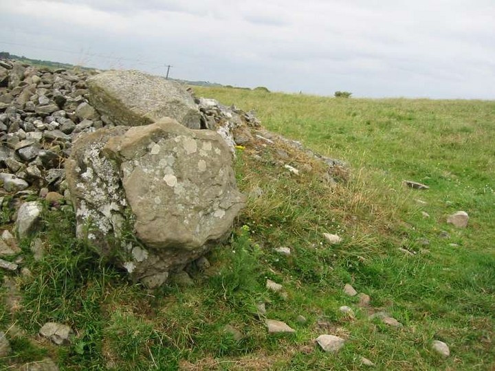
Possible kerbstone from the cairn. Proper investigation was hindered by bullocks and lack of human permission.

The remains of the wrecked and robbed-out cairn. This may have been a passage grave and is 130 metres below and to the north of Slieve na Calliagh.

1.5 metres tall and easy to find just 100 metres back from the road. The peak in the distance between the trees and the shrub is Cairn T passage grave on Carnbane East (Corstown) – Slieve na Calliagh (Sliabh na Caillí).


The remains of the passge and chamber of Cairn V. Spot the concentric!

Detail of the roofstone of the back recess in Cairn T, showing the prominent ‘Large nested arcs’.

Inside site 4, an undifferentiated passage tomb. I like the strange light effect. The ugly manner of the construction to enable the re-building of a mound over the tomb depresses me.


Detail from the Eastern passage entrance stone. I leaned over the stone and took the shot facing back in to me.


Looking south. Verschoyles Hill to the left, Lugg and Saggart Hill to the right.

I chose this shot to post as it best shows the very faint sun-like marking that I noticed out of the corner of my eye as I took in this site. It’s just to the left of the dog’s head. It could be natural…

Ancient versus modern. There can only be one winner (at least that’s the feeling I got around here!).

I’m not too sure what this is, but until corrected otherwise I’m putting it down as a burial cist. It’s about 150 metres east and slightly north of here:
themodernantiquarian.com/site/8434
on the down slope towards Glenasmole valley. It’s quite hard to miss so I don’t know why it’s not marked on the OS map. Cursory research on the ‘net last night found no mention of it either.
The alignment of the largest stone, a 3 metre long kerb-like or recumbent, is roughly west-east. What may be a capstone lies at the west end of this, looking over a small water-filled pit that is lined with small boulders. The pit itself is about a metre long north to south. I didn’t feel up to investigating this watery grave today but will return later.
Another possibility is that it’s a small portal tomb, but there is no evidence of another large stone that would have supported the capstone on the south side. To confuse things even further, north of the large recumbent supporting stone there is evidence of a small passage, putting the burial pit outside the ‘tomb’.
The views from here are great. Last night there was low cloud over the city, completely hiding it from view. Were you a stranger you would not have been able to tell that a million and a half people were out there somewhere to the north-east. East of here the significance of Piperstown Hill is apparent, with Mountpelier behind that to the north-east.
Ballymorefinn – Baile Mór Finn – The big town of Finn (Finn McCumhaill {McCool}).


Looking west, with what may be remains of a small passage on the north side


Looking South, over the recumbent into the pit with the possible capstone to the right.

I came across this on a previous trip back down from Seahan Hill and was curious. The camera battery was dying a rapid death and the light was fading fast so I split and said I’d return. I approached it from one of the forest tracks on the left of the Ballinascorney to Kilbride rifle range road. It’s the one with the largest entrance and has a forestry barrier. Walk along this track for about a mile (you will start to descend after about 300 yards – don’t worry, keep going). At the end of the track there is another steep track on your right hand side (due east). Head up here and make sure you check out the quartz encrusted boulder at the top. You’ll meet another track crossing here. Turn right and walk for another 100 metres or so and bam, there it is, just inside the tree-line.
How can I describe this? Best thing is to look at the shots. However, if you’re up here, check out the views to the east and north, just over the fence and 100 metres into the heather. The day I was there, low cloud hung over the city to the north and all the way up Glenasmole valley. Beautiful.
Another 123 metres higher, and about a mile further south up the track you were on, is Seahan Hill, which you’ll want to visit.

Full profile of this weird and wonderful ‘monument’. The ‘head’ sits up there rather precariously.

Looking west. Were there no trees or clouds you could see across to Saggart Hill to the west and Knockannavea to the north-west.


Scarily life-like for a natural feature

Looking south. This pile is about 5 metres from base to head.

The stone to the right of the firebase is the sill stone of the small court at the mouth of Seefin’s passage. Mama nature is already doing her slow erosion up here at 621 metres without some idiot helping her along. If you happen this way again, have your fire someplace else, far away from the tomb.

Well, with plastic jug for your convenience

Tumulus B, looking north west, with the Boyne in the foreground and the main tomb up the hill


The back of the tomb with nesting swallow (I disturbed her with the flash but she soon settled back down :-).