
wideford

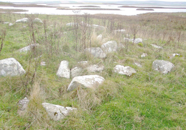


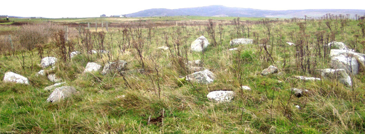
Coming up the Stoneyhill road beside Maes Howe just past where the viewpoint sign is on the left there is a footpath marked on the right. From the ridge on which the house sits with your back to the house look across the intervening field and the mound with its exposed material is there before you. Follow the path and you come round to the gate of the field in which it lies. Even in summer the outline of mound, ditch and bank is fairy obvious. Presently (August) the marshy are is dry. In the field around which the path goes are two or three mounds covered in grass that stand higher than the bell barrow, and in the tops of at least two are the tell-tale signs of antiquarian barrow-digging. I came by the side opposite the viewpoint sign aong a couple of ruts, which I do not recommend as the marsh plants stand high and their lushness hides the much pitted surface of the ground – even though dry you do not know from one step to the next how far the foot will go. I was strongly put in mind of going to the Knowes of Trotty. Then again, taking the ‘marsh’ into account reminded me of a 19th century antiquarian account of digging mounds at Langadae (Burn of Langa Dee) : “The burn or water courses have been conducted in a meandering manner about each mound.“, and further “On each of these mounds there is and was a lump of white quartz ” brings to mind the disintegrating stone of the bell barrow here.
RCAHMS NMRS no. HY31SW 7 at HY31471395 has been re-assessed a few times, the large size of the central mound and the lack of sharply defined features leading to its being currently classified as an unusually proprtioned bell barrow rather than a disc barrow like Wasbister. This N/S aligned barrow was 102x85’ with an irregular ditch of between thirteen and twenty-one feet. The platform and ~17.4m diameter mound both presently stand a metre high, and there were the remains of a 5” thick earthfast stone on the latter with the same orientation.

most obvious barrow, with stone near top of downhill side
Image credit: wideford
These are by the west side of the Stoneyhill road before you go over the hill to the Stone o’ Hindatuin. They are in the field adjoining a smaa house. The description is misleading. One of the barrows stands higher than the others, the third from the roadside. And actually the first two could equally be one of much larger diameter that has been cut in twa. In a hurry to get to the Ness of Brodgar talk I left entering the field for closer inspection on a fine winter’s day. My camera revealed a single stone on the downhill side of the taller barrow near the top.
RCAHMS NMRS record no. HY31NW 7 consists of turf-covered earth and stone mounds at HY3173 1553, 3175 1551 and 3175 1550 plus another that may only be a spoil heap, being only about four metres across and under half a metre high. The definite barrows used to be between 30-37’ across but have lost a couple of yards subsequently. They stand a metre high on a false crest. An urn with ashes, not surviving, was found in the smallest of the three, which is cut through by a peat road


Peninsula man-made for 2-4 metres down, chambered tomb/s, decorated cist lid etc. etc. with pics
orkneyjar.com/archaeology/brodgar2006.htm

On the Black Hill of Warbuster downhill of the Ring of Bookan, seperated by a hill-dyke and (formerly) the old road to Sandwick and Birsay (which also passed through the lower third of the Wasbister disc barrow). This is the mound excavated by Thomas, as shown by a comparison of his report with that of the first grave in the “John O’ Groat’s Journal”. In 1848 or earlier a trench dug by Dr.Wall of Skaill from the SW to the centre of this 71½ by 10’ tumulus found nothing. And on July 30th 1849 Thomas first trench of 3 or 4’ across that came from the south was similarly fruitless, even when the central pit was dug out to 6’ or 7’ diameter. The barrow presented a very different appearance then, with “but little earth in comparison with the many large angular pieces of stone” (now it looks a partly turf-covered mound of earth with some loose stones in exposed areas and a few earthfast stones barely peeking up from the top). It was built up with topsoil from the moors about. On the second day digging through several large stones from the SE and lifting an outsize flagstone lid revealed a “parallelogram, regularly built on stone” 26x27x18” containing a skeleton. The grave lay W/E and came from 4’ above the natural, 10’ from the centre, with the skeleton lying diagonally and head facing west. Later in the year Thomas was called back again to aid the “Woodlark"in its explorations. Two more crouched inhumations were found in cists, one in a trench from the N to the centre and another in a cut on the east side. Though roughly the same distance from the centre as the first they were much cruder burials and came from much further up within the mound, 6-7’ above the natural, only about a foot below the mound top. A fourth burial was expected to be somewhere on the W, but all the debris from their excavations having been dumped there they consequently didn’t have enough time left to look for it.

view over village to Ness of Brodgar funerary complex, Watch Stone extreme left
Image credit: wideford


Stones of Stenness with Comet Stone and several mounds
Image credit: wideford


last on-site archaeology, the second skeleton as best I could get
Image credit: wideford
