
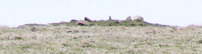
Knowe of Crustan barrow and mound, L & R of photo respectively
Image credit: wideford

Knowe of Crustan barrow and mound, L & R of photo respectively

Knowe of Crustan frae old Windbreck track at field’s eastern edge


unreported (to RCAHMS leastways) third mound further along ridge yet

north side of mound 1/’A’ from track to Skipi Geo

south side of mound 1/’A’ from inside field


detail of walling on north side of mound 1/’A‘
Two ways to reach this from the road to the Brough of Birsay. An entrance gap by the building you see connects the fields for both mounds. One of these had easy entry by an ‘Orkney gate’. Or so it seemed, as, uniquely in my experience, the securing loop had been hooked into the fence and I only undo what I know I can put back the way it was. The field within which the Knowe of Buttquoy is situated is entered by a barred metal gate, though this too has been further secured with a metal loop (not all Orcadian stock are super-smart, because I have seen an electric fence pass across a similar gate in case any stock might batter this in !). Anyway, I used the latter N.B. a farmer on another occasion informed me that you climb over the hinged end of a gate if you find you have to do this anywhere. The cows were far from me, but still, once past the knowe I went over to the other building and into the field where mounds 2/’B’ and 3/’C’ are. One of these is beside the wall just up from the building (by the bye, these drystane walls stand apart from any I have seen elsewhere, more like masonry in appearance and a distinct orange cast). Though this provided a slight elevation the view of mound numero uno from here ‘told’ me nothing new. Still hurrying, back into the knowe field and up the opposite end from this to where Point of Buttquoy mound 1/’A’ is close to where the track to Skipi Geo runs. Features clearer from inside the field. Still best to come here when the vegetation lies lower. If it ever does that is, he says covering himself.

looking across stone spread to Point of Buckquoy 1/’A’ same field
Two ways to reach this, either an ovine catburglar-proof ‘Orkney gate’ into the field next door then through an opening by the building or the wire-looped metal gate to the site’s field. Used the latter – a farmer has informed me that you climb over the hinged end of a gate if you find you have to do this anywhere. Managed to forget that this mound almost up against the roadside wall was the knowe itself so only took a hurried look (and I thought my digital camera wasn’t focussing, some weird stuff because it wasdoing so). Enough to see what felt like a circular spread of large horizontal stones on the top, invisible from the road as is often the case with such features.
Now I had time but there really were kie in the field. Tried hard to find any other access, including a very overgrown old track or ditch and down the old Windbrack track down to Ramly Geo, but even the old wires have been ultra-tightened now.
Now I had time but there really were kie in the field. Tried hard to find any other access, including a very overgrown old track or ditch and down the old Windbreck track down to Ramly Geo, but even the old wires have been ultra-tightened now. I think archaeologists should hire animals, because in those few places in Orkney I see “Beware of the Bull” there is always O.S. 1:25,000 archaeology, even if including WWII stuff ;-)
APRIL 2005 I considered for a moment paying a visit, I’m no scared of cows and calves me, but had my targets to reach still. Beyond the reported Crustan mound is what looks to be a yet smaller one. This looks very low in comparison with the other two mounds, but much more interesting because of the stones you see in my photo, either scattered over it or protruding through, possibly both. It played hide-and-seek like Mittens, only visible from certain spots along the road. Really need someone in the locality to investigate further as to age and nature of this.
RCAHMS NMRS record no. HY22NE 5 for the Knowe of Crustan includes at HY27532906 110m SE along the same ridge a turf-covered mound about 12m across and 1m high that is likely to be another barrow.

Exploding bunny population taking its toll and seems to be more cattle scarring

sharp wall, destruction layer, cairn remains ?


exposed areas at tip of Point with possible orthostat – a ‘real’ archaeologist told me the flat bits look likely too. Let’s hope the equinoctial storms don’t take it away anytime soon.
Despite all the recent heavy storms, inc. a sub-hurricane, it survives. So apart from the 1.3x0.65m sticking out there must be much of the slab in the mound.

looking across larger depression landward, earthfast stone visible

mound from other side of ?marshy area past nousts
At the end of the channel instead of crossing over to Eves Howe turned right and onto the beach. Owing to erosion there isn’t enough cliff outside the fields to walk on at all, the fences and their ‘standing stones’ ready to topple over. A slab fence with barbed wire goes down to the low tide mark and I managed to clamber over a gap and continue on to where the headland is sufficient to climb onto. The mound with its various peaks runs from the field boundary to the very point, completely covered in grass. So I don’t know whether the depressions at the seaward end are from excavation or robbing foundations. On the one hand at the cliiftop the smaller of the two looks more than 2m less, on the other I did see one white earth fast stone in the centre of the larger. I suppose whoever removed the structures could have dug unrecorded into archaeology below. And of course the Long Cairn on the Head of Work does have a later oval cairn inserted in one end which could parallel the sub-circular chamber excavated here. The two (post-mediaeval) boat nausts now look more alongside than into the mound.
In the nearer I could see the walls lining the long sides. The report describes it as walled on three sides with slabs along the bottom. It provided the only dating evidence for the mound, a single Grooved Ware sherd, and the excavator thought the noust built from mound material. Seems strange the sherd came too. So could the material be in situ, part or all of summat previously here? Certainly the fact that stones were found protruding about these two could relate to barrows being built over the sites of previous activity – pity Heritage Scotland hasn’t AFAIK communicated the results of this headland’s geophysics to RCAHMS, only that they exist.
Opposite the Deerness Stores a road goes down to Marwick Bay. On the left are the farm and buildings of Newark, but before you come to this there is a sign for the footpath to Aikerskaill. The grassy path is new since last I was here and is nicely level and broad. Fairly soon you reach two long concrete slabs, laid over the two drystane walls of a bridge through which the ‘drain’ that skirts the landward side of the broch field comes around and meets the shore. The nearer you come to the mound the bigger and blockier the ‘boulders’ about the path and along the field edge. Much then obviously material from the site rather than rounded beach stone.
Going by the record the mound should continue into the next field along, though all I see down the other side is a small pond with a very small cone of land sticking out the centre. In the SW corner the barbed wire fence is just moveable enough to climb carefully over, be sure not to leave the lines tangled.
On the southern side is a line of stones that looks like a wall course. But the left half of this looks to be made out of boulders rather than slabs, though I only took a close look at the right as this is a more obvious line of walling and so may have been misled by loose material. Actually I had the feeling I was looking at the remains of structures of two different periods because of the disparate nature of stones over the mound, and most of the Broch Age material had been removed at some stage. Up on the eastern end earth and stones lie exposed and apparently eroding downhill, a few white boulders on the surface (from the broch?) but mostly dark fragments. In one area here I could make out through the grass bits and bobs of three or more courses of walling. These courses as I saw them were only a scant few inches high. Though I read this as an incurving wall, maybe of the inside of the broch or internal furniture, it could have been a stabilised collapsing wall now incorporated within the mound apart fom this outer face.
Quoyburing is, or was, pronounced Quoyburrian (similar name construction to Quoyburray near Round Howe, although the latter is no longer regarded as a broch).

alternative site found at Nether Scapa, stock in field makes further investigation unsafe at present (pre-dates and outwith agricultural improvement, runs diagonally)

inside of other passage, big enought to crouch through, with collapse in far distance

rim of broch mound with Grandag bay behind

view across top of unexcavated half from fence
Rimmed platform cairn with central mound. And these can have one or more kerbs, perhaps explaining the reported stones conspicuous by their present absence.
Ness of Brodgar 2006 excavations with pictures
RCAHMS NMRS record no. HY31SW 112 – like Barnhouse with tombs, only more so
Haven’t found it on the website but in the talk today the discovery of a cup-marked stone was described, from trench eleven IIRC
a site that parallels and complements Mine Howe.


back of Maes Howe appears to echo hilltop at rear left of frame


To get the clearest views of the bank and ditch walk along the side road that leaves the main road as you approach Maes Howe from the east/Kirkwall. They are quite spectacular.


