A 13m x 3m x 2m wall was constructed from the Rossel Howe Cairn material (HY22SW 5) some time after the Orkney Name Book of 1880 (the ONB actually places two tumuli here). During the demolition human remains were found in a cist. At the south-east end two stones, one approx 2.3x0.6 m fallen but the other approx 2.3x0.8 m still erect, are thought likely parts of a chamber.
wideford


Having started at the south end of the ‘Swartland Drovers Road’ trail when just past the present sewage station I chanced to see on my left a small unnamed holm at the top of the Loch of Harray. I think this is most likely a crannog like those in the Voyatown and Swannay districts – the present NMRS designation is quite recent, probably interim. A comparison with the Loch of Wasfale in Firth, going by large-scale maps, this islet is roughly the same length but only half the width, giving as very approximate dimensions 35m by 12m but nowhere near as high. Even unaided you can see that a level mound or platform occupies the central half, with its sides gradually going down to loch level. At high zoom my camera shows at least three large stones (one erect) and a couple more at the back (perimeter wall ?). The stepping stones run NNW from at or near the mound’s edge. Following on in this direction the 1st 25” shows a circular stone arrangement offshore at at HY28881965, between the holm and the Wasum site (HY28841971). Ruling out an actual stone circle my guess would be that this had been a cairn, but it looks most rum on said map.
The way to both totem tombs is now very well signed, but if you take your eye too long off the piece of road they mass at you’ll hit a low bump. There is plenty of construction going on at Banks, where there will be a Tomb of the Otter visitor’s centre to complement that for Ronnie’s Tomb of the Eagles (have heard no news of Wedgie’s survey of that landscape). Hamish has put a weatherproof cover over the present tomb entrance and will be installing a low-level lighting system to help folk. To the south you can see a wartime lookout station [watch your step going that way or you can walk around the coast from nearby Burwick], and here there are several small burial mounds with large stones exposed (Hamish can point out several pieces of interest to prehistorians above the tomb if you don’t want to go that far) – unfortunately being with a part I did not get time for photos and the Burwick bus is only for ferry passengers.

northern end of Knowes of Trotty cemetery seen from farmroad to Winksetter
Image credit: wideford

excavated Knowes of Trotty seen from Winksetter farmroad
Image credit: wideford


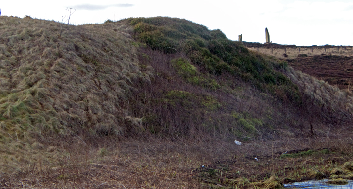
Knowe of Midgarth seen from Woodwick
Image credit: wideford

broch mound looking across to Toy Ness
Image credit: wideford

looking across Scapa Flow
Image credit: wideford

broch occupied part of a larger mound
Image credit: wideford
A geophysics image produced for an investigation at Redland in the parish of Firth of a site occupied ~3300-2000BCE clearly shows a boundary around round houses, and this wall/ditch has been compared by those concerned with the Great Wall at the Ness of Brodgar in the parish of Stenness.
orkneyarchaeologysociety.org.uk/index.php/features/redlands-investigtion
With the lochan low went over causeway yesterday, seemed even more exposed than last time I managed to do this. To call it a causeway is to over-egg the pudding as it is more a line of stepping stones (warning -halfway across you have to jump onto the edge of a slab to get between stones). Saturday I had the feeling that the stones could be re-used from the original prehistoric structure on the islet, perhaps when the kirk was founded. Looking back along the mound’s northern side from the far end there is a kind of stepping to the turf – one of the two contenders for causing this is a broch of course

seen from Point of Snusan
Image credit: wideford

Stones of Stenness on a gloriously sunny day
Image credit: wideford

Salt Knowe has an amazingly flat top as if something has been carved off the top
Image credit: wideford

Wasbister Disc Barrow and end of Dyke of Se(e)an as seen from top of Salt Knowe
Image credit: wideford

Plumcake Mound from the giddy heights of Fresh Knowe, with The Brecks cairns on top of hill left background
Image credit: wideford


Fresh Knowe looking to Bigswell, the southernmost element of the mediaeval Brodgar ‘experience’ (the other end being the Ring of Bookan)
Image credit: wideford
eastern side of Fresh Knowe showing excavation hump etc
Image credit: wideford

Fresh Knowe from south with Ring of Brodgar in left distance
Image credit: wideford

Fresh Knowe and Plumcake Mound with Bookan Tomb on hill behind
Image credit: wideford

Salt Knowe, South Knowe, Brodgar cairns, Ring of Brodgar, Comet Stone. In this view the backdrop is not the Black Hill of Warbuster but Linga Fiold (with the Lyking mounds facing us).
Image credit: wideford


Burgar cairn with circle of Castle partially glimpsed lower left
Image credit: wideford

cairn (L) and broch (R) despite disparity in size both called broughs on first O.S. 25”
Image credit: wideford
The 1st 25” map show’s Peter’s Kirk (HY32NW 12 at HY33742870) on uncultivated land between the low cliff and an obtuse angle wall, west of which ‘enclosure’ are the legend Burial Ground and a due N/S aligned oval Cairn (apparently banked) slightly bigger than the kirk – another smaller building is shown at the edge of the southern wall segment near the corner. The stone cairn (HY32NW 16 at HY33712870) is presently described as turf-covered, about 9mD by 0.7m in height and marking the edge of a settlement mound at whose highest point the kirk is. Though in 1967 Ordnance Survey were unable to classify it, as the result of what they considered severe mutilation, in 1981 the SMR talks of what might be the concave inner face of a structural wall on the north side, formed by a row of edge-set slabs. Also on the settlement’s edge, east to south-east of the kirk, are several irregularly placed erect stones. These are tentatively described as grave-markers but could be from an underlying structure [as with the broch features diggers have found at Warebeth Cemetery on occasion]. To the north-east of the site the cliff cuts through the settlement to reveal traces of prehistoric structures up to three metres in depth, described as unsurveyable by O.S. in 1967. Alongside is kitchen-midden.

July 17th to August 22nd (sic)


runic sentence stone with foot of Black Hill of Warbuster behind
Image credit: wideford

sentence in runes on Ring of Brodgar stone honeyed by summer sun- why this stone, do the runes use earlier symbols like we graffiti wall posters etc ???
Image credit: wideford

pair of stones with The Brecks atop Black Hill of Warbuster in the distance
Image credit: wideford
