wysefool

wysefool

All posts expand_more 301-350 of 362 posts

Kingston Lisle Tumulus

Just visited yesterday. It is located at the extreme north end of the village (opposite the modern cemetary), in a break of trees, marked on the Explorer 170 map as ‘TUMULUS’ (in capitals – which Rhiannon advises me – means it’s Roman)

... and it’s in someones back garden with an unfriendly dog.

Hagbourne Hill

This barrow sits on the south side of Hagbourne Hill, sort of on its own crest. It has been planted with some trees and seems to have avoided the plough. It is very ‘flattened’ now. From the Ridgeway (at bury down car park near West Ilsley) if you know where to look (or have a good pair of binoculars) it can be seen.

Miscellaneous

Liddington Castle
Hillfort

Of times on Liddington’s bare peak I love to think and lie,
And muse upon the former day and ancient things gone by,
To pace the old castellum walls and peer into the past,
To learn the secret of the hills, and know myself at last,
To woo Dick Jefferies from his dreams on sorrow’s pillow tossed,
And walk with him upon the ridge, and pacify his ghost.

Alfred Williams (local poet and friend of Richard Jefferies)

Folklore

Whiteleaf Cross
Christianised Site

from ‘Chiltern Country’ by H J Massingham (1944)

‘...50 feet high by 25 long, from a pyramidal base (Bledlow Cross has none) 340 feet wide. It can be seen from Shotover and many a point in the vale, just as the White Horse can from Faringdon Folly and many a point in the vale. The Sinodun Hills are visible from Whiteleaf and the blue veil of the Berkshire Downs as though let down from heaven. The Cross saw and was meant to be seen with the range of the falcon.

As I argued in a book written some years ago, it has stood or rather leaned against the bluff above the Way from the time when tin ingots on men’s shoulders, flint from the factories at Grime’s Graves, wool-tods on pack horses, sheep, cattle and ponies, chapmen and pedlars, pilgrims and soldiery passed along the Ridge Way on the summit, first as a solar or phallic sign and from the eighteenth century onwards as a cross.‘

Round Hill Mound

Round Hill Mound

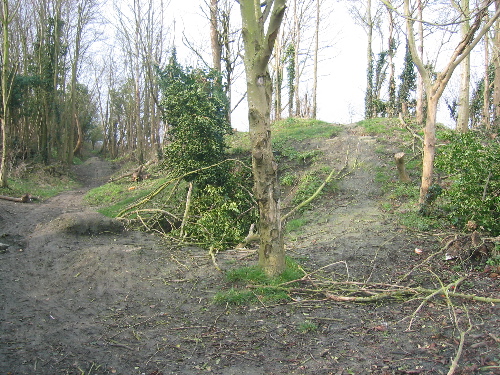
Marked on the explorer 170 map as ‘mound’. The site is to be found on a track leaving the east of Wantage. The site is much worn down and appears to have been used as BMX track for some time!

(added 14/02/2007). Musings on what it is: If marked as mound and not tumuli, then I suspect (and only that!) that it may be a moot point similar to scutchamer, except on a smaller scale, and NOT a burial site. Please bear in mind that I’ve been wrong before (I said Didcot FC would win the championship one day..... :-)

Harwell Barrow (possible location)

Possible barrow site in Harwell Village, Oxfordshire.

There are two road signs in the village in close proximity that seem to indicate a possible barrow site. There is obviously no barrow left anymore, and I suppose the site has been built on at some time in the past and is now covered in houses.

In the vicinity are some very large pieces of stone. One is in the corner of a building (4feet in height approx) and one is adjacent to the bus stop (again about 4feet long) and these appear to be rectangular in shape. There are also some large sarsen stones nearby.

I cannot find any reference to it, and I do not know from what period it may have come from. (long, round or saxon? et al).

(Listed under misc. earthwork)

Image of Blowing Stone (Standing Stone / Menhir) by wysefool

Blowing Stone

Standing Stone / Menhir

old postcard of blowing stone hill, the blowing stone itself being at the bottom of the hill. No date, But would guess late 19th century or early 20th. Of note is the un-metalled (surfaced) road. Locally, chalk was used for roads and tracks. This seems the most likely reason for some local roads being named ‘white road’.

Scutchamer Knob

Just visited the ‘Knob’ this spring (2005) and have seen new changes. There is now a fence around the base of the knob and there has been some clearing of the scrub and trees on top. Guess I kind of liked it better before!

Image of Winterbourne Stoke Group (Round Barrow(s)) by wysefool

Winterbourne Stoke Group

Round Barrow(s)
from ‘Ancient British Barrows’ (especially those of wiltshire and the adjoining counties). Soc of Antiquaries 1869.

Wysefool says: this is a very old line drawing, of an aerial view of the Winterbourne Stoke barrow cementry. It was based on the drawings of Sir Richard Coalt-Hoare.

Image credit: J B Nichols and Sons Printers?

Miscellaneous

Uffington White Horse
Hill Figure

This is a poem that fronts a book entitled ‘A School History of Berkshire’ by E A Greening Lambourn.

Old god of ancient worshippers,
Hoar guardian of the Vale,
Reveal the secrets of the years,
And to thy children’s eager ears
Unfold thy wondrous tale.

While yet the she-wolf’s litter played
On the seven hills of Rome,
I saw yon dimpled hollows made
With pick of stone and wooden spade,
To be the Flint-man’s home.

I watched the painting victim bound
On Wayland’s altar-stone,
The low-browed priesthood chanted round,
I saw the red blood soak the ground,
I heard the dying groan.

Look where the lines and circles there
Make patterns in the wheat:
Oh, that was a city, great and fair,
With temples tall and market-square,
And many a stately street.

Where wind-swept Ashdown stretches free
Above the laden plain,
I saw the Northmen break and flee,
Heard Alfred shout for victory,
And saw Earl Sidroc slain.

I heard the Gospel message given
Where village crosses stand;
Where wild beast-men had snarled and striven,
I saw the spires rise white to heaven,
Throughout a peaceful land.

Where Ock once ran through wild and waste,
By rush and reed and thorn,
I watched the jolly monks, moon-faced,
With shaven head and corded waist,
Bind up the rustling corn.

But yesterday I saw you claim
Your Father’s heritage;
The land that bears the English name,
The race that won the English fame,
I watch from age to age.

Old Watcher we are known to thee
As children of the breed:
We will not shame the ancient name
Nor fail the ancient creed.

E.A.G.L. (published 1908)

Folklore

Wayland’s Smithy
Long Barrow

Norse (or Teutonic) Mythology

Wayland (alt: Weland, Volund, Vulcan et al) appears in various guises in various mythologies (even Ancient Greece!). In the Northern Mythology he and his brothers come into contact with the Valkyrs, beautiful ladies with swan plummage who can fly, only to lose them later. Wayland pursues his love with zeal and this causes him to be captured and enslaved. He is put to work creating weapons of magical power and during his capture suffers the loss of an eye and a cut achilles hill resulting in a lame leg.

I thoroughly recommend anyone interested in wayland smithy to read up on the Norse Mythology for the full story, it is truly a wonderful tale.

The Saxons have many mythological associations with the Norse tradition and you can see how the story of Wayland has been carried from Remote Scandinavia, through mainland Europe and with the arrival of the Anglo-Saxons, into England and then to leafy Oxfordshire.

Although the folklore relates to the Anglo-Saxon mythology of a Neolithic Long barrow (many thousands of years difference!), it is still an interesting aside.

Tied up with Wayland Smithy are a number of stones and barrows relating to the tale. Wittich’s Hill, a barrow (Wittich was the son of Wayland) and Beaghild’s burial place (a princess whom Wayland ravished), another barrow are but two in the local area.

Folklore

Wayland’s Smithy
Long Barrow

the secret passage

There is some folklore concerning Waylands that a secret passage lies underneath it and opens up in Ashbury coombes (a mile or so away). Shepherds in the late 19th century used to strike a crowbar into the ground near to the ‘cave’ (as it was then before reconstruction in the 1960s) and hear a hollow sound.

I guess they were half right! Later archaeology helped us understand that Waylands had a number of stages of construct. The hollow sound was likely to have been an earlier grave lying underneath the present sarsen faced long barrow.

I have also read of the secret passage connecting to White Horse Hill. The two sites seem always to be closey linked in folklore.

Image of Uffington Castle (Hillfort) by wysefool

Uffington Castle

Hillfort

This is the earliest photograph of the Manger and Uffington Castle ramparts that I have seen. Although slightly damaged and blurry. You can still make out the edge of uffington castle. You can also just see the white horse carving and dragon hill is visible on the left hand side of the photograph.

Image credit: wysefool (personal collection) - Original 1902 (author unknown)
Image of Uffington White Horse (Hill Figure) by wysefool

Uffington White Horse

Hill Figure

This is the earliest photograph of the white horse that I have seen. Although slightly damaged and blurry, you can still make out the chalk carving.

Image credit: Wysefool (personal collection) - originally taken in 1902 (author unknown)
Image of Wayland’s Smithy (Long Barrow) by wysefool

Wayland’s Smithy

Long Barrow

This is the earliest photograph of Wayland Smithy that I have seen. It was probably taken in 1902 and shows the smithy before reconstruction and before the first serious dig in 1919. It was once called Wayland Smith’s Cave and NOT Waylands Smithy. You can see why from this picture.

Note the trees in the background, these are probably the beech trees planted there by the Victorians to turn it into more of a ‘folly’. Even after the storms in the 1980’s some of the original trees still remain to this day.

Image credit: Wysefool (personal collection) - Original taken in 1902! (author unknown)
Image of Blowing Stone (Standing Stone / Menhir) by wysefool

Blowing Stone

Standing Stone / Menhir

This is the earliest photograph of the blowing stone that I have found. It was pasted inside the cover of an early copy of ‘The Scouring of the White Horse’ by Thomas Hughes (1892 edition), along with other photographs of local interest. One of the other photographs is dated 1902, so I suspect that this one is too.

Antiquarians; note the chain around it and running through the holes in the sarsen. Also, the cottages in the background are the ones that are still there. This is the location that the blowing stone is still in today.

Of major interest is the huge tree that the blowing stone is next too – That tree must have been felled many years ago.

I like the way the young kiddy is trying to find the right hole to blow into!

Image credit: Wysefool (from personal collection) taken 1902! Original author unknown

Miscellaneous

Fox Barrow
Round Barrow(s)

From: The Berkshire Archaeological Journal Vol 42 Part 2, Berkshire Barrows by L V Grinsell (1938)

Foxes Beorge (Fox Barrow)
Blewbury Charter;
There is no doubt this is a barrow, and it is the barrow still called Fox Barrow adjoining Grims Ditch at the meeting point of the parishes of Compton, Blewbury, and East Ilsley.

Fox Barrow

(26th September 2002)

This round barrow sits on the side of the hill here and has a track running past it which heads up to East Ilsley. It is well worn down, but still is a large clump of earth. It sits right on the modern county boundary which then appears to follow the line of Grims Ditch in some places. From this vantage point the other barrows in the Churn Knob area are clearly visible.

Why it is called fox barrow and is named, (as opposed to some of the others in the immediate area) I do not know. It was clearly a well known barrow as it was used for a county (and probably parish) boundary. This is quite common in the area.

You can just see Wittenham Clumps from the site as well.

Bledlow Cross and Wain Hill

(28th May 2003)
There is no obvious path up to the cross that I could find, so after tangling with the undergrowth and struggling up the steep slope, I came across it in a small open area. It is slightly overgrown and hasn’t been cleaned (scoured?) for a while I guess.

It sits on a slope, slightly facing downhill and the ends of the cross are not a perfect square, rather they appear to ‘flange’ at the ends.

The view from the site seems to be over towards Henton rather than Bledlow, but the naming could be to do with the importance of the settlement of Bledlow over Henton, or simply because Bledlow is nearer. With the trees cleared, a view across to Bledlow would be plausible.

As to its prehistoric antiquity, it seems possible that it is prehistoric in date, given the position close to the Ridgeway path and the location of some round barrows close by. A Carbon dating of the sub soil (similar to that performed on the White Horse at Uffington) would be conclusive.

Expect to sweat to get here! Only for the fit and healthy!

Miscellaneous

Rams Hill
Enclosure

What is a causewayed camp?

Unlike an iron age hillfort, where the ditch and bank runs almost completely around the fort, a causewayed camp has a ditch which is crossed many times with entrances. An iron age hill fort is for defence, a causewayed camp is not. Its prime purpose is not defensive in nature.

It was first thought that they were enclosures for cattle in the Neolithic period. Many bones from culled animals of many types were found in the ditches surrounding these structures.

It is thought that they performed a variety of social, economic and religious functions for early neolithic communities.

Rams Hill

Rams Hill lies adjacent to the Ridgeway between blowingstone hill and white horse hill. It is very easily missed as all that remains is a prominent, but gently sloped hill.

If you look carefully, you can just (and I mean just!) make out the much eroded remains of a single bank and ditch just below the crown of the hill. The hill itself is small but sufficient to stand out in the surrounding topography.

On the OS map, Rams Hill is marked as a ‘fort’. This is slightly misleading. It is not a hillfort of the Iron age, but a neolithic structure known as a ‘causewayed camp’.

Its original use seems to have been as a meeting place for trading and possibly ceremonial purpose. Its position relative to the White Horse and Uffington castle should be noted. Also, on foot it is not far from Lambourn Seven Barrows.

Dragon Hill

Natural or man made?

A question that has been bothering me for quite some time (and indeed every time I visit) is:

Is dragon hill a natural formation, or is it man made?

I have found some archaeological references to it and all indications are that the geology is natural. I agree, except to add that the top may be artificially flattened. I believe it is ‘man-enhanced’, that is to say, that it is a naturally occuring piece of geography and that prehistoric man may have added to it to perfect the shape.

Also, note the similarity of it to Silbury Hill. It is like a ‘mini-Silbury’ to me.

Folklore

Dragon Hill
Artificial Mound

Ah, the old story of St George and the Dragon is attached to Dragon Hill, as it is to many places. Could it be a big analogy? Is St George the Christian faith and the Dragon the Pagan one? Such a significant place of heathen worship for centuries (nee Millennia) must have had to have been conquered.

Pigtrough Bottom (top of)

A much denuded round barrow is sited just of the Ridgeway path here. It is just next to a small break of trees where the Ridgeway crosses the B4001. It is positioned with a wonderful view over the Vale of the White Horse looking down on Childrey village.

If you approach the area on the Icknield Way (B4057) from Wantage you get a wonderful view of Pigtrough bottom (it looks like a giant pigtrough from a distance, hence its name). Best viewed on the junction of this road and ‘Silver lane’ – just before you reach the dip next to Childrey.

Miscellaneous

Wayland’s Smithy
Long Barrow

More Holy than rightious...

Those huge sarsens at Waylands (and indeed many other sites). Ever noticed that huge one at Waylands full of little holes? Well how? I was dicussing this recently with a visitor to the site who suggested that the geological formation of the sarsen was to blame. Apparently, the holes were formed when the sedimentary sandstone in more liquid form, moulded around tree roots. The later cooling and formation of the stones caused these holes to appear. The wood, rots away, or at best creates a weakness, and hey presto, the holes appear and erode. Holy or Hole-y?

Folklore

Wayland’s Smithy
Long Barrow

Female and Male stones?

The huge sarsens that guard the front of the tomb are four in number. Two other original large stones are missing. Are they in any particular shape? I have always looked at the lozenge (or diamond) shaped stones as female (think hips!) and the thinner more upright stones as male (think phallus!). This appears to be the case at Waylands Smithy (look at some of the piccies). I think the missing one on the left hand side was male and the missing one on the right hand side middle was female.

The avenue at Avebury sometimes leads me to a similar conclusion with male and female stones.

Miscellaneous

Wayland’s Smithy
Long Barrow

Those interested in Waylands Smithy Neolithic origins should consider getting hold of a copy of John North’s wonderful book ‘Stonehenge, Neolithic Man and the Cosmos’ in which a section is devoted to the Archaeo-Astronomy of Waylands Smithy and how it is sited according to the rising and setting of certain star constellations that had either ritual, or functional importance to neolithic man. Apparently, Waylands Smithy has a relationship to Deneb, a star in Cygnus (the swan) in the Milky Way. This was a star that set on the northern point of the horizon and was revered in Northern Mythology.