


Another of the original large sarsens in situ.


Diff angle of Fence running straight through the long barrow

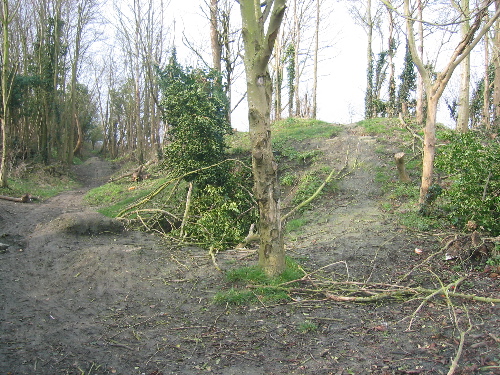
Remains of the long barrow (gentle bump) with addition of fence and posts straight through the middle of it!

Footpath adjacent to the long barrow. Sarsen stone pile collected from the area.


The barrow is in the main clump of beech trees adjacent to the road.

Pig trough barrow sited with a lovely view across the vale.

Disc Barrow of Wessex Type, taken from adjacent bowl barrow. You can still make out the ditch, bank and ‘lump’ in the centre.

Old Ministry of works sign at LB7B

Pub sign from ‘the blowing stone’ at Kingston Lisle.

diff side – site in poor neglect and in need of the chainsaw and a tidy up.

Kingston Lisle Bump – unfriendly dog shown for scale


On top of the barrow site looking out. Chilton village is in the middle ground and the ridgeway is on the horizon.

Looking up the hill to the barrow from the road.

Section of Cherbury showing the 3 bank and ditch defense. (taken 2003)

There’s a pot of gold somewhere in that there hill!

Lord Wantage Monument, sited on a bronze age barrow (and much fun for outdoor raves back in the day...)

One of the barrows of the LB7 complex that is outside of the major concentration.

Frosty morning February 2007. This is one of larger barrows in the complex opposite the entrance to Seven Barrows Farm (just on the bend)

Taken in the recent ‘one day winter’ of 2007. The denuded barrow shape can be seen on the horizon.


old postcard of blowing stone hill, the blowing stone itself being at the bottom of the hill. No date, But would guess late 19th century or early 20th. Of note is the un-metalled (surfaced) road. Locally, chalk was used for roads and tracks. This seems the most likely reason for some local roads being named ‘white road’.

Wysefool says: this is a very old line drawing, of an aerial view of the Winterbourne Stoke barrow cementry. It was based on the drawings of Sir Richard Coalt-Hoare.

Showing the front of Wayland Smithy when it was known as Wayland Smith’s Cave.

Maiden castle southern ramparts, probably taken about 1910.

Maiden castle northern ramparts, probably in 1910 or close to that date.

This is taken from the old railway embankment that runs out of didcot towards upton.

This is the earliest photograph of the Manger and Uffington Castle ramparts that I have seen. Although slightly damaged and blurry. You can still make out the edge of uffington castle. You can also just see the white horse carving and dragon hill is visible on the left hand side of the photograph.

This is the earliest photograph of the white horse that I have seen. Although slightly damaged and blurry, you can still make out the chalk carving.

This is the earliest photograph of Wayland Smithy that I have seen. It was probably taken in 1902 and shows the smithy before reconstruction and before the first serious dig in 1919. It was once called Wayland Smith’s Cave and NOT Waylands Smithy. You can see why from this picture.
Note the trees in the background, these are probably the beech trees planted there by the Victorians to turn it into more of a ‘folly’. Even after the storms in the 1980’s some of the original trees still remain to this day.
