
The ‘hogback’, with a bunch of highly suspicious looking characters clustered around the main panel in the background.
May 24th 2005
Image credit: IH
The ‘hogback’, with a bunch of highly suspicious looking characters clustered around the main panel in the background.
May 24th 2005
It’s a really odd shape for a hillfort. Like one standard hillfort that’s ben cracked in half, then each half set against the edge of the scarp, one next to the other. Or perhaps one hillfort with a hinge, which has been swung open, to make two hemispherical forts. It’s been described as being like a pair of half-moon spectacles when viewed from above.
It’s got fair sized banks and ditches, but it’s most salient feature is the great big rock cut basin just on the edge of the scarp, see Pebble’s photo. Given the nearby astounding rock art, you can’t help but wonder if there’s a connection between this thing and the cupmarks which litter the area.

Ditches, banks and stuff. On top of a hill. Must be a hillfort.

Taken at some point betwen 1920 and 1940. 2 decades might be a bit vague, but it’s just the blink of an eye to the stones themselves, though not to the signpost. I wonder what happened to it.

Ripples on water, concentric circles in liquid and in stone.


The NMR reckons there are a couple of cupmarks on this stone, it does make the proviso that the stone is weathered, which it is, but the cups are a bit dubious.
It’s a similar stone to many of those in Northumbria, some of which have undeniable cups, but these two are a bit iffy, maybe it’s because they’ve been well hammered by the elements. I couldn’t for the life of me get a decent photo of them.
Strangely, Stan B doesn’t include them in any of his books, nor are they on the online Archive.
It’s a canny old stone though.
Millstone burn could be viewed as six separate sites, seven if you count Snook Bank over the other side of the burn, more if you take into account the disparate locations of some of the stones listed as part of the same group. Rock art nomenclature can be a funny business, as new panels are discovered. Hence some of these have ended up with unwieldy and not-exactly-inspiring names like ‘Millstone Burn 6c(ii)’.
The OS map marks two concentrations of them, but the Beckensall Archive lists a whopping 65 separate marked stones as part of the Millstone Burn groups, and that doesn’t include those at Snook Bank.
Groups one and two are the closest to the road, with some from either side on either side of the road, just to make it trickier to keep track. A few of those on the east side seem to have been relocated, as they seem to form part of a row of spaced stones next to an old trackway. Stan Beckensall has suggested that this track may be of prehistoric origin, leading from , Simonside, via the rock art at Lordenshaws, the down to the river Coquet, up again to the rock art, standing stones and cairnfield of Addyheugh and through Millstone Burn, across to the ridge of sandstone to the coast, via Corby’s Crags, Lemmington Wood and Lamp Hill, so maybe they have been relocated, maybe not.
Group three is mostly around the 220m contour, just by the trouser-snagging barbed wire double fence. After 3e(ii), things get a bit awkward. The other side of the fence is seriously deep heather, and panels 3e and 3g are flush to the ground, so without a gps, I’m pretty sure I’d not have found them in a month of Sundays.
Group four is back over the fence, onto more navigable terrain, some more complex motifs, but heavily eroded. Back over the fence again (the rock art hurdles or what?) and down amongst the heather for group five, which is really just the one stone, but a nice one worth visiting.
Group six is one of the most interesting of the lot, as it seems to be arranged around a natural feature that screams (to the overactive imagination) “I’m an Ur-temple*! You see if I’m not!” Just to top the sense of viewing-apace, the motifs are on the edges of some stepped outcrop. I still can’t decide if these steps are the result of quarrying or a natural thing. It’s on the heathery (north) side of the fence, but you still need a final hop to get back down to the road.
A word of warning to those in cars, approaching from the south, it’s a dodgy blind curve that ges on for yonks, so be wary when looking for the parking spot. Approach from the north may be easier for those in cars. Alternately, the bus to Longframlington drops you off well placed for a nice hike up past the cairns on mount pleasant.
One of the things that nags at my mind is the sink-hole like hollows that occur near some of the marked rocks. They could be bell pits, I’m not sure. It does seem a bit more than coincidence that they are mostly near the rock art, though I didn’t wander too far away from the RA, so I couldn’t say if these pits are evenly distributed away from the RA. I do know that some of them have tadpoles, and that if you get too close to the edge, you find yourself in deep mucky sludge that hints it goes down a fair way. More background detail that adds to the texture of the place’s histry is the fact that the old roman road runs right next to the area with the carved rocks, and that there was once an old coaching inn hereabouts, of which all trace is now lost.
All told, there’s a lot to be found here, but it’s awkward in places and often difficult to see. Winter visits are probably a good idea. The groups near the A697 are easy enough to find using just the OS map, but if you’re after seeing any of the others, don’t be fooled as I was a few years back into thinking that the western group on the map are on the obvious outcrop. They’re not, and whilst it’s a nice view, I don’t recall finding any carvings. In retrospect, there may have been, but at the time I was expecting soething as snazzy as Old Bewick, so I would have probably missed it if it was there. It’s probably quite easy to miss some even with a gps if the light isn’t right, they can be quite faint.
I’ve a strong suspicion that the reason the motifs around here (including those at Snook) are so faint has something to do with the now extinct power station at Blyth. If this place was chosen partly as a result of it’s excellent views over Northumberland’s coastal plain, it’s position as the first set of propr hills between the sea and the Ceviots has probably also mant it’s got more than it’s fair share of acid rain. Often, there’s a weird microclimate going on here as the air rises and moisture either dumps down here whilst it’s dry a few miles away, or else it stays up in the clouds whilst in Rothbury it’s chucking it down.
One last thing of note about Millstone burn. It’s where Prof Richard Bradley and his chums from Reading Uni did their valiant attempt to apply statistics to the study of rock art. Apparently they found that the more complex motifs are situated where there is a wider view. Whilst some would say this is a bit of a no-brainer, they did try, and so now we know there’s only a small likelihood that the marked rocks were chosen as a result of random chance. But the view isn’t the be-all and end-all of the decision to mark some rocks and not others, else the bigger outcrop to the west would be dripping with CnRs.
These fieldnotes may have been brought to you with the daft assistance of the Millstoneburn mono-tourist board. Come to Millstone, gateway to the Cheviots, and bring a gps device in case you find any new panels!
* You know, those things Cope goes on about in the papery tma. A bit out of fashion these days, but they’re still there out in the landscape, whether they’re a la mode or not.


Natural ‘altar’ formation that appears to be a focal feature of the inscribed/scultptured/carved/marked/peacked/heavily eroded rocks of the Millstone Burn 6 group


Details of some 145 cup marks on a boulder also known locally as ‘The Fairy Stone’.
Description of, and references for, a stone with 14 cups, many with grooves/ducts and two with pennanulars.
(NMRS Number: NC92SW 10)
Archaeology notes, references etc.
(NMRS Number: NC74NW 4)

The mighty Beckensall’s interpretation, presumably based on a rubbing of a stone in the area of Weetwood 8. Despite confusion regarding the exact location and number of carvings, efforts have been made to ameliorate the apparent ambiguities.

My interpretation of the carvings on this bit of outcrop differ wildly frm that shown on the Beckensall Archive. It could be a conflict of interpretation, or an entirely different stone in the under documented* group of ‘Weetwood 8‘
* With a notable exception


Millstone Burn 3g
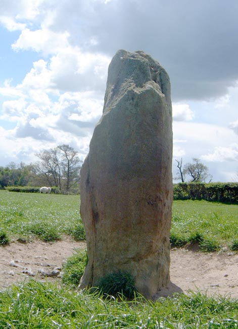
I did wonder if this could have once been upright, as the marks are on the edge, and the weathering does seem similar to what you’d see on a fallen standing stone. Odd placement of the cups and grooves, quite unlike the others in the area.


Millstone Burn 2h(i).
Otherwise know as ‘The little one just above the main one’.


Millstone Burn 1f. East side of the road, south of 1a.

Millstone Burn 1a, on the east side of the road, just by the mostly obscured footpath sign.
RCAHMS say:
“A stone circle of 9 almost evenly spaced monoliths (maximum height 1.2m) with an overall diameter of 7.8m. A quantity of small stones lies upon the site, but these appear to be the result of field clearance. The site lies within a cultivated field. There are no traces of an outer circle.”
According to RCAHMS:
“Clachmhor is a large triangular erratic block, situated in a pasture field to the NE of Culnakirk farmsteading. Its upper surface bears at least ninety weathered plain cupmarks, some conjoined in pairs, and measuring up to 90mm by 30mm. A ring of upcast material around the stone probably indicates a relatively recent attempt to move it.”
The following from Canmore:
“Guisachan, standing stone. In the parkland some 75m SW [NW] of the ruins of Guisachan House (NH22NE 7.00) is what appears to be a standing stone. The boulder is 1.7m wide at the base, 0.8m thick and 1.3m high, with a rounded ‘pointed’ top. There are 4 cup marks towards the base of the stone, in the centre of its NE face.”
Duncan and Harden, J and G (1987 a)
‘Guisachan, (Kiltarlity and Convinth parish) standing stone’,
Discovery Excav Scot, 1987, 25
This has to be up as a contender for the title of ‘rock art with the best view’. It really is in an excellent spot, with the big end of the cheviots arranged directly in front of you, leaving no doubt as to why this spot was chosen to be marked. I was particularly pleased on a recent visit to be able to confirm that the allegedly sacred hill of Simonside is also visible, which is unusual for this end of Northumberland.
What Fitzcoraldo says below about the ghostly appearance of the carvings is spot on, they do have an eldritch quality about them, an effect which is most pronounced in strong sunlight. At times, it’s possible to ook from angles that the motifs almost vanish into the quartzy glistening white surface of the outcrop. At other times, in different lighting conditions, they can appear totally different, and the surface of the outcrop looks much darker, and reflected light can pick the pattern out superbly.
You’d think that they’d be at their finest at sunset, but I found that the trees can cast annoying shadows which prevented the motifs from being highlighted as well as I’d hoped. Pah! One of these days I shall manage to get a good photo which shows the carvings and the view. It’d be great to spend a year or so standing over this outcrop watching it intently as it’s appearance shifts.
The panel Stubob speaks of at the top of the hill is one of the best examples of fresh pick marks, possibly evenmore so that the hidden motif at North Plantation. According to the Beckensall Archive, these fresh picks have been designated ‘Chatton 13’ (with only a 2m difference in the 10 digit refs, good going eh?!).
Whilst it seems a shame to expose such fresh cup marks to the ravages of the elements, they should provide a good indicator of the rate at which the stone hereabouts erodes. This in turn may help in attempts to ascertain the best preservation strategies for what remains of the area’s prehistoric rock art. Maybe.
Chatton 4 is in the middle of a little hillfort, (or a settlement with high banks), this is a lump of stone with carvings. It’s more or less in the middle of the earthworks, and it’s difficult to think that the builders of the earthworks were unaware of the carvings.
The cup and ring on the top of the slab are considerably more worn looking than the ones on the side. It’s tempting to think that this may have been because they were used in some way by the Iron Age (?) folk who built the earthworks. It’s definitely not just the results of natural weathering, more the kind of thing you’d get after years of people running their fingers over the motif. At least to my mind, but admittedly, I am just making this up as I go along
The panel to the east that Pebbles speaks of is that designated ‘Chatton 5’ by the Archive, and has an unusual little motif, both in it’s form and it’s position on a vertical surface.
One last thing to say about Chatton, it can be an infuriating place. There is so much that leaves nagging questions which will never be answered. There are maybe-cairns, maybe-cups, maybe-burnt mounds, traces of maybe-houses. Combine these maybes with the general mystery of the meanings of the motifs, add a strong sense that quarrying and erosion may have caused the loss of some carvings, and this is a place that needs to be pondered in depth.

Obscure, but part of the overall picture, Weetwood North is actually closer to Whitsunbank and Coldmartin Loughs than it is to Weetwood.
There are 2 panels, both nothing to compare with the fancier motifs in the area. Both associated with a robbed out cairn, which is almost impossible to discern these days.
One of the things that intrigued me the most was the ditch that seems to surround the little hillock upon which the cairn is built. If it’s prehistoric (which I have no evidence to indicate one way or the other), then it’s another example of an earthwork surrounding a panel of rock art. Not that I think they’re contemporary with each other, but there may be a causal link. I dunno, it’s something to think about when you’re tromping across moorland in the rain anyway.
I missed the more complex of the two, but details of both are to be found on the Beckensall Archive.


Weetwood North a
The radio mast thing at Coldmartin is in the Background

Weetwood 6


This is a high density rock art site. It’s easily possible to spend a couple of hours wandering about playing spot the carving. There are loads of them, most of them nowt to write home about, many quite seriously worn down. But it’s still fun to hunt about matching them up with their descriptions, just on the off chance that oe has been missed, or that the lighting conditions have revealed ones not recorded before (unlikely, but you never know...).
One thing that is assuredly the case, is that the more complex motifs occupy the higher ground, with the wider views. The main panel, listed as number 3 by Beckensall, has to rank in the top 5 of British rock art sites.
If you’re in a hurry and want to see some fines examples of prehistoric art, then nip up here, and make a beeline for Panels 3, 5 and 6. You could take in all 3, and be back in the car within 20mins.
Alternatively, if you’re not in a hurry, meander across the moor to Whitsunbank and Coldmartin, or if you’re feeling a bit hyper, tromp down to Chatton, then up to The Bowden doors, get a feel for the Till valley, and appreciate the landscape, to try and suss out the placing of the enormous number of carvings around the valley.
One source says: “This elongated, pear-shaped mound of stones is the best preserved cairn in Southern Scotland, due probably to its remote location. It lies in the Newcastleton Forest in a clearing next to a forestry track, some distance from any public road.
The cairn measures about 52m in length and at its widest part is 13.5m across. Stone slab chests which served as tombs are buried at various points within it, their locations indicated by upright slabs protruding from the mound.
The site was investigated in the C19th, but there is no published evidence of any result of the enquiry”
But according to RCAHMS,:
“An account of an investigation in 1870, after there had been a considerable disturbance of the cairn, mentions “several stone coffins of various sizes standing exposed”. When these were examined nothing was found except a little charcoal in one of them (J Brydon 1872). ”
NMRS Number: NY58NW 6

“The cairn is aligned WNW-ESE and includes a partly scrub covered mound of stones up to 2m high and measuring 45m along its long axis by a maximum of 22.5m wide. It is wedge shaped in plan with the wider end to the east, where there is a hollow thought to be the site of a collapsed megalithic chamber. Two indentations about halfway along the cairn’s long sides are thought to represent the position of two further megalithic chambers.”
From’t RSM
It always seems a bit odd to find a hillfort half-way up a hill. You’d think it would have been too easy for attackers to lob missiles down from above.
But, the inhabitants of Rothbury must have had their reasons I suppose. The fort is on a nicely situated plateau, and there are traces of hut circles. They went to a bit of effort to build the double ditch and rampart system, though in some places there’s just a single bank and ditch, as the natural slope is pretty steep.
There’s also a cairnfield with it’s own enclosure running up to the top of the hill, where the burial cairns and rock art can be found. EH say the cairns are clearance, but as they’ve not been excavated, and also as there are a number of confirmed burial cairns, I’d like to know how they could tell by just looking. Like those who build forts halfway up hills, I suppose EH must also have their reasons. As must the people who chose to pile field clearance cairns next to rock art, and then enclose the carin field.