
Very faint motifs brough out by side-spray of water and excessive post-processing of jpeg.
Image credit: IH
Very faint motifs brough out by side-spray of water and excessive post-processing of jpeg.
Very nice rock art site.
The photos here by Jan and Gus show what it looked like before the excavation. It looks a bit different now, the cairn isn’t there at all. Instead, there are a couple of motifs that were previously overlaid by the cairn. The results of the excavation concluded that the outcrop had been marked, then some of the carvings had been quarried, then re-marked, but in a way that implied a lack of understanding of the original motifs, and in a much cruder manner. Now I think this might be being a bit harsh on the Bronze agers who made the cairn. The crudeness of execution could possibly be that their motifs haven’t eroded quite as much, and just because they are not placed in a manner that allows the running of water from one to the other, doesn’t make them cruder as such. Whilst they may have not known the meaning of the original markings, it’s got to be highly probable that their own symbols, which are more complex, had meanings of their own.
It’s a great place to check out fresh peck marking. The two most complex designs are so clear you can count the individual pecks, they’re quite shallow and form unique designs, with closed penannulars and a strange keyhole shaped thing with a serpentine tail. There’s also an excellent example of what are referred to as enhanced channels. This is one of the ones that would have been covered by the cairn.
I’d definitely recommend visiting in dry weather when the bracken is low, as there are bogs and the bracken tops 6 feet in places. The ground is very uneven too, so it’s quite easy to trip over boulders, or have a foot or even a whole leg disappear into a crevice. There’s a IA settlement to the west and some BA cairns just to the east, but these are invisible in the high bracken of summer.
I didn’t have time to look for the other panels, but the main one was enough to make me quite content. There are enough motifs, some clear, others really faint, that I found an hour not long enough to appreciate the place properly.


Spider nest in cup and ring. Arachnoid des-res.
A handily convenient little panel, close to the road, just a short hop up the slope. The motifs were not immediately apparent, as someone had placed small rocks ver them, presumably in an effort to protect them from the elements. This had the advantage of providing a good spot fo a spder to make a nest in one of the cups. It was probably a bit surprised when it the stone lifted up and a hippy started peering at it with a camera.
There are faint traces of an older. Much more heavily eroded CnR, perhaps implying that like the nearby Hunterheugh panels, this one was re-carved at some point. It’s difficult to say, though the peckmarks on the lower CnR are clearer, it could jut be because it’s been covered over, whilst the others have been exposed.


Abysmal lighting and thick lichen on a rather worn CnR. So it goes.


There are a few panels at Snook, but I only caught a couple of them,, the lighting condition were appalling, to be honest the few pics I got are a bit naff.
The rock art is in an area with a cairnfield, one of which is supposedly a ring cairn. It’s also been quite heavily quarried. It’s proximity to ‘Millstone’ Burn gives a hint as to why. It’s really an extension of the Millstone Burn site, on the east side of the burn , with excellent views out over the coastal plain of Northumberland.
The highlight of the visit was undoubtedly the opportunity to see the Northumberland Rock Art Project at work. I have nothing but respect for these dedicated folks, who are giving up their spare time to help try and make sense of these enigmatic artefacts and determine the best ways for them to be protected for the future. The attention to detail in the recording is quite frankly astounding. They are collecting vast amounts of data on the placing and condition of the carvings, as well as spotting a few new panels.

Chatton 5: An unusual motif, with it’s gapped ring and it’s position on a vertical surface.

Chatton 5, with the area of the main panel just visible to the upper left.
This big old carved slab of a stone has a special place in the annals of rock art as it was one of the first (if not the first) to be recognised a prehistoric relic, back at the start of the 19thC.
There are a good few bits of lesser RA dotted about in the field with the main slab and it’s smaller sibling, many of which quite clearly show the signs of quarrying. The quarry marks on the big slab indicate that it may have had a narrow escape. Perhaps it was recognised as something worth keeping just in time.
I’d advise taking the route up behind the trees, rather than straight up the quickest route, save that for the way back down. The former is a much gentler slope, and as the ground is a bit on the sludgey side when wet, it’s probably easier and safer to go the slightly longer route.
I wish I’d known this when I once lugged a bloody great old style video camera up there. Nearly as much as I wish the tape hadn’t been recorded over. So it goes.
Once you get to the area marked on the map, you can’t miss the slab, stands out like a sore thumb with the smashig expanse of the moor stretching out behind it. The temptation to go yomping off over the moor is almost irresistable. There are cairns, cists, a hillfort, a ruined farmhouse, waterfalls, crags and allsorts of moor-type stuff.


This is an odd one.
I’ve seen a few cross sockets in Northumberland, and I can see why some people have suggested this could be one, as it’s probably been on one of the St Cuthbert pilgramage routes. The one time spring may infer some kind of fonty-ness, and whilst it does have metal chisel marks on part of the groove, it just doesn’t fit the bill as either a font or a cross socket. Not the ones I’ve seen in these parts.
But it doesn’t look like any of the prehistoric RA nearby either, but the area is dripping with such. So I’m going to hedge my bets and say that it’s a prehistoric jobby that’s been co-opted for early christian religious malarky.
Notes in the night
It serves as a very effective marker to let you know you’re on track to get to Ketley Crag after dark. It looms out at you, and the hollow in the side of Chatton Park Hill becomes a yawning gulf of shadow.

Some stones. I think these are the outer wall. This is about as good as it gets. Though in the autumn you can see the roundhouses quite clearly.

Wow! Look at that! It’s... er, a ditch. Gosh. How fascinating.
“You dragged us aall the way oot here to look at a ditch?”
An low-profile site if ever there was one.
I include it here mainly from fond memories of dragging some friends out to see it in the early 90’s which was the first time I heard the term ‘underwhelmed’. On that occasion, it actually looked a bit better than it does on the photos here, as it was autumn, and the vegetation was much lower.
A minor point of interest is that the adjacent footpath yielded what at the time looked like no more than a suspiciously spherical lump of stone, about the size of a grapefruit. The benefits of hindsight, and a couple of museum visits have since pointed out that this lump of stone was excatly the right size and texture to be roman ballista ammunition. Such a thing, found next to a late IA defended settlement, within spitting distance of the roman wall, caused my imagination to run rife, creating scenes of valiant defiance against overwhelming odds. Of course, it’s just as likely that this was nothing more dramatic than a bit of target practise.
The floorplan fits well with other excavated settlements in the area, two hutcircles are quite well defined, with a stockyard area, a much reduced bank and ditch. In places, the remains of cobbling can be seen. Generally speaking though, I wouldn’t go out of your way to visit, unless you have a thing about Millstone extraction sites or Curricks, both of which can be found further along the path, as can one of the most peaceful, secluded, truly relaxing waterfalls I’ve ever seen.


It’s a lot easier to find the outcrop now that the trees have gone. You don’t need a gps for this one anymore.
However, the shortest route from the main road is deceptive on the map. The footpath cutting through the old plantation looks nice and straightforward on the map, but in reality, it’s seriously difficult to walk over. Half buried, rotten tree stumps and branches combine with heather to form a rather irritating obstacle course. And that’s on a good day, I shudder to think how awkward crossing this would be if it were wet, when the bogginess would add to the fun.
All of this can be easily avoided by skirting the edges of the old plantation, it’s now got an open access sign, so whilst it seems a bit like going out of your way, it’s much quicker.
When you get to the outcrop, just keep heading to the furthest edge, and the carvings are easily found.
There are at least two overgrown cairns between the outcrop and the road, they don’t look like they’ve been mucked about with, though they are low, so may have been robbed out. They’re not marked on maps or recorded on databases as far as I know.
With it’s cups and multiple rings, nearby cairns and the obligatory view of Simonside, Tod Crag is a nice example of Northumberland Rock art. A bit out on a limb, but it sort of links the more complex motifs found in the north of the county, with the simpler ones found to the southern end of Northumberland. It’s halfway in between, both geographically and stylistically.

Panel 1a with the crescent moon setting above the distant silhouette of Simonside.


The view north, towards Simonside, from Middleton Bank Top. The silhouette of this hill may or may not have been a factor in the placement of this patch of rock art. But it keeps cropping up again and again, I reckon there’s something going on.

Showing 2c in reference to 2a, which is just by the rucksack at the top. As you can see from the photo, there’s been a lot of quarrying around here, bits of rock art turn up in walls in a few of the farms around Shaftoe Crags.

This paltry pair of cups nd a groove are not on the online archive, but if they were, they’d be Middleton Bank Top 2c.


Water to impose an interpretation of what’s there.

The grid ref given in ‘Prehistoric rock art in Northumberland’ is incorrect. Presumably it’s a typo, as it’s exactly 1km out. The book says NZ0587 8395, the Beckensall Archive says NZ 05835 82943 for panel 1a and NZ 05713 82995 for panel 2a. A good tromp for exactly a kilometre in the wrong direction has proven to me that the Online archive is telling the truth. A subsequent trek about the same distance to the North west has proven to me that it’s a good idea to verify your co-ordinates after you’ve entered them into a gps in a hurry. The irony of the whole thing being, that when I finally found the darn things, I didn’t use a gps, the book, or the map. By that time I knew the area quite well, and there was only one outcrop I hadn’t checked, the one with the carvings. Bah!
Havings said all this, Neither are spectacular examples, being quite seriously eroded. The stone is soft around here. But both panels are a lot clearer than the one at the nearby Hallion’s rock . They’re reasonably accessible, especially when the vegetation is low, both are just off the footpath, one either side. Look out for the feeding trough.
Whilst not fantastically inspiring bits of rock art, they add to the general loveliness of the Shaftoe Crags area. Especially neat is the cleft of the ‘Long Byres’ just to the south west of these panels, which I defy anyone to deny as being a prime spot for any self-respecting hunter-gatherers to bed down for the night.
As usual for the area, there is an obligatory view of Simonside, silhouetted against the horizon, but this potentially significant view is annoyingly obscured by trees from panel 2a.

The basin is the thing just to the left of the image.


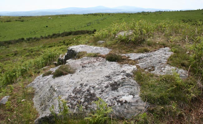
The outcrop viewed from the north.
A modest, yet nicely executed bit of rock art.
Two motifs, each with a couple of rings, either side of an enhanced natural basin, directly above what looks like a rock shelter. It’s quite licheny, and when you pour water on the motifs, it trickles down quite nicely into the basin.
There’s a vague line of stones running from here back up the hill to the cairn, but it’s so disturbed, and there are so many other stones lying about, it’s probably just my imagination.
The outcrop is the lowest, and last on the ridge to the north of the cairn, where the land dips down.
GPS stuff: NU 04739 03139, elevation 234m

From SB’s 1986 Shire Archaeology series ‘Rock Carvings of Northern Britain’ ISBN 0 85263 760 8
Reproduced with kind permission.
8 figure grid ref: NX 5285 5738
RCAHMS says:
“This cup and-ring marked rock is situated on a gentle slope on the SE flank of Cambret Moor to the W of a field-system (NX55NW 26). The smooth, slightly sloping, upper face of the rock bears a faint cup-and-ring, around which there is a spiral which completes six circuits of the cup and-ring, measuring 650mm across. A channel runs out from the cup through the ring and spiral. Also on the rock, there is a cup and three rings, measuring 250mm across, and what may be two large pock-marks near the edge of the slab.”


