

This place lives up to the hype. Not a big panel, and a pretty cramped rock shelter, but such carvings! So well placed and superbly executed, a masterpiece of prehistory.
The motifs at Chatton are snazzy enough, but if you go to Chatton, make time for the ‘Neolithic Lino’ in the rockshelter. It’s right down at the bottom of the slope, so maybe nip down from the top, avoiding the outcrops, then walk along, especially if it’s wet, as the soil is v. loose and rather dodgy underfoot (besides, one should attempt to minimise erosion).
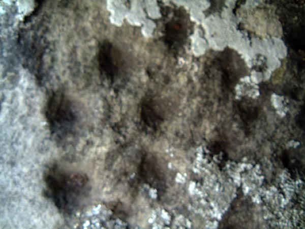
It’s a great place to see how carvings erode over the years, the motifs at the back are worndown where they’ve been exposed longer, whereas those at the front, which were turfed over until quite recently, still have their peckmarks plain to see.
My mind is not convinced by the alleged standing stone just up from the rockshelter. I think it’s equally likely it’s an erratic that’s simply fallen upright as it fell down the slope. There are many others which are at various angles.

Panel 1a. Rock art doesn’t get much more eroded than this. If it does, it’s not really rock art anymore, it’s just bare rock.
Try though I did, I did not find this (again) today. Though the cairnfield is definitely there, and possibly enclosed, I was bamboozled by the crazy weathering on just about every damn stone, outcrop and boulder in this area. And the lovely lichen, some of which is in fruit, which was good to see.
Find that obscure rock art next time, maybe.

The glove is pointing to the very faint motif with multiple rings around the cup.

Burial cairn (since enhanced by modern walkers) about 30m SW of the titchy stone. One hell of a good burial spot for anyone who had a thing about Simonside whilst they were alive.
Directly rieved from the RSM:
“The monument, which falls into six separate areas of protection, includes the earthworks and buried remains of Mickleden Beck prehistoric cairnfield, an associated field system, a funerary cairn and a medieval dispersed settlement. It is located on unenclosed land along the valley
floor either side of Mickleden Beck and is centred 840m south west of Pike of Stickle. The monument represents evidence for the prehistoric and medieval exploitation of this landscape.
The prehistoric cairnfield consists of four groups of round and oval-shaped clearance cairns, two on the north bank of Mickleden Beck, two on the south bank. The group centred at NY27180645 consists of over 30 cairns up to 0.7m high; the round cairns measure between 1.9m to 5.4m in diameter while the oval-shaped cairns measure between 1.8m to 19m long by 1.8m to 6.9m wide. Within this group of cairns there is part of an associated field system comprising discontinuous and generally irregular stone banks and elongated cairns following the alignment of the valley. A cross-valley stone bank has a greater width and stone volume than the valley-aligned bank. The cairn group centred at NY27060624 consists of over 20 cairns up to 0.6m high; the round cairns measure between 3m to 5.4m in diameter while the oval-shaped cairns measure between 2.3m to 11m long by 1.8m to 6.6m wide. There are two alignments of elongated cairns suggesting that these may have been constructed along the lines of former boundaries. At the eastern end of this group of cairns there is a short length of stone bank. The cairn group centred at NY26800676 consists of over 30 cairns up to 0.6m high; the round cairns measure between 2m to 8m in diameter while the oval-shaped cairns measure between 1.9m to 14m long by 1.8m to 6m wide. Within this group of cairns there are further traces of the associated field system, the most significant element being a cross-valley wall and a series of stone banks meandering along the valley.
As with the previously described cross-valley wall this one is also much more substantially built than the valley-aligned banks. Pollen samples taken from beneath both of the cross-valley walls suggest a pre-medieval date. The stone banks include cairns within their overall alignments and their form is more consistent with stone clearance which may have been deposited against former boundary markers. They appear to define two irregular and discontinuous lines along the valley.
The cairn group centred at NY26320689 consists of seven cairns up to 0.7m high; the round cairns measure between 2.7m to 3.5m in diamater while the oval-shaped cairns measure between 3.3m to 5m long by 2.5m to 4m wide. There is a small semi-circular stone bank just to the north of the cairns. To the south east of this cairn group there is a field consisting of a gently-sloping area of cleared pasture bounded by streams on three sides and a continuous decayed stone wall on the remaining side. This wall effectively acts as the fourth side of an enclosing quadrilateral as it links two parallel streams. There are two entrances through the wall, one at the north end the other near the centre. This enclosed land is largely clear of surface stone, is well-drained, and is relatively good quality pasture land.
Within the field there is a single oval-shaped cairn which is interpreted as a funerary cairn. It consists of a small circle of approximately 20 stones which define an external kerb surrounding a slightly raised scatter of smaller stones. It measures 4m by 3m and is 0.25m high with a slight surface depression possibly indicative of disturbance. The form of this cairn corresponds with the Kerb Cairn monument type, and excavated Scottish examples are typically dated to the later Bronze Age. At NY26200733 there are the remains of a rectangular stock enclosure bounded by a series of stone banks and cairns. There is a small circular stone-free shelter built into the enclosure’s south west wall.”
Mickleden Beck is a virtually intact prehistoric landscape. A walk along it from east to west is like wandering back through time. The lower end is still farmed today, and has field clearance still going on, within field boundaries unchanged in centuries. As you get a bit further along, past the curve, the remains of medieval settlement give way to BA field boundaries and cairns on either side of the beck.. Throughout the journey, the Neolithic looms omnipresent in the form of Pike O Stickle to your right.
This is such a gorgeously secluded place, the valley is 3-sided, with nice steep slopes on left and right, and when you get to the end, it just stops. Steep slope at the end too. The road to nowhere.It’s quiet too, the sound of the water babbling over the stones is lovely and soothing. Whilst you wander, you can engage in the obligatory game of spot the axe rough-out. We didn’t find owt particularly special, but there were a few bits of andesite that looked very much like the bits that flake off flint when it is knapped.
It’s worth keeping going to the end of the valley, as the sheepfold at the end is sufficiently peculiar to warrant a good pondering. It has two little rooms off to the side, like you’d see on the footprint of an excavated roundhouse. Combine this with a vague bank and ditch, it’s very tempting to think of it as being a re-used ancient dwelling. Maybe they used to polish axes here, you never know…
A good spot on top of the Pike would perhaps lend a view sufficient to show up all of the field boundaries/cairns and maybe help make sense of the confusing jumble of millennia still visible in this fantastic valley.
Oh, and the sheep are inexplicably fluffy. They try to look menacing, but they are just too fluffy to get away with it.

Flake from an axe rough-out. Notice the conchoidal fracturing. You can knap this stuff like flint it would seem.

Currently residing in Newcastle Upon Tyne Museum of Antiquities.
(The haft is a replica)

Currently residing in Newcastle Upon Tyne Museum of Antiquities


A bit of an iffy one this, as the jury is still out regarding the existance of any chambered cairns in the Cheviots, but a double row of parallel upright stones described in Northumberland County History (Vol. XV, p.38) and located at NT76410347, currently in plantation, has been interpeted as the remains of a chambered long cairn.


Chinese pond in the background, quite picturesque, but rather a shame to have uprooted the poor thing.


Bit of a suspiciously straight edge from this angle.
A relocated stone, this one is currently out of favour with the Archaeologists as it’s obviously not in it’s original context.
It currently resides next to the Chinese Pond in the gardens of Walington Hall, where it was placed in the 18th century, having been moved from it’s original position on the NE side of the Poind burial mound near Belsay, on the other side of Shaftoe Crags.
In it’s present state, it’s about 7ft tall, but was probably shorter when in a socket. It’s slightly squared base raises questions of possible interference by it’s re-locators and may also add weight to the argument that the Middleton stone, more or less halfway between Wallington and The Poind, may have also been shifted, as it too has a squared base with heavily weathered grooves and fluting on the top.
Rumour once had it that there was a circle in the vicinity of Shaftoe crags, and all 3 of these stones may have been part of it, it’s easy to imagine a Duddo-like small circle, with similar groovey-fluting.
Either way, this stone seems to have a bit of a ‘somebody-else’s-problem’ field about it in that many people visit Wallington and the Chinese Pond, yet few notice/remember this stone, despite it being smack bang next to the path.
In this position, it’s probably the most accessible of Northumbrtian prehistoric relics, but being in the grounds of the hall, you have to pay the entry fee.

Error 404. Stone not found. This stone may* have been moved from a different location.
* No doubt about it really.


The stone is fairly easy to find, it’s embedded into the south side of the bridge, just under the arch. When the Beckensall archive describes it a 80cm from the bridge, it’s not a typo.
There’s a convenient parking spot just on the bend of the road for those in cars, but beware the humpbacked bridge, it makes a blind summit, and has been the site of a few head-on dunches in the past, so beep as you approach. It’s fairly easy to get down to the stone, there’s a gate in the fence, and a permissive path.
If it’s dry, you’d be hard pressed to make out the rings unless the light was very low. Fortunately, there’s all this water right next to it, so the full motif is easy to moisten to bring out the detail.
I can’t help but think that the people who put it here may not have noticed it, and that there may be others in the immediate vicinity. Given the bridges proximity to the carvings still in situ at Middleton and Shaftoe crags, and the portables at Old Deanham, it’s a good chance there are more marked stones in the area waiting discovery.
Rumor has it there was once a large panel in the area, which has been covered over for a long time now. Hopefully it’s still there and hasn’t been broken up. Lots of the prehistoric stones around here have been broken and/or moved.

Panel 1d. Above an overhang, about 3m up, more or less 20m to the left of 1c, (22m left of 1b).

Panel 1b. At about the height of a (wet) knee.


When you look at the map, it’s easy to think that it should be possible to get here from the north side of the river Coquet. There’s a nice dotted green line crossing the river, just to the west of the cliff. Do not be fooled. This may be a suitable fording place if the river is exceptionally low, but when I visited, the water came up to me waist and the current was strong enough to cause slight concern.
Still, it was worth it, as this is a unique collection of carvings.
There’s just enough room to scramble along the edge of the river below the cliff, but the ground is quite sandy and loose, and the overhangs mean that quite a bit of ducking and dodging is mandatory, so a hard hat may be another thing to add to the list of required kit.
The panels are spread along the cliff, at various heights. It’s worth checking the Beckensall archive link to get an idea of what’s there, but as yet, no-one has come up with a diagram of exactly where each panel is on the cliff. This isn’t surprising, as it’s a very 3-D surface, and making a decent diagram would be quite tricky. Besides which only nut-cases* are likely to actually go visit such an inaccessible panel of faint carvings, so there wouldn’t be much call for such a diagram.
The site has a quite powerful atmosphere, especially when you’re sitting hiding from the rain under the overhangs of the rockshelter. Perfect opportunity for pondering the whys and wherefores of the unusual motifs. They’re made all the more inscrutable by the lack of any other prehistoric remains in the vicinity, though Beckensall reports that years ago, it was said that there were possible burial mounds nearby.
One thing that occured to me on the way back to Warkworth, is that to a bod travelling up the Coquet from the sea, the hill directly above Jack Rock is the first one which affords a view of the omni-present Simonside. It also seems that the present level of the river is unlikely to have been the same when the carvings were made, but why this should be of any significance is difficult to pin down, other than vague thoughts of why some motifs are ‘up-a-height’, whilst others are ‘way-doon-below’.
* By which I mean, err, ‘Dedicated Rock Art Enthusiasts‘

Advance of the sheep of doooooom. Hardy little blighters they are too.

Screeeeeeeeeeeeeeee!
But no jumping allowed.

Panel 2f, right the way up the cliff, still with it’s protective(?) coating of lichen.
A whole load of pages, showing all 14 panels discovered so far.
A bunch of photos of the outcrop and it’s carvings
A bunch of images of the portable rock art embedded in the bridge foundations.

Possibly a fallen orthostat, about half way between Heughscar Hill and the the words ‘Hag Stones’ on the map.
Another route up to the moor is from the village of Askham, as you can see on the map. this allows a quick route to the top of Heughscar Hill. This allows a good vista over Moor Divock, without having to get all knackered going up the High Street. With a pair of binoculars you can probably make out a lot of the stones and cairns. Without them, you can sort of see the way down to the Cockpit and White Raise.
There are a couple of nice pubs in askham too.


‘Natural’ cup? I have serious doubts, despite Mssrs Hzssledine and Haszeldine claiming this to be the case.
>Edit< I'm a lot more open to the idea they are natural now I come to think about it all again...


