
V
vulcan


The Bulwarks on Minchinhampton common could be iron age or possibly later. The earthworkings are about 1 mile in length stretching between SO857004 and SO863013 and possibly cut into bedrock. There may also have been a dry stone wall some 4 foot in height retaining the spoil of the waste stone. There have also been modern day quarrying of stone from the SO857004 end.
Image credit: Vulcan

Having walked up the long ‘passage’ up the hill, and you thought the climb was over, you are then greeted with this sight!!
Image credit: Mike


View of the very steep natural defence of the South west side. Not shown on the picture is a small ditch defence at the bottom of this natural embankment.
Image credit: mike


This folly castle was built in the mid 1700’s on the hill that was originally an iron age camp. St Blaisus (sp?) an hermit lived on the hill and thats where today we get the term blaizer for jacketwear. There is some connection to Jane Austen and the castle whether it was a direct connection or featured in her storyline, I’m not sure.

Blaise Castle built in the 1770’s as a folly. The castle is sited on top of the Iron Age Camp in the grounds of the estate.


The tree here in the ditch may have a good reason to be there – to stop mountain bikers? The exhaust pipe has no reason to be there.

A double ditch defence. At this point the centre bank peters out.


This may well be the southern most henge of Priddy Circles?


The ‘tump’, as it’s colloquially named, is a later feature of the 22 acre Maes Knoll fort and is part the great earthwork, Wansdyke.

If you go to the fort this way, as I did, then you will soon realise the mistake you made!!

Boundry of the fort
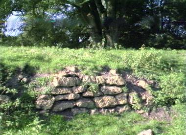
These loose stones have been cut out of the bedrock.

Is this what remains of Felton longbarrow? Is it the longbarrow?

Westbury White Horse and the tell tell signs of the ramparts of an Iron Age camp just to the right of the horse- in this case Bratton camp.

Glastonbury Tor just visible on the horizon (approx 15 miles). Glastonbury Tor, Brent Knoll would have been used as beacon signalling against Irish invaders coming up the Bristol Channel.

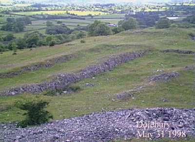
Looking down onto the well defined ramparts and ditches.
Part of the ancient wall defences for South Cadbury

Disturbed ground where ‘Arthurs hall’ was discovered.

Grotto – A Victorian folly.

The layout of the fort.

Cross sectional view – artist impression of how it would have looked.

Rocky outcrop on top the fort.
You can see where they got the stone for building the walls.


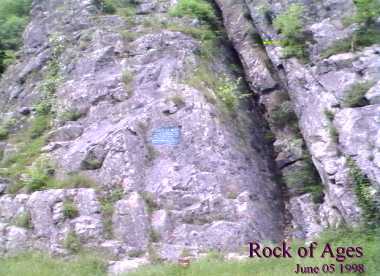
Nearby Aveline’s Hole is the cleft in the rocks where the Rev Toplady was inspired to write the hymn ‘Rock of Ages’ while sheltering from a thunder storm.


Fort is approached by a permissive footpath from the A46. It’s a well preserved fort.


1-50 of 60 imagesNext page