
fitzcoraldo


Whitby Gazette
A £27,000 funding boost is to be used to help document the archaeological recording and research of sites unearthed following the Fylingdales Moor fire in September 2003.
The £26,900 project, which is being funded by English Heritage, will also be used to produce advice on lessons learnt from the fire and subsequent restoration projects as well as guidance on disaster planning for moorland environments which contain historic sites.
It will be managed by the North York Moors National Park Authority and Blaise Vyner, an experienced local archaeologist and private consultant who has been involved in the site since the initial post-fire archaeological survey, will carry out the project.
More here…whitbygazette.co.uk/news/Cash-to-reveal-moors-secrets.4414314.jp
Firestone
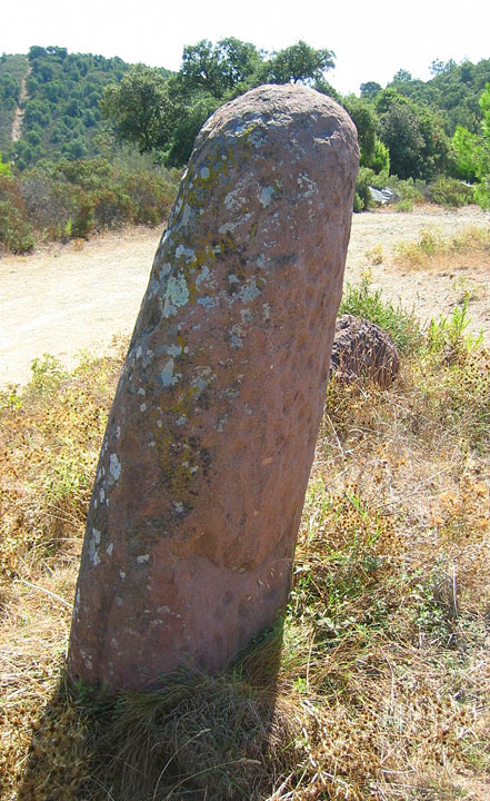
Three thousand springs tombed beneath the peat,
each autumn spreads another blanket
to muffle the curlew’s sobs,
the pipits all.
One feckless fag end thumbed into the wind
and flame rips away your shroud;
leaves you nude staring up
at clouds.
In a carbonised land of blackened ling,
Saxon dykes, Danish tracks, alum roads,
tank ruts, a scatter of roasted adders
and bird silence.
Astonished at the sun, at the lenses, the men
measure your incised lines, the questions:
boundary stone? map to find Orion?
stone speech?
Or just some hide-clad priest’s contraption,
to be unveiled on sacred days to steer
the same old shivering fear safe
into his hands
Harry Nicholson July 2007
From
Voice of the Moors – Magazine of the North York Moors Association.
Issue 90 Autumn-Winter 2007
north-yorkshire-moors.org.uk/voice_magazine/voice_90.pdf
The following folklore is taken from, Dolmens & menhirs de Provence by Daniel Riba (pub. Equilibres 1984). Riba credits the tale to J. P. Clebert.
The tale was written in french all I have done is is typed it into the babel fish translator. I could have paraphrased the tale but I have decided to paste the translation it its entirety as I believe that the babel fish adds its own poetry to the tale.
It was time a fairy which liked has to be disguised as a shepherdess. Thus disguised, it from went away, under the thickets of oragers and pomegranates, and played of the mandoline. The false shepherdess, thanks to her beauty and, fear-to be, has some magic melody, arrived has to inspire a great passion has a young genius of the vicinity which finishes by him requiring its hand. The fairy authorized to grant it to him, if it accepted, of its dimension, that the marriage was famous on a table formed of three stones of which she made him a meticulous portrait. The young man recognized in the description of his beloved the stones which, for ten centuries, had had descends the mountain of Frejus to pile up with the bottom of the close throat. Joining together all its supernaturelles forces, physics and, he arrived has to draw up the two first stones, but was unable of deplasser third. Overpower, it believed to have lost the hand of the shepherdess.
But the fairy, has which it was not indifferent, took it in pity. The following night, it approached the recalcitrant stone and traced around it a magic circle. At once, an immense flame rose and the heavy flagstone was transported on the two others. At dawn, the shepherdess magician supervised her lover to share her joy at the time or he would discover the wonder. But the young man understood only that it was a quite modest genius and that it was condemns has to die because it liked a fairy more skilful than him. He thus died, followed soon by the fairy, insane of despair.
Another legend makes following the preceding one and the end disputes some, since it holds for ensures that the fairy survived has his/her unhappy companion it disappears only in smoke, without to join the kingdom of the shades. During the clear nights of winter, it returns to contemplate its jewels, masks under the dolmen. A pure young girl who would see it then would be likely to receive in gift a handle of pearls or diamonds. For reaches the treasure, the fairy seizes the horizontal flagstone, then of only one gesture, it makes half-open the ground: it is which pile up of the trunks loads of gold and precious stones. But of all the young girls who came there to spend a sleepless night, none has borer never yet the secrecy of the dolmen. From where the legend concludes that the purity is a difficult way
A pdf guide to the megaliths of Var
various galleries and information regarding prehistoric Provence
A wiki page of pictures of the various Var dolmens

Currie, Frodsham and Beckensall at the Ben Lawers excavation

Jesus makes the scene and small children provide the scale in this old postcard.
Image credit: Collection Germain fils aine. St. Malo


From an old unmarked postcard
Image credit: Laurent Nel. Rennes
An almost overgrown circle of stones sited on a small natural ridge appears to be the kerb of a mound10-20cm high. How much of this mound is natural is unclear.
Prehistoric Monuments of the Lake District.
Tom Clare
Tempus
2007
From Lacra C the terrier and I headed across the fields in search of the elusive avenues. After crossing some boggy low ground we came across a group of stones that more or less fitted Burls description of ‘a few footballish boulders’. The eye of faith is definitely required here but given enough to-ing and fro-ing it is possible to make out an avenue. Saying that, if Mr Burl had said that they were just a fortuitous arrangement of boulders I would also agree with him.
I’m not too sure what to say about this site other than have a look for yourself and see what you think.
From Lacra B the terrier and I walked west for a 100 or so metres to Lacra C. In the past these three stones have been interpreted as the ruins of a stone circle. Aubrey Burl is of the opinion that this is a fallen three, possibly four, stone row, which when you see the stones makes a lot more sense and besides that if anyone knows the difference between a circle and a row it’s Mr Burl.
The stones themselves are quite low but of a decent size, they are aligned roughly north east-south west and are graded in size, the largest being the most northerly.
The largest stone also makes a handy seat to once again sit down and admire the views.
From the village I followed the footpath that crosses the railway and then follows a sunken trackway uphill. As I walked up through the rough pastures I was aware of Black Combe, this hill is huge but in my opinion its presence is almost benign. This massive, soft, whale-back of a hill has to compete with two other even larger presences, the sea in front of it and the central fells behind it. Never the less Black Combe looked marvellous and reminded me of Benarty in Fife, part of the landscape but not domineering.
What drew my eye from the hill was the gentle curve of the coast, the estuaries and of course, the sea. As I reached the top of the hill I was able to look along the coast over Millom, the Duddon estuary, Barrow, Walney Island, and across Morecambe Bay into Lancashire and on to North Wales, and as my eyes got used to the haze I was able to make out the faint profile of the Isle of Man on the horizon.
Once at the top of the hill the terrier and I made our way over to Lacra B. We found the circle quite easily. The circle is sat in knoll on the hillside, all around the circle are large outcrops of bedrock jutting out through the turf at forty five degrees almost as if they are defending the stone ring.
The circle is composed of low stones and has definitely seen better days. The largest stone is just over a metre tall. It’s possible to make out the slight rise of the central cairn but the thing that gives this circle its charm is the views, again it’s the Duddon estuary, the coast and the coastal plain that draw the eye with Black Combe still visible over the brow of the hill.
I sat down in the circle and thought about how the land was used in the past, the estuaries and coast would have been an attractive place to live, Early man would have found this a rich place to forage and hunt. Wildfowl, shellfish, fish and animals would have lived here in abundance. Later, the pastoralists and farmers would have found the fertile Cumbrian plain ideal for raising stock; the surrounding hills would have provided summer pastures, much as they do today. The fertile soils of the coastal plain would also be an ideal place to plant and raise crops, the rivers running off the hills would have ensured an abundance of clean, fresh water, the wooded slopes providing an almost endless supply of timber for building and fuel.
The coast would have also provided the opportunity for contact with others. Archaeological evidence shows us that people have been navigating these coasts since at least the Neolithic, this part of Cumbria would have been an ideal stopping-off point for those early navigators steering a course to and from Wales, the Isle of Man, Southern Scotland or Ireland and they may well have used Black Combe as a guide.

Regarding the Drawing by Sir J.Y. Simpson.
Plate XXVII is a rough sketch of a large slab cut with cups and rings, and groups of circles apparently with radial grooves similar to those of Scotland and England, which was found in the western county of Kerry. A cast of it has been for many years in the museum of the Royal Irish Academy. My friend Dr Stokes states to me that he has seen a similar ring or circle cutting the rocks in situ a mile or two from the celebrated Staigue Fort in the same county.
From
Archaic Sculpturings of Cups, Circles, &c. upon Stones and Rocks in Scotland, England & other Countries
by
Sir J.Y. Simpson, Bart, MD, DCL
Published by
Edmonston & Douglas
Edinburgh 1867

“A slab from Kerry, Ireland”
Plate XXVII
From
Archaic Sculpturings of Cups, Circles, &c. upon Stones and Rocks in Scotland, England & other Countries
by
Sir J.Y. Simpson, Bart, MD, DCL
Published by
Edmonston & Douglas
Edinburgh 1867


From
R.D. Derbishire. 1873
Notes on discoveries at Ehenside Tarn, Cumberland.
Archaeologia 44, 273-92.
Image credit: R. D. Darbishire

From
R.D. Derbishire. 1873
Notes on discoveries at Ehenside Tarn, Cumberland.
Archaeologia 44, 273-92.
Image credit: R.D. Derbishire

From
R.D. Derbishire. 1873
Notes on discoveries at Ehenside Tarn, Cumberland.
Archaeologia 44, 273-92.
Image credit: R. D. Darbishire


I walked here from Boat Howe following the ridge down from the Howe to Bulatt Bridge and then taking the left hand path towards Wasdale Head.
To find the cairn, once you have passed some broken down enclosure walls keep following the path up a sharp incline walk on a few more yards and then head east towards Hard Rigg, you should be able to see the cairn after a few yards.
The cairn sits on a col between Wasdale and Eskdale moor and as such may mark some form of territorial boundary, a liminal space. The setting couldn’t be any better with the drama of the southern fells laid out before it.
The SMR states that this is a round cairn topped with a tumbled drystone wall of a circular sheepfold. It also states that local tradition has it that this was once a beacon, one of a chain between Millom and Cockermouth.
Whatever it was, it is now a very special place and is well worth a visit if only to sit within it’s walls and watch the shadows of clouds move across the fells.
To return to the path, I would advise that you retrace your steps, the area south of the cairn is very marshy, as I found out to my cost. On the plus side, I picked a large bagful of wild thyme from this area and encountered a huge dragonfly.

Looking SW from Boat Howe along Miterdale to the coastal plain


