Stands dwarfed by modern traffic signs beside a crossroads on the old Bodmin/ St Neot road. Is it a menhir or just a large upright stone that was once itself a road sign?
There is a lump of metal imbeded in the top of it that may have sometime had a sign in.
Mr Hamhead
‘The Roman Camp’: Iron Age hillfort to the west of St Neot. It has been ploughed over but is still visible as a large square? shaped mound in the centre of a field.
Like King Arthur’s Hall this earthwork is a bit of a mystery. It stands on high ground to the west of the village of St Neot on the road to Bodmin. Allthough much of the centre of it has been disturbed by shallow mining it’s outer walls remain. The whole thing measures 160ft by 120ft in a rough rectangle.
Carburrow is one of those areas on Bodmin Moor that contain so much history in such a small area. Extensive Bronze Age huts litter the southern slopes with the remains of a long house up against the wall at the bottom (very near Tor farmhouse). There are two cairns atop of the tor, the one on the eastern side was hollowed out in the 2nd World War so the home guard could use it as a lookout post.


Close up of Inscribed stone (I have tried to adjust the contrast to help read the lettering)
Image credit: Mr Hamhead

According to the local history book for Lanteglos parish a stone lined cist was discovered here by the local farmer whilst he was ploughing in the early 1970’s.
Sorry Phil but “Essa 3” is the possible stump of a menhir that Robin Payne mentions on page 249 and 250.
In the hedge behind it there are several other large stones of the same type and the Devils Stone is at the bottom of the field.
The Essa stones puzzle me although I have to admit Essa 1 does look like it could be “proper” as we say down here.
You do wonder how long this one will stay upright what with all the erosion around its base caused by cattle and water.
The Devil’s Stone is in danger of being completely obscured by ivy and other green things!
It stands beside the minor road from Polruan to Lanteglos Church and got its name from the fact that coffins would be rested on it! (so says Robin Payne in the book “Romance of the Stones”) He goes on to say that it is believed to be part of a group of stones that may have made up a barrow in the area mentioned on the 1803 OS map.
There are two or three other large stones built into the wall just inside the field and also on the othere side of the road to the left of the gateway.
The stones are not in keeping with most of the soft cornish slate that is generaly found in this area so must have been brought to this spot but I am still not convinced.
If you walk around the fields here you will see many large lumps built into walls as well as the three Essa stones.
If they were building a barrow wouldnt they have used smaller stones easier to transport?
The tithe map does mention a barrow field at Triggabrowne, further east from the church but why would they then transport stones half a mile or so along the ridge just to leave them in a pile beside the track?
The Barrow Field, as it is known locally, can be viewed by walking south from the Spar shop in Pelynt village. A nice lane heads from the car park down to Wilton Mill where the path vears to the left around the property. Follow the track beside a pond to the road, turn left up the hill. The barrow field in on your left and can soon be viewed through a gate way. I have not been able to make out anything of any signifigance in here, the field being ploughed on regular occasions (what poor eyesite I had...on my most recent trip I walked into the field and identified perhaps 7 barrows, although they have all been “landscaped” by the plough over the years)
.
Continue up the lane turning left after the next field to take a green lane back to the village.
For more information on the discoveries in this field seek out Geofrey Grigson’s book “Freedom of the Parish”.
It is not easy to make anything out in the field where Bake Rings once were. There are many undulations in the field (and on the other side of the road) but to say what shape or form they once took is very difficult.
Not a site worth going out of your way to view.
4th Jan 2004
I can’t believe I have never visited this place before. I have driven past it so many times and I see it everyday on the horizon....but never ventured up to it.
To reach somewhere to park it is possible to take the narrow lane off the B3359 just to the north of the hillfort. This leads up to the radio mast (a landmark for many miles around). WARNING! in order to turn round you will have to go off road on what is a very muddy track in the winter. I managed to park by a gateway once I had turned round. The other problem is getting back onto the main road, nasty junction!
It might be advisable to park in the laybye on the B3359 just further on, from there a footpath cuts cross the field towards the hillfort.
The walk from the road is a short sharp climb until you suddenly come across this large earth bank. I had never realised how large it was, standing in the ditch I would put the bank at up to 9ft high in places. Once inside there is a wonderful flat space gently sloping to the west. I walked straight across and measured 100 paces. The entrance to the fort is on the west side and here the ditch has been filled in to allow access.
The view even on a dull winters day is superb. Looking south you can see the sea from Looe bay to the Dodman, the clay “hills” disapear as you turn to the right and Helman Tor and then Rough Tor and Brown Willy come into view. Further round Kilmar Tor, Stowes Hill and Caradon Hill can be seen before the hill behind the fort obscures further vistas.
Walking around the ditch I noticed how much quartz had been used in the construction of the bank. The stone is common in the area (see Duloe Stone Circle) but it made me wonder what the fort would have looked like in those early days before grass had taken hold, especially on moonlit nights.
Just a last note....on the west side of the bank there sits in the ditch a large lump of rock, it is very similar to the lumps at Essa, nr Polruan. Is this just a lump of rock or was it once a menhir?
28 Nov 2003
Five months since my last trip I am on top of the world again. Little bit colder today but still a good view. It is actually busier today then it was at midsummer. The five telescopic stick waving regatterd up hikers passed by with a quick glance up at the trig point but a big Cornish well done to the three student types (including the one with the wild mohecan) who had traipsed up there from Codda through bog and stream. The fact that we had to tell them where they were isn’t important, they did it (I am also going to forgive them for calling us professional ramblers just because my mate had a GPS)
I just wonder if they ever found their way back?
28 Nov 2003
The sun was setting as we climbed up the hill towards the cairn. King Arthurs Hall had shown itself to me from a different angle...walking to it from Casehill it looks as if it sits in a bowl, but from the north it is sat on the ridge. Anyway, we had visited it earlier in the day and as the sun was leaving us and we had just walked 8 miles there was no point in detouring again.
After the dissapointment of the two cairns supposedly near Loudon Circle it was nice to find something that could be identified. In what is a manmade view, ie wall built on one side of it and the clay tips of Hensbarrow in the distance, it is not easy to visualise the position this cairn had in the prehistoric landscape. All I know is, on this fine winters day as the sun set in the west there was a fine view from this spot.
The amount of large stone lying in the area here does suggest that there may have been “something else”. If so and if it was situated where it now lays then by looking east you would view the three cairns as models of Showery Tor, Roughtor and Brown Willy. Any thoughts?
The three cairns are worth looking at, they have stone work that seems to be laid in circles rather than the massed piles that I am more familiar with on the moor. There is a fair amout of quartz but then it is prevelent on that side of the moor in many old walls so I think it was just the stone availiable.
In the field to the south of the cairns is another “standing stone” with a recumbent stone beside it, or is it a rubbing stone?
After walking around Michealstow I decided to head up to the Beacon. I local farmer had told me that although it is on private land there was a stile over the wall that everyone uses. This was not the easiest thing to find but once over the walk to the hill fort was simple.
The gorse covered banks surround the site of a medieval chapel and some stone work remains amongst the undergrowth incl part of an arch. Some of the forts original banks have suffered from sheep erosion and in places the area has been quarried for the local greenstone.
It is still a wonderful place in which to sit and take in the views.
Just a word of warning to anyone thinking of visiting this site. The landowner is not at all happy for people to set foot on his land. He has “asked” me not to use the footpath that runs through his farm and has gone to court to try and get it taken off the map. I have also been told by others in the know that he has threatened others, so...

Sun rises over Northern Dartmoor 5.05 AM 21.6.03 as seen from Rilaton Barrow.
Image credit: Mr Hamhead

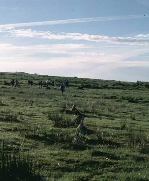
The gathering waiting for the sun, 4.45 AM 21.6.03
Image credit: Mr Hamhead
Looking NE 6AM 21st June 2003, Not the best picture in the world.
Image credit: Mr Hamhead
Kerris Inscribed Stone
Whilst in Penzance for Golowan (who needs Glastonbury?) I had to visit some friends out at Kerris. First time I had been to the house so imagine my surprise when they told me they had a “stone” in their fireplace.
The house has been renovated over the last few years from a very ruinous state. Whilst making the old fireplace safe they discovered letters on a granite upright. Calling in Craig Weatherhill, who then called others they found out they had a 6th century inscribed stone. It is in a form of Latin and spells out something to do with Kerris. I promise to find out more....
Although not inscribed, the stones in the fireplace at the other end of the cottage are huge! If as they have been told there was possibly a circle in the area before Borlase came then perhaps this is what happened to the stones. The biggest one that makes the right hand side wall of the fireplace is approx 4 ft deep by 6 ft high! whilst the lintel is a good 7 ft long.
Again, pointed out to me by Iain, this embankment is in line with the stone circle and Brown Gelly. It may also line up with the Hurlers and Caradon Hill but neither are visible(except for the TV mast). The trackway passes between small barrows for approx 25 yardsup the hill. There are also two barrows on the hill above and to the right, covered in vegitation.
The row lies accross the bottom of a natural bowl below the Craddock Stone Circle. Iain, our guide on Saturday morning, found it easy after we had visited the settlement below Golddiggins Quarry. This is a new area of the moor to me and there is lots to discover! Much discussion was had as to what various mounds, stones, dips might have been. Hopefully I will have some photos to post soon.
I have reached the top of Cornwall, this is my second time up here, the first being in thick mist about 16 yrs ago. What a difference 16 years makes! The views are fantastic, Morwenstow to the north, Rame Head to the south, Dartmoor to the east and looking in to the wind most of Cornwall to the west. I wonder how many TMA sites can be seen from here?
There are two barrows up here though I would guess the one on the summit is modern in its construction (though many of the stones possibly belong to an older structure) The southern one though looks to be original with a shallow depression in the centre.
My plan to walk back via Loudon Hill has been cancelled as the track from Fernacre looks barren and windswept, I shall return via Butter Tor.
But before that I have a birthday lunch to eat.....with the best view one could ask for.....the wine list please waiter....waiter?
The footpath from King Arthurs Hall takes you beside this settlement. Lots of huts that are each devided in two by a grass covered ridge. Did not explore far up hillside, only into two or three huts.
Standing on Butter Tor looking back you can make out early field patterns on the hill side to the right of Garrow farm House.
Maybe it was the sun beating down on my bald patch but I thought I counted 9 stones with 2 still standing proud. Did not realise till I got home that there was another circle to the south east, another reason to go again.
I have been wanting to get out here for years....So, seeing it is my 40th birthday and I felt like doing something special I decided to walk up Brown Willy taking in King Arthurs Hall, Garrow Tor, Loudon Hill and Middle Moor Cross.
Loaded up with lots of goodies I set out from Casehill (I have never had a problem parking there), first stop KAH. What a site, the sun was shining like it only does in Cornwall and in the middle of the hall the reeds were all topped with cottony blossom. Overhead Skylarks kept up what would be the soundtrack to the day and everything was perfect.
Must geta picture I thought........got camera out focused everything with Roughtor standing proud in the background......click......something don’t sound right.....the shutter has not closed.
Well it wasn’t going to spoil my day but I am afraid i will have no photos of my birthday walk to share with you.
I had a great day, didnt make Loudon or Middle moor but I can reccomend using the Garrow route to climb Brown Willy. It took me 2 hrs each way...but I do stop and look at things.
Slightly overshadowed by the numbers at Stonehenge, there was still quite a gathering on Bodmin Moor early saturday morning. About 30 people gathered to watch the sunrise and then walk over to Craddock circle whilst approx 40 bikers from the Plymouth area also joined us on the barrow. Add to this those camping out and you have numbers approaching 100.
The sun rose right on time over the northern edge of Dartmoor before dissapearing into the cloud cover, the mist sitting in the Tamar valley making for a wonderful vista. The bikers departed to visit a friends grave, we headed off towards the Hurlers and Craddock Moor.
I know this site as Ballowal Barrow, but whats in a name? This has got to be one of the most perfect spots in the British Isles. What a place to be laid to rest.
This is the Lands End...not that commercialised ediface to the south. On a clear day like what we had last Sunday (9.2.03) when you can look out and see the Scilly Isles....the sea below you white with spray....the sky blue as it can be, you forget all the troubles in the world.
I noticed that the information board has disapeared from the side of the road, shame because it was very informative. I hope it will be replaced soon otherwise the site can look just like a pile of mine waste which it was I believe before it was uncovered.
If you find yourselves in West Penwith and have done all th circles and standing stones...make your way out to Carn Gluze as the sun is setting over the sea.........you wont regret it.
This Iron Age Round is situated on the northeast side of Hawks Tor, near the village of North Hill. Not easy to get at, it is also on private land. A footpath runs above and below it, the one running below giving best access.
At first I thought I was just in another field untill i noticed the size of the banks. These run round about two thirds of the round and have a deep ditch outside them. On top grow ancient oaks. The area above ythe round is gradually being taken over by rhododrendrons whilst below it the valley is of ancient woodland.
I have not been able to find out too much about this site, and would welcome any other info.
One of the Pipers has a ordnance survey mark carved into it and there is also a cross carved on one, was this to get rid of the pagan forces?
Sited on the landward side of the Coast Path between Gorran Haven and Mevagissey. This low earth mound is described on the OS map as an enclosure. At the west end a crescent shaped mound joins on to a larger raised level that runs down the field.
If any other remains lie under the thicket through which the path runs I could not tell, but they would be very close to the cliff edge.
A nearby tumulus, also marked on the map, appears to have been ploughed out.
During the 2nd WW an American airforce supply plane crashed onto the hill above the fields. It was carrying a supply of spam and plasma........nice.
Not your usual assortment of fallen stones in a roughly circular shape but a series of diamond shaped fields with hugh earth banks. Best seen from the northern end of Stowes Hill (Cheesewring) on a sunny evening when the sun is over to the west.
The field system is inside a modern field system and is on private land, however a permissable path runs along below them and then turns sharp left to take you up on to Sharptor itself.
When you get close you realise how big the banks are, and then wonder if they carry on under the gorse to the east.
It is worth going up on to Sharptor for the view, on a good day you can make out the whale shaped hump of Lundy Island far away to the north.
There is a very basic campsite just over the hedge from the Pipers. Just a field and a toilet plus shower. All you need really. Penzance is not too far away if you do need anything and you have the whole of Penwith to explore close at hand.
If you do find you have some spare time after visiting all the sites from TMA then just take a walk along the coast path from Penberth Cove or Lamorna to St Loy’s Cove where you will find a tea shop/Cafe that serves wonderful home grown food.
Other places worth visiting include Porthgwarra right down on the South West tip where caves have been cut through the cliffs to reachthe beach and as you head west round the headland you come across a giant hole and some of the most dramatic cliffs in Cornwall.
And don’t go to Lands End!


Wish I had looked at the fieldnotes before i went up to Leskernick last weekend. I was begining to think that the OS map was lying!
Did not find any trace of the circles, mind you it was not a day for standing around looking too hard.
Will try again when the weather improves.
Great hut circles on the hillside.

Don’t like to be fussy but it is pronounced row (as in argument).
To get to Roughtor drive to Camelford and head SE, a single track road takes you out to a car park(look out for the big dipper !!) and from ther it is a good walk up to the tor. On your way you will pass many hut circles, head for the left end of the tor as it is easier to ascend the top from there.
Don’t miss the Charlotte Drymond memorial stone to the right of the ford just below the carpark. A modern day menhir.
15 Dec 2001
It is one of those days on the moor when there is not a cloud in the sky but it is bitterly cold. Driving from south coast to north coast I decided to take a detour and ended up here. The stones are easy to find, walk up the track from the works gate and they are on your right. Shame about the clay works, they are supposed to be closing down but will no doubt be worked for waste products in near future. The circle is perfect, one can imagine what it was like years ago before the works was here, sitting in the shadow of roughtor (which is looking amazing today). I wonder why it was sited here? what was destroyed by the clay works? any thoughts.
A large flock of sheep decide they should check me out, one inparticuler with a black face and large twirly horns keeps a close eye on me all the time I am within the circle. She never goes more than 4ft away , but no closer....if i move she moves......
will post photos when I get film back

Far away from the usual hunting grounds of Cornish antiquities lies Duloe Stone Circle. Built of local quartz from the West Looe valley this small but perfectly formed site is well worth a visit.

How it should look....
When quarrying reached the edge of the Cheesewring the workers erected stones to support it if it should be disturbed by blasting. Those stones still stand, the three right of centre in the other photo. Take a look when you visit, they do not and never have touched. This photo shows the Cheesewring as it should be, even more wonderous than it is . If only we could get the stones removed....(sorry about the quality of the photo)
To find the circle head out along the track from the Hurlers carpark. When it forks, take the left one out towards Golddiggings Quarry. About half way along, as the track starts to bend right there seems to be a barrow/mound ? on your left. From here leave the track and head off towards the low tor towards the SW. Bearing slightly left of a line between the tor and the Cheesewring behind you you will somehow find the circle, it has a gorse bush in the middle of it..but there are several bushes!
Better still buy a map.
I am a tourist guide operating in the Bodmin Moor/ southeast Cornwall area. Don’t let that put you off! I am also a big Cope fan and love nothing better than heading of accross the open moors in search of whatever is out there. You don’t even have to come on one of my organised walks, just email me quoting the Modern Antiquarian and I will sort something out. I gotta walk.....
Sunday 4 Nov
There is a BIG sky, a flock of Golden Plover circle overhead before landing in a nearby field to roost for the night. This is my first visit to the stones, expected them to be bigger, there is no way I am going to squeeze my healthy body through there!. i take a couple more photos and head off towards Ding Dong mine. The colours are amazing today, just what I needed after a few heavy weeks of work. The view from the mine into Mount’s Bay is breathtaking, the sun catching the coast all the way down to Lizard Point. I head back, two others have now found the stones and others are on the way, I say hello and head back to the car to drive to Cape Cornwall to watch the sunset over the Scillies before heading for home contented.
Previous page851-900 of 900 posts