Images

Image of Pabyer Point (Ancient Village / Settlement / Misc. Earthwork) by Mr Hamhead

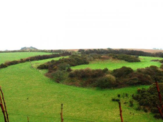
12.11.06 late afternoon

Not the easiest place to photograph...which is why there is a delay of about 4 years since my fieldnotes! This is the view from the north looking up at the settlement. The cliff drops away just beyond the bushes on the skyline. When I had walked the coast path previously I had not noticed the bank on the hillside, perhaps it was the light.

Articles

Pabyer Point

Sited on the landward side of the Coast Path between Gorran Haven and Mevagissey. This low earth mound is described on the OS map as an enclosure. At the west end a crescent shaped mound joins on to a larger raised level that runs down the field.
If any other remains lie under the thicket through which the path runs I could not tell, but they would be very close to the cliff edge.
A nearby tumulus, also marked on the map, appears to have been ploughed out.

Sites within 20km of Pabyer Point