
Taken 10th April 2005: The round barrow built into the henge bank, viewed from near the centre of the henge.
Image credit: Simon Marshall
Taken 10th April 2005: The round barrow built into the henge bank, viewed from near the centre of the henge.

Taken 10th April 2005: The henge from the east(ish).
This image is made up from six photographs (badly) stitched together to make a panorama.

Taken 8th April 2005: A view from the north west giving an indication of how close the fort is to the farm.

Taken 8th April 2005: Caer Lletty-Llwyd viewed from the rampart to the the north east.
This image is made up from three photographs stitched together to make a panorama.

Taken 26th February 2005: Taken from Rhyd Uchaf, a platform to the south of Maen Llia (SN92441905). Not easy to find in the snow, Rhyd Uchaf is thought to be Bronze Age and associated with the other sites around Maen Llia.

Taken 26th February 2005: Taken from the road to the west of the stone.

Taken 26th February 2005: Viewed from the west with William alongside (armed with a snowball).

Taken 26th February 2005: If you’re lucky this is what you’ll see of the stone from the main road (the A4215).

Taken 26th February 2005: An unusual view, taken looking down on the stone.

Taken 26th February 2005: Viewed from the south west (approximately). The lack of light and space under the trees make photographing the stone rather tricky.

Taken 29th January 2005: The lump to the right of the shot, behind the fence is what’s left of the Long Barrow.

Taken 29th January 2005: Not the most exciting place you could visit. Here’s Buckholt Wood Long Barrow from north. This place is only for the hardened enthusiast!

Taken 8th January 2005: The capstone as the sun set. Boy it was cold!

Taken 8th January 2005: The site viewed from the west.
Standing disrespectfully on the capstone are William, Alfie and Louise. Behind them are the extremely friendly ponies in the adjoining field.

Taken 14th November 2004: The stone from the south east, with the gate open for a better view.

Taken 14th November 2004: The gate hinge, packed into a hole in the stone.

Taken 26th September 2004: Looking approximately south east, here’s the stone surrounded by reeds (that hide a lot of mud). In the distance is the kind gentleman who showed us where the stone was, along with William who was pestering him.

Taken 26th September 2004: I think this shot is taken from the north east of the stone. Manouvering around was extremely tricky because of the bog that surrounds it.

Taken 26th September 2004: This grubby little photo gives an indication of what you’re looking for as you walk along the track. Maen Llwyd is partially hidden by reads to the south of it, and not all that easy to spot.

I am grateful to the Society of Antiquaries of Scotland (www.socantscot.org) for permission to reproduce this photograph of the carved slab at Nether Largie North, taken during excavation in 1930.

Taken 26th September 2004: Viewed from the south west, Llech Idris gets thoroughly inspected by William and Alfie.

Taken 26th September 2004: Viewed from the north east (approximately) with William giving some idea of scale (he was about 108cm tall at the time).

Taken 26th September 2004: Looking approximately south you get a good idea how thin the slab is.

Taken 26th September 2004: Llech Idris viewed from the west with Afon Gain running behind it and Mynydd Bach in the background. Bleak isn’t it!

Taken 12th September 2004: Three apples at Wayland’s Smithy.

Taken 12th September 2004: Looking down the horse’s back towards Dragon Hill and the vale.

Taken 15th August 2004: Beautiful lichen on one of the stones.

Taken 15th August 2004: The red arrow indicates what I interpreted as a possible axe head carving on one of the smaller stones.
I should emphasise that this marking has not yet been positively identified as prehistoric or even artificial.

Taken 15th August 2004: This is what I interpreted as a possible axe head carving on one of the smaller stones.
I should emphasise that this marking has not yet been positively identified as prehistoric or even artificial.

Taken 15th August 2004: Two stones looking very much like they’ve been dumped (on the south west side of the circle). In the background is the golf course.

Taken 15th August 2004: Looking across the circle towards Sellafield nuclear power station.

Taken 15th August 2004: Greyscale at Greycroft.

Taken 15th August 2005: Looking approximately south west towards a distinctive looking peak (Grasmoor?). The stone in the foreground is one of the two that flank the entrance to the circle.

Taken 14th August 2004: The decorated slab from the road, complete with subtle fencing and well placed telegraph pole (I thought a second photo of the site in the context of its surroundings wouldn’t hurt).

Taken 14th August 2004: A slightly weird shot looking down the slope.

Taken 14th August 2004: Some rather nice big cup and ring marks. The two big ones are about 6 inches in diameter.

Taken 14th August 2004: Glebe Cairn viewed from a spot near Nether Largie North.

Taken 14th August 2004: One of the axe head carvings within the cist.

Taken 14th August 2004: The cairn viewed from the footpath (more specifically perched on a wall next to the footpath).

Taken 14th August 2004: I think the cairn in the foreground is Nether Largie North, and the cairn in the background is Glebe Cairn (thanks to Hob for helping me identify the cairns).
I’ve unwittingly managed to include Càrn Bàn cairn in this photo as well. It’s visible on the horizon above Nether Largie North, left of centre in the frame (thanks to Greywether for pointing that out).

Taken 14th August 2004: William and Lou clambering on the cairn with the old school in the trees behind them.

Taken 14th August 2004: The stone in the photo is part of the cist to the south of the main burial cairn.
My fingers are there to indicate two artificial looking grooves in the stone, each about the width of a finger. They are just about visible in the photo, but relatively easy to spot when you’re there.

Taken 14th August 2004: The smaller (and older) cairn in the foreground with the large stone circle/cairn in the background.

Taken 14th August 2004: A mere 17 years after my first visit, here’s the next generation (William approx. 108 cm) standing in the cist at Templewood.

Taken 14th August 2004: The southern stone.

Taken 14th August 2004: Here is a reconstruction of one of the Upper Largie cists in Kilmartin House. The little piece of card reads...
This is one of the stone graves or cists found at Upper Largie. The pot inside (a reconstruction) dates to between 2,000 and 1,500 BC.
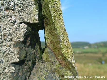
Taken 13th August 2004: Looking through a hole in the larger of the two remaining standing stones.

Taken 13th August 2004: The larger of the two standing stones (that are still standing).

Taken 13th August 2004: A disgruntled trainee megarak sitting on the recumbent stone.

Taken 13th August 2004: The stones viewed from the north east (or thereabouts).