

Ring ditch. Late Bronze/Iron Age? Stock pen?

Ring ditch. Late Bronze/Iron Age? Stock pen?


Closing ditch around the east end.
Excavation of anomalies in the next trench showed they were tree throws.
Atkinson found this enigmatic feature in the 1950s.
It seems to lead NNE from the first elbow in the Avenue. Any more information will be welcome. It will be invisible after the excavation.


Looking south showing the progressive infilling of the ditch in the section.

E. Ditch of longbarrow with possible posthole at top left.


Possible postholes at top and extreme bottom.

General view of excavation showing 4 possible postholes.

The berm of the Bell Barrow on the right is just visible.


Stonehenge Riverside Excavations Aug 08.
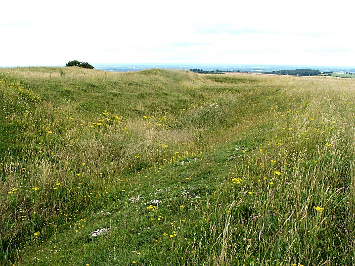
The “elbow” where the Avenue changes direction. The new orientation is shown by the ditch in the next excavation.
Stonehenge Riverside Excavations Aug 08.
The “elbow” where the ditch and bank change direction. Stonehenge itself is off to the top right hand corner.

Standing in the ditch of the Avenue showing the differential plant growth although I suspect the difference may be caused by people preferring to walk there rather than on the bank.

Stonehenge Riverside Excavations aug 08
Possible “Periglacial striations (?)” with some later artificial working. Re-opened Atkinson (1950s) trench in foreground.
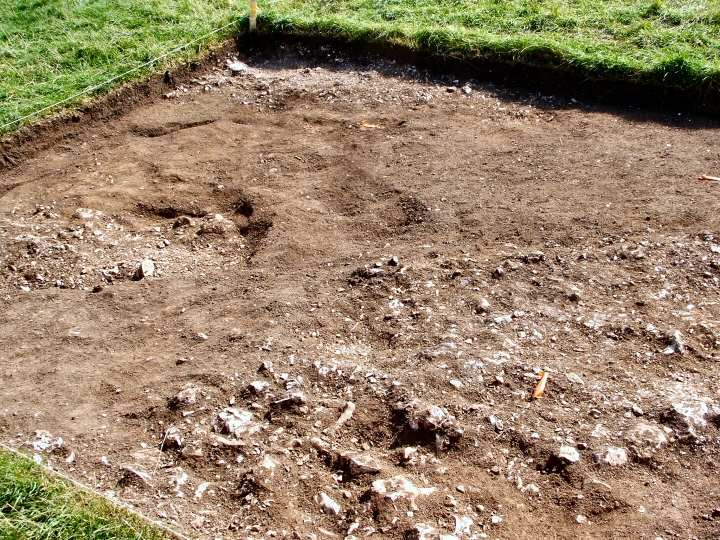
Aerial photography and geophiz found a line of postholes and it was suspected there was a large enclosure here with a timber lined avenue leading to Stonehenge Bottom. Field walking found pottery and tools and the present excavations (Stonehenge Riverside Aug 08) are designed to discover if there was a settlement here about 3000BCE.
Jim.


Stonehenge Riverside excavations Aug 08.
Early excavation at the site. A rumour has it that they have found suggestions of a roundhouse.

Stonehenge Riverside excavations Aug 08.
Looking East across the Avenue. The parallel marks at the top of the picture (in the middle of the Avenue) may be old cart tracks.

Stonehenge Riverside excavations Aug 08.
Scatter of flints with some Bluestone fragments a few metres West of the Avenue. Stone dressing area?

Stonehenge Riverside excavations Aug 08.
Western ditch and bank with possible post holes left of centre.


Looking NW with one of the more “finished” sections of the ditch and bank.

Looking N with partly completed ditch in foreground, a “causeway” and a tree in the next ditch.
Looking NE showing the discontinuous ditch and irregularity of the bank.


What a surprise and delight and what a curious site.
As noted in the fieldnotes elsewhere, this fort/settlement/refuge was never finished. This is plainly obvious when walking around it. In some places the ditch and bank are nicely finished and contoured, then there is a break, a sort of causeway, and the next bit is quite different: a shallower ditch, a less “finished” profile and dumps of earth on top which have had no attempt to make them into a profiled bank.
It looks just like a building site when everybody has just knocked off for tea! There is the strong feeling that if you were to wait a bit they’ll be back.
Archaeologists have suggested that each section might have been constructed by a different family. What a source of competition/arguments/backbiting that arrangement could have been!
Anyway it was abandoned when almost finished. Why? Did Big Brother (Sister?) across the valley, Beacon Hill, tell them to stop/join forces/out perform them/enslave them?
Internal and other external features are difficult to see as waist high grass and nettles obscure them.
A winter visit might be in order.
The site is not visited much and there are no worn paths anywhere. Skylarks and buzzards while I was there and it is much quieter than Beacon Hill with very little noise from the A34. Although not as high it probably has better views and is much easier to get to the top.
A site for the imagination.
Access
Take signposts off A34 to Old Burghclere, go through village and at T junction to the left (N) park on verge on right. (2/3 cars?) Take bridleway (S), level if muddy path along valley floor, with diversions. Gentle slope right to the top. At iron gate take sharp dog-leg to the left, follow field boundary to 5-bar gate. (Private land?)

Looking through the S entrance with two of the “Seven Barrows” just visible by the A34.

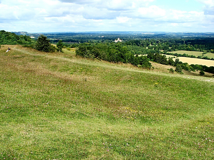
Looking N towards Highclere Castle. Seat of Lord Carnarvon.

Looking SE with upper and lower banks in distance.
To the left the tomb of the 5th Earl of Carnarvon, sponsor of Howard Carter and co-discoverer of Tutankhamen.


This site is familiar to anyone traveling between Southampton and Oxford on the A34,
A great rounded hill on the W of the gap in the N Hants Downs.
The “fort” is not that obvious from below but after a very stiff climb (with many pauses for breath) the banks and ditches are revealed. They are all very well preserved and of impressive dimensions and some views reminded me of Maiden Castle although smaller. It’s a rather peculiar shape being like an hour glass with the top chopped off, a result of following the contours I suspect.
In the NW corner (not SW as MAGIC has it) is the tomb of the 5th Earl of Carnarvon, the sponsor and co-discoverer with Howard Carter of Tutankhamen.
Extensive views except to the NW with Ladle Hill to the E and plenty of chalk flora and fauna.
The only downside is that the roar of traffic from the A34 below is difficult to avoid. Otherwise a very worthwhile site to visit.
Access
Small car park at base signposted from A34.
Very steep climb to top with many steps.

Inane graffiti on a stone in The Avenue. I suppose it’s only chalk and will wash off but why do it in the first place?
29th June 08.

Fossilized root channel and remains in a stone in the S. Circle.
(Spaceship Mark pointed this out)

Fossilized root remains in a stone in the S. Circle.
(Spaceship Mark pointed this out)

Stone in S circle with fossilized root channels and remains.
(Spaceship Mark pointed this out)
A new book on the geometry of Stonehenge and the author seems to have simplified the setting out of the stones, Aubrey Holes etc using techniques available at the time.
Experimental archaeology was used at a site in Oxfordshire to check out the feasibility of the theories.
It seems to be a well researched and sober account.
timesonline.co.uk/tol/life_and_style/court_and_social/article4003818.ece
Jim.
P.S. I have to declare an interest. A picture I took at the Winter Solstice appears on the front cover and on page 258.