
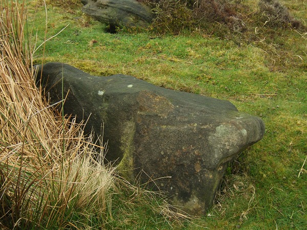
July 08. Stones of the cist. Compare this with Stu’s photo of the cist taken a year and a half previously.
July 08. Stones of the cist. Compare this with Stu’s photo of the cist taken a year and a half previously.

July 08 – what an overgrown mess. View of the western edge of the site with the central cairn to the left, the ditch in the middle and outer bank to the right.
An interesting site but what a mess. It sits in it’s own little enclosure on Harland Edge with an information board next to it showing a plan of the bank, ditch, central cairn and cist which you need to study to get any understanding of the monument as the whole site is covered in a layer of bracken and heather. It consists of a central raised cairn (with traces of a stone kerb) that measures about 8 metres square and is about a metre above the surrounding square ditch. Within this central area is a cist which Bateman illustrated as being edged with 13 stones and containing a layer of charcoal with a collection of bones towards the north with a further group of bones as well as fragments of lead ore contained within an arc of stones in the south-eastern corner. He noted that the bones as well as the arc of stones were all fire scorched. The 3 metre wide ditch leads to square bank that measures a further 3 metres in width and stands about a metre tall although the northern side has been lost to a packhorse track.
I got the distinct impression that Hob Hurst’s House and the group of barrows that follow the northwest-southeast line of Harland Edge formed part of a boundary or division of the moors between the sites of Gibbet Moor to the north and those of Beeley Warren on lower ground to the west.

A slightly wider angle view than Stu’s with the cairn’s ring running from upper left to lower right.

Not an easy site to find but what’s left of it becomes recognisable once you know where it is. The outer three large stones are the most obvious things to look out for then the bank which seems to measure a couple of metres wide with a large stone that may well have formed part of an inner kerb. It’s a shame that the site is so damaged as it could have been an impressive place. I’ve got an OS ref of SK2696075154 which puts it just a shade to the right of the circle marked ‘enclosure’ on the OS 1:50000 map. There’s a load of (clearance?) cairns and rocks of the Swine Sty field system as well as a handfull of barrows to the northeast.
A limestone and rubble cairn measuring 17-18 metres in diameter and less than a metre tall which stands at the foot of Beacon Hill with Great Asby Scar just beyond to the east. These hills are of course the same ones that overlook Gamelands circle a mile and a quarter to the southeast. It’s just possible that there is a sightline between these two sites, if anybody is passing Broadfell it might be worth checking it out (I didn’t realise until checking the map much later).


A limestone and earth cairn measuring between 18-23 metres in diameter and about a metre high that stands on a northeast-southwest spine of land that runs between the valleys of Lyvennet Beck to the west and Scale Beck to the east. It has been lucky to survive as there is a limestone quarry just a few metres away to the south. Some nice views to the northeast towards the Lune Forest and Dufton and Murton Fell.
This is the new official Fag Fen website with a nice wizzy intro and more modern look, it also seems to have rebranded itself as an ‘Archaeology Park’. The old website at flagfen.com is still there at the moment.
English Heritage have Little Meg recorded as a Round Cairn.


Looking northwest. Cist to centre with bank behind curving round to the right.

Looking over the edge of the cairn towards Baslow Edge on the left of picture


Looking northeast across the circle towards Sheffield. The bank extends to nearly the edge of the picture on either side and the stones of the inner and outer edge are visible to the left of centre. The central cairn is next to the clump of grass in the middle of picture.


Summer 2008. Compare the undergrowth in this picture with Stu’s photo of the same stone.

Looking southwest with the smaller damaged barrow to the left, larger barrow to the right.


Looking southeast from the track towards Harwood Dale Forest shrouded in mist

Head Stone to the left with rather tasty looking rock in the foreground.

It’s sad to see that nearly four years after Andy’s photo the painted smiley face has not washed off. It’s amazing how far idiots will walk to deface a stone.
John Wesley (the preacher) wrote the following about the site in 1770 –
“I took a walk to the top of that celebrated hill, Carn-Brae. Here are many monuments of remote antiquity, scarce to be found in any other part of Europe: Druid altars of enormous size, being only huge rocks, strangely suspended one upon the other; and rockbasins, hollowed on the surface of the rock, it is supposed, to contain the holy water. It is probable these are at least co-eval with Pompey’s Theatre, if not with the Pyramids of Egypt. And what are they the better for this? Of what consequence is it either to the dead or the living, whether they have withstood the wastes of time for three thousand, or three hundred years?”

Assorted tat found at the stones 30th September 2007 – carved wooden turtle, carved stone reptile or squid and inexcusably, a glass bowl.


Start of the chain. The northern barrow with the southern barrow to the right, looking south.


View from the top of Lilla Howe looking southeast down towards Scarborough.

Louven Howe represents the highest point in this chain of barrows and stands just by the junction of several tracks. One leads north into Sneaton High Moor Woods, one south into Langdale Forest, one southeast towards Scarborough and one northwest along the same ridge as Ann Cross and Foster Howes.


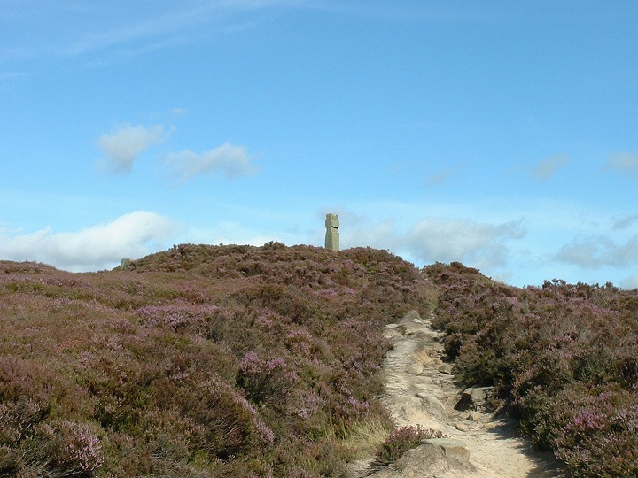
Looking roughly north. Boundary stone on the barrow, Trig point to the right.
About half a mile southeast of the Foster Howe barrows on the same ridge stands the lowish barrow at Ann Cross. EH record it as being about 18 metres diameter by 1.2 metres high although it seemed smaller to me (non megalithic push-bike included in photo for scale). They also mention a 2 metre wide ditch and some traces of a stone kerb neither of which I can confirm as I didn’t notice either feature in the short time I was there. It does however have the ubiquitous crater left behind by those naughty early antiquarians who seemed to love excavating barrows but weren’t so keen on actually recording what they found. Canon Greenwell had this to say on the subject in 1890 when he wrote about the barrows of the area – “Nearly all the barrows have been opened, and many of them in quite recent times, but no account of these examinations has been recorded, so far as I am aware, except a short notice of the openings of some on Cloughton Moor”.
While the barrow has great views west, the eastward view towards the sea is now partly blocked by the trees of Louven Howe Side and Pike Hill.


Looking northwest. Southern barrow to the left, central barrow to the right.


