Stone 166 in PRANYM assuming I’ve got the right stone. It’s in the right location but the illustration and description in the book don’t really match. The grooves are pretty deep on this one but I couldn’t get a decent photograph.
Stone 166 in PRANYM assuming I’ve got the right stone. It’s in the right location but the illustration and description in the book don’t really match. The grooves are pretty deep on this one but I couldn’t get a decent photograph.

Stone 173 PRANYM. This would appear to be the same stone that rockartwolf photographed. From certain angles it resembles the kind of seashell that might be found on the nearby beach...


What a difference a few years make to the moor. Compare this photo with those taken after the fire from 2003/4.

Looking west over one of the stones. The footpath to Leam is over the hill.

Now that’s what I call heavy vegetation. One of the stones of Eyam III, September 2007


Looking west towards Gotherage Plantation. The cup marked stone is bottom right with the centre of the cairn in the middle of picture.


Looking southwest over the barrow with the valley of Burn Howe Dale to the left and Fylingdales Moor to the right.


The reward for getting soaked – looking southeast towards Abney Clough and Highlow Brook.

The bank extends from left to right just above the small stone via the two clumps of heather.

Looking south over the two stones towards the flying saucer shaped hill of Abney Low.

Looking southeast from the large boulder at the northern end of the alignment. The smaller stones are lost in the grass above (not the ones to the upper right of picture)


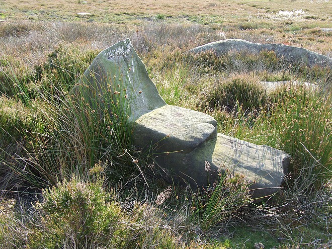
The chair stone. This stone is thought to be natural but is said could have formed a ‘prominent feature’ of the cairnfiled. I should coco!


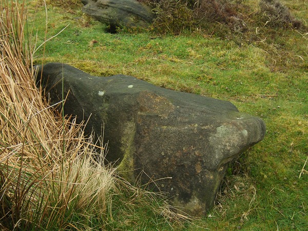
The smaller stone is almost lost in vegetation. Compare this with Stu’s photo from 2002


I’ll go out on a limb on this one. This is the area of the site marked on the map and at the correct gps ref. I think I’m standing at the northern outer edge of the ring looking south with the inner edge (marked by the change from bilberry to heather) extending and curving rightwards from the nearest fence post to the right hand side of the picture. Just above this the change in vegetation then curves back towards the left (following the line of purple heather)

Looking SSE from the stones of the northern entrance. The white pole is a handy marker for the stones while the track to the site follows the line of the wall that curves to the upper left of picture.

Looking northish from behind the southern outlier, past the southern stones and towards the large stone of the northern entrance.


A simplified version of the plan of the site taken from the information board


July 08. The two most obvious stones of the cist, towards the southwest.

July 08. Stones of the cist. Compare this with Stu’s photo of the cist taken a year and a half previously.

July 08 – what an overgrown mess. View of the western edge of the site with the central cairn to the left, the ditch in the middle and outer bank to the right.

A slightly wider angle view than Stu’s with the cairn’s ring running from upper left to lower right.