


Chocolate lab for size reference.
This Dolmen is further down the track than Postman’s directions suggest. It’s almost a mile from the tarmac road to where the footpath forks. At the fork (after a makeshift gate and fence) turn left and enjoy the view...

An image of the damage caused to Bryn Cader Faner by some idiot deciding to erect a stone in the middle!


Looking North, very easy to find, a short walk from the source of the River Severn.

A very round cairn mostly grassed over. There are a few indentations in the centre that could be the result of collapsed cists.
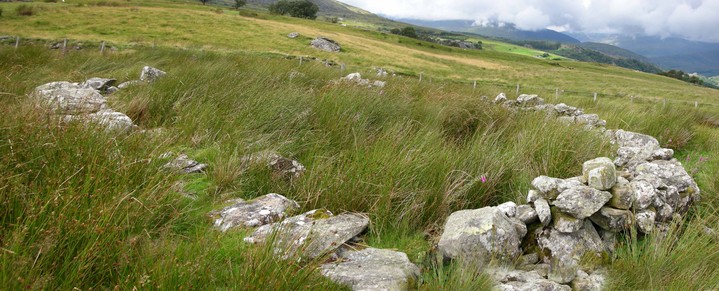
Cadw lists it as being religious, ritual and funerary, but also tells us that it known locally as ‘The Cock Pit’, could this be a later development/use of a convenient small round enclosure?

The more obvious of the three Round Barrows at the top of Tarrenhendre. Awesome panoramic views from here!

With a dog for scale. The angular position of the kerb stones reminds me of Bryn Cader Faner.


The original cairns dimensions can just be made out in this photo.

“The cairn is situated on level ground near the head of the Egnant valley at a point where the land begins to fall away fairly steeply down valley to the SW. A mountain pathway passes close by.
The cairn consists of a low mound of mixed grade stones for the most part consolidated with grasses and mosses. The E half of the cairn contains a large proportion of loose rubble. Overall it measures 7.8m (N-S) by 7.3m with a maximum height of 0.35m. The cairn appears to be more-or-less intact and there is no structure visible. The cairn contains a signifcant amount of quartz.”
Above is the site description from the RCAHMW website. It was last visited by them on the 29 April 1984.
As is painfully obvious some idiot has used this cairn to create a marker cairn for walkers at the head of the valley! The remains of the original burial cairn are still visible below the pile of stones.
There is a second ring cairn called Graig Wen very close to the north east of this cairn but I was unable to find it this time. At least it’s not been converted into a sheep enclosure!


The town of Dolgellau can just be seen in the top left hand corner of this picture.


This cairn looks as though it may have been modified over the years, although on closer inspection there is a lot of cairn material in the long grass.


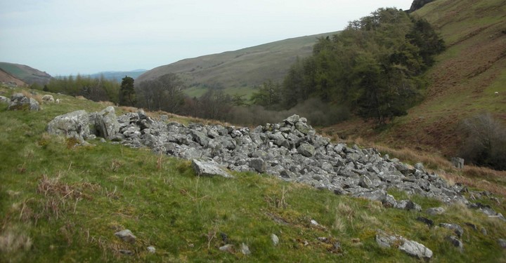
This cairn appears to be on the same alignment as the Carneddau Hengwm cairns (a couple of miles to the south). This has been plundered to a much greater extent than either of the Carneddau Hengwm cairns probably due to its proximity to the track.

Looking towards the Great Carnedd from Llecheiddior Cairn

The ‘legs’ of the recumbent ‘earth mother’ are just visible from this angle – and I agree, that ‘bloody pylon’ is far too close!


Not just a massive monolith but wonderful colours too!


Looking northwest with the capstone and the only visible kerbstone.

Looking roughly northwest with the cist in the foreground

Taken from the other side of the Afon Disgynfa with the cairn at the foot of Moel Sych


May be a ring cairn behind the stone to the left??

Looking north west towards the Afon Conwy


With Annette on a cold misty morning – very atmospheric!


Standing in the centre, this is a complete 360 degree view of the circle


