Lucas de Heere’s picture of 1574.
stubob
George Owen’s drawing of 1603 depicting the stone burial chamber at Pentrelfan; the earliest known illustrative record of the site.
Top photo by JJ Evendon. (two more pix on the website)
Some great pics of Le Mont de la Ville, Henley-on-Thames.

Image credit: Printed in Charles Knights 'Old England' 1845.
Charles Knight in his book Old England (1845) wrote of Le Mont de la Ville as being:
“....a copy in miniature of such vast works as those of Stonehenge and Avebury....”
No mistake.....the passage grave is an excellent looking structure and it still is....errr....just that it’s not actually on Jersey anymore.
Knight continues:
“This singular monument, which was found buried under the earth, was removed some fifty years ago [in 1785] by General Conway [to make way for his parade ground] to his seat near Henley, the stones being placed in his garden according to the original plan.”
It’s still there today in a private garden.

“I have no scruple to affirm it is the most magnificent mausoleum in the world, without excepting the Egyptian pyramids.”
William Stukeley.
Image credit: Mc. Gahey.

Antiquities of England and Walesby Francis Grose (1783).
Image credit: Francis Grose

Antiquities of England and Wales by Francis Grose (1783).
“Now it’s time to look at your work in the gallery.”
Image credit: Francis Grose.

From Antiquities of England and Wales by Francis Grose (1783).
This rather rough looking sketch was drawn before that fateful night in 1815.
Image credit: Francis Grose

Published in Antiquities of England and Wales by F. Gorse (1783).
Image credit: S. Hooper

“Unlike most monuments of the same high antiquity, it remains, in all probability, as originally constructed. It was described two hundred and fifty years ago by the antiquary Stow, and the description is as nearly exact as any that we could write at the present hour.”
(Charles Knight: Old England)
Image credit: Charles Knight
The study of the history, the archaeology, the natural history, the language and many other subjects of interest in the Island of Jersey
(Searching ‘archaeology’ in the photo archive throws up some interesting stuff).
William Camden (1551-1623) was one of the very first antiquarians, and a leading member of the Society of Antiquaries, established around 1588. In his book of 1586 ‘Britannia’, written in Latin and translated and published a number of times the first in 1610, Camden describes man made and natural wonders.
“Near that bleak and dreary region, between Penrith and Kendal, called Shapfells, was, some thirty years ago, another remarkable Druidical monument; but upon the inclosure of the parish of Shap the stones were blown up by gunpowder, and were converted into rude fences.” (see photos above).

“That marked a is singular in its rugged-ness. The stone b inclines towards the north, and its present position is supposed to be its original one: in its general appearance of bending forward, it is not unlike the single stone in the avenue at Stonehenge. The stone c differs greatly from the others, in being square and massive. The largest stone, d, is prostrate; it is fifteen feet and a half in length. The engraving represents not the circular arrangement, but remarkable separate stones, of which e is at a considerable distance from either of the circles.”
(Charles Knight: Old England)
Image credit: Charles Knight?

“In the neighbourhood of Lambourn, in Berkshire, are many barrows, and amongst them is found the cromlech called Wayland Smith.”
(Charles Knight: Old England)
Image credit: Charles Knight

“Near Liskeard, in Cornwall, in the parish of St. Clear, is a cromlech called Trevethy Stone, Trevedi being said to signify in the British language a place of graves”
Charles Knight: Old England.
Image credit: Charles Knight
Photograph showing the excavation of the barrow in 1977.
(Worth a quick look for the size of the exposed kerbstones).
“It does exactly what it says on the tin”

Public release photograph showing the carving of the stag and other figures in the Church Hole Cave.
Image credit: Sergio RIPOLL
A 5 page article on the website forum entitled:
Evidence that the Avebury stone circle and its associated monuments show knowledge of past Polar positions.
by S. F. Wells
“The presentation discusses, firstly, theory and suitability of the use of 3D scanners to record rock art, secondly, some results of Archaeoptics’ use of this technology in recording rock art at Creswell Crags.”
(1.5mb pdf file).
Good article from the International Newsletter on Rock Art
No. 40 2004 by the Bradshaw Foundation. Some good photos and sketches of the engravings in the Church Hole Cave.
Ossum’s Crag appears mainly to have been an occupational site, although human bone was recovered during excavation.
Flint and chert artefacts including blades and scrapers from the both the Mesolithic and Neolithic, prehistoric pottery, hearths and animal bones ranging from bison to vole.
Don Bramwell in his 1954 book ‘Archaeology in the Peak District’ suggested that a small raised ridge in the caves floor was used by flint knappers as an anvil stone.

Nan Tor when excavated contained a wide array of prehistoric material including various parts of the human skeleton, Neolithic pottery, flint tools and arrowheads from the Mesolithic, Neolithic and Bronze Age, bone tools, animal bones, pendants and again later finds up until the Medieval period.
Excavated by Thomas and Moore in 1962 the cave contained a disarticulated Neolithic burial along with a leaf-shaped arrowhead, a microlith, a thumb scraper and animal bones. The cave also contained later Romano-British artefacts.
Chesterton’s The Ballad of The White Horse is a lengthy read.
Here’s a snippet from Book VII The Scouring of the Horse:
And all the while on White Horse Hill
The horse lay long and wan,
The turf crawled and the fungus crept,
And the little sorrel, while all men slept,
Unwrought the work of man.
With velvet finger, velvet foot,
The fierce soft mosses thenCrept on the large white commonweal
All folk had striven to strip and peel,
And the grass, like a great green witch’s wheel,
Unwound the toils of men.
I wouldn’t go balls out and say this was a place not to be missed like....but it’s all part of the Hope Valleys bigger picture.
The circular enclosure is more visible from the road. Up close and personal the enclosure walls can still be made out by following the encompassing moss covered rocks, but other possible structures within the enclosure can make for a confusing time of it.
Dated to the Bronze or Iron Age the enclosure is suggested to have been either for holding livestock (a similar purpose has been suggested for The Holmes a few km’s away to the SW), or a small farmstead. The confusion of walls within the enclosure interpreted as the foundations of small buildings.


Like the henge at Arbor Low, the Bull Ring too has a barrow to the SW of the earthworks.
Crikey Me!
What’s happened to the Bull Ring...? This is still Dove Holes ain’t it?
All nicely mown, no motorbike tracks and totally devoid of any rubbish. Even a little information board has appeared on the path between the henge and the oval barrow.
Looks as if the village is finally taking a bit of pride in the Bull Ring and what is one of Northern Britains best upstanding henges.
It’s always been a worthy place to visit and in its present state perhaps more so. Even a typical wet October day in the High Peak didn’t put a damper on the experience.
Of the two barrows on Chelmorton Low the SW barrow, at 24x21m diameter and some 1.7m in height, is the largest. Its partner 20m away (NE), being 18x17m and 1m high.
SW: Was first dug in the early 1780’s, revealing a cist in the north-eastern edge of the mound,and containing the remains of perhaps five burials. Later excavations located a 20m diameter ring of limestone kerbing.
NE: Has been excavated by a number of people, amongst them T. Bateman in 1846 who recovered a number of flint artefacts and evidence of a cremation. Again work in the 1960’s uncovered kerbstones, this time set out in a polygon shape

This is a top spot. Maybe not right up there in the list of Anglesey’s ‘must-see’ monuments... but hey... with the kids in tow, the dunes at Aberffraw Bay looked pretty good and the cairn a bonus.
There’s not much left. The rim of the cairn and a handful of decent sized kerbstones. Perched on a small spur on the west side of the bay, above the point where the River Ffraw joins the sea.With views over to Snowdon and the mountains along the coast towards the Llyn Peninsular it’s a top spot.
In the CADW guide for Anglesey the cairn gets a brief mention for the Mesolithic material it covered.
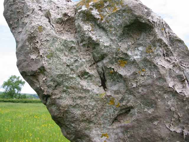
I’ve got a similar photo to Moth’s of this stone. It looks a decent enough sized stone from the roadside, perhaps 4ft or so in height. Compare it though to some of Anglesey’s other stones and it’s a bit of a dwarf. I’m afraid to say because of this, there wasn’t any real motivation on my part to find a way through the hedge.
Bryn Celli Ddu just gets better and better with each return visit, although the small restored mound can look a little odd from certain angles....
Opposite the chambers entrance on the outer edge of the ditch are a number of small kerbstones. Excavation revealed them to be the remains of a stone and timber enclosure that contain the burial of an ox (see Rhiannon’s Folklore entry below).
Excavation reports on the earliest monuments at Bryn Celli Ddu including the causewayed enclosure of Bryn Celli Wen.

05/05. The ruined chamber of Trefignath’s 2nd phase, the huge capstone lies broken.

05/05. Stone 5, first stone on the left once through the locked gate. Very worn carvings of zig-zags and lozenges.

05/05. Entrance walling, in the centre of photograph, to Trefignath’s wrecked middle chamber.

05/05. The four visible kerbstones. Another one, or perhaps two are maybe still there all be it overgrown. (Looking across the Menai Straights to Snowdonia).
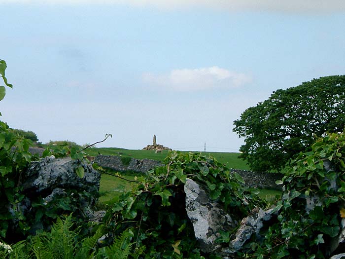
All that’s left of this cairn is a large earthfast boulder, split down the centre, that the farmers and stone robbers couldn’t cart off.
Wish I’d ‘a known that before I set off looking for Bedd Branwen.
Read all about it in the museum at Llangefni on the way home.
Thomas Bateman made the steep climb up Narrowdale Hill in 1846.
Heading straight for the centre of the barrow he soon found the primary burial, a cremation contained within a rock cut grave along with an urn and flint. The capstone that covered the grave had a later cremation, also in an urn, placed on top.
A small cist of limestone slabs, holding a still later cremation, was also unearthed close to the barrows surface in the SE. This burial too contained worked pieces of flint and antler.

05/05. There are 3 summits on Wetton Hill, this barrow is on the North-Westerly one. The highest point of the hill, home to a further 3 barrows, is in the middle distance.

05/05. Barrow on the summit of Gratton Hill (Dove Dale right of centre).
Sadly the henge only survives as a cropmark now-a-days... Once some 80m in diameter the earthwork had entrances to the NW and SE.
All is not lost though the Round Hill barrow that sat within the centre of the henge is still going strong, a huge thing... over 30m in diameter and a little over 3m in height.
Neither henge nor barrow have been excavated.