IronMan

IronMan

All posts 51-100 of 949 posts

Boleigh Fogou

We’d arrived at the site unannounced, not remembering (must do my research properly) it was necessary to make an appointment before hand. Jo May’s daughter was just on her way out as we drove down the track leading to the house, and so she asked if she could help us. We told her we intended to visit the fogou, and she let us know (in the nicest possible way) that we should really have booked in advance. She said it’d be okay this time though, as there was no activity taking place in the Caer centre, and proceeded to lead us to the fog

Sat before the entrance, I fixed my gaze on it’s depths and struggled to see far into the passage at all – the darkness has to be seen to be believed. Life teemed all around the mouth of this ‘cave’, bees and butterflies fluttered round the bluebells growing on it’s banks. Up above in the trees was the noisiest display of ravens I’ve ever heard. It was pretty easy to start to imagine this was all part of the magick of this site.

This is a real class site, and has made me totally reassess not only fogous, but my entire psychological relationship with all sacred sites. Fantastic.

Tregiffian

It’s a real shame that this site is partially submerged beneath the road, as I reckon it would have been another ‘perfect’ site had it not been (see the Merry Maidens for a definition of ‘perfect’). Like Holy says, not a great place for meditation, though on a very busy day, from within the chamber perhaps the traffic noise above could give the same feeling as listening to Sunn O))), who knows? Traffic meditation, now there’s a new idea! :-)

The Merry Maidens

The word ‘perfect’ gets used a lot for this circle, so it was no surprise that Ursula and myself both uttered the word in unison as we approached. An incredible place, which from certain angles achieves total symmetry. I took a few shots trying to frame this perfect symmetry, then we sat on a wall nearby gazing at this wonderful place, before moving on to Tregiffian.

Mayon Cliff

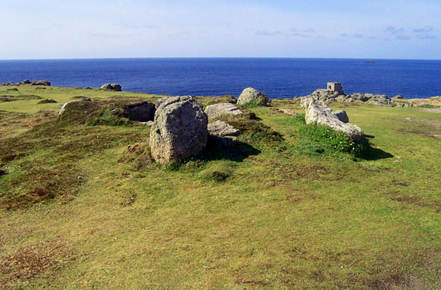
As we approached this site, on our way walking to Land’s End, we were greeted with the site of heavy industrial equipment, hauling salvage from a ship run aground below the cliffs. I took a few shots and had a quick look at the site, before getting away from this ugly scene!

Nine Maidens of Boskednan

We walked here from Men-An-Tol and were immediately impressed by the small barrow just above the main circle. Both sites are so obviously in reverence to Carn Galver, it just dominates the landscape.

Men-An-Tol

We approached this site with eager anticipation having seen and read so much about it before. Ironically, this exposure meant that once we arrived at the site we were a little disappointed. Needless to say, it is a great site, and the surrounding landscape wonderful, but it didn’t really have any surprises left to offer us. It was exactly as I’d expected it to be, nothing more, nothing less. We hung around for a while, and took the obligatory shots, then left as a dogwalker approached the site.

Lanyon Quoit

A wonderful site, worthy of the attention it gets. The re-positioning of the stones is quite obvious, but doesn’t in any way spoil it. We sat here for a while as the midday sun burnt away what was left of the cloud cover, and the day took a lighter turn.

Zennor Quoit

This was our first site on our Cornish trip, and was an excellent start. The size of this monument is quite something – I’d certainly not imagined it to be so big. Luckily I had re-read the fieldnotes for this site and didn’t mistake the posts for anything significant, and so was able to impress Ursula with my knowledge. She was a bit taken aback in fact, as she had also thought the semi-constructed cowshed was part of this ancient monument ;-)

Image of Mayon Cliff (Cairn(s)) by IronMan

Mayon Cliff

Cairn(s)

In the background can be seen the machinery being used to salvage from a ship, run aground on the cliffs below, blocking the path between Sennen Cove and Land’s End.

Image of Langdale Axe Factory (Ancient Mine / Quarry) by IronMan

Langdale Axe Factory

Ancient Mine / Quarry

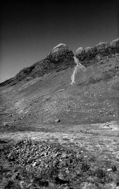
The rocky dome of Pike O’Stickle protrudes from these high plains. Potential natural rock temples are scattered all over the environment. To call this just an axe factory, is in my mind, underestimating the powerful magic contained in this landscape. The axe-factory craftsmen would, most probably, have lived here for part of the year, and therefore most probably worshipped here.

Carnasserie

Very late addition here (it’s about six months since my visit), and I don’t know why I haven’t posted notes yet... here goes then:

The path leading to these stones can be found by following the sign posts up to Carnasserie castle. While here it’s a good idea to take a look around the castle – the reason being, it’s possible to see the stones from the SW tower, and it’ll make the journey much easier than plodding round the fields aimlessly!

When I visited it was raining, not very hard, but enough so I had my hood up. As I explained above, I worked out the direction to these stones by looking from the castle tower. The castle was very atmospheric, and in the rain it’s open roof led an eerie atmosphere to the place. Excited by the sight of these two stones, I span round quickly, ready to jog back down the wet spiral staircase steps. A lintel, unseen due to the peak on my hood, blocked the way. Crack! I smashed my head on it and tumbled down a few steps. I landed with a thud and a very sore head. A bit dazed, I shakily proceeded down the steps. Now this castle is in the middle of nowhere really, and I began wondering if I’d been knocked out, or anything more serious had happened, who’d have found me? Once I reached the bottom I sat down, stars spinning before my eyes, rubbing the nasty lump which had by now appeared on my head.

I soon decided to carry on regardless and made my way to the stones – they were wonderful and I soon stopped feeling sorry for myself as I became acquainted with this pair of fine standing stones. Anyone visiting the Kilmartin valley would do well to track these down – it’s roughly a 3/4 hour round trip on foot from the car park, just off the main Kilmartin valley road. Carnasserie cairn lies just above the stones, and as a wise Welsh farmer once advised, it’s best to follow your nose to find it. Once you do, and if it’s clear, you’ll be blessed with a stunning view down the valley to the Nether Largie cairns. This cairn is almost in the same line as these, and if you look behind you you’ll see the huge cairn Càrn Bàn on the horizon.

I’d definitely recommend this site, just watch for stray lintels would be my only advice.

Miscellaneous

Anderton
Cup and Ring Marks / Rock Art

From the Anderton parish council newsletter, Spring 2002ce

The Cup & Ring Stone
You may remember mention in a previous Newsletter of the Cup & Ring stone found in September 1999 at the edge of Lower Rivington Reservoir. The stone was found at a time of unusually low water level at the eastern edge of the reservoir (which was constructed in about 1850) at 10 metres below the high-water mark, so that as a rule it was visible only very infrequently. It was of a rather irregular shape, but its dimensions were roughly 80 cms in length. 55 cms wide and 50 cms deep and it was put on display at The Anderton Centre. pending examination by Lancashire County Council to confirm the ‘genuineness’ of the carving. To date we are still awaiting examination by a suitable expert .... more news on this topic in a future Newsletter.

The article can be found here.

If the stone was found when the reservoir was at an ‘unusually low water level’ it begs the question,is there any more rock art down there?

Summerhouse Hill

A frustrating one this.

I had read two extremely vague references to this site, on one of my trawls for sites on the web, both saying this was a Stone Circle. I could find absolutely no reference to this site in any of Burl’s books however, which had alarm bells ringing for me. I jotted the site’s grid ref. down anyway, along with a load of others, before setting off with MrsIM for a day out. We were in the Carnforth area, after visiting Heysham Head and so decided we may as well visit. We wandered round the field a few times, using my GPS as a guide (which was playing up). No joy. I was however very excited by the sight of five huge stones, similar to the nearby Three Brothers. We soon came across a mound, which on further inspection we realised gave this site it’s name because on it’s top are the remains of a brick summer-house. The mound itseld however looked suspiciously like a huge cairn, right down to the retaining kerb of large stones. I decided this couldn’t be it – no way could you mistake this for a stone circle. Another frustrating twenty minutes led to no further discoveries – other than the remains of an old lime-kiln at the far end of the field. We decided our time hadn’t been wasted when we walked past the field edge and saw the view out across Morecambe Bay – it’s quite something. We were even able to make out the rough location of The Druid’s Circle of Ulverston.

On the way back to the car we made another inspection of the summerhouse, and I decided that this must be the site in question, and that the references I’d come across were just plain wrong. The five stones which had me excited earlier, when viewed from the top of the mound formed a semi-circle with the mound itself roughly in the centre. I took some photos as the rain started to pour heavier and heavier, then our rumbling stomachs got the better of us and we decided to get to Lancaster for some grub in The Water Witch.

Looking at the maps again, I’m sure I’ve missed the actual site – a cairn seems to be marked off at the opposite end of the field on MultiMap and on my Explorer map the location of the ‘cairn’ is very confusing. I’ll try and clear this up as soon as possible!

Woodland plans for the Northern Isles

Orkney and Shetland, Scotland’s northern outposts, have become famous for their unrestricted vistas of land, sea and sky.

Now centuries of history and natural forces are to be defied. Plans are being laid to transform the scenery of the bleak Northern Isles with the planting of up to quarter of a million trees over the next three years.

Landowners, farmers, crofters and community groups are being offered government grants of up to £3,000 a hectare to reverse the islands’ treeless image and return them to a state that the Vikings would have recognised.

Ministers believe the ambitious tree-planting project will not only improve the look of the islands but also provide a boost for tourism.

“Orkney and Shetland are famed for their open landscapes but there is a strong local demand for more trees,” said Scottish Executive environment minister Allan Wilson. “Creating woodlands there will improve the environment for islanders and boost wildlife tourism which will strengthen the local economies.”

Pollen studies by scientists have revealed that both of the island chains were once covered in dense woodlands of birch, alder, willow, hazel, rowan and aspen. But Neolithic and Bronze age settlers from around 3000BC are believed to have been the first to start the process of cutting down the native woodland to provide wood for fuel and grazing for animals.

Jeremy Watson, ‘Scotland on Sunday’ 2/3/3

Nine Ladies of Stanton Moor

Only my second visit here – last time I came it was in a big group (8 of us in total), and was a nightmare visit from start to finish. The site itself seemed gloomy at the time, and after reading all the horror stories, I thought I’d seen enough of the place. This time we had been staying with friends in Sheffield on Saturday night, and so the four of us visited here after seeing the Andle Stone and Doll Tor. My mind is now totally changed – the site seemed so much bigger. The sky was clear above and so we took the opportunity to sit by the site and take it all in. It was quite peaceful with the distant rumble of traffic barely audible. I’m now definitely a Nine Ladies convert!

Rowtor Rocks

This is a truly amazing site – from the moment I entered the site I felt transported. Each turn around the huge boulders offers something new – at times it’s like being on one of the original Star Trek sets. The subtle movement between the natural and the artificial is the most incredible thing here – cave entrances turn out to be man-made, passageways to higher and lower levels of the rocks open up before you. The actual prehistoric rock art on display (what little we could find of it) is just a small part of the attraction here – these rocks seems to have been drawing human attention forever. An incredibly magickal place.