This site is on Princess Anne’s estate so you must stay on the public footpaths. Else you may have a similar experience to me when I visited Gatcombe Lodge barrow a while back.
themodernantiquarian.com/post/34802
juamei

Mmmm cock. This is a chalk phallus found at the bottom of one of the mighty shafts at the rings. It’s currently in Dorset County Museum.

Whats left of the barrow inc concrete cist cover reproduction.
The sign on the front of the concrete reproduction on site.
“Concrete reproduction of decorated cist-slab of the early bronze age (probably 1800 – 1300 BC) now in The City Museum, Bristol.”

A selection of the tat we removed on just 1 visit to West Kennet longbarrow summer 06.

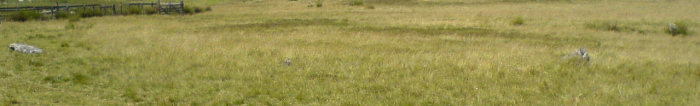
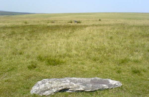
[visited 21/10/06] Back here again, sans pain, but still with the mud. We walked towards the farm from the West pondering where the cist is and found a helpful sign just before the farm which directed us straight to it. Reading the miscellaneous notes here, it seems a round barrow mound covered the pile of rocks now lying in a muddy field. There isn’t much to see now beyond that, but I think its still worth the effort. Does make me wonder what is at the bottom of the other few thousand barrows around the south...
Access is fineish. We parked in the pub between the third priddy henge and the incomplete henge and then walked along the road to get to the path to the east of Pool Farm. There are “No Parking” signs up there, so I suspect its the closest point. Just before you get to the farm this way, turn left across 2 fields and you’ll see the cist. Best bit about walking this way is you can walk through the farm and back along the road to the West of the farm past the field with the incomplete henge!
Oh and chalk up another victory for the evil cows, we were chased out of the field to the West of the farm. Yet more proof of the Bovine threat, how long before our govt moves to combat this evil????
[visited 1/7/6] Having never visited an exmoor site before, I had some trepidation as to how much we’d be able to see in high summer. The answer is, pretty much all of it. This is a weird little thing, about the same diameter as (say) Kingston Russell but with stones that struggled to reach my knees. I liked it but couldn’t help thinking, is this all it is? Now, having visited different sites on exmoor in short open grass I can apreciate how powerful this could have looked 4 thousand years ago, stones very much defining a ritual space.
Access is very good, we parked just down the road but there is parking by the gate to the field. Someone had actually parked in the field within 10 metres of the circle and seemingly then gone for a walk. Which was unsightly and spoilt the “we are in a desolate moor” effect, I think the circle was aiming for but never mind. You can find the circle about 20m to the right of the sheep fold as you look from the road.
[visited 1/7/6] This was a strange little beasty and I guess the majority of stone rows about these parts look very similar. We found 6? stones in a double row pointing roughly towards the porlock circle|circle and then another stone on the same alignment about 5 metres closer to the circle. We think it was the row, but its hard to tell, the stones were barely 10cm above the ground and hidden in heather. The two rows were about a metre or so apart, with the stones in each row being about a metre or so apart as well. The row itself was located just off the brow of the hil and off the path to the right.
Access is good, its maybe a 5 minute walk up an open path to where the row is, though you may have to negotiate heather to get to it.
[visited 1/7/6] Getting used to the underwhelming size of the stones took a bit, but having warmed to the task we quite liked this ‘setting’ (apart from the random blood on one of the stones). Apparently people used to think this was the remains of 2 concentric circles and now they think its the remains of two rows. Personally I have no idea. I stood at pretty much every stone we could find and surveyed the weird arrangement of stones, seemingly raised upright at random, but once in a while offering glimpses. A possible curve here, 3 in a row there. So unless a lot of stones were removed which would have made this clear, I suspect the builders were on strong drugs when they put this up.
Access is ok but probably only by foot unless you have one of those fanangally off road wheel chair things. The circle is easily accessible to a moderately fit person, its about 15 minutes walk along tracks through the heather, ferns and peat, from the nearest car parking spot.
[visited 1/7/6] Its a weird thing relative perspective, in a different place & time I’d have called these smallish, but here they are massive. Two gert big chunks of rock leaning to the side, I don’t know whether they were ever standing but tbh they look as if they were. Apparently they were used as medieval forrest boundary stones so I’m unsure about a prehistoric provenance, all complicated by a weird metal thing attached to one of them (see pictures) [edit] its an OS thing apparently (see misc notes) so I didn’t bother putting the extreme closeup up. The views though, oh the views. The moors off to the right and the beautiful devon/somerset cliffy coast to the left.
Access is ok, but difficult for wheels as you need to go up a bank and along a narrow path in the heather. Parking is by the side of the road, or by the clifftop and a little walk.
[visited 2/7/6] Drive towards Two Gates from the A-road, trying to find a setting next to the road, stop randomly to take bearings, realise you’ve gone far too far but are close to some other settings, go to those instead. And it was a real treat to see by accident. My first triangular setting, again no stone higher than my knee, but with two in short grass we really saw the power that these small settings can provide. I kept thinking if I stand in the middle and say the right incantation I’ll be imbued with a mystical power, but sadly no.
Access is good, its about a 5 miunte walk from the car in a straight line or a 15 minute one walking in zigzags. Keep on the path and head down the hill, if you can still see your car, you’re not far enough down.
[visited 2/7/6] If ever a stone was a way marker at the top of a valley, this was it. Its in lovely location and its flat faces point north down the lush green landscape into the valley. The stone is one of the largest we saw over the weekend and possibly the nicest. Head away from the road and bear left down the hill, you should see it about 30 yards away at the head of the valley.
Access is good. About 5 minutes from the road, over open moor with low grass.


The 3 clearly visible on the left are flanked by 3 on the right which were visible-ish when I took the photo


3 clearly visible and at least 1 more poking up from the heather

Yet more swasticas at the Nine Stones. The abuse of this ancient site seen on 28/05/06. Methinks its getting to the point where the police should be involved.
[visited circa may 2006] Back again again. I’ve revisited this site several times since my first notes, it used to be on my way home and was ideal for a 1/2 hour chill from the hectic life(tm).
Anyhow, I’ve also revisited my thoughts on the potential bank barrow. Having seen all of the visible ones in Dorset from the ground, I think this definately qualifies to be classed alongside them. Its certainly as long and if this land has been ploughed a lot, the lesser height and width can be explained easily.
More importantly in my mind:
- its older than the obviously old stone wall that cuts across it.
- it seems to be thicker at the higher end
- it has no defensive use
- it points at the long barrow
Anyone in the area who’s also seen a ‘proper’ bank barrow should go have a look!

It looks better when you are there trust me! The barrow is about 1.5 metres high and clearly defined within a fenced off area.

Finds from Solsbury Hill currently lurking in a glass case at Bristol Museum close to the Pool farm cist stone.
a) Daub from hut site
b) Weaving comb
c) Burnisher from metacarpal bone of celtic ox
d) pottery sling pellet

My hand next to a foot (2nd from the left at the top). I think its a size 4 foot.

Ghostly apparition standing in the feck off huge hole in the middle of the barrow.

Dyer describes this as a Neolithic – Bronze age transitional barrow. It contained a boat shaped rock cut grave lined with dry stone walling holding the remains of at least 28 people.
[visited 02/06] This is a large ruined round cairn/barrow on the edge of the same escarpment as Nympsfield and Hetty Pegler’s Tump. Its a bit of a sad sight to be honest, given the massive hole in the middle, but is worth a look if you are in the neighbourhood. The views would have been awesome before the forest arrived...
It’s in the woods to the NW of Nympsfield long barrow. Starting at the long barrow, head away from the car park to about 10 metres from the corner of the grassy area. Now go into the woods and head along the edge of the escarpment straight to the barrow. Access is ok, but probably a bit rough terrain for a wheelchair.


This photo was handed to Heritage Action. It shows another pathetic swastika inside the circle. It was removed immediately after the photos were taken. Apologies about the quality of the photo.
A part rubbed out chalk swastika can be seen as a white blob on the stone on the other side of the circle.
Image credit: Samie Tuckin

This photo was handed to Heritage Action. It shows another pathetic swastika inside the circle. It was removed immediately after the photos were taken. Apologies about the quality of the photo.
Image credit: Samie Tuckin

[visited 28/12/05] I almost crashed first time I drove past this on the way to Dorset, not only are the ramparts immense but there was a gert huge nipple on top of a giant breast, just to the right of my vision. Cut to 1 1/2 years later, I finally had the Warminister map and went “Oh thats Cley Hill”. This is a popular place and I was fortunate to get a parking space as I headed up here for sunset.
The defenses are steep, in fact the whole hill is steep, I imagine they had all sorts of fun trying to get the carts with provisions in up to the top here. Now perhaps my brain just sees breasts, but the barrow is large and very carefully placed... As a whole the hill is still in great condition and sees a lot of use, not surprising given how prominent it must be from Warminster.
Access is up a steep hill and through a gate from the car park.
[visited 27/12/05] After 20 mins eating my lunch and warming up in the car after a visit to Hod Hill, I set off for Hambledon Hill. A neolithic enclosure, long barrow AND a hill fort? Its enough to make a megarak go weak at the knees. I parked at the carpark between hambledon and hod, which meant the view to the North was saved till last, delaying gratification is always for the best I find.
So I came to the long barrow marked on the OS map and the neolithic enclosure first, the barrow is denuded but still obvious to an observant seeker. As is the enclosure, split with a fence but still followable as a line of bumps in the grass. I’m surprised the enclosure isn’t further forward tbh, there is a lot of hill to the North untouched. Eager for the view I hurried on, down and then back up to the fort entrance and onto a melange of weird banks. I think I picked out the fort from the medieval lynchets, but with a Maes Knollesque cross bank, I’m not convinced the fort itself went right to the end of the hill.
And what is with the large long barrow shaped top of the hill, just to the north of the cross bank? What possible defensive function did this fulfill? Is this related to the strip lynchets? Reading the notes here on TMA, this is actually a barrow? Did the farmers fill in the defenses at the North end of the hill?
Confusedly I struggled against the biting wind to the View. And what a View. I couldn’t stand and stare for long as I wanted to leave the hill without losing bits of my face due to frostbite, but on a clear day you must be able to 20miles from up here. I’m coming back in the summer, because this is one of the best views for miles about and I love my Views.
Access is a mile or so from the carpark, up a fairly steep slope and through a few gates.
[visited 27/12/05] I’ve been pondering on visiting this place for years, finally getting off my arse to see this and hambledon in the same day. So, firstly, this place is huge. I’m not surprised the Romans went to the additional hassle of cornering off part of this massive fort for their pad, the iron age ramparts would have required many hundreds to defend properly. Walking the ramparts in December is a chilly affair but the views either side of Hambledon are awesome, looking out down the side of Cranbourne Chase and onto the vast plain in front of you.
Access is for the reasonably fit, the car park is at the bottom of the hill then its up a steep slope to the fort.
Plans to stabilise the ancient Silbury Hill mound in Wiltshire have been unveiled by English Heritage.
The man-made monument, believed to date to the Neolithic period, developed a hole at the top five years ago after the collapse of infilling in a shaft.
There are proposals to remove an inadequate backfill from this and other cavaties and replace it with chalk.
English Heritage said it would preserve the long-term stability of the hill while minimising further damage.
Surveys have confirmed that the overall structure is stable, although there are pockets of instability resulting from tunnels dug in 1776, 1849 and 1968.
English Heritage is drawing up a brief for contractors to come forward with their proposals for how the work should be done.
The organisation is also looking at how to fund the project.
From the beeb: news.bbc.co.uk/1/hi/england/wiltshire/4477192.stm
Text from the info board at Maumbury Rings relating to its prehistory. There was more about the roman stuff & later.
---
A large circular bank was built of chalk rubble on open grassland, with an entrance in the N-E provided with a large standing stone. Inside the bank was a wide and deep ditch. Cut into the base of the ditch was a series of large tapering shafts about 10ft (3m) apart and with an average depth of 34ft (10.4m below original ground level, 22ft (6.4m) from the base of the ditch. Eighteen shafts were located. The spacing suggests there were 45 in total. The shafts were dug using antler picks and spoil was raise in baskets by ropes. The archaeological evidence suggests that each was deliberately filled in with several seperate deposits. Four shafts contained red deer skulls or skull fragments, of possible ritual importance. Carved chalk objects were also found.
The government is to re-examine plans for a road scheme aimed at diverting traffic away from Stonehenge after the cost of the project doubled.
The scheme, which includes building a tunnel for the A303 near the ancient Wiltshire site, was estimated to cost £183m when it was announced in 2002.
But now the government says the project will cost around £470m
A detailed review of the tunnel plan, as well as other road proposals for the site, will now be carried out.
[visited July 2005] I walked here from Stoney Littleton, if you take the most direct footpath route its about a 40 minute walk and rather pleasant except for the mud. In addition to the 5 stones on the green I mentioned last time, I also found 3 others by the stream. You can see these by following the footpath on the other side of the main road from the green.
Cove Cottage does exist, but being a polite person I didn’t enquire & they have big hedges so no idea whether its megalithically named. Opposite this cottage are a row of houses called lansdown view. To prove these right, head North away from Faulkland back towards Stoney Littleton, about 5-10 mins out of town on the footpath, the world opens up for you. Rhiannon may be pleased to know Kelston Round Hill is clearly visible, as is the Westbury white horse and the mendips. Lovely.
‘A remarkable slab decorated with seven foot carvings, ten cup-marks and a horned device ... formed part of a sealed stone cist containing two cremations dating to the first quarter of the 2nd millenium BC. The motives from Pool Farm are largely without parallel in Britain, and most similar to Scandanavian examples (eg Bornholm), though it has been suggested that the destroyed Calderstones passage grave (Liverpool) is a comparison.‘
(from here somerset.gov.uk/somerset/cultureheritage/heritage/swarf/themes/neoeba/index.cfm)
A gate has been installed in the cave to protect the engraving, after consultations between English Heritage and other interested parties, including the landowner and English Nature. Also note that no visits will be possible until bat hibernation season is over.
(From ubss.org.uk/news.php)
---
Reading another report, UBSS have control over the access.
BBC news story about some Cresswell Crags style rock art found at aveline’s hole.