Howburn Digger

Howburn Digger

All posts expand_more 401-450 of 510 posts
Image of Stronach Wood (Cup and Ring Marks / Rock Art) by Howburn Digger

Stronach Wood

Cup and Ring Marks / Rock Art

Found and photographed on the 14 Oct 2010 an eight foot slab 80yards uphill towards the ridge from the main carvings. It is in dense forestry and has a lot of earth, peat and a tree growing on it. It projects out into the drainage ditch between the rows of plantation trees. It took me an afternoon of pacing and searching in the fairly impenetrable forestry plantation, but this slab is where the missing slab was said to be. I didn’t have a spade or axe.

From Canmore
“Somerville notes an 8ft long piece of rock projecting from the turf, some 80 yds from NS03NW 7, nearer the summit of the ridge. It is sculptured with five cups with channels radiating from them, and the remains of circles. It was not found in 1965, possibly buried by bulldozers in conifer drainage.
J E Somerville 1901; R W B Morris and D C Bailey 1967.

This alleged cup and ring marked rock could not be located in dense afforestation.
Visited by OS (T R G) 31 October 1977.”

Image credit: Howburn Digger

Deer Park

Deer Park – 12 October 2010

The simplest way to approach these stones is to drive North out of Brodick towards Corrie. Pass by the Cladach Retail Outlet Village and continue along the coast road for a few hundred yards till you get to the vehicle entrance to Brodick Castle on your left.
Drive up to the Castle Carpark (there is no charge for parking or for simply passing through) and then exit the car park (there is a one way traffic flow system through Brodick Castle grounds) and continue through the castle grounds. You will pass a house on the right called Kennels Cottage and then descend to a small bridge at the start of a stretch of road bounded by Beech Hedges on either side. Pull in here and park. The field with two stones is on your right. The solitary stone stands in the field on the left. They are seperated by the Castle driveway exit road.
The largest stone A is about twelve feet high, stone B thirty yards away is 9 feet. Stone C in the next field is nearly eight feet (and leaning!)The three stones seem to form some kind of an alignment, but with the Beech hedges and road in between it is difficult to judge precisely what. There is sufficient space for two intervening stones. The Brodick Heritage Centre has on display, a cist which was found on the same alignment, thirty yards from stone B towards stone C. It was ploughed up in 1980 and contained an intact food vessel.
These fields are under barley almost every summer and usually you cant get near the stones till after the harvest. It is now under grass and yesterday was full of jumpy inquisitive stirks. Thankfully they have been moved elsewhere today and I can get right up close to these big stones. The tallest one has the traditional Arran Sandstone fluted and weathered top. The site reeks of having been something bigger originally but this flat, fertile land is at a high premium here in the more Northern end of the island and has been under the plough for many centuries. It is easy to imagine that there was once much more to this site than the three surviving roughly aligned stones and the cist. However it is what we have left and for that we should be glad.

Moyish

October Moyish Frenzy – 16 October 2010

An hour till the ferry

Shaggy-haired Junior dodged a bullet, what with Jimmy the Brodick Barber being shut on Saturdays. So instead of a a much needed clipping, he and my OH popped off to purchase bespoke chocolates and play crazy golf. I checked my map and decided on Moyish. I had last been up to the Moyish stone more than half my lifetime ago, as a teenager on a camping holiday. I’m still coming to Arran...
I had time for a quick scoot up the road beside the Co-op and turn right, then first left. Time was not on my side, the hot October sun beat down on me and I regretted wearing my fleece and jacket. I found myself puffing and panting my way up the street in a small housing estate. A children’s play area lay ahead which hadn’t been there thirty years ago, I climbed over the fence at the back, turned right through a hedge, crossed a deep, steep sided stream, over a barbed wire fence and through a gorse hedge.

An absolute beauty of a stone. A giant in the regular Arran monolith style, it stands with a slight lean to the East. Its top is fluted and weathered like the tallest ones on Machrie Moor. It stands on a fairly level field terrace high above Brodick with superb views East to Mainland Scotland and North to Goatfell and Cir Mhor. Set in a reedy field bounded on the West by a Beech and Hawthorn hedge with turning leaves and deep red berries. I lean against the stone and rest for five minutes drinking in the view, the peace and the last seven days spent here on Arran.
Wandering back down the hill with the car parked in line at the ferry terminal and Junior and my OH sitting waiting for me on the Co-op wall, it didn’t feel too bad to be leaving Arran. I know we’ll be back again next year and Moyish had hit me with a last minute boost.

Image of Sannox (Standing Stone / Menhir) by Howburn Digger

Sannox

Standing Stone / Menhir

Also in Sannox lies this unrecorded/ unlisted boulder with three cups. I asked the owner of the property if she was aware she had a cup marked stone in her wall. She replied that the stones had been dragged in from surrounding fields and she had no idea which field or where it had come from!
Don’t ya just love this place?

15 October 2010

Image credit: Howburn Digger
Image of Sannox (Standing Stone / Menhir) by Howburn Digger

Sannox

Standing Stone / Menhir

Between The Mid Sannox Stone (in the field behind the Golf Club) and the Dundarroch Cottage stone, lies this toppled ten foot by four foot stone. Its just off the road in the trees and is kinda sloping upwards at 45 degrees...

15 October 2010

Image credit: Howburn Digger
Image of Sannox (Standing Stone / Menhir) by Howburn Digger

Sannox

Standing Stone / Menhir

Standing proudly in the autumnal splendour of Dundarragh Cottage’s garden. I don’t know where else to post this picture but it is one of a number of stones in Sannox (either by the roadside or in people’s gardens). Sannox is a wee place so maybe they could all be gathered together under “Sannox”.

15 October 2010

Image credit: Howburn Digger
Image of Kingscross Point (Standing Stone / Menhir) by Howburn Digger

Kingscross Point

Standing Stone / Menhir

The poor old monolith is sheathed in a pointless concrete and rubble cairn with only a couple of feet of its original length being visible. It sits right at King’s Cross Point between Lamlash and Whiting Bay.

Nearly nine year old added for scale.

12 October 2010

Image credit: Howburn Digger
Image of King’s Cave (Carving) by Howburn Digger

King’s Cave

Carving

Cornflake yellow emulsion paint daubed onto an ancient carved cross where the main King’s Cave bifurcates. The cross is carved near the human figure with its arms raised up.

Image credit: Howburn Digger

King’s Cave

11 October 2010.

We headed South through the forestry from the car park a mile or two south of Machrie. The car park is well signposted and a visit to the caves is best done as a circular walk. Over the years we have built a preference for walking in heading South and returning to the car park along the cliff walk to the North of the caves. It just seems easier, and this walk does involve walking over a few hills (The Big Hill of the King – Torr Righ Mor) on the way in and (The Little Hill of the King – Tor Righ Beag) on the way back. The shortened name Tormore is given to an area of farms a mile to the North.
Just three short months ago we were here in baking summer sunshine. Now today the wind is driving into us with an arctic blast although the sun is shining brightly. My other and better half thoughtfully carried my fleece and waterproof out of the car boot leaving it usefully hanging in a wardrobe in our cottage at King’s Cross Point on the other side of the island. I pulled on my hat with earflaps and gritted my teeth as we marched into the wind. Junior ran ahead doing aeroplane impressions along the path. It takes about twenty five minutes of stiff walking to get to the cliffs above the caves and begin the descent.
(Anyone with kids who visits this site might want to detour up the first burn along the shore to see the dinosaur footprints on a sandstone slab. There are also more dino-footprint trails on the Cleats Shore below Bennecarrigan between Torrylinn and Sliddery on the South end of the island)

There were plenty of visitors on the Sunday lunchtime when we visited. They all really focussed in on the main King’s Cave. Some christian person had thoughtfully painted yellow emulsion over an ancient incised cross. Although I dont do chalking of cups, rings, carvings etc I can understand why people used to do that kind of thing. But this emulsion is new since July, so what gives? Why? I suppose I should be glad they didn’t daub their cornflake yellow Dulux over the human figures, cups, rings, Ogham writing, fish, deer and curly celtic snakes. There is also an enormous amount of graffitti from the last couple of hundred years. And everything is covered in a semi-congealed, cave-slime concretion which makes photography difficult in the deep darkness.
We picnic on the shore further along and then explore some of the other caves. A few of the others have graffitti and carvings. There are about twenty caves in all and a few natural arches. There is a superb cave, fourth in from the North, which has a twenty metre long “corridor”, a metre wide, which ends with a great chamber off on the right of the “corridor”. I got a bit ruffled in the very dark enclosed space and had to leg it out pronto. I would have been useless in a Chilean Mine.
The walk back out is an easy one, once you are up on the cliff top. Out at sea, the wind whipped the Kilbrannan Sound into a froth of dancing white horses and reminded me that I had no fleece or jacket. Once the path opens out beyond the forestry the views North are spectacular. Machrie is spread before you and in the distance the big solitary stone at Druid stands out like an exclamation mark near the mouth of the Iorsa.
The caves are well worth a visit, the whole visit can be done in about two and a half hours (taking your time) and while the site is listed here as of uncertain antiquity... you’ll be in no doubt that these caves have been used by people for as long as they have been landing their boats on Arran’s shores.

Image of King’s Cave (Carving) by Howburn Digger

King’s Cave

Carving

King’s Cave (or more properly The King’s Caves) is not one cave but a series of about twenty caves and natural arches along a short stretch of Arran’s West Coast.

Image credit: Howburn Digger

Dreva Craig

Dreva Craig – Wednesday 8 September 2010

This site is a cracker. Not least because it nestles on its hilltop, a mere two minute walk from the road (a very handy wee car park and fence stile). The fort is surrounded by many upright stones which form a chevaux de frise along most of the approaches. The chevaux de frise has survived incredibly well considering its closeness to the cleared pasture fields (with their excellent dry stane dykes) which surround it. Once I’d manouevred my way to the tumbled defense walls I found myself staring into the remains of some dwellings which had been inserted into the thick stonework. The view from the highest point inside the fort is spectacular.
There are steep crags which would have needed little in the way of defence construction on the Drumelzier side of the fort. The village of Broughton is only three or four minutes away in the opposite direction but this fort seems more to do with tiny Drumelzier across the Tweed in the valley below.
The twin forts of Tinnis Castle Hill and Henry’s Brae sit perched on their conjoined hilltops across the other side of the Tweed beyond Drumelzier. Below, where the Drumelzier Burn flows into the Tweed, I could see the Whitethorn tree which marks Merlin’s grave. On the way up the Dreva Road, I passed Merlin’s huge, flat-topped altarstone by the roadside at Altarstone Farm. Far below and halfway down the Tweed to the altarstone sits the lonely menhir on Drumelzier Haugh. Folklore, Prehistory, Iron Age, Medieval. A very busy little stretch of my corner of Scotland.

I watched the sun set somewhere over behind the hills near Kilbucho and headed back home for hot chocolate and bed.

Drumelzier Haugh

Pandemonium on Drumelzier Haugh Thursday 9 September 2010

This is not the easiest stone to get to. The last time I visited was about ten years ago and it was a simple walk across two fields of barley stubble between the stone and the Drumelzier – Dawyck road. Those fields are now under a ten – twelve foot high Willow plantation. When I looked from across the Tweed on Dreva Craig on Wednesday evening I could see the stone occupying a little fenced off corner still under grass.
I parked at a pull-in near Dawyck and started the walk in only to be met by a big herd of very flighty sheep with a big horned ram snorting and stamping at me. I live on a farm and I’m used to livestock, however the beast obviously felt I was a threat to his harem of a hundred ewes so I quickly moved myself to the other side of a fence and continued towards the Tweed. I was then chased by a barrel-bodied pony-horse hybrid which galloped up to me and kept nudging me in the small of my back with her snout. In order to escape Dobbin’s attention-seeking behaviour, I carefully picked my way over a collapsing dry stane dyke injuring my shin and found myself faced with a six foot burn to traverse. Despite a long, limping run and jump I fell short of the far bank and ended up knee deep in the burn. Still a field length to go before I could reach the Tweed and the walk upstream to the stone, I picked up my pace and was met by a gang of stirks as I turned the corner to cut along the last field boundary. These young bullocks were very agitated by my presence and stamped and huffed at me from the other side of a too-low fence. I felt my enthusiasm for the lonely stone trickle away like the stinky water oozing out of my bootlace holes. But I squelched on anyway. The bullocks formed a guard of honour on the far side of the fence and mooed loudly as they accompanied me on the last stretch of my journey to the stone. The sun had already passed behind the steep hills which hem in this lovely valley.
Then the stone was in front of me. What a delight! Lichened, squat and sitting proudly in its little fenced-off reserve, its angular wedge top cocked a snoot at the sky’s dying light. On one of its lower faces, the stone appeared almost glassy, like the blue-ish chert which I keep finding in my tattie patch. Now hemmed in by the willow plantation, the stone is sort of cut off from the wide valley floor which it used to look out on. Did it have any brothers or sisters originally? I could see no tumbled brethren and no big stones re-used in the dyke which propped up the low fence which was still holding back the bullocks. I was surprised to see the ring ditch and soutterain were visible close by in the stone’s little fenced-off reserve. Their outlines were betrayed by deep curving lines of clover growth and they were exactly as they appear on Google Maps.

maps.google.co.uk/maps?hl=en&safe=off&q=drumelzier&ie=UTF8&hq=&hnear=Drumelzier,+The+Scottish+Borders,+United+Kingdom&ll=55.604846,-3.367385&spn=0.000642,0.001714&t=h&z=19

They proved impossible to photograph from ground level of course.

The return tramp to the car held a similar spate of livestock incidents as my outward journey had and I got wet twice more evading livestock and making unnecessary crossings of what turned out to be a loop in a burn. The fates continued to conspire as an engine warning light and a SRS seatbelt light came on simultaneously en route home. Pandemonium indeed.

Image of Drumelzier Haugh (Standing Stone / Menhir) by Howburn Digger

Drumelzier Haugh

Standing Stone / Menhir

The wedge shaped top. The green hill to the left of the white pole is the site of Tinnis Castle, a set of medieval tower stumps in the middle of an older hillfort.
The bumpy green hill to the right of the white pole is Henry’s Brae hillfort.

Image credit: Howburn Digger
Image of Dunadd (Sacred Hill) by Howburn Digger

Dunadd

Sacred Hill

Bootweary foot trying the thirty year old plaster cast on for size.
Got a nice picture of the carved boar as well, but posting it seems pointless, like posting a photo of a drawing from a Ladybird book.
Argyll trip August 2010

Image credit: Howburn Digger

Arbory Hill

This Is Very Steep... site visit – after tea – Monday 30 August 2010

The best approach to Arbory Hillfort is to take the minor road (Station Road) from Abington village and drive over the railway bridge and cross the River Clyde. Take a left turn at the junction after the caravan site, drive on for another third of a mile and pull in at the parking area on the left. Cross the road and head along the very straight track across the field below and to the right of Arbory Hill. This isn’t the mighty Roman Road from Crawford Fort (it descends further up ahead). This field track ends in a large levelled area across a small burn from the foot of Arbory Hill. Descend to the burn, step across and start the climb.
It is steep.
Very steep.
Very, very steep.
I found myself having to stop for breath regularly and look South. I couldn’t help it as the massive road terrace scar of Roman engineering had started to become a magnet for my gaze every time I stopped (which was a lot). It was seven o’clock or so when I started up from the burn and it took half an hour of hard climbing (with breathers) to get to the first line of the defences at the hilltop. The summit is at 1400 feet. The climb feels like twice that.

maps.google.co.uk/maps?hl=en&ie=UTF8&ll=55.496588,-3.672078&spn=0.001288,0.003428&t=h&z=18

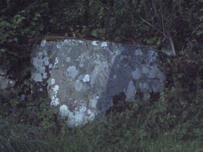
Arbory Hillfort is a mighty construction. The first scarped rampart bank is around a two metre climb up from the outer ditch. At one point it was easily three metres up. The ditch here is littered with tumbled stonework from the first rampart wall and some of these stones are large (5’ x 3’ x 2’ was the largest I saw tumbled into the outer ditch). There are about five yards between the first rampart and the next ditch. The rise to the top of the next rampart is around another three metres up from the second ditch. You are now in the interior of the original fort. But five or six yards ahead lies yet another rampart which was inserted into the older fort at a later date.

This next rampart is not another steep grassy stony bank but an incredible eight or nine metre wide spread of tumbled stone which still stands around two metres high in places around its original wall line. This near circular stone rampart was originally three metres wide and must have been at least that height. There are two entrances both less than two metres wide.
I sat on the wall of one of the circular cell-like buildings built into this central stony rampart and looked across Upper Clydesdale as the setting sun turned everything a delicate orangey- brown. There was a distant hum from the M74 and the sounds of dogs barking in Raggengill Kennels far below. A buzzard soared above me, wheeling and staring down at me. There are a number of rather enigmatic features in this hillfort.
1. A series of circular, stone built chambers (about the size of a small room). Their walls stand to a height of two metres in some of them. One of them is around twenty feet long and rectangular with a rounded end. There are a series of much smaller scale ones just two or three feet across. The farm below the hill is called Cold Chapel and I wondered about those little stone chambers…
2. A row of cairns, facing West, built along the edge of the second rampart. They initially look like they have to be fairly modern but are well lichened and fast in the peat which has grown here. They stand up like a row of teeth. They are perhaps three to four feet across at the bottom and rise to four feet high or so.

The sun dropped behind Drake Law and Craighead Hill to the West and very quickly a deepening dusk sent me clambering down the steep slopes back to the present day. Arbory is an incredible construction. Atmospheric and enigmatic. I reached my car and drove home to cocoa, biscuits and a well deserved early night full of dreams about the strangeness of Arbory.