Howburn Digger

Howburn Digger

All posts expand_more 451-500 of 510 posts
Image of Arbory Hill (Hillfort) by Howburn Digger

Arbory Hill

Hillfort

One of the dozen or so circular dry stone buildings and features built within the later, innermost stone rampart. These range from six feet across “cells” to a twenty foot long building with a rounded end. There are similar features just a few feet across.

Image credit: Howburn Digger
Image of Arbory Hill (Hillfort) by Howburn Digger

Arbory Hill

Hillfort

Five odd looking cairns preside over the middle rampart looking West. There are two smaller ruined ones.
I figured these were relatively modern additions but the stones at their bases are fast in the peat.

Image credit: Howburn Digger
Image of Arbory Hill (Hillfort) by Howburn Digger

Arbory Hill

Hillfort

Looking South from the inner stone rampart, across another rampart and through one of the gateways. Like Devonshaw Hillfort a couple of miles away, the Southern entrance has a titulus-like ramparty-type structure outside it which blocks direct access.
The fort looks down onto another massive engineering work, the roman road from Crawford Fort as it circumnavigates Raggengill Hill on its route North.

Image credit: Howburn Digger

Devonshaw Hill

25 August 2010

Devonshaw is one of a string of hillforts planted along the western edge of the Upper Clydesdale Hills. Arbory, Kirkton, Bodbury are others within a few miles. I can see my work’s cut out for the next couple of weeks...

There is a draw-in at the side of the A702 on the Northbound side of the road. Look for the gap in the crash barriers and draw in. If you miss it drive on, turn around a mile ahead and come back. This road is a death trap. There’s a bit of nfty traffic dodging to avoid getting splattered by the stream of artics and juggernauts and a great opportunity for a barbed wire wedgey getting over the fence and onto the hill. The fort is then a ten minute scramble up the steep side of Devonshaw Hill.
Gradually the sound of the traffic disappeared as I climbed higher. On a terrace high above the road I paused for a breather and leaned back against an outcrop of rock. My nostrils were hit by the most hideous smell, when I checked behind the rock there was a half eaten, half decomposed sheep whose partial evisceration was spread across the green, green grass in a scene reminiscent of The Killing Fields meets Shaun the Sheep. My movement set up an immense cloud of blowfly and bluebottles from the carcass and I stumbled away across the maggot crawling grass trying to retain my dinner.
Like most sites in South Lanarkshire, Tinto is always somewhere over your shoulder and she looks onto Devonshaw Fort with a real massiveness. The fort itself is a delight, perched daintily like a fifty pence coin on a western spur halfway up Devonshaw Hill. The hut circles in the interior are clearly visible and the ramparts still very intact. The steep inner rampart is a real challenge to get up.
There are some big boulders which occupy the end spur of the outer rampart which look rather interesting. I’d often seen them when driving up the A702 and noted their monolith-like appearance. Frost shattered and earth fast, they are a group of sizeable stones which mark one side of an approach to the South entrance. On the hill above the fort there is an unremarkable grassed over cairn with a superb outlook.
I stretched out on the high western rampart of the fort for a while watching the lowering sun strafe the valley below, picking out its greens and setting diamond reflections dancing on the waters of the Clyde. Tinto looked on and said nothing.

Panoramic views and atmospheric. Highly recommended.

Stronach Wood

I’d photographed the main panels and was turning to go when I saw a strange looking crack in the steep step of rock in the ground between the cup and ring panels. I looked again. And again! My heart went into overdrive and I had to sit down. I thought it was going to burst out of my chest. I was looking at a three foor long, two foot high bird like a Raven. I stood up. I sat down again and approached it sliding along the peaty grass. I ran my fingers along the deeply carved beak and around the beautifully shaped head. I simply could not believe what I was seeing and touching. I took a photo with my other half’s new camera.
When I looked back at the image on the camera screen under the trees, I saw what appeared to be a pair of bird’s feet above the Raven’s head. I walked over to check. As I looked in disbelief a Heron took shape. I could make out a bird below the Raven’s beak. It looked like a Curlew. It wasn’t carved out in deep relief like the Raven and Heron.
I resisted the temptation to wash off the deep coating of lichen, mossy slime and the peaty discoloured patina on the carvings and just started taking pictures as they were. The wind suddenly dropped and a horrendous midge attack ensued. I fled their bites shaking with utter joy. A sense of elemental elation carried me out of the wood and back to the car. I drove back to Lamlash. My head swam. I had to pull over at the top of the hill between Brodick and Lamlash and get out and get my breath back.

I returned a number of times that week. On the last day Mrs HD and The Boy came with me. They spotted the birds straight away (when I showed them the direction to look!). Suitably amazed, Alison took some nice photos. There had been a lot of rain the night before and that morning so the Raven was standing in a puddle of water and the carvings showed up better.

Reported the carvings by email to RCAHMS early in the week. Notified the Brodick Museum and Arran Heritage. Sent on the photos to both. I simply could not understand how these carvings sat in plain sight for so long without being noticed. A quick examination of photos on TMA and on BRAC showed the carvings visible but far in the background of Hob and Greywether’s photos. In the 1901 PSAS illustration the carvings lie under a strip of peat and turf separating the known cup and ring panels. Hmm... I thought... When exactly did the peat and turf wear away? Drove to Edinburgh to examine Stan Beckensall’s 2004 manuscript report and the photo archive at RCAHMS on Thursday. Beckensall never noticed them, his report contains no photographs. But I found M van Hoek’s photo, it was exactly the view I needed and showed the strip of peat to be there in 1980 but a bit of the rock is beginning to show through. I paid the very helpful member of staff £1.18 for the colour photocopy of it and left.
RCAHMS got in touch today and asked me to pass the details on to Discovery and Excavation Scotland. So that’s that.
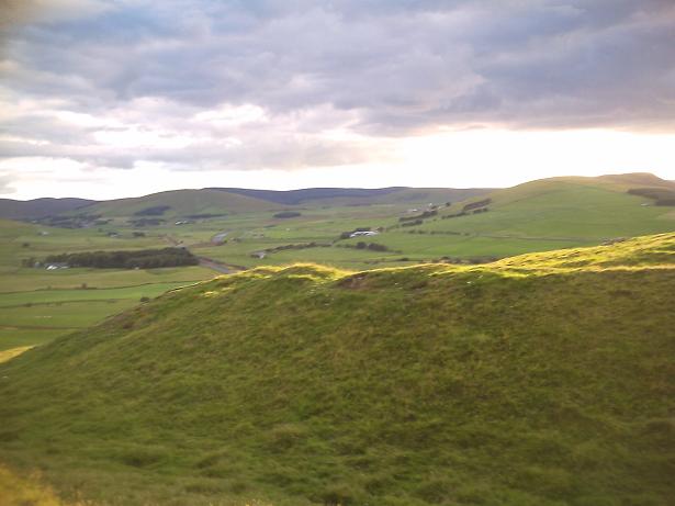
So anybody going to Arran this summer, get along to Stronach Wood (very easy access and very close to Brodick) and catch some elemental revelation for free.

Stronach

For about half the week this stone was flanked by a variety of wheelie bins. Wheelie bins need to be collected from the roadside and this stone has unfortunately found itself right on the verge so be prepared for your souvenir shots to feature a variety of coloured wheelies!
Park just across from the primary school and the the stone is right there by the car park. Dont get run over.
This stone had a partner. It lies tumbled in the woods across the road. Cross the road and go into Stronach Wood. Follow the low wall and fence line of the primary school into the trees until the school boundary fence turns to your left. Continue on your original bearing for the same distance again. Even in the undergrowth and trees it is hard to miss. I was out of battery power on my camera when I went... so no pic! Next time!

Giants’ Graves

It was summer 1988 when I first visited this site. I’d approached it through deep plantation forestry and endured the clouds of firey midges which hung in biting clouds around it. Visits in the 1990’s were no better. There were no views or any way to understand where this cairn stood in its landscape. All changed now!
The best way to approach these large Clyde Type Chambered Cairns is to follow the Glenashdale Falls path. Dont go up the steep signposted path if you want to avoid an excruciating climb! It is much gentler to walk on up to the falls and is really not much longer. You should walk the path right up to the falls then take a left along the smooth flat forest road which takes you around the hill. It makes for very easy walking and you are met with a spectacular view of the cairns as they sit in profile on the crest of their terrace with the Ayrshire coast behind them. The forestry has been completely clear felled allowing some wonderful viewing. You then walk down a gentle path on your left to the cairns.
The southern chambered cairn is aligned east/ west and looks directly to the black flat topped volcanic plug of Mochrum Hill near Maybole. These plugs/ igneous intrusions stretch from Scotland’s West Coast to East Coast taking in Ailsa Craig, Mochrum Hill, Tinto Hill, Arthur’s Seat, Bass Rock and the Lomond Hills.
The north chambered cairn sits on a north/ south axis and although only the massive cists are left in the centre, there are still large stones marking where the “horns” came out to. Views to the barbed peaks of Goatfell and Cir Mhor to the north are spectacular. If you are wondering where all the many tons of removed cairn material went... then on you way down the steep winding path look to your right and see the beautiful dry stane dyke which runs across the hillside! There’s your cairn!
While munching a fish supper with my Mrs and kid the following evening, we could see the stumps of the north cairn from the path out to King’s Cross Point in Whiting Bay far below. In its original state the cairn would have been very visible.

Image of Stronach Wood (Cup and Ring Marks / Rock Art) by Howburn Digger

Stronach Wood

Cup and Ring Marks / Rock Art

The dot which is just above and between the letters “a” and the “r” in “marked” is not the site. Do not attempt to go there. It is not a cup and ring marked stone instead it is a bog full of midges and clegs accessed through some nasty head high bracken and deep heather which is home to some very nasty deer ticks.
The site above the ampersand (the “&” in the “cup & ring”) is the one you want!.

Image credit: Ordnance Survey

Stronach Wood

My 1994 OS Landranger map had not one but two sites marked at Stronach Wood – one being the main one here in Stronach Wood and the other a few hundred yards further up the hill. I decided to start with the one further up the hill then walk down to the next. The first attempt ended with me sunk in a bog, totally drenched, bearing many midge bites and harbouring a deep sense of failure and disappointment. Then I set up a big Red Deer deep in the insect infested bracken and heard gun shots break the afternoon air a few minutes later. My sense of failure and disappointment turned immediately to one of getting off the hill before I caught a stalker’s bullet. I made my way noisily down to my car on the String Road determined toreturn and find the carvings. Getting changed back at the cottage I found a derr tick munching its way into my shoulder. Nasty creatures, they are difficult to extract without leaving the jaws in your flesh. It left a very painful bite which swoll badly and is still draining a week later.
The following morning I found myself back in the same mire and unable to find the stone as marked on my map. It took a third attempt to come to the conclusion that the old edition of the map was simply wrong or I needed new specs. I do need new specs but the old OS map seems to show two sites and I’ve posted the relevant map clipping to show folks where not to go (just in case their map is as old as mine was).
I bought the new OS Pathfinder edition and there was only one site marked! Once I had tracked down the deer stalker’s access track off the main road I was at the carvings in a few minutes. But get this folks… there were quad tyre marks across the panels! (Once you shoot that deer on the hill you gotta get that yummy venison down to the butcher’s shop and onto the plate somehow. Maybe Arran Heritage should take out a few of the plantation trees and take the path around the carvings…)
These carvings are groovy. I’ve seen many a cup and ring from Ben Lawers to Achnabreck but nothing had prepared me for the utter grooviness of these. Fluid and writhing… some of these seem to have a real sense of movement in them. A devastating midge attack suddenly ensued when the wind dropped and I had to flee the site but I was drawn back twice more during my week on Arran to look at and photograph some other stuff I’d seen up there – but I’ll post about that once it has all been checked out and verified. If they are for real it will be a big WOW! But until things are verified then I shall temper my enthusiasm and say nowt!
The complete removal of the forestry plantations around Giants Graves above Whiting Bay has transformed the landscape they occupy. I’m sure this plantation at Stronach Wood will soon be due for clear felling as well. It will help with interpretation of the this site in relation to the megaliths in the immediate area and the notable landmarks in the landscape (Goatfell, Cir Mhor etc). There must be more art lurking under the peat on the red Arran sandstone which forms this hill!

Air Cleuch

The Air Cleuch burn tumbles down a steep sided gully in the hills above the Dalveen Pass. The Pass is an ancient routeway up from Galloway a few miles below. The rocky outcrop bears many cup marks and juts out above the right bank of the burn, about a hundred yards upstream from the wee bridge on the A702. The views are spectacular. The site looks across at the Daer/ Clyde watermeeting where the farm of Crookedstane has a standing stone. Together, the hills of Upper Clydesdale and the Moffat Hills mark the watersheds of the three main rivers in Southern Scotland, the Nith, the Tweed and the Clyde.
A couple of hundred yards above the outcrop, the Roman Road crosses the burn on its way from the lonely fortlet at Durisdeer to the fort at Crawford. Between the cupped outcrop and the A702 are three rather curious flat topped mounds. There are also earthworks of an ancient settlement a few hundred yards to the west and beyond that a ruined medieval bastlehouse. The hillside is littered with platform settlements, cairnfields and Bronze Age funerary sites. In the hills just a mile to the north, Lead, Gold and Silver were mined throughout the ages. This area is now pretty much deserted save for a few bored sheep, but it was a very busy place for us humans in the past.
Summer or winter, the site really has a desolate, empty feel and despite the nearby M74’s best efforts, the silence of the empty hills wins over with peace, perfect peace.

Bizzyberry Hill

Bizzyberry is one of those rather surprising hills, Not very high (363 metres) but commands extraordinary views over to the Tweedsmuir Hills, the Broughton Heights and in all directions. The views North on a clear summer night are breathtaking and you somehow feel that you should get such vbiews from a comparatively low elevation. To the far West you can see Ben Arthur (The Cobbler) in Argyll and panning acroos to the East there’s Ben Lomond, The Trossachs peaks, Ben A’an, The Lomond Hills of Fife. And of course it looks over its shoulder forever at the might bulk of Tinto Hill with its massive cairn on the summit.
Bizzyberry Hill actually has two forts. The fort at the summit has a spectacular steep rock cut ditch on one side. Now under turf it is great for rolling chocolate eggs and children down. Some remnants of the defence wall can be discerned around the edge of the fort’s footprint.
Further down the hill at its Northern end sits another fort, This has circular stone footings for houses and is protected by three deep ditches which are also useful for rolling children down.
The spring (“Wallace’s Well”) just below the summit fort is still there, though little more than a trickle from a crack in the rock into a boggy puddle.
The hill also holds a probable cremation cemetery on the saddle between the forts. There are also at least three cairns. I have located two of them. One yielded a bronze axe (now on display at the NMS in Chambers Street, Embra) and a jet bead in the 19th century.
I have climbed the hill many times and it is best done in sunshine with a picnic. My kid has been climbing it since he was three so its not very difficult. The “Ewe Hill Hillfort at the North End of Bizzyberry is the best preserved and the ditches and house footing are in very good nick.
Parking? Park at the layby a mile or so North of Biggar on the A702 signposted for Gladstone’s Cottage Ruin, the hill sits across the road. Or park in Biggar and walk out past Loaningdales Outdoor centre to ascend the hill.

Lightshaw

I visited this site today in a misty drizzle as the light was falling. Huge coal lorries flew past. Yet this mighty stone exudes a real timeless peaceful authority over all the passing traffic. The site stands in a landscape shaped by grassed over pit bings and slag heaps, old mine workings and deserted railway lines. The mining hasn’t completely left and there are huge opencasts in the vicinity (one a few hundred yards behind the stone).
There are two massive stones on the skyline a few hundred yards above the Lightshaw stone which may just be there as a result of field clearance or the opencast. I’ll check them out on my next visit. Forgot my camera today!