


The remaing kerbstones of the eastern end
Visited May 2019


The western chamber (upper left) and the middle chamber (right)
Visited May 2019


taken from the information board of station 1:
Funeral customs from three millennia
Easily accessible during a walk, there are numerous tombs of a necropolis, a “city for the dead,” down the flat slope to the river Aue. The oldest tombs are the largest and the most elaborate: in the period from about 5,000 to 4,500 years ago, some buried their deceased in megalithic tombs. They built large boulders chambers, some of which received low and narrow entrances. The stone chambers were covered by a pack of earth. The resulting mounds are available in elongated or even round shape. So that the loose soil did not immediately drain again, many plants received a wreath of larger field stones. Had the chambers an access, several deceased could be buried in them, as it is still e.g. happens in family tombs.
In the centuries around 1400 BC, the second important group was built: the round burial mounds with one to three earth burials each. The deceased were bedded into tree coffins at an earlier stage, later they were burned and the remains were placed in urns. They were made of clay, often of fabric or leather. At the time, the population was already using tools and jewelery made of bronze, which at first could not be made in this area. Swords, daggers, needles, neck and arm jewelery came from the south and southeast. Monuments of the type described, as far as they are even preserved, are easily recognizable as ruins in the terrain. It is different with grave fields from earth or cremation burials. Although it characterized funerals from about 700 BC. By flat small piles of earth and / or by upright stones / wooden posts. But they have not survived until today. A few yards to the north was a burial ground, which was occupied between about 350 – 570 after Christ’s birth. There were more than 6,000 people buried. In the grove east of here is a urn grave field from the time of about 600 to 300 BC. Partially, the funerals are located between the older large burial mounds, in some cases they are also set in the hills.

Currently only in German, but with a foto gallery and a flyer in PDF format to download
Deinste 1 is a passage grave, which was sunk into the underground in the manner of the simple dolmen (Urdolmen). Until the 1930s there was a field consisting of 43 barrows in the heath around a now silted lake. In the remainder of a once large round mound, which contained two tree-coffin burials, lay a small chamber, whose easr end is strongly disturbed. Of the formerly three capstones only two are present. The third fell victim to stone seekers in the mid-19th century. In the first quarter of the 20th century, the open chamber was the target of robberies. The site could be restored and protected from further destruction. The big mound with a diameter of 25 meters was completely dug up. The support stones had been placed in a 90-centimeter deep pit and stand out only about 50 centimeters above the surface. The spaces between the stones were filled with stone slabs. On the south side was a narrow entrance. In front of it lay staircase stones and a door sill stone. A wedge-shaped stone closed the entrance.
The grave is located about eight kilometers south of Stade and 1.5 kilometers southeast of Deinste. At the train station in Deinste you drive on the Hauptstraße to the south. The Hauptstraße turns into the Kirchweg. After about 2 km you’ll reach the private road Bei den Hünengräbern, which branches off to the left. Park your car here and walk about 350 m on this road, the tomb is then on the right, about 70 m in a field.
Visited May 2019
taken from the on-site megalithic board:
The megalithic tomb of Deinste is located in the middle of a large burial ground. As late as 1930, the burial ground lay in a heath landscape and comprised 43 hills. At a survey in 1959, 23 tombs were counted.
Tomb raiders had partly destroyed the megelithic burials already in the 20’s in the search for stones, which were desired as building material. In 1928/29 the burial chamber was examined for the first time. The remains of the grave mound remained untouched, it should be preserved as a monument. But after the former heathland was converted into farmland and pasture and the mound was partly cleared, in 1959 an archaeological investigation of the entire complex was necessary. The excavations have been financed by the district of Stade.
The results of the investigation: The grave was erected at the highest point between two lowland areas. The supporting stones of the chamber are embedded in a pit excavated about 90 cm deep. On the narrow sides of the chamber is a supporting boulder; there are three boulders on the southern long side and two boulders on the northern side. Traces of the stolen northeastern support stone were detected.
The boulders point with their glacier-ground smooth sides inside. The gaps between the support stones are closed in detail with flat struck stones. In the approximately 40 cm wide gap between the southeastern and the middle support stone on the southern end of the chamber a so-called sill stone is fitted; the granite block placed on top closes the chamber. Two approx. 1 m long stones flank the passage to the chamber; it is paved with elongated rubble like a stair case. The chamber floor is double-paved with two layers of head-sized boulders, between which there is a bed of small stones with gravel. On their outsides, the support stones are packed with fist-sized beaten debris. Of the three capstones originally present, only two remained: the northwestern one, from which parts were cut off, and the middle one, which had to be “redirected” back to its old position during the restoration.
At about the lower edge of the capstone, a stone wreath of “bucket-sized” boulders surrounded the chamber. The stone wreath was halfway up the sand-hill, which had been so littered with the burial chamber that the capstones were scarcely covered. After 1928/29 a flint axe and two flint blades from the chamber as well as a small cup vessel from the filling sand of the chamber, which had been ejected during a robbery excavation, had been recovered in 1959, another flint axe and some ceramic discs could be excavated in the chamber. To the north, east, and south of the chamber lay ceramic slabs of old-fashioned broken vessels on the grown floor. The vessels were largely reconstructed.
In the Bronze Age, the Neolithic grave site, which was used in funerary beaker culture and the single grave culture for burials, has been extended. Presumably, three tree-coffins have been made. As part of the expansion, a mound of turf was built over the entire system. The mound had a diameter of 24.5 m and was at least 2.1 m high. In places, a stone wreath could be excavated from grouped stones, which bordered the large hill. In the upper layers of the extended mound, the excavators found remains of destroyed urns and cremated bones. Probably in the late Bronze Age and the early Iron Age so-called urn burials took place at the same place.
Through a lease agreement between the owner and the district of Stade, the Neolithic burial chamber was preserved and made accessible to the public.


Sorry for the blurred photo, but the midday sun was so glaring that I noticed this later.
Visited May 2019
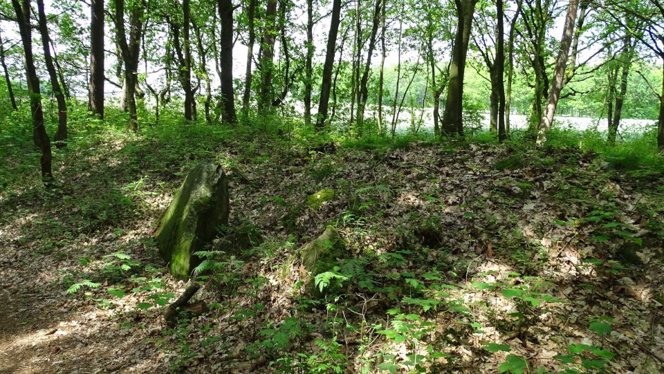
Hammah 2, like Hammah 3, is still buried in a mound with a length of 20 m and a width of 16 m. The burial chamber is oriented approximately west-east and has a length of 6 m and a width of 1.5 m. It has four support stones on the long sides and one end stone on the narrow sides. All are still in situ. The capstones are robbed except for one fragment probably damaged by blasting attempts.
The grave is located in a small grove south of the Groß Sterneberger Straße. On this road you drive from Groß Sternberg to the east in the direction of Stade. Approximately 650 m behind Groß Sternberg a sign points to the right to the tombs (Hammah 2 and Hammah 3), here you should also park the car. You walk on the dirt road to the southwest, after about 500 m this track turns to the right and you reach a forest hut. Here you leave the main path and continue on the right side of the hut on the trail. Hammah 3 lies about 75 m along this trail, Hammah 2 is only about 40 m further on the same trail.
Visited May 2019