

Quite an extensive monument.... and very rare. The only other ‘triple barrow’ I know of is way down in Surrey at Turners Hill... although there is a triple co-joined stone version at Pen y Garn-goch, near Llanwrtyd Wells...

Very hard to photograph and convey what’s going on here... but right by the road to Rough Tor from the old RAF airfield on Davidstow Moor... and near the fine Crowdy Reservoir round barrow.
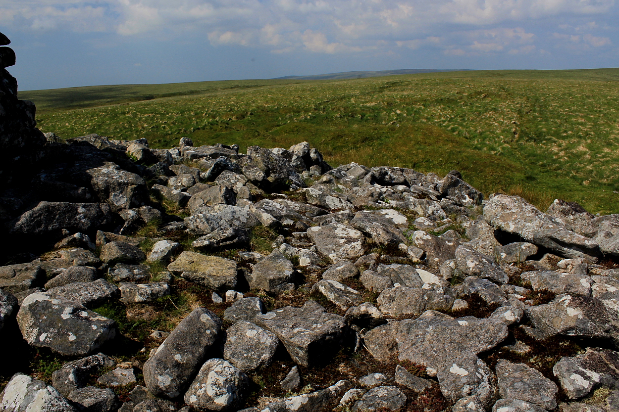
Something really needs to be done about moron trail bikers...or there really will be no ‘Butts‘
Wondrously located overlooking Nant Paradwys, this large cairn is a little under a half-mile south of the fine Esgair Ceiliog Ring Cairn (not shown on current 1:25k mapping). Combine a visit to both and a superb day hanging out in wild upland surroundings can be yours for relatively manageable effort.
The more adventurous, however, may wish to consider extending the walk to Carnau (just under one and a half miles further along the cwm at SN88955780), this providing the added bonus of an audience with the enigmatic stones at Bwlch-y-Ddau-Faen (SN89425830) en-route. There are many other route choices available, to be fair.
The latest Coflein record states:
“Cairn some 8m diameter by 1.8m high. Sheep shelter built at centre. (CPAT 1982). Evidence of cairn kerb still in place. Stone sheep shelter approx. 4m in diameter x 1m high. (CAP 2004)”
The Cwmdeuddwr Hills of Y Elenydd – ‘The Green Desert’ of Mid Wales – can be confusing places, even to those who consider themselves reasonably experienced in the locale.. so, first things first: please ensure you are not seduced by the relatively low height of these tops and erroneously believe you do not need map, compass and waterproofs. No intention here to teach anyone to suck eggs, as they say, but even the late, great, Wynford Vaughan-Thomas experienced complete navigational meltdown around these parts.
To emphasise the point, take a look at the Coflein records for Gro Hill and, in particular, the number of “Either not located at time of field visit or mis-sited” statements. Yeah, even experienced field archaeologists appear bemused by these hills.
The issues with Gro Hill are undoubtedly exacerbated by the fact that the OS has not recorded any prehistoric cairns here upon current mapping. Yet here they are, although possibly not where Coflein has them logged! The views on a clear day are sublime, the vibe delivering exactly what has brought me to these tops time and time again.
As a general overview, Coflein reckons:
“Gro Hill Cemetery comprises the remains of at least three small round burial cairns. The largest cairn is situated to the West and measures about 5.5 meters in diameter and up to about 0.4 meters in height. Within this cairn is an open visible cist measuring 0.9 meters from NW to SE. The southernmost cairn measures 3.5 meters in diameter and up to 0.2 meters in height. The easternmost cairn measures 4.5 meters in diameter and up to 0.4 meters in height. This cairn also has an open visible cist measuring 1 meter. All three cairns have suffered disturbance or robbing.
Source: Cadw scheduling description. [Foster/RCAHMW 18.09.2008]”
Bwlch-y-Ddau-Faen – the ‘Two Stone Pass’ – is an enigmatic place. Assuming wild, windswept moorland a couple of miles from the nearest road is your thang? Firstly there is a natural spring here amongst the peat hags; secondly, a number of standing stones protrude from said peat to varying degrees forming an irregular ‘ring’, as opposed to ‘circle. So why the colloquial reference to ‘Two Stones’ when there are substantially more than a pair of stones here? As I said, enigmatic place, augmented by a fine, sweeping view toward the Great Escarpment of South Wales dominating the southern horizon. Reassuring to find everything in its right place, so to speak. For what it’s worth, I’m tempted to think what we have here is a typical, if disrupted upland Welsh ring. With numerous diminutive orthostats barely breeching the current surface it just feels ‘right’, you know? It is difficult to hypothesise a satisfactory reason why these tiny stones should otherwise be here. But there you are. All is silent now, almost overwhelmingly so; however the location is significant, the past cacophony of untold drover’s agitated cattle seemingly hanging in the wind just out of human audible frequency.
Refer to notes for nearby Carnau for further context of this intriguing stone setting:

Upon the long barrow. No, really...


The long barrow from upon the round barrow...


Looked a bit more than 10ft, to be fair...

A very substantial round barrow more than compensating for the prohibitively overgrown state of the adjacent long barrow...

Apparently now some 10ft high..


Approaching from Sherrington to the approx northeast....
Beautifully sited to the south of the meandering River Wylye, just east of the village of Sherrington, this would be a first-rate monument to visit... if only someone in the locality would see fit to undertake a little pruning of the overwhelming mantle of industrial-strength vegetation once in a while.
This, however, would appear unlikely in the extreme... if only to judge by the farcically sour-faced short woman clearly seriously affronted by me having the temerity to drive down a public road in HER village while she let her dog run out of control. Ignore such ignorant fools, I say... those whose money and privilege cannot even accord them basic good manners.
Yeah, combine a sojourn here with a visit to the wondrous Corton long barrow... or the great Boyton Down Round Barrow (the nearby Boyton Down long barrow was even more overgrown than this one)... and happy days.


Under all that industrial-strength vegetation is a very substantial long barrow...

Almost completely overgrown – but, thankfully, not quite.


I approached via the track ascending from Corton village past Foley’s Cottage – sadly no sign of Eddie Murphy – an unlocked gate eventually allowing access to the appropriate field on the right, that’s just prior to reaching the bridleway descending to Model Farm.
Despite the images here upon TMA, I was somewhat taken aback by the substantial nature of the monument, the obvious damage notwithstanding. The position is excellent, as is the vibe.
With Corton being just a short diversion from the A303... and with limited parking available in a layby near the Dove Inn... I did wonder why I hadn’t been to this wondrous place before?


The monument is very substantial and nowhere near as overwhelmed by vegetation as others in the extended Boyton area. Bit windy, though.

Approaching this classic long barrow from the south-east, I was reminded of another: Crippets, near Cheltenham in Gloucestershire.
Time Team focus upon the Bank Cairn and some hut circles beneath Rough Tor, Bodmin Moor.
Set more-or-less due west of the magnificent Eastern White Barrow, the assumption is most folks would look to combine a visit to both, right? Note, however, that the monuments stand approx three quarters of a mile apart, a not insignificant distance upon upland Dartmoor.
Having been used as the building source – not to mention foundation – of a drystone shelter for peat cutters during the 1800’s, the interior of the monument has not faired well. Neither, for that matter, has the former Petre’s Cross, the remains of which can still be seen.
Historic England has this to say:
“This monument includes a round cairn, wayside cross and shelter situated on the summit of a ridge known as Quickbeam Hill. The round cairn survives as a circular stony mound measuring up to 21m in diameter and 1.7m high. The wayside cross is positioned on the cairn, but is inverted. It measures 1.3m high and is of rectangular section with both arms broken off. It was one of four set up by Sir William Petre, who had purchased Brent Manor after the Dissolution of the Monasteries from Buckfast Abbey in 1557 and was used to mark the bounds of the Forest of Dartmoor in 1557 and 1786. The round cairn has been disturbed by the construction of a two roomed shelter within the structure of the cairn itself measuring 11.5m long by 4.7m wide and having a fireplace and chimney. This was constructed in about 1847 by workers at the Red Lake peat ties, in connection with the Naptha Works at Shipley, who re-used the cross as a chimney lintel at the same time. Following the partial destruction of the building the cross was re-erected.”
I approached from the large car park at Shipley Bridge to the approx south-east (SX 681629), a formerly pleasing starting point which is sadly now being used as a revenue cash cow for the National Park... biting the hand that feeds... of tourists bound for the Avon Dam Reservoir and serious walkers alike... and, furthermore, disproportionately impacting access to the countryside for the less well off, for which £4 is a significant additional outlay. Yeah, speaking to a number of locals passing by, the car park charge is apparently VERY unpopular with residents. But since when did the wishes of people who actually live in the locale count for anything? So... given that fiscal targets must be met to provide creature comforts for tourists, at the very least the machine MUST be able to accept card payments!!! My lack of cash placed me in quite a dilemma until a local stepped in to assist me. Shame on those incompetents failing to maintain this ‘facility’ and discriminating against those not meeting their limited criteria. Simply not good enough.
That negativity aside, the trek to c1,548ft Quickbeam Hill is upon a clearly defined, gently rising path, so should offer no technical difficulties except in poor weather. Note, however, that the main track does not directly access the cairn, the intervening terrain proving rather hard going. In retrospect, it’s probably a good idea to gain the crest of the ridge sooner, rather than later, in order to minimise this. Or perhaps I’m simply getting old?
As for the cairn:
Despite being aware it is a ‘whopper’ from the distant view enjoyed from the ‘Heap of Sinners’ cairn upon Huntingdon Warren a few years back, I’m nevertheless pretty well overwhelmed upon arrival by just how big it actually is. The views to be had from the summit are far-reaching, the isolated upland vibe exquisite. Historic England notes:
“This monument includes a round cairn known as Eastern White Barrow situated on a prominent ridge on the north eastern side of Quickbeam Hill. The cairn survives as a circular stony mound measuring up to [c85ft] 26m in diameter and [11.5ft] 3.5m high. A secondary cylindrical marker cairn is situated on top of the summit allegedly built by soldiers during the Second World War. In 1240, 1609 and 1796 the cairn was one of the bounds of the Forest of Dartmoor.”


Highlighting the remains of the Peat Cutters’ hut construction from and within the cairn.


The remains of Petre’s Cross are foreground, the Eastern White Barrow upon the skyline.

Although much less upstanding than its superlative eastern neighbour – at least nowadays – this is, nonetheless, a substantial cairn. The remains of Petre’s Cross can be seen to the left.

Despite having viewed it from Heap of Sinners a few years back now – that impression making an eventual visit an imperative – I was not prepared for the sheer size of this beauty... wondrous!


Looking towards the ‘Western White Barrow’ some 3/4 of a mile to the, er, west. Quite an additional extension, but it had to be done. NOT a place to be caught in poor visibility....


Shame about the ‘conning tower’, apparently erected by troops during WW2? Guess we can allow those guys a little leeway in the circumstances....

Looking toward Puper’s Hill (right skyline) and the great ‘Heap of Sinners’ upon Huntingdon Warren (centre, left).

At (apparently) almost 12ft in height, this is among Dartmoor’s finest cairns...