
Given to me by a resident at Shipley Bridge May 2024 (Incidently, while assisting me parking to avoid the farcical car parking tariffs which, it appears, are VERY unpopular with locals). Stick the number in your phone – you never know...
Mr Cane was clearly on a bit of a downer following his visit here some years back now... hey, it happens, doesn’t it just? However, since the vegetation (judging by his images) was fortunately less overwhelming during my early Spring sojourn, I found myself in a position to disagree. Yeah, I liked it here and would recommend coming, this despite the woods proving a lot more popular with (non-antiquarian-minded) folk than I had anticipated.
Indeed, the eastern of the southern pair (of those monuments marked upon the map, that is – there are, apparently, a further three within the environs of West Wood not troubling the cartographers for whatever reason) is a particularly fine specimen of a bowl barrow, complete with encircling ditch. Its neighbour to the west, although not of comparable stature, is pretty substantial, too... the northernmost example, completing the OS annotated trio, slightly less so.
Access is straighforward from the B2068 – a Roman Road, aka ‘Stone Street’ – although the downside to that demonstrable obsession with ‘straightness’ is the traffic fair motors past; hence, there is some traffic noise to deny a perfect ambience. Note also that it is unwise to attempt to take a direct line (through the break in the trees) from the eastern of the southern pair of monuments to the western... if you value your legs, that is. Industrial-strength brambles all the way.
Incidentally, note that the round barrow at nearby Tumulus Farm (TR 13481 42341) is apparently of Roman origin. Sigh....
The northern-most round barrow at TR 13643 43412. I did not realise there are – in actual fact – three further round barrows in West Wood not shown upon the map...
TR 1365543040 appearing much more than just over 7ft.
TR 1365543040. The western-most barrow can just be seen through the forestry ride. By the way, I strongly advise visitors DO NOT attempt a direct approach since the intervening ground consists of industrial-strength brambles!!
TR 1353243044 – the western of the southern pair... smaller at (apparently) c5.5ft in height.
TR 1365543040 – the eastern of the southern pair of round barrows, this an impressive example rising to apparently over 7ft... It looked much more.
This site caught my eye while scanning the map for something to ‘bolster up’ a planned trip to not-too-distant West Wood... and turned out to be a first-class, primary visit, including possibly the finest surviving round barrows in Kent?
Unfortunately, however, there is a negative aspect: The Three Barrows are located immediately adjacent to the (cue drumroll)...’North Downs Way’, thus inevitably suffering from the attentions of plodding hikers ‘doing the way’/French tourists (judging by the language!) and, far more seriously, moronic trail bikers. Indeed, the ‘leader’ of one such group of ‘broom-broom-halfwits’ steadfastly refused to meet my gaze after I countered his ‘good morning’ with a cold, silent stare – hell, the fool damn well knew riding his farcical contraption here – to the detriment of everyone else – is out of order! It’s one thing to act like an idiot and not know any different – ‘stupid is as stupid does’, after all – but to realise you’re being stupid, yet carry on regardless, is surely beyond contempt? Shame on him and his kind.
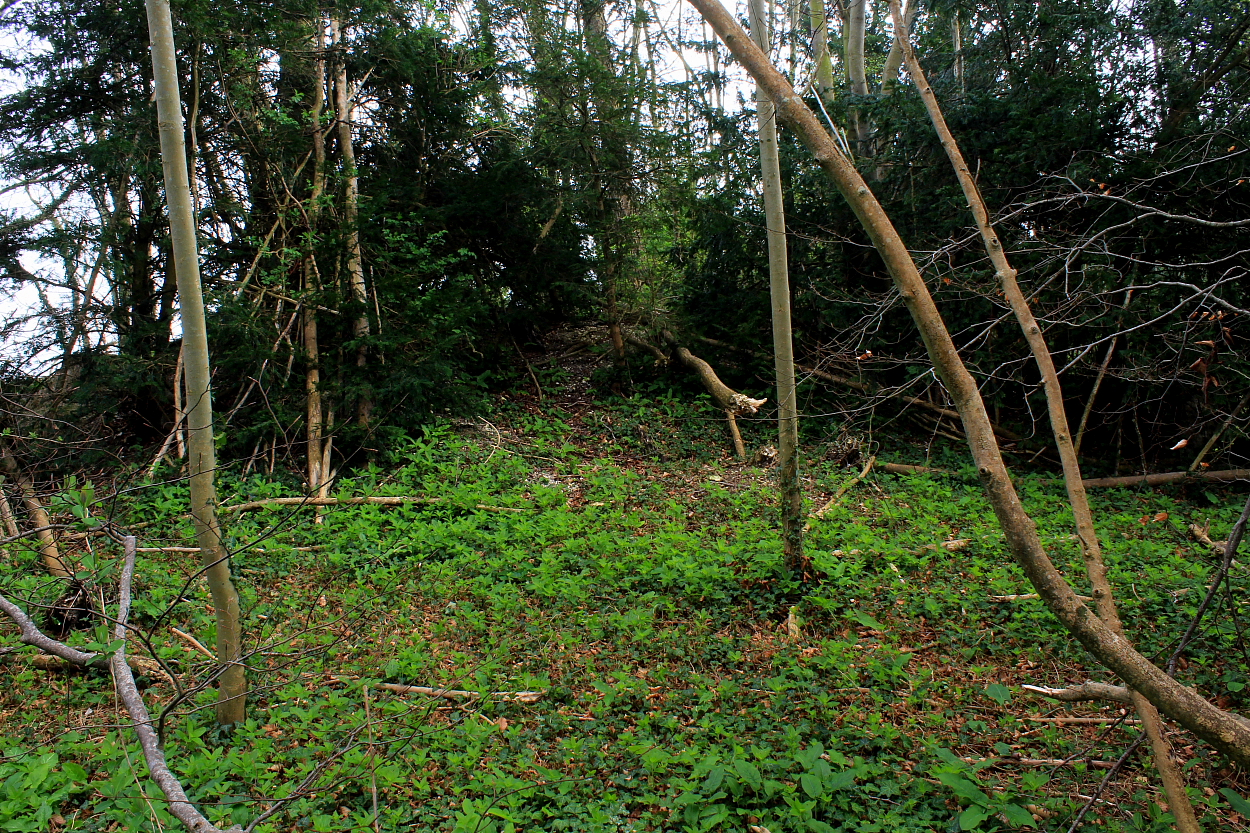
Having said the above, however, Rubury Butts is still a great place to hang out for a while... since the very substantial northwestern monument is seriously overgrown, the summit a hidden haven of wondrousness.
Historic England summarises thus:
“The three bowl barrows known as Rubury Butts at Three Barrow Down, Womenswold, Kent lie at the convergence of the three parishes of Womenswold, Nonington and Shepherdswell in a lightly wooded copse adjacent to the North Downs Way. They were noted by the C18 antiquarian Bryan Faussett in his Inventorium Sepulchrale published in 1860 who believed that their name derived from ‘’Romes berig Butts’, meaning ‘ the butts at the Roman burial place’. Faussett undertook excavations of Anglo-Saxon burial sites at Golgotha, Shepherdswell and Barfrestone approximately 2km to the east and it is thought possible that these later monuments may have been positioned intentionally within the sight of the three earlier barrows. It is certainly the case that a resurgence of interest in barrow construction took place in the Iron Age, Romano-British, Anglo-Saxon and Viking periods when burials were made in ancient mounds or new mounds were constructed. Nationally barrows are known to have acted as Parish markers as in this case..... It is likely that the Rubury Butts bowl barrow cemetery is Bronze Age in origin.... The barrows are aligned in a row on a north-west to south-east axis approximately 5m apart. The northernmost barrow is 26m across and stands to 3.5m [c11.5ft – G] in height. The middle barrow is 14m wide and 1m high and the third, adjacent to the track, is ovoid in shape, approximately 21m wide and 1.9m [c6ft – G] high, eroded to the south-east by the track. None of the mounds have obvious ditches.”
North-western...
The damage is all too obvious... but then, if one argues with a fool, so does he/she/it.
South-eastern barrow......
The mighty north-western barrow... heavily overgrown – and so spared the ravages of passing half-wit broom broom bikers...
Summit of the south-eastern monument... still hanging in there despite the criminal activities of biker morons.
The south-eastern barrow...
At nearly 12ft high, the northern monument is arguably Kent’s finest round barrow.
At nearly 12ft high (85ft across), the north-western barrow is the unexpected pièce de résistance of the trio. Not that this is apparent from a distance...
The centre barrow...
The ‘middle barrow’ is apparently some 3ft in height (45ft across), although it appeared to have a lesser profile to me? Was this always thus?
South-eastern barrow, with moron biker damage evident. A curse be on them all.
The south-eastern barrow beside the track. Needless to say, a lesser monument would’ve succumbed to the erosion of moron bikers long ago...
At approx 6ft tall (c69ft across) this, the south-eastern of the ‘Three Barrows’, remains a substantial monument despite the all-too-obvious attentions of moronic trail bikers.
Bit wet, but there you are...
Llyn Cyri – the referenced lake of ‘Craig-y-Llyn’. As it happens, the great cairn was sited so as to not overlook it. Incidentally, this is the reverse view of the framing of Twll yr Ogof between the ‘portal stones’ of Cerrig Arthur stone circle located some 5 miles across the Mawddach to the northwest
Looking approx west to the sea. There is (apparently) a cairn upon the unnamed hilltop seen below (to the left of the forestry)... although I wasn’t able to positively identify it.
Looking approx northeast along Cadair Idris’s great northern escarpment towards the summit of Craig-y-Llyn. Pen-y-Gadair, the mountain’s 2,930ft apogee, can be seen top right.
Despite the inevitable central damage – note the apparent ‘excavation’ by an old woman as well as Wynne-Foulkes back in the day – this remains a substantial cairn.
Looking approx NE across the – much more impressive than I recalled – monument towards the central summits of Cadair Idris.
So much going on here, to be fair.
A quick look at the “mound” at TR034502 in passing…
Pretty rare, apparently…
It’s up there somewhere – honest.
Report of “The excavation of Fan round barrow, near Talsarn, Ceredigion, 2010–11” within ARCHAEOLOGIA CAMBRENSIS Volume 162
Should you go, I reckon it’s pretty much odds on you’ll leave a fan of Fan, so to speak...
Fan, as the prosaic name suggests, is an elongated ‘peaky ridge’ rising to the west of the hamlet of Nantcwnlle, a little over a mile and a half distant from the great, sacred hill of Trychrug.
Not to be outdone... it, too, is crowned by the remains of a formerly substantial Bronze Age cairn subsumed within a grassy mantle. Despite being “inadvertently levelled during pasture improvement” between 1996 and 1998, subsequent excavation in 2010-2011 discovered several cremation burials/cups/urns. So no doubts about said monument’s prehistoric ancestry, then. [refer ARCHAEOLOGIA CAMBRENSIS Vol 162 – see misc link]
The Citizen Cairn – suitably intrigued – approached via a pleasing footpath attained by taking the minor road exiting Bwlch-Llan to the northwest. Boasting sweeping panoramic views, this was a fine way to spend a blustery afternoon. A ‘Peaky Blinder’, perhaps? Furthermore, if time is not pressing, why not continue on to the wondrous Trychrug beckoning upon the skyline?
Coflein reckons:
“A disturbed circular cairn, c.21m in diameter, 1.6m high, set upon a summit, has produced a pygmy cup and possibly a bronze spear-head (see Briggs 1994 (Cardigan County Hist. I), 193 No.183).” [RCAHMW AP965053/42-3 J.Wiles 02.10.03]