
Looking from Treen Cliff to approx northwest.
Image credit: Robert Gladstone
Looking from Treen Cliff to approx northwest.


Eastern flank, looking south(ish). Again, very impressive.

Western flank, looking approx south. Impressive.

Approaching from the north-west, it doesn’t appear much... for a few seconds.

Well worth the additional out-and-back detour from the summit of Showery Tor....


I was surprised at the substantial nature of this one....


The ‘circle is approx centre – looking from Rough Tor (with a little optical assistance)
Two barrows as different as chalk and cheese… as you might expect upon these bovine-inhabited chalk downs.
A good scramble to where Lieutenant Hugh Goldsmith (RN) ended up with egg on his face. The arrogant muppet.
For Petre’s sake! How big is the eastern?
Two complementary – yet nowadays VERY different – prehistoric monuments still grace the rolling chalk of Boyton Down, rising due south of the eponymous Wiltshire village... although to be fair, a glance at the map will show Sherrington has an equal association.
Yeah, such is the extreme, overgrown state of the older Neolithic long barrow, that The Citizen Cairn had to double-check said map to confirm he was not going doolally, despite it measuring in at almost 150ft in length!
Thankfully, no such issues are prevalent with the very fine (10ft high) Bronze Age round barrow still standing tall a little to the NNW. Indeed, that is so large it was found to contain a primary cremation, plus thirteen later (Saxon?) inhumations upon excavation. Once again, clear evidence that folk back then were quite happy to venerate the traditions of those who went before... either that, or maybe simply fearful not to upset the old gods?
Worth seeing...


Northern defences – Showery Tor is upon the horizon

Looking from the cairn upon Little Rough Tor to Rough Tor


Looking approx NE towards Showery Tor from Rough Tor summit. Note remains of the church upon cairn material

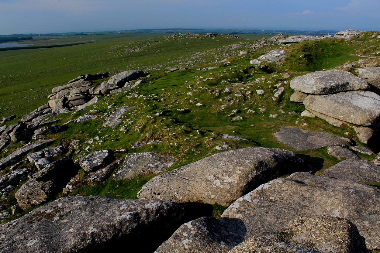
Looking approx SW across the enclosure from the cairn upon Little Rough Tor – note the defences to right...


Retrospective upon (finally) moving on to Rough Tor. Note the substantial nature of the ring cairn...

For me, this is THE most special tor in the West Country.


20 years since I was last here... a long time for us, but a blink of an eye for Showery Tor.


Looking across to neighbouring Rough Tor... it would take the greater part of the day before I could move on, however.

Wow. Brown Willy rises beyond, itself well, well worth a visit

The great ring cairn surrounding its enigmatic charge... the latter like a mustang petrified to stone within its corral... as in one of those tales of yore.

One might say ‘What could be more enigmatic than this fantastic monument?’... but, actually, Nature Herself provides the emphatic retort upon Showery Tor, seen upon the skyline.


I didn’t appreciate this wondrously enigmatic monument for what it was when I last ascended Rough Tor very nearly 20 years ago now. Had to come back one day. It appears Wessex Archaeology term this a ‘Bank Cairn’, presumably since it kinda resembles the stone equivalent of Dorset’s great ‘Bank Barrows‘

Landscape context of the ‘long cairn’ – for want of a better description – looking from the main car park to the east. This view explains why Time Team had to come here to prove it was indeed the real deal... looks just like a field boundary.
Located to the immediate west of the Crowdy Reservoir, facing the dam, I neglected to visit this round barrow when last in the area visiting the Advent ‘Triple Barrow’ during 2017. The fact that this decision was in error became all too obvious as soon as I clapped eyes upon its substantial profile this time around, the monument apparently getting on for 9ft in height with a diameter of c62ft.
Historic England reckons:
“The monument includes a bowl barrow, situated on a south east facing slope, overlooking the valley of a tributary to the River Camel. The bowl barrow survives as a circular mound measuring 19m in diameter and up to 2.7m m high on the downslope side. It has a largely-buried surrounding quarry ditch, from which material to construct the mound was derived, measuring up to 4m wide and 0.2m deep. In the centre if the mound is an early excavation hollow.
Sources: HER:- PastScape Monument No:-434434”


The serrated profile of Rough Tor would rear up on the skyline... in better conditions

Just a quarter mile from the enigmatic Advent ‘Triple Barrow’... pretty substantial.
This is a somewhat shy, retiring monument located right beside the road heading towards the wonders of Rough Tor from the former WW2 RAF airfield upon Davidstow Moor... so easily missed/ignored.
That, however, would be a travesty you’ll regret as soon as you get back home... for these three closely related (if not entirely co-joined) bowl barrows – hence ‘Triple Barrow’ – form a very rare monument, indeed.... in fact, I’m only aware of one other (seriously overgrown) example way done in Surrey, upon Turners Hill, near Farnham (although there are three co-joined round cairns at Pen y Garn-goch, near Llanwrtyd Wells). Are there any more?
So, travellers should watch out for this slumbering enigma and, in addition, make the short detour to view the rather splendid round barrow (just the one, mind) located before the Crowdy Reservoir Dam. There is, incidentally, another monument a little further on past the water works, to the left.
Historic England has this to say:
“The monument includes three bowl barrows, situated on the upper southern slopes of a ridge, overlooking a tributary to the River Camel. The three barrows, two of which are contiguous and the third immediately adjacent, are aligned west to east and spaced so closely they are almost a ‘triple’ barrow. The barrows survive as three circular mounds enclosed by an outer, oval partially-buried ditch. The mounds from west to east measure 24m in diameter and 1.3m high; 18m in diameter and 1.2m high; and 19m in diameter and 1.3m high. All three mounds have pits and trenches associated with early excavations or robbing. The surrounding outer quarry ditch is up to 3.2m wide and 0.6m.
The mound and ditch to the south east are cut slightly by a hedge and road.
Sources: HER:- PastScape Monument No:-434423”
