
A bit of zoom almost reveals evidence of a wall.
Image credit: drew/A/B
A bit of zoom almost reveals evidence of a wall.


The probable landing place, not for me, plans are being made for island behind tho :-)

We parked at Tangasdale and followed the Hebridean Way, west, heading towards the coast and dunes. Following various marker posts we headed south via various inlets and very odd rock placements, oddly not noted by Brannigan etc. Other rock settings they did note, once again where not found.
Still Dun Ban is a fantastic site, it probably is a promontory fort, once again it could be described as broch, the walls are wide enough, in parts still in good condition.
We had the good weather, which luckily had accompanied us on the days before and after.
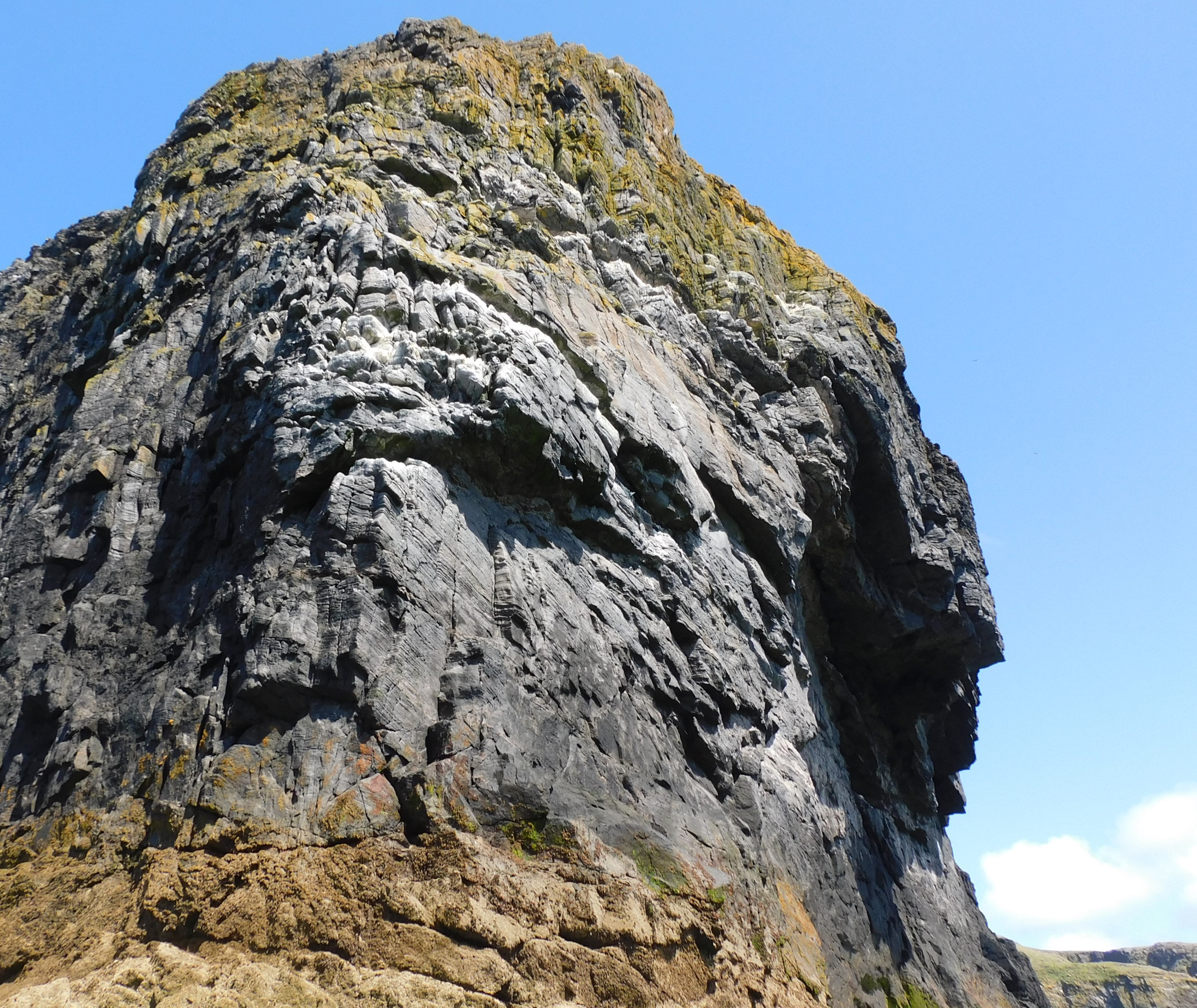
On returning to the car we walked up to Loch Tangasdale to have a look at Castle Sinclair / Dun Mhic Leoid, a tower built on top of an island. Sadly no dun or crannog, no sign of a chamber cairn also despite a good look.
Visited 12/07/2022.
Heading south from Bruernish, on the A888, I parked just beyond the junction to the houses of Breibhig near quite a severe corner. People have used this space to head south west on a small track that leads straight to the stones, one up and one down.
One of the best settings for views east, back then and more recently as the concrete block shelter proves.
Once again I provided a masterclass of being unable to find invisible sites, including a supposed stone circle, a case of Canmore’s favourite phrase ‘no trace’.
Still the standing stones and scenery make it all worthwhile.
Visited 12/07/2022.
Some closer up photos.


The west side of Dun Mingulay taken from north of the natural arch.


The promontory from the south west, defences look ok to me.

A bit of zoom on the west part of the fort, the further away promontory.

A bit of zoom, I’d climbed from east to west, then back, having to go back as quickly as I could because of the boat’s schedule.

The promontory fort is in the middle. Berneray Lighthouse, on another island to the south.

Centre cairn looking north, to the left you can see a bit of the ruined village on Mingulay.

Looking down on top of the central cairn, capstone missing sadly.


Looking north towards Mingulay, the north curve of the cairn can be seen.
Slightly wider than it’s near neighbour this site sits at 9m wide and is 0.7m in height. There is a kerb on the south east.
Now another nearby cairn could not be found as the jinx of Brannigan and co re-appeared. The mound to the north east could also not be found in a masterclass of not finding the invisible sites. This had already happened a few times and I can guarantee that this wouldn’t be the last hunt for the invisible.
Still we headed up Beinn Mhartainn, by which time the weather had cleared.
Visited 11/07/2022.
From Taigh Talamhanta we headed back west via the fallen standing stone and Dun Bharpa to visit the first of two cairns, I could find, near the track/fence south of massive chamber cairn.
The grass covered site is 8m wide and in parts 1m high. Interestingly it appears to have a double kerb on the south side. Infuriatingly someone plonked a fence on the site’s south east.
Not the biggest site in the area, but another indicator that this was perhaps used as a path to and from both sides of Barra.
Visited 11/07/2022.
Like the T’s I found this is a hard place to describe and at the same time found it to be reasonably similar to nearby Balnacraig or Aird Veenish – multi purpose and oft used sites.
We came down the hill from Dun Bharpa were it was almost dry, trying to find a place to cross the marsh to Talamhanta proved a difficult task. Eventually we found a place we could get across and jumped a stream which thanks to the previous nights rain had grown a bit larger in size. The dog was delighted to have a paddle ;-)
Traces of roundhouse, wheelhouse, souterrain, enclosure everywhere. I had read about this place but that made it even more confusing.
Now if the place was to get a good excavation and allowed onlookers I’d be straight over. Great views north and east.
Confusing and interesting at the same time.
Visited 11/07/2022.
From Balnacraig we headed cross country over the west edge of Grianan, to find a sort of track that led straight to Dun Bharpa, situated in the shoulder between Grianan and Beinn Mhartainn.
A stunning place, a huge place, a massive amount of stones / stonework, stones still standing, mega capstones and a view that is outstanding. To the north fairly clear, and today looking south and west misty but clearing gradually.
Standing beside the cairn and walking round it seemed fairly calm, trying to climb to the middle I was met with the full force of the Atlantic wind. However, I didn’t fall, or vanish into the cairn. Bizarrely as soon as we stepped back down on turf, or bog in certain bits, the wind died down.
The fallen stone is to the east and it must have been impressive as it is 3m in length, an outlier to the chamber cairn. We found the stone on the way to Taigh Talamhanta.
It is a must visit, a wonderful place.
Visited 11/07/2022.

A wee bit of zoom reveals a wee bit more stonework.


From the the south near Bruernish, the dun is to the left of the promontory.
A “fantastic bunch of volunteers” have built a replica Iron Age roundhouse on a large Bronze Age causeway dating back 3,500 years.
More info : bbc.co.uk/news/uk-england-cambridgeshire-63095495
More great aerial stuff.
More great drone photos.


Looking south east, sadly it isn’t a small dun close to the shore.


North section of the wall looking east, the road leads to the village on Vatersay.


