
The Ancient Monument Schedule for the Corbie Knap, the map also shows that there was at least a stone stood at Greenhill before it’s destruction/burial. Also shown are the location of former cairns and most interestingly a Picts fort.


Removed to neighbouring field to be used as a back scratcher.


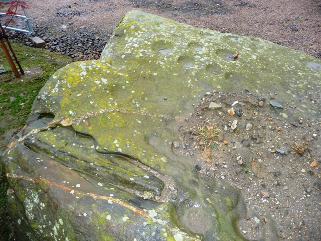
The site of the circle which looked south towards Hatton.
After yesterdays sad discovery at Westertown little did I expect the same thing to happen again. On the way to Corbie Knap Greenhill farm is passed. So the perfect opportunity to visit. On asking permission to view the site I was told by the farm’s occupant that the farmer had grown tired of ploughing around the stones and had therefore dug a hole and buried them, leaving brown earthy marks. Nothing grows on this patch.
The occupant was genuinely sad but said some stones had been pulled aside and dumped round the farm, during previous site destruction. One had been set up in a neighbouring field, another beside the garden and two dumped in amongst piles of stones and farm waste. The circle must have been made of red and grey granite.
Follow the directions to Corbie Knap, Greenhill is on the north side of the road.
(Maybe safer for me to stay at home tomorrow!)
Visited 14/10/09.
Some 14 meters wide and 11/2 meters tall this cairn defys the elements and agriculture. At least here the farmer has the remains of the cairn, nearby cairns were dismantled for dykes and then ploughed into the land. Inside the cairn there is a cist which was opened then the cairn was rebuilt over it. There is bad damage to the northern side although some kerbs remain. Over the fence/wall and the southern side is more overgrown but at least it still has some shape. The cairn overlooks Cruden Bay and the North Sea so if coming here wrap up, the winds can be cruel.
Turn west, signposted Gask, just before Longhaven north of Hatton on the A90. Follow this road until it’s end, turn right and cairn is on the left about 50 meters into the field on the crest of Gask Hill, just before the Hillhead of Gask farm.
Visited 14/10/09.


Stopped when driving past, torrential rain and mist gave the stone a ghostly feel. To me, anyway!
Mr. Robertson still lives at the farm and doesn’t mind if people stop as long as they don’t disturb farm work and cattle.
When new barns were erected at Corskellie farm four large boulders appeared. After being turned over up to 56 cup and ring marks were found on one of them. Fortunately the farmer placed these near the fence at the minor road, therefore it didn’t suffer the same fate as happened at nearby Westertown.
Travelling south from Aberchirder, on the A97, cross the River Deveron at the Marnoch Bridge. Take the first right. If driving be careful this is a very hilly and twisty road. The minor road goes thru Corskellie farm after two miles. The boulders are easily spotted on the left hand side.
Visited 13/10/09.


Cairnton emerging from the mist from Westertown whose land it is on.
Anybody looking for the cup marked stone, at Westertown (NJ58824450), will be wasting their time. The farmer buried the stone at least ten years ago in the same field in which it had rested for years. There then followed “a stushie” between the Historic Scotland people and the farmer. So, in the end not a very good result.
“Ladies from the nearby town of Turriff, in centuries gone by, are supposed to have come to the woods at Delgaty. There they would find lumps of yellowish sandstone which they then shaped into small blocks similar to soap. This they then used, on returning to their homes, with water to clean their kitchen utensils and tables. This practise only stopped in the late 1800’s, when the real thing became more available.”
Mrs. E. Shand, Woodside Of Delgaty.
Canmore’s description is short and to the point, “Fragments of an urn found in a small tumulus on a muir at Burnside Of Delgaty, were donated to the National Museum Of Antiquities of Scotland, by J. Stuart in 1853.”
The tumulus is small and somehow still exists overlooking the Delgaty Burn. Made from small boulders there appears to be a very small kerb ring on top. Another part of the Delgaty mystery falls into place!
Leave Turriff heading east on the Ardin road and stop immediately after the first bridge. The barrow is a good 300 meters south thru sometimes boggy ground.
Visited 9/10/09.


On the western slopes I came across this beaut of a rock. No rock art, pity.


A row of stones leading from the west/north cairn.

The smaller cairns are hollows left and right, the biggest cairn at the top. This the northern approach.


And several kerbs remain on the eastern cairn to the north.

Several kerbs remain of the west cairn on the northern side.


The approach from the south some of the stones are used to help the dyke which surrounds the site.
I tend to agree with the older description rather than OS’s more up to date version.
I don’t like to disagree with the OS people but surely some of their results for this site are misleading. Set on top of a hill, just outside Maud, this kerb cairn and it’s two smaller pals must have been massive, it’s appropriate it’s nickname is “The Giant’s Cairn”. Sadly only some of the kerbs remain but enough remain to give a fair picture. Massive boulders that might have surrounded the site have been pulled and piled into two massive heaps. Some explosive work, ah the local apprentices again fresh from Gaval no doubt, has happened here as quite a lot of boulders have drill marks in them.
Canmore say four, I say five near each other plus at least another six stones are earthfast of the biggest kerb cairn which has been hollowed out. This is quite easily the biggest area for a kerb cairn I’ve ever seen. I’ll put the Canmore link up for comparison.
More interestingly the OS says there are no trace of the two smaller kerb cairns slightly to the north. I have to say they are wrong. Both cairns have several small kerbs surviving and both have been hollowed out. Also both have little straight lines of stones heading north for a short distance. Perhaps an entrance of some sort.
To the south of the cairn there is some erosion. This gives an indication of how the cairn was build, loads of small boulders and earth.
Like Broomend and Pitglassie there is a lot going on here. To the north there is Auchmachar Cairn (visible) and RSC, Louden Wood, White Cow Wood, to the east Aikey Brae, West Crichie, Skelmuir, to the south Auchmaliddie, Old Maud and to the west Culsh (destroyed) and the removed cairns at Atherb. Maybe it’s just my mind doing overtime and running riot, which is nothing unusual, but this is a worthwhile visit. Good all round views of the rural area. Looked for ages amongst the boulders for any rock art but no joy!
Follow the B9106, Victoria Road, going north out of Maud crossing the South Ugie at the Old Maud Bridge. Follow the road until the first severe corner and follow the track up the hill, if coming south the Cairndale signpost will be seen. This is dead straight, stop at the first corner, the cairn(s) are on top of the hill in front. I intended to stay for a few minutes but did a Gladman and remained for about three hours! Right on!, as he would say.
Visited 7/10/09.
With a delivery van going miles astray I took advantage and went back to Woodside of Delgaty to look at the remains of another possible ring cairn. There are plenty of small quartzs and stones that look more like pebbles on a beach. The small cairn looks over towards Bennachie, 20 miles away. Although badly damaged by ploughing the width of cairn is approx 25 meters. Rumours of an excavation have yet to come to fruition.
From Woodside Farm, ask permission from Mrs. Shand, follow the tree line south until the gate. The cairn is clearly visible to the western side some 30 meters into a tattie field at present. Before looking at the cairn look amongst the trees to the left/east.
Near the fence could be a small but undamaged grass covered cairn. I posted an image to see if anybody could throw some light on the matter.
Visited 5/10/09.

This near the Woodside cairn. Looks like a small cairn or barrow. Mrs. Shand, of Woodside, informed the Council archeos but no reply........

The remains of a possible ring cairn, looking west.

From the south, with Woodside farm in the background.

Beside the tall tree in the background is the remains of another ring cairn, further east.
Skene’s Wood, Greenlands, Balbithan and Larrick have many hut circles and cairns within them. Like Bellmuir, near Methlick, this must have been a close knit community living in the shadow of Bennachie. Larrick is the old Scots name for Larch, perhaps an indicator to local environs. Unlike the neighbouring villages these hut circles and cairns are to be found in a field only a few meters north of the house at Larrick.
Leave the B977 between Hatton Of Fintray and Kintore, taking the minor road to Inverurie. Larrick is the first track to the left. Parking is available at the house. Probably best to ask permission, as I did in a roundabout way.
The only reason for coming here was a conversation with my accountant who happens to be the accountant for the residents at Larrick. So cheers to John Smith.
Visited 3/10/09.


Sand storm covering the Gouk Stone and the standing stone at Caskieben. The hill behind is Tyrebagger. From inside a hut circle at Larrick.

Hut circle on top of the possible cairn.

