
When visiting Broomend Henge you can see the henge plus two original stones and the Pictish symbol stone. In the same field there is one of the stones that formed an avenue leading to another circle.
I’ve often wondered about the fourth stone and today my curiousity was cured. It is in a private garden about 50-60 meters from the single stone heading towards the now (sadly) defunct paper mill behind a fence, bushes and trees. Nobody was in so I jumped the fence and took a couple of foties. That now leaves Caskieben as the one stone I’ve to find in the Tyrebagger to Broomend mystery.
Visited 22/04/2010.


The High Law is an easily found to the east of the A975 south of Cruden Bay on the farm track after Kiplaw Farm. Just up the road is Slains Castle the inspiration for some guy called Dracula.
Like a lot of cairns/circles in this area agriculture has taken its toll but it still survives. To the north west it has been quarried, to the south west a water tank has been built and the wall mentioned by Canmore has long since gone to be replaced by a fallen down barb wire fence. A trip hazard for my clumsy feet.
Remarkably the views are stunning with great scenery all round even as far as the Grampian mountains. This would explain why it had been used a beacon in days gone by. Contained within its 23 meters width and its height at over 31/2 meters was a cist, in the midst of the cairn stones. When opened it was empty suggesting an earlier excavation. However the real miracle is that it still exists just a short walk from the track.
Visited 19/4/2010.
The maze of roads in this corner of the North East make this a hard but worthwhile place to find. Travel north from Newburgh, on the A975 taking the first minor road north west after the B9003 Collieston road. (Slains primary school is at the junction.) Keep going in a northerly direction past the ruins of St. Adamnan’s Chapel until this road ends. Then turn left then right ands keep going until a clump of trees can be seen at the top of the hill opposite Pitlurg farm.
It is only a short walk to the Neolithic round barrow from the road. Today that was a good thing as the weather returned to it’s normal freezing conditions with odd ball showers of hail and sleet.
The barrow is almost 20 meters from North to South and is 15 meters wide. Some rig and furrows have encroached onto the site However it still stands at over 11/2 meters in height being made up of earth and small stones. Trees also remain within the enclosure giving a sense of age. Canmore says a wall surrounds the site, it also is covered in turf and grass. One or two biggish stones are all that can be seen. This place has an ancient feel as it looks down onto the North Sea. Although it doesn’t seem high the views here pretty excellent. Bennachie can even be seen, the builders had built and chosen wisely.
Visited 19/4/2010.


Travel east from Methlick on the B9005 stopping at the bridge that leads to a quarry. This quarry is still in use and a locked gate means that the rest of the journey is on foot.
The cairn is situated on a small hill on land littered by rocks and bog. Also there are hut circles, causeways, a standing stone and maybe the remnants of a circle. There is also another cairn but a severe dowsing in rain sent me back over of the bridge to the cover of the car. A pile of stones indicates the cairn which is mostly grass covered being almost 10 meters in width and less than a meter high.
This is an interesting and historic place. Quite clearly this was a major settlement and, for me, it would be great to go back in time just to catch a glimpse of what it really looked like. Throw in Mill Of Kelly, Shethin, Schivas, Ythsie, Fedderate and the Candle Stone for good measure, a great days hunting!
Visited 17/4/2010.
The cairn is surrounded by many hut circles centred on NJ880364. I’d hoped to take images of most of them but a torrential downpour sent me running back to car after spying the first hut circle. Various hut circles, causeways etc. are on the banks of the River Ythan. So a fine excuse to go back!
Visited 17/4/2010.

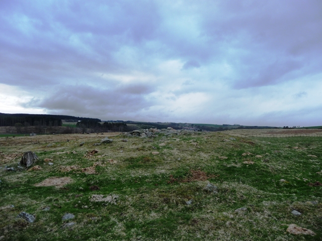
The cairn in the background.

Head west from Insch on the B9022 towards Kennethmont turning north at the Weets signpost. Cross the railway bridge and stop at the second cottage on the left hand side. There is room to park, I asked permission. The hut circles of this settlement are in the field behind which is reasonably flat. Walking thru the first field is an ankle breaker. There are two hut circles here as follows:
NJ5702 3022.
This is the largest of the two being some 12 meters wide and a 1/2 meter tall. The surrounding bank is 2-3 meters in width with a possible entrance in the south east. It is easy to spot the difference as this one doesn’t resemble a duck pond.
NJ5704 3025.
This one does resemble a duck pond but is probably in better condition. It is almost 11 meters wide and a 1/2 meter in height. The bank is some 3 meters in width with entrance once again to the south east.
The field containing the hut circles has many small cairns dotted about. Just to the south is a very stony field which contains the remnants of a medieval ferm toun. So a historic area indeed!
Visited 15/4/2010.

NJ5704 3025 looking east.

NJ5704 3025 looking west.

NJ5702 3022 looking west towards Kennethmont.

Looking south NJ5702 3022.
Leave the A96 north of the Oyne fork turning west at the small village of Colpy taking the Largie road. Turn south for a 1/4 mile at the Wrangham road. Fallow Hill is easily spotted on the left hand side being the small hill with trees on its top. These roads are single track and farm traffic can be a hold up.
Stop at the first group of trees on Wrangham road and follow the dry stane dyke to the small wood. The barrow is straight in front at high end of the hill, with great views of Bennachie and Dunnydeer etc. It is some 8 meters at its maximum width and half a meter in height at its tallest. Beware the rabbits and badgers have had a field day in this wood, so watch your feet. In reality there isn’t much to see here but its a pleasant short work nothing strenuous. Another small piece in a very large jigsaw.
Visited 15/4/2010.


After bombing up the road after todays disaster I headed first for Craig Dorney Hillfort, this the second visit in much better weather conditions. The walk from the road isn’t far but after recent snow there was still some tricky places – snow/bogs.
There are three lines of natural defences, the original architects weren’t stupid, with steep rocks covering the north, south and west. The remains of a rampart and an ancient path encircling the hill can still be seen. Also still standing guard is a massive glacerial, keeping an eager eye on the valley below. To be fair there is good all round views. As the Who sang ‘You can see for miles and miles and miles.........‘
Re-visited 10/4/2010.
After driving from Luton to Glasgow for the match (then wanting to jump from a moving car) I thought it best to advantage of early KO (in more ways than one) to get up the road quickly and make good use of the sunlight on a beautiful/terrible Spring day.
Leaving the A96 at Huntly join the A920 Dufftown road turning down the Haugh Of Glass road. At the war memorial/village hall turn south. Go past Nether Dumeath RSC stopping just after Beldorney Farm at the rennovated but un-named house. The kerb cairn is on the small hill to the east.
Thru the gates and head diagonally across the field to another gate. The cairn is in front, some 5 meters wide with a fairly continuous kerb of plus 20 stones, some are covered in moss. Also the centre has been hollowed. As usual the scenery in this part of the world is beautiful with spectacular views of Craig Dorney Hillfort, which had taken most of my temper with a very fast climb.
Ah well, time for dogs abuse in the pub! Grrrr!
Visited 10/4/2010.


Clever, these guys. I wished I’d seen this before and then I’d have spotted the Maiden Stone. Ah well!
Bennachie translated from the Gaelic means ‘Hill Of The Breast’ which is an obvious reference to the Mither Tap, the ranges most famous peak. It is also famous for the stunning hillfort. Words can hardly describe this place. The walls are massive and shelter the Maidens Causeway which leads to the Maiden Castle at the foot of the hill. They also stretch most of the way round the peak the other defences being natural, it must have virtually impossible to attack. Being on the roof of Aberdeenshire the all round views are stunning and luckily I see this place every day. One flaw tho, no running water nearby except some melt streams. (no problem recently!)
On a day that would have Mr G and the Postie proud we made our way from Oxen Craig to the Mither Tap. But this can be reached by a few paths from the various centres surrounding the range. All of them are excellent and fairly well maintained being in reasonable condition despite the recent heavy snows. Snow still hangs about in deep drifts.
This is a must visit place, truly the most visible monument in the area. You can’t miss it.......literally!
George, once again showed his posing qualities, led from the western approach. After that Mel led the way back down, we’d walked for more than ten miles. Time like the squalls had flown past. Brilliant day!
Visited 22/3/2010.
When you look at Bennachie the pointy shaped one (technical terms of the highest quality) Mither Tap at 1699 ft looks highest. However it isn’t, Oxen Craig stands at 1733 feet and on its peak is a cairn with fantastic views especially of the Mither Tap but also all the way to Tap O Noth, Durn, Knock and the nearer hillforts.
The cairn originally stood at 12 meters in width and was at least one meter high. Some of the stones have been used to make a shelter and who could blame these early shepherds/quarry workers. The weather can change quickly in these parts. Last week there was still over a foot of snow lying.
From Tillymuick look up and follow your nose or use an OS map or Bennachie guide. The paths are fairly steep but quite well maintained. Wrap up tho, normally it is very cold and exposed at the top.
Easy for Mel and George (who posed on Little Oxen Craig), they run up and down these hills for fun. Not me, I walk and then forget to stop!
Visited 22/3/2010.
Leave the B9002 after Oyne turning east at Premnay/Leslie junction. Follow this road until the refurbished church. A path heading south crossing the Gadie burn leads eventually to the ancient village, in a large clearing in the woods. Best to take an OS/Phillips map.
Canmore correctly suggests that this was a hillfort but it is more likely to be a small village with fortifications. Unfortunately this is a site covered in grass, heather and gorse but there is more than enough even for the untrained eyes. Several hut circles can be seen, including two with obvious build work still standing. A massive rampart must have surrounded the settlement. This can be best viewed on the eastern flank.
Some damage has been done by de-forestation but to be fair the site is well protected. As for the rampart an entrance can be seen on the best kept remains being 4-5 feet wide. A full scale excavation could find many objects here. However the best place to see the fort/settlement is way above on the way to the Oxen Craig cairn. Just before the cairn is Little Oxen Craig, one of Bennachies quarries. It looks straight down onto the site giving a full scale insight to builders intentions.
Other forts are clearly visible, views up and down the valley, access to a small stream and agricultural systems. Very clever, very sensible.
Thanks to Mel and her dog George for showing the way, and for making sure I didn’t go to slow!
Visited 22/3/2010.


