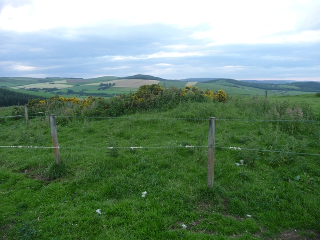
Mowat Newton 3
The remnants of this ring cairn are scattered amongst plates of living rock, alas I couldn’t find any rock art. Basically all thats left is a small circular ditch, where the stones should be. Only one kerb remains. Sadly a pile of stones a few meters away indicates their final resting place.
Only the views to north, south, and west save this site. This should have been a magnificent place instead it resembles a rubbish dump. Soon this site will vanish perhaps no bad thing considering its former status. Very sad place!
Visited 8/07/2010.


Mowat Newton 3, looking west towards the Grampians.
Mowat Newton 2
This is the furthest north of the almost demolished ring cairns. Most of the stones have been removed but at least 2 kerbs remain with a large boulder perhaps being another. In the middle of the 4 meter wide cairn is a rocky slab , perhaps a cist.
This place is also covered in small cairns, on the slopes of Stot Hill are many field clearance heaps.
Visited 8/07/2010.

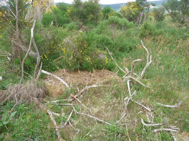

Unfortunately this site is a shambles with supposedly 5 ring cairns on it. I could only find 3, the others being covered in gorse or smashed to bits by farm machinery.
The remnants of this cairn are found nearest to the East Newton farm, slightly to the north. The stony mound is now turf covered being 14 meters in width being almost a meter high. It is hollowed out in the centre. 2 large boulders, probably kerbs, remain but look as if they’ve dunted. A small circular track shows where the other kerbs would have sat.
Head west from Lumphanan following the signs to the Peel of Lumphanan. Take the first minor road south, road is a very loose description, East Newton is two miles further on. I asked permission to park which was given.
In reality I was heading for Cairn Mude, on Stot Hill (this farm is on its western slopes) Unfortunately the trees, ferns and jabby things made progress impossible but I know where the cairn is so next time I’ll try from the other side.
Visited 8/07/2010.


At the small village of Muir Of Fowlis on the A980, area covered in ancient sites, take the minor road east signposted Tough (RSC nearby which I’ve yet to visit)
The cairn is situated on the northern side of the road after the track to Guise Farm (the second track north) and can be identified by the group of trees on the skyline. A fairly steepish climb awaits to the well kept if added to cairn.
It stands some 20 meters wide, at least 2 meters tall. Mostly turf covered some cairn material pokes thru. Field clearance has been added to the northern side. With that it was back down the hill only to climb it again. I’d forgotten the fotie machine!
Visited 8/07/2010.


This stone sat for thousands of years before being caught up in Scotland and it’s wars. Legend has it that Macbeth was beheaded here after Macduff’s forces had overtaken their opponent. Sitting beside an old railway line it represents a significant piece of history.
Head south thru Lumphanan, don’t follow the A980 go the opposite way west following the sign for the Peel Of Lumphanan (excellent medieval fort and moat, good place to park as the info board explains much of what happened in the area. The stone sits 300 meters south west over the road with a small climb to the stone. Good views over to the Grampian mountains.
Visited 8/07/2010.


After reading a book about the real story of Macbeth, instead of William Shakespeare’s portrayal (surely the Mel Gibson of his day concerning Scottish history) I decided it was time to find this cairn. (Rhiannon’s folklore giving an also necessary prod)
The cairn is situated 1 mile north west of the village of Lumphanan (good pub) fairly clos to the A980. Pull in at the first track on the north side side of the road. I asked permission to park, so everybody was happy.
Immediately behind the farmhouse, a fairly steepish climb of 500 meters, on Perkhill lies the bronze age cairn with tremendous views up and down the valley. Poor Macbeths body was taken here after being defeated and beheaded by Macduff. At least he had a nice spot to rest. The cairn is 13 meters wide and 3/4s of a meter high. A kerb surrounds most of the site, with a large slab/boulder being a possible cist.
(On the way to cairn a sheepdog and lamb befriended me on my way. The lamb obviously supports Rangers :-( as it seemed to try to trip me up every now and again. On this form the lamb would get in their team now.)
This is an area steeped in history so plenty for the visitor to see and do in this, one of the most scenic parts of Aberdeenshire.
Visited 8/07/2010.


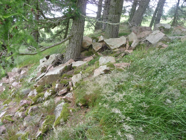
Due to severe forest farming not much can be seen here apart from small parts of rampart on the western side. Heavy growth doesn’t help which make the Canmore notes an excellent read. I found the cup marked stone, or I assume I did, but didn’t see any cup marks so I’ll go back and check properly. But I’ll take a diiferent route here next time at Crichie farm.
With a sidekick in tow we approached from the west parking my car near the B993, west of Inverurie, opposite the Auqhythie minor road. Head east up the forestry track to its end head thru the trees in a south easterly direction. A fence will be reached head south until a path is found. As I climbed the fence I didn’t notice a lower fence which I fell over. Unfortunately for me the fence pinged back up battering the left leg catapaulting me up into the air. However we proceeded and made it to the remains of the fort. On getting back to Turriff, to the docs and painkillers. Good fun this hobby!
Visited 1/07/2010


Fantastic details about the work carried out at this site. No warnings about hidden dangers tho!
Once again haed north thru Westhills, go past South Auchinclech, until the crossroads. From here turn right onto the B979, going past Auchinclech stone circle, until the signpost indicating Tertowie. Travel along this road for a mile, approx, pulling in at the road to Tertowie house. The stone is to the north.
Climb the fence, aided by a dry stane dyke, to the next fence and dyke over this then look east. Over the next fence and dyke, arrival. Tyrebagger hill dominates this part of Aberdeenshire, home to the famous RSC and The Slacks cairn. (as well as a standing stone I’ve yet to find) Standing at 11/2 meters tall it has great views centred on the mentioned hill. There are many excellent areas of flat rock rock nearby, I checked the lot but no rock art could be seen by my amateur eyes.
Visted 4/07/2010.


Travel north thru Westhills following the signs for Blackburn. About mile later is the road to South Auchinclech farm. Go down this and look east at the first cottage, the stone should be about 40 meters away standing at the moment in a ‘perk o tatties’.
Locals say this stone leads the way to Tyrebagger and the famous hill can be clearly seen to the north. It stands at almost 11/2 meters tall and is surrounded by ancient landmarks. So a well worth the effort for a quick look.
Visted 4/07/2010.


Face painting, period clothes and ancient language make fighters of young blades at Picts event.
More info:
The second cairn on Bar Hill is some 40 meters south of the summit. Easily spotted as it is fenced. Like its near neighbour it is covered in turf and has been hollowed, probably an excavation. It is also crowned with various jabby things so I left it undisturbed. At 11 meters wide and half a meter in height it looks down onto the River Deveron which in turn leads me home.
Visited 2/07/2010.