

Some beasts skull and limbs. The fort is still used by somebody.


The clearing, which you cross to climb up the hill with the trees in front.

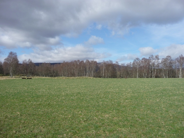
From Nether Blairock farm, the fort is in the trees far right. Hill Of Maud in the background.
I took a more circular route and didn’t see the alternate path on the way down. Oh, I wished that I did!
The key local legends here link the fourteenth-century Robert The Bruce to the area’s prehistoric monuments from thousands of years earlier. Bruce was taken ill at the Battle Of Slioch against the Comyns (1307). His camp was supposed to have been on Robin’s Height, to the north of Slioch, and the OSA in 1799 described the hill as having large inscribed stones and entrenchments. Whatever these earthworks and stones were, they are long gone. The prehistoric round cairn and long barrow on Newtongarry Hill to the north-east, along with a third, now vanished tumulus, were said to have been built by Bruce’s men as observation and communications posts, with the sick king giving orders from the camp. In later years one of the tumuli was named the Fairy Hillock, and was also supposed to have been a place of execution.
Mysterious Aberdeenshire
Geoff Holder
Head south from Logie Coldstone on the A97 taking the first minor road, west, signposted Groddie. Keep going until Bridgefoot were the tar ends and stop. There is plenty of room for parking. Also you will just have gone past Milton Of Whitehouse souterrain.
Good boots, sticks, waterproofs, water, clean clothes are or pretty much essentials for this walk. Look west and a stile can be seen. Up and over, thru the gates, past the ruined croft until the next gate. At this point there are two choices, take the path south or north. I chose south. From here the path, sometimes good or bog or snow or mud winds itself around the bottom of the Little cairn hill gradually climbing. I kept going until the path met a track which went further up the back of Little Cairn. At this point I headed cross country, crossing the Coinlach Burn to go thru the heather in a north westerly direction bypassing the 2nd hill, Mid Cairn. From here it begins to get quite a bit steeper and snow still hung about. Fortunately I’d fitted spikes to my boots so hardly any chance of slipping.
Over the ridge and go in a North Easterly direction. This led to a path that leads straight to eastern end of the top section. The cairn is at the top on the western end, so another 1/4 mile. As seems the norm the trig point is surrounded by built up stones forming a much needed wind break.
Slightly to the south the cairn still stands defiantly against modern man and the weather. It is made up of quite large stones. Unfortunately misguided idiots have placed smaller stones on top making a weird pyramid shape. Shame, but it still stands at 17 meters wide and 1.7 meters tall. The views are fantastic, almost unbelievably Bennachie can be seen to North East. Lochnager to the South, the Cairngorms to the west and rural Aberdeenshire to the east.
Even tho it was a warm day it was violently cold and windy up top. So wrap up warm.
On the way down I chose the path down past the Mid Cairn. To start with, tho rocky, this seemed a good idea. Go past the cairn and go steadily down to jump the upper reaches of the Coinlach Burn. Climb up the ridge following the path. From here it became, for me, a nightmare. It is violently steep, unrelenting it would have been much better to go the way I’d came but curiosity had taken me to the other cairn. The path by this time is a slippery shambles and with the spikes and sticks serious injury was avoided. Eventually I reached the bottom but my ankles and feet were in agony. The little shuffling steps being a tall person’s problem. 874 meters of sheer hell!
Still I’d reached the bottom, no real injuries and weather, as arranged, had stayed reasonably good all day.
(31/2 hours up, 21/2 hours down)
Visited 7/4/2011.
Some water spirits were less than benevolent. A man desperate to reach his sick wife but despaired because the Luib Bridge over the Don had been swept away in a flood, accepted an offer from a very tall individual to carry him across. In the mid-river the kelpie, for such the stranger was, tried to drown the man, who only escaped after a fierce struggle. When he reached the bank the fustrated creature threw a boulder at him. Passers-by added stones to the boulder until it became known as Kelpie’s Cairn.
W. Gregor
The Witch. (Stories From Congarff)
Monandavan is set in a beautiful valley in a beautiful part of the world. It is also set in the middle of a field used for equestrian sports. Fortunately the season hasn’t started so no dirty boots.
Follow the directions to Kinord but stop 100 meters approx along the track and look north. The low outer ring is some 16 meters wide with the inner ring being 8 meters. To my eyes it looks possible that most of this site remains except the passage to the inner chamber. Almost makes me wonder what a little TLC would reveal. Then again that is maybe the reason to keep on looking and wonder. Sadly some field clearence fills the inner circle. On one side of the valley was the soon to climbed Morven (and it’s horrifying descent) and Mulloch with it’s nightmare western side. (that is for another day!)
Visited 7/4/2011.

The souterrain is in the trees in the middle of the ploughed field.


Looking north east, the ground surrounding the site is used for equestrian sports.


Looking east towards my arch enemy Mulloch Hill. I now know the path up tho, next week I’ll conquer.
Sunnybrae was very apt name as the sun, as arranged, had become very warm which made the woods a very pleasant place to be. Canmore says two kerbs south and west, I agree, but I think fallen trees have covered another 3 or 4 kerbs, so this might be more complete than expected.
So some of the kerbs remain in situ in a cairn that is 8.5 meters wide and stands 0.6 tall. In it’s day it must have had tremendous views south especially to west and Morven.
I stopped at the southern end of Witchlock Loch on the A97 (cue for folklore I’d think) pulling in near the tree forestry station. The cairn is to the west, basically walk 100 meters west and look for a very squint tree. As can be seen from the pics I removed some turf. After I was finished I placed the turf back to leave the place looking the same.
Visited 7/4/2011.


Deskry Farm can be found by going south on the farm track just before the A97 crosses the Don. I parked at the farm and made my way up the hill. The cairn is situated between two small woods.
Nothing much remains of this grass covered cairn which must have been massive. Nowadays it’s width can be measured at 17 meters and height at 0.4 meters. Somewhat ironically a pile of field clearence, no doubt containing cairn material, sits slightly to the east.
Visited 7/4/2011.
The Luib is a place with a very good atmosphere and has a beautiful location. One kerb defiantly remains whilst the central mound has been hollowed. The remaining stones forming an inner circle of types. It stands at almost 6 meters wide and 0.4 meters tall.
From the A944 take the A939 east towards Corgarff and the Lecht (ski centre). These roads are very famous as they are normally the first to be blocked in winter time. Go past the primary school then stop and were two tracks head in a northerly direction. (The Luib is the farm down the road.) Following the directions given to me, I found the gate, saw the telegraph pole and aligned it to the pylon further up. In this way the cairn can be found in the middle.
Visited 7/4/2011.


With Corgarff Castle in the background. This is often used to publicise Aberdeenshire aka Drewland.

There seems to be lots of souterrains in this area Clova, Buchaam, Whitehouse etc. Sadly this is the one in the worst condition. Only a pile of stones is left and a small depression in the ground. Sad, as going by the Canmore notes there have been loads of discoveries.
Once again one of the locals came to my aid and led me to the remains. She almost seemed embarrassed when I told her about Buchaam but she went on to tell me about a cairn at The Luib. Thanks to her directions I found that no problem.
Keep going onto the A944 when the A97 crosses the Don. Take the first road heading back east and keep going till it runs out near Castle Newe. Walk down to gate and take the path north, then head west. The pile of stones is 20 meters approx away.
Visited 7/4/2011.
This souterrain must also have been some place if the finds are anything to go by.


