


The excellent SW barrow, slowly disappearing under vegetation.

Birdlip Camp (centre) seen from nearby Crickley Hill fort.

The impressive eastern rampart, looking north.

Looking SW from the ramparts across Witcombe Reservoirs to Cooper’s Hill, with High Brotheridge Camp rising slightly higher beyond.

Not the easiest thing to photograph, but the circular feature in the foreground is probably the most enigmatic aspect of the site (see fieldnotes). Churchdown Hill can be seen in the middle distance.

The very steep southern scarp face, looking across to Barrow Wake.

The northwestern aspect of the fort, where the natural scarp does much of the defensive work. Crippetts long barrow is hidden behind the tree line on the right skyline.


The northern rampart ends abruptly at the quarry face.

The northern rampart, hitherto very overgrown and difficult to access.


The eastern earthwork, extending away from the fort.

Hillforts of the north Cotswolds, seen across Cheltenham from Hartley Hill on a rather hazy day. Battledown is indicated but is not a certain prehistoric site.

Looking across the top of the mound (more exposed stone) towards Cleeve Hill and Dowdeswell Wood.

Some of the freshly exposed limestone blocks on the mound.

Looking north. Various bits of exposed limestone can be seen on the mound.


The modern marker cairn at the southern end of the summit ridge boasts terrific views of the Ogwen Valley. I can’t find anything to indicate that it is built from anything older, but there’s so much going on up here that I wouldn’t discount it either.

The southern cairn, looking SE towards Yr Elen and Carnedd Dafydd.

The less-knackered central cairn, looking north. The shoulder of Moel Wnion fills the right of the picture.

The knackered northern cairn, looking across to Ynys Mon.

Somewhat distant Moel Eilio seen from Bwlch ym Mhwll-le near Moel Faban in the Carneddau. The much-trashed cairn can just be seen as a pimple on top of the mountain.


Looking NE with Llefn and Gyrn looming above.

Fine little cairn with central cist.

Looking WSW towards Moel Faban, topped with obvious cairns.

Two adjoining circular structures, looking SE to Drosgl and Gyrn Wigau. The settlement is quite sheltered in the high-sided valley, despite being above 400m OD.

Detail of low remains of settlement walls, looking up to Gyrn.

Postie crossing one of the larger circular enclosures in the settlement. The western Glyderau (and Moel Eilio, right) provide the wonderful backdrop to the setting.

Low rubble remains of settlement walls. Looking SE to Gyrn Wigau.
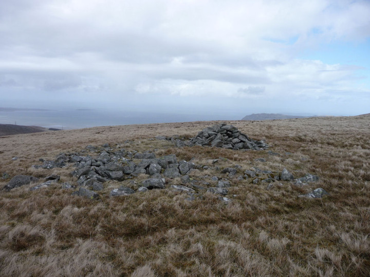
Looking north out to sea (Ynys Mon and Puffin Island can just be seen far left horizon).

Moel y Ci is the dark hill in the centre of the picture. Seen from Bera Bach, looking over Gyrn Wigau. There is a prehistoric settlement in Cwm Caseg (left).

The be-cairned summit of Carnedd Dafydd, seen from Bera Bach. Someone will tell me if that’s the cairn on Garnedd Fach visible to the right?

Carnedd Llewelyn (left of centre), flanked by Foel Grach (far left), Yr Elen (right of centre) and Carnedd Dafydd (right). All but Yr Elen are topped with prehistoric cairns. The viewpoint is Bera Bach.

Some further landscape context for the settlement, from Bera Bach. Carnedd Dafydd is the snow-flecked mountain on the left, the western Glyderau centred on the elegant cone of Elidir Fawr provide the rest of the backdrop.

Drosgl from the summit tor of Bera Mawr.

Maes y Gaer (centre), seen from the summit of Bera Mawr.

Moel Wnion, illuminated, with becairned Cras to the right and Ynys Mon beyond. Seen from the rocky summit of Bera Mawr.

The kerbed cairn, looking north out to sea.

The smaller kerbed cairn, looking NE. Llwytmor Bach is the ridge on the far right. Beyond that rise the hills above Penmaenmawr, the general vicinity of the Druid’s Circle complex.

The main cairn, looking west. Moel y Ci, with its own cairn, is the dark hill far below, far left. Ynys Mon lies across the Menai Straight, right skyline.

The really very impressive main summit cairn.

The massive summit cairn, looking SSW. Carnedd Dafydd emerging from cloud on the left, Moel Eilio far right, western Glyderau out of sight behind the cairn.

Becairned Foel Grach (left) and cloud-wreathed Carnedd Llewelyn rise above Cwm Caseg. Seen from Gyrn Wigau to the northwest.
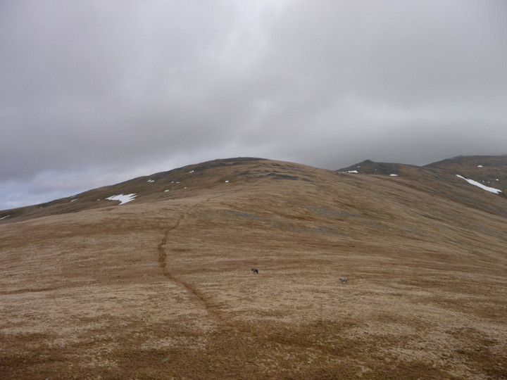
The two ponies show us the way to Drosgl, seen from Gyrn Wigau. The larger summit cairn can be seen on the left (the pointy one on the right is modern). Bera Bach and Carnedd Uchaf rise beyond.

The obvious notch of Bwlch ym Mhwll-le (centre), with Moel Faban (left) and Llefn (right), seen from the summit of Gyrn Wigau. The cairns are to the right of the notch.

Moel Wnion (with conical Gyrn to the left) seen from Gyrn Wigau to the south.

Moel y Ci (centre) from Y Garth on the way up to Drosgl. The Sling burial chamber is situated in the lower ground to the right of the picture.

Moel Faban from Tan-y-Garth above Bethesda.