
The interior of the Morfa Bychan D chamber. Including resident.
Image credit: A. Brookes (20.9.2013)

The interior of the Morfa Bychan D chamber. Including resident.

Morfa Bychan D, after some bracken-trampling to reveal the entrance.

Looking down on the capstone of Morfa Bychan D.

Sheer cliffs protect the eastern approaches.

Sunrise at Gilman Camp, almost autumn equinox.

Looking up at the fort from the tip of Gilman Point.

Twisted limestone outcrop within the fort.

Detail of the gorse-covered single bank, from outside the fort looking seaward.

Sizable limestone blocks within the site. The overgrown nature of the interior makes it difficult to determine if these are natural or part of something structural.

The single earthwork of the main enclosure, seen from inside the camp.

Waiting for dawn inside Gilman Camp, looking east over Pendine Sands.

Artist’s impression of the camp, from the info board at Pendine. The viewpoint would be the cliffs above Ragwen Point, very close to the Morfa Bychan chambered tombs.

The promontory fort is the far left headland – seen under moonlight pre-dawn from Pendine. The lights of distant Tenby can just be seen beyond the fort.

The camp from the west. During the site’s occupation in the Iron Age and Romano-British period, the surrounding land would have been under water, or a marsh at least.

Seen from the reclaimed land to the east. Apologies for glare, we were walking straight into the low sun.

Landscape context for the enclosure’s position above the estuary. From St John’s Hill to the south. Apropos of little, Dylan Thomas’ writing shed can be seen bottom left of the photo.

The southern curve of the earthwork. Laugharne lies tucked away out of sight below the trees.

The view across the sloping interior of the enclosure to the estuary below.
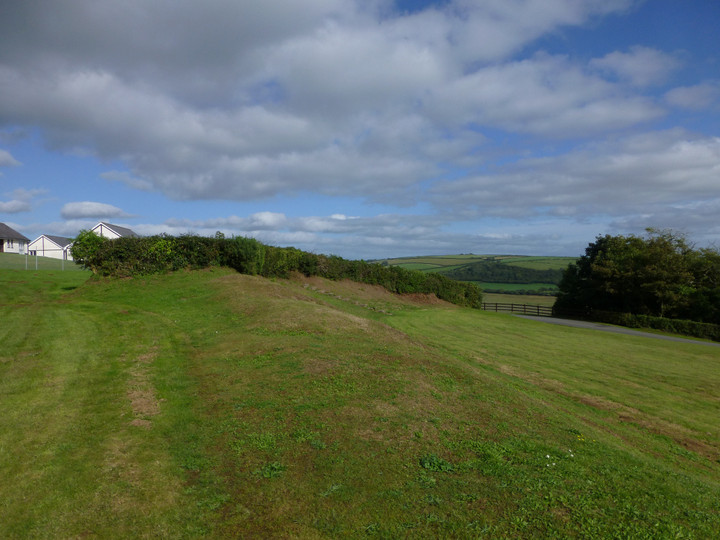

The single bank of the enclosure from the west, any trace of an outer ditch long filled.

Looking down on the earthwork of the D-shaped enclosure from the terracing to the northwest (that I assume to be a relatively modern feature?).
The Taf estuary lies below, the distant hills on the left skyline are Llanmadoc Hill and Rhossili Down on the Gower peninsular.

A further view showing how prominent this hill is among the fertile valleys of Carmarthenshire. Seen from across the River Taf to the WSW.

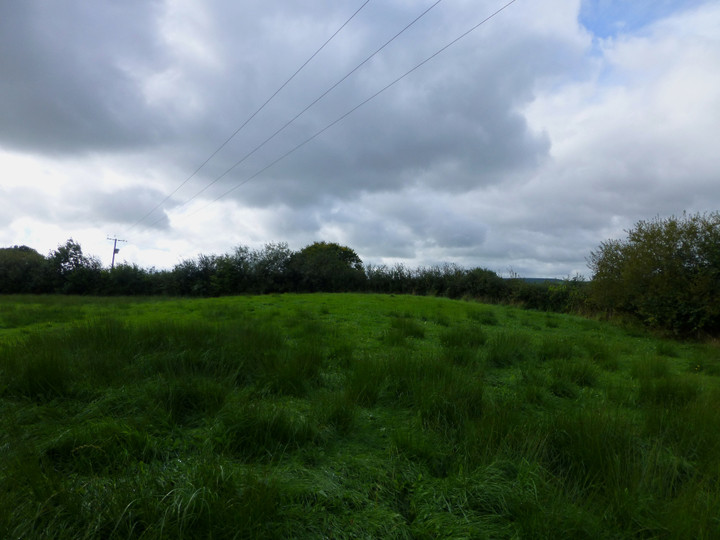
The barrow from the NE. It has a large diameter (about 20m), but this may represent plough spread of a taller but less wide monument.

The barrow seen from the east. The intervening ground is unpleasantly wet.


Moel Eilio (far left) above Llyn Peris and Llyn Padarn. There are various prehistoric settlement sites in the valley. Ynys Mon can be seen in the distance over the Menai Strait. The viewpoint is Glyder Fawr.

The north face of Castell y Gwynt is a mass of shattered rock forming vertiginous cliffs.
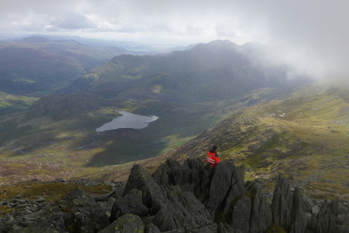
Postie takes in the view from the rock stacks of Castell y Gwynt.

Towards a missing Yr Wyddfa.

Amongst the spires.

Looking down on Dyffryn Mymbyr stone circle from Castell y Gwynt.

The valley setting of the settlement, seen from a cloudy Glyder Fach. The position of the Dyffryn Mymbyr stone circle is also indicated.

From the eastern slopes of Glyder Fach.

No day for mirrored reflections in Llyn Caseg-fraith this, as the cloud rolls in to swallow Carnedd Dafydd. There are still people on top of Adam and Eve though.

Tryfan presents its formidable eastern face, the triple summit clear with Adam and Eve atop the central, tallest peak. Bristly Ridge up to Glyder Fach rises on the left.

The Carneddau present their southern aspect to the Glyderau. Carnedd Dafydd is in shadow just left of centre, with Pen yr Ole Wen on its left and Carnedd Llewelyn behind to the right. Tristan’s Cairn is on the very far right skyline.

Moel Siabod stands isolated from other mountains, as seen from Glyder Fach. The Arenigs and Arans (thanks Mr G) ranges can be seen on the right horizon.

Seen from Twll Du, across Cwm Idwal. The summit cairns on Carnedd Dafydd are hidden behind the daunting rock buttresses of Pen yr Ole Wen.

Further landscape context from Glyder Fach.

The settlement nestles in the steep-sided Ogwen Valley, between the formidable rock faces of Tryfan and the Glyderau to the south and Pen yr Ole Wen to the north.

Towards Carnedd Llewelyn, Pen Yr Helgi Du and Pen Llithrig y Wrach, the Carneddau being the site of one of the highest Bronze Age cemeteries you will find in these islands.

The circle is built on quite a slope.

The view from the circle across the valley to the eastern Carneddau.

Seen from the rock-strewn slopes of Glyder Fach as we entered the hanging cloud. Pen Llithrig y Wrach is left of centre.

Pen Llithrig y Wrach is the round shouldered mountain in fleeting sun on the left. From Braich y Ddeugwm, Glyderau.

Flint nodule in one of the stones of the SE quadrant inner circle.

One of the remaining stones in the SE quadrant inner circle.

