
The cavern isn’t “underground”, but rather is set in the side of a natural cliff, now topped by Pembroke Castle.
Image credit: A. Brookes (25.4.2014)

The cavern isn’t “underground”, but rather is set in the side of a natural cliff, now topped by Pembroke Castle.

The eastern side, with the waters of Milford Haven beyond.

The overgrown southern side of the fort.


The eastern flank of the fort. A sea of brambles and heavy rain didn’t invite further ingress.

Industry has rather intruded on the setting of the fort. The site still has a commanding view of the waters of Milford Haven.

Good luck to anyone who wants to investigate further. A winter visit may be a better option.

The northern flank of the seriously overgrown fort.

The cliffs protecting the southern flank of the fort.


Very different weather to our previous visit.

Detail of the stone construction of the larger circular enclosure.

The bigger circular enclosure inside the settlement.

Looking across the settlement from approx. SW.

Smaller circular structure (hut circle?) inside the settlement site, to the west of the big circular enclosure.


The original fort seen from the southern extension.


The northern annexe. The ridge of the Malverns stretches away into the haze.

The central, original part of the fort, seen from the northern extension.


Southern barrow with northern (and Worcestershire Beacon) beyond.
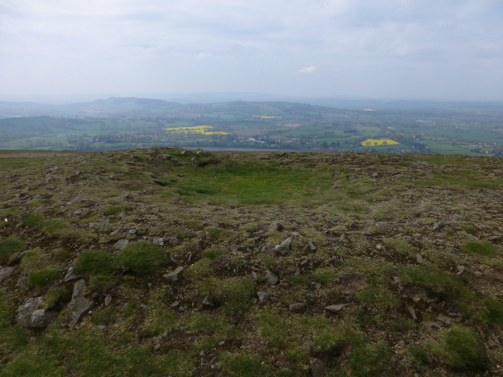
Looking into a hazy Herefordshire across the southern barrow. Must be some hillforts in this view.

The northern barrow. I’d like to say this is evidence of continuation of communal gathering, but actually it’s the paragliders out of shot that are the attraction.


Table Hill and North Hill from Worcestershire Beacon, where a couple of cremation burials were discovered.

Landscape context (l-r): Sugarloaf Hill, Table Hill, North Hill.

The summit of North Hill, with what may possibly be a destroyed cairn. Looking towards Worcestershire Beacon, the highest of the Malvern Hills.

If there was a cairn on the summit of North Hill, there’s little left of it now.

Table Hill barrow. Looking NW from Worcestershire into Herefordshire on a super-hazy Easter Monday.

The probable round barrow on top of Table Hill.

The probable round barrow on Table Hill, with North Hill beyond.

Landscape context for the becairned hill, from the south (near Ludworth Intakes cairn).


Looking east towards the High Peak, showing the landscape position of nearby sites.

The eastern view looks almost intact. The cairn mound appears to be surrounded by a wider base or collar.

From the south. The distant hill, far left, is Wild Bank Hill – topped with another cairn.


Looking NE-ish. There are extensive views from this site.

The top of the mound looks dished, but this is still a substantial monument.

A fine looking barrow with a lot of barbed wire in the way. Sad to say, I couldn’t be arsed with the hassle.

Robin Hood’s Picking Rods, close to the Chisworth stone. Although the Rods themselves have been worked in comparatively recent (Medieval) times, there is a suggestion of profuse cupmarks on their sides. Natural or not?

Some scale for some of the larger cupmarks.


Wonky-horizoned landscape context. Robin Hood’s Picking Rods top right. Looking SW-ish.