
Multiple cupmarks on the inner face of the orthostat.
Image credit: A. Brookes (19.9.2015)

Multiple cupmarks on the inner face of the orthostat.

There are cupmarks on two faces of one of the chamber orthostats.

Exposed stonework in the remains of the surrounding mound.

Lovely rounded quartz cobble in the edge of the surrounding mound. Smoothed and polished, it must have come from the sea, which is quite close to the tomb.

Carr-dyni (bottom left) and the Rhinogydd.

The stone appears to have been completely buried in the sandy soil at one point.

The water-filled hole at the base of the stone makes me wonder about its long-term stability.


The stone is set into a crumbling bank, gradually being eroded away by the sea.

Not marked on the OS map, the first I knew of this stone was walking along the beach.

Landscape context from Criccieth. Moelwyn Mawr rises in the background.

Carn Fadrun is centre skyline, seen from Criccieth Castle, itself possibly the site of an Iron Age fort.

Late afternoon at Caer-dyni, nearing the end of a long walk from Llandecwyn.

Craig Cwm-Silyn is the mountain in shadow just left of centre, with Garnedd Goch far left and more of the Nantlle Ridge stretching away to the right.

Moel Hebog, with Moel yr Ogof on the left, seen from Penrhyn Farm on the coast to the SSW.

Moel y Gest from Penrhyn Farm to the southwest. The relative flatness of its surroundings ensure that it is a commanding presence from every direction.

Dark silhouetted Yr Eifl and Tre’r Ceiri rise far right, far higher than the later fortification of Criccieth Castle. From Black Rock Sands. Far left skyline is the also excellent Garn Boduan hillfort above Nefyn.

Moel y Gest, flanked by the mountains of Moel Hebog, Cnicht and Moelwyn Mawr.

With Moel y Gest hillfort to the left.


Stone built rampart. This is such a great viewpoint – looking towards the Moelwyns.

The interior of the enclosures is full of lovely rocky outcrops, it reminded me of Trencrom. Looking towards the hills of the Lleyn peninsula (I think Tre’r Ceiri is over on the left).

Looking over the plunging southern flank of the site across the Afon Glaslyn estuary to the mountains of the Rhinog range.

Fragmentary remains of stone walling built around the rocky outcrops at the eastern end of the summit.

The impressive rocky eminence of the defended enclosure, seen from the lower eastern summit.

Moel y Gest dominates the town of Porthmadog. Seen across the Glaslyn estuary.

In the long shadow of Criccieth Castle, looking towards the prominent Moel y Gest. Moelwyn Mawr is the mountain to the left.


Sarsen with natural basin, close to Devil’s Den.


Looking back down the Herepath towards Avebury, from Avebury Down. The small unnumbered barrow at SU11807052 can be seen in the ploughed field on the left. Oliver’s Castle, Morgan’s Hill and Cherhill are all visible on the skyline.

Small, unnumbered round barrow at SU11807052, on the south side of the Herepath.

Cwm Croesor and Cnicht.

Lovely Cwm Croesor, a settlement site for over 2000 years.

Moel Siabod from Ysgafell Wen in the Moelwyns. Pen Llithrig y Wrach, with its own cairn, can be seen to the left.
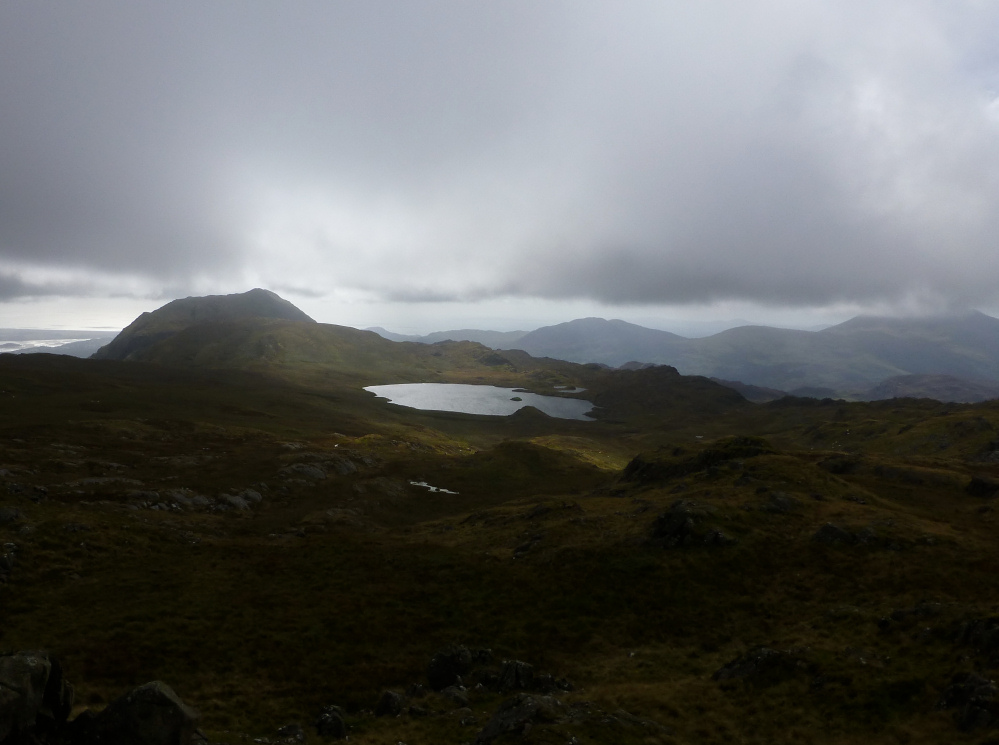
Llyn yr Adar and Cnicht, with misty Moel Hebog far right. From Ysgafell Wen north top.


