
Image credit: Rockandy

Triangular companion to the main panel. This has about 30 cups.

Although largely turf-covered, can this really be the rock described in the Beckensall Archive as a boulder with 16 cups? It has over 50. Does the archive panel lie elsewhere?

Stone-setting close to the sheepfold.

?Cist or ?sheep-dip close to the sheepfold looking over the site of the cup-marked rock.
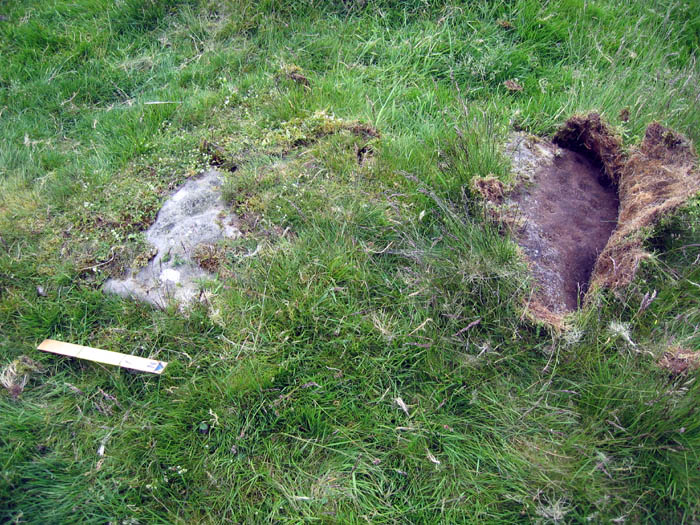
Second cup-marked rock, just N of the first.

Cup-marked rock; showing extent of turf cover.

Cup-marked rock; view W to sheepfold. Grindon Wood in middle- and Sewing Shields in far-distance.

Cup-marked rock.

View E from middle cairn.

E’most round cairn; view to SE.

E’most round cairn above Settlingstones Burn; view NE towards Two Woods. One of the large boulders near its apex is highly eroded and may have had cup marks.
Visited this site just south of Hadrian’s Wall at Shield on the Wall to look for a cup-marked boulder given in the Beckensall Archive as ‘Round Cairns west of Middle House’. According to the Archive, an English Heritage Field Warden had found a boulder with 16 cup-marks as part of the round cairns but only an approximate grid reference is given and no photographs. Although the moor is access land, getting to the site is problematical due to difficult car parking on the Military Road and a walk of about 1 mile over rough tussocky and often boggy terrain. Three round cairns dated to the Bronze Age stand on a slight ridge just south of Settlingstones Burn. Keys to the Past describes them as being between 8 and 10m in diameter and 1m high with one disturbed in the centre due to excavation, but I found the archaeology difficult to interpret on the ground. After a search of the numerous boulders, I eventually found a cup-marked stone, mostly turf-covered, about 40m east of the sheepfold fairly close to a stone setting which might indicate the original centre of one of the cairns. A second cup-marked rock can be found about 1m north of the first rock.


