Image credit: IH


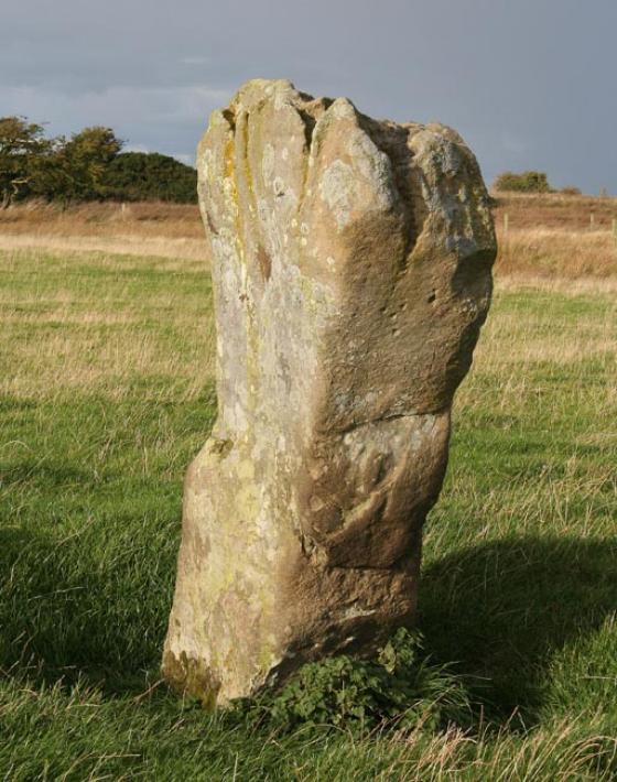
View down the Tyne valley to the SW, past Corbridge, over Hexham way. The stone isn’t in it’s original position, but probably came from pretty close by, with more or less the same view.

Thornborough High Barns in the background.


Re-visited 25-02-07
This little marked stone is more or less exactly where akas555 reports it, on the south side of the field boundary. (Garmin e-trex says NZ019648 when rounded up from 10 figures). It looks like a very old boundary, with the remains of a bank, mostly quite low, but giving the impression that it may have once been quite substantial, with traces of hedge in places. The absence of undergrowth shows there are oodles of field clearance stones in the bank, making me wonder if there are any other carvings still hidden from view. The marked stone is quite obviously no longer in situ, but presumably came from somewhere fairly close. Maybe there was once a cairn in one of the fields, or I suppose it may have been part of an inconvenient (from a farmers point of view) lump of outcrop. The former seems more likely.
I spent a very uncomfortable afternoon in high summer a couple of years ago looking for it on the wrong side of the fence, which is festooned with brambles and nettles. I was searching on the north side of the fence, further east towards Brockhole dean, which is where it appears to be when using the ref given on the Beckensall Archive. So near, yet so far...
I feel a revisit armed with akas555’s info and a gps would be in order.
I spotted this on the Northumberland Rock art Website, and because there was no photograph I thought I’d take a look.
This portable is on the south side of the fence, directly (magnetic) south of Thornborough High Barns, well situated over a view of the tyne valley.