|
|

|
|
Shapinsay
|
|||||||||||||

|
|
|
Sites in this group:
|
22 posts
Broch of Steiro Broch |
6 posts
Castle Bloody Souterrain |
14 posts
Hillock of Burroughston Broch |
|
6 posts
Howe Hill Ancient Village / Settlement / Misc. Earthwork |
11 posts
Mor Stein Standing Stone / Menhir |
13 posts
Setter Noost Ancient Village / Settlement / Misc. Earthwork |
|
5 posts
Twi Ness Cairn(s) |
Sites of disputed antiquity:
|
9 posts
Unyatuak Artificial Mound |
Latest posts for Shapinsay |
Showing 1-10 of 86 posts. Most recent first | Next 10 
Howe Hill (Ancient Village / Settlement / Misc. Earthwork) — Links |
Canmore site record for Howe Hill |
11th January 2024ce |
Howe Hill (Ancient Village / Settlement / Misc. Earthwork) — Images (click to view fullsize) |
|
11th January 2024ce |
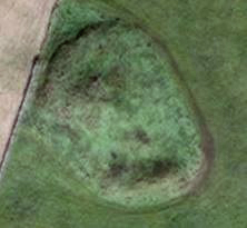
Howe Hill (Ancient Village / Settlement / Misc. Earthwork) — Fieldnotes |
|
The Pict's House/Fort" on Howe Hill, aka the 'hillock Of Howe' – RCAHMS record no. HY51NW 5 on Howe Farm – was an amorphous mound prior to first excavation sometime before 1880. What can be seen of the knoll is roughly 50 by 40 yards and reaches 11’ 6” at the higher end. Excavation at the top revealed curving drystane walls, After excavation the structure was filled in, but there were still ruins visible in 1923. The Pict’s House structure is thought to be a broch, though a more recent opinion has it as more like an unenclosed settlement, A solstitial alignment to the Mor Stein to my mind indicates an earlier origin or purpose to the whole I could get to within a field of it all around and only saw a grassy mound. Having a large circular walk to finish I left it in peace. |
11th January 2024ce |
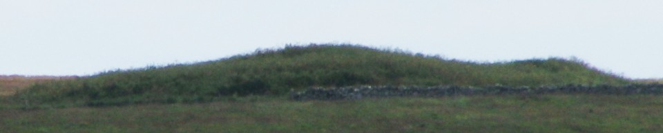
Mor Stein (Standing Stone / Menhir) — Miscellaneous |
| John Bews says "from the mound at Howe the sun rises on the longest day, I think, directly over this stone. Moor Stone may have been quarried some distance south-east of Castle Bloody..." Howe Hill https://canmore.org.uk/site/3097/shapinsay-hillock-of-howe as distinct from the Hillock of Howe |
3rd January 2024ce |
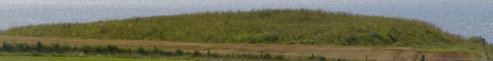
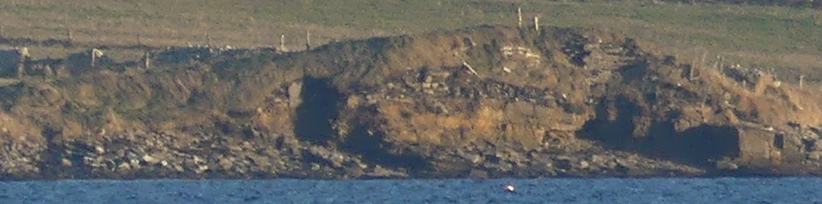
Broch of Steiro — Miscellaneous |
|
"Countrywoman" visited this site in the 60s; partial collapse in 1964 brought out a building in the outer wall. In 1967, a wall-chamber was revealed and she noted a structure in the nearby shore under low banks. Strong walls had been exposed a year later. The site suffered serious gale damage in 1984. The main feature is part of the broch tower's NE wall arc standing 4' high and having a scarcement with rubble-filled alcove thought to have been access to a stair/gallery. A later wall cuts across the wall arc at the east. RCAHMS site no. HY 51NW 10 additionally mentions a ruinous naust up against the W side and, also at the W, outbuilding traces including an edge-slab in the shoreline. Then E of the broch there is rubble covering a well-paved floor set directly on the natural. |
10th July 2021ce |
Broch of Steiro — Images |
|
10th July 2021ce |
Showing 1-10 of 86 posts. Most recent first | Next 10