Probable main entrance to the enclosure
Image credit: ginger tt
Probable main entrance to the enclosure
Bank and Ditch to the north of the site

The track between the intial defense and the main ditch and bank
The digging into the hillfort culprits (all three of them).
Oh for a lurcher.....
WF x

Bank looking towards private house

Looking up into the interior of the hillfort

Ditch and Bank

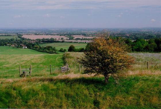
Little Coxwell Hillfort from the Shrivenham Road. The site occupies the wooded crest on the top left of the piccy.

The view towards WHH and Uffington from Little Coxwell, full magnification on my cheap digi, so not the best quality.

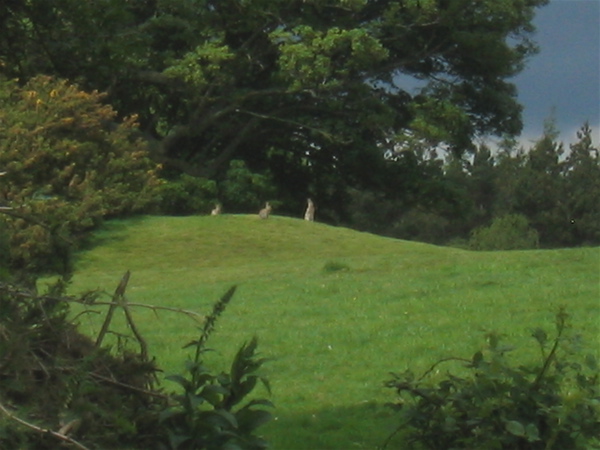
Difficult to make out, but there’s def a earth circle in the centre of the photo. Hut circle or barrow – I know not! Located in the field approaching the site and huff and puffingly uphill.

That’s the first bank, on the other side of the fence.

Yep, it’s steep (they haven’t put that on the warning sign)

The earthworks begin on the other side of the road in the trees
The rain broke in the afternoon, and having some free time, I decided to scout the hillfort.
Herein lies the problem with some sites, some of them are private property (cue Marxist rants) and being of the opinion that it is better to err on the side of caution, I donned the trusty combats and DPM jacket and proceeded with caution in the horseless carriage up the road to the site.
Following the OS map, I meandered through the wonderful villages of the vale, made a few wrong turns (ok, nobody’s perfect), doubled back and eventually made landfall near the site. Parking in the access road for St. Mary (blesséd be her name) Lodge, I clambered out of the motor and grabbed the faithful digi (including spare battery) and eyed the landscape.
A hedge and a barbed wire fence pose little issue with a country lad, so I tramped in a straight line across from the motor and launched myself through the hedgerow and over the wire.
The field had many established trees in it (and a herd of cattle who thankfully were far away to my right – bulls and bullocks can be troublesome), and I could see the rise of the topography clearly ahead. A cracking view of Uffington and the White Horse is clearly visible from here. Was this place in opposition to the Atrebates? With the river Thames and its tributaries being the possible tribal boundary, it may be and it’s obvious from this hillfort location, that you could keep an eye on Uffington.
Across another fence (with the music from mission impossible rattling around me skull) I came across a road and could see the tell tale embankments of a hill fort in front of me. Being conspiciously camoflaged, I looked left and right and with confirmation of the coast being clear, dashed across into cover.
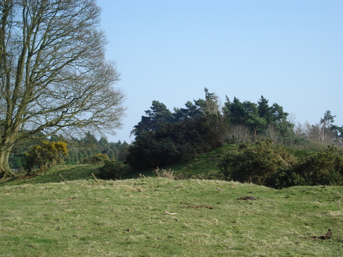
The whole site is very overgrown with mature trees and established ‘jungle’. This makes it very difficult to work out what it what and where is where. A little tree strewn valley led me up to the earthwork. It seemed small to me, until I realised that I was on the edge of the fort and not in it (init!). The bunnys had moved in and there was plenty of burrows to see.
I explored more and found a fence with open fields beyond. Was that it? Cos it seemed a tiny hillfort to me. I realised that the piece I’d been in was just part of the complex. Beyond the fence I could see the buildings of a large private house and more earthworks. Keen to explore without being exposed, I followed the fence line (crossing more barbed wire) and could then see the bigger picture. This hillfort runs the length of the contour and I’d just been at the beginning!
The ditches and banks are less defined than, say, Uffington, but if the field beyond is the interior of the fort, then it’s a biggy. Being in full view of the house didn’t seem like a good idea, so I grabbed some snaps (the bunny’s didn’t mind at all) and headed back whence I’d came to explore the other side.
A lovely tree lined avenue headed towards the house and looked tempting, but I avoided the temptation and went back to where I started. Whoops – a car came up the drive and I mingled nicely into the background. The site is adjacent to the road and every engine noise put me on edge.
I footed back over my original path and looked at the field below the site. Like all hillforts, you can see the problem with charging uphill and attacking – you’d be exhausted before you reached the fight!
I did spot a lovely earthwork circle in the field below. Didn’t look like a barrow, but def a circular earthwork of some description. Maybe it was a hut circle? Feeling vulnerable in the middle of a field with no cover, I twitched as another car came up the drive – better safe than sorry I thought, and I guess my luck had run out, so I headed back to the car and over the hedge and barbed wire. Sat in the car, I couldn’t help thinking that I might be a looney-tune, and that it was OK to go a stomping and that we have a right to see our heritage. But, I know how precious landowners are ‘bout their little bit of land, and I know gamekeepers that carry shotguns (OK, so I’m a big rabbit) and was thankful that it’s better to be ‘invisible’ if you can.
I guess it’s a different mentality than wandering moors and fells, were nobody gives a toss what stones or lumps and bumps you’re looking at, in the South it’s more a case of ‘Get orf MY land’... or else!
And was it on a Mary or Michael Ley Line?
Dunno
WF
Also listed as Lower Coxwell Camp on the pastcape web site. Neolithic axe heads and flint scrapers have been found within the site and are kept in the Ashmolean museum.