|
|

|
|
AberscrossStone Circle
|
||||||||||||||||||||||||
|
|
|
Images (click to view fullsize) |
|
|
Fieldnotes |
|
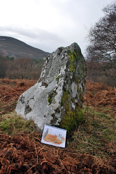
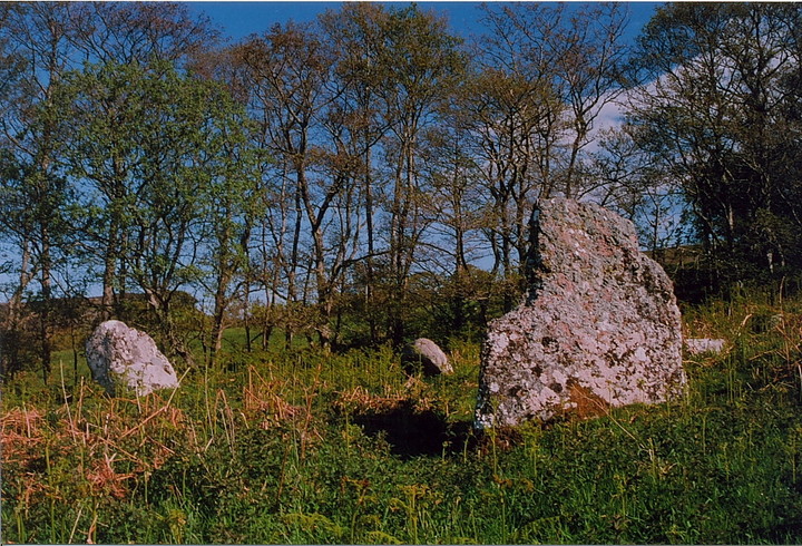
| 02/05/2017 - Not quite sure why I hadn't visited this circle before. Easy access and just a short distance from the road. I wasn't feeling too well so a potter round a few stones, taking it slow was a good idea for the day. I really liked this one. The stones are nice and the biggest one interestingly shaped. I love the area round here, very peaceful and still. |
 Posted by thelonious
8th May 2017ce Edited 8th May 2017ce |
|
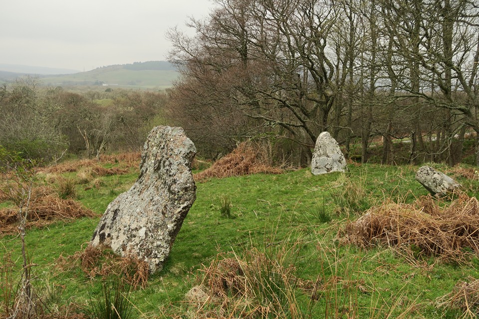
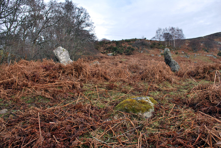
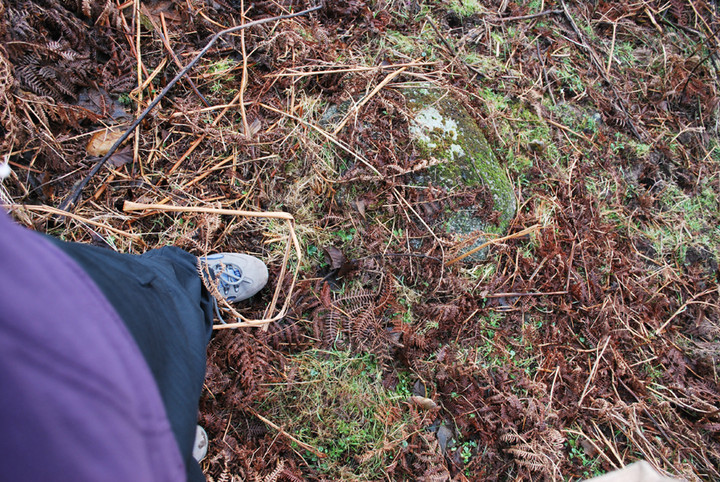
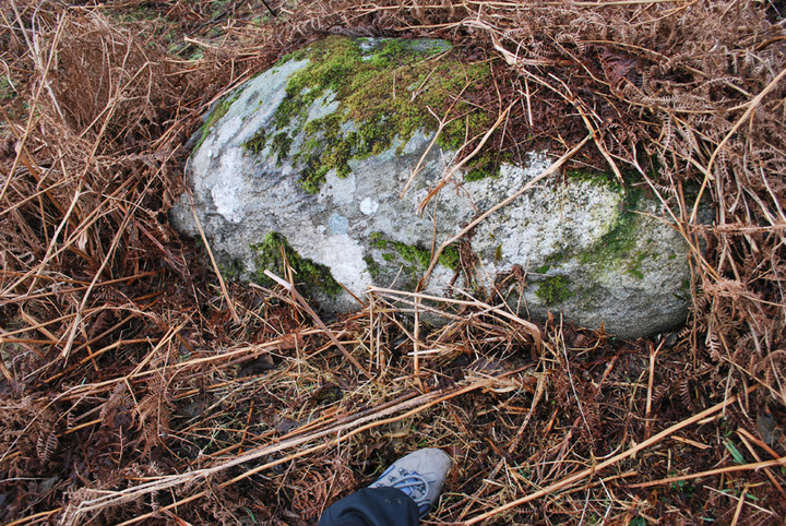
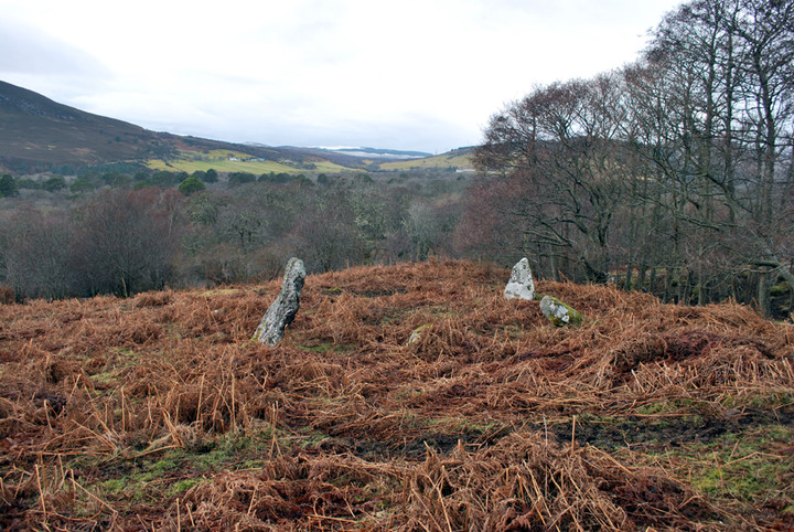
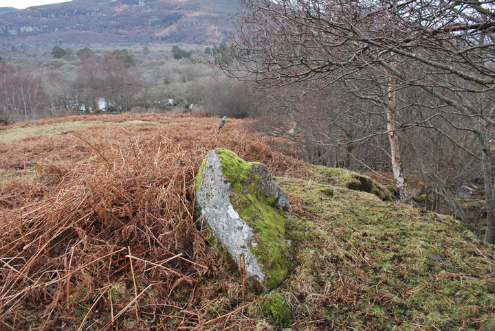
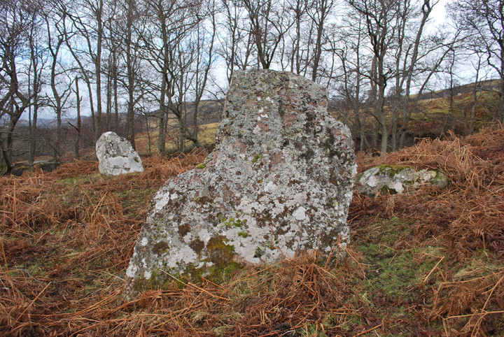
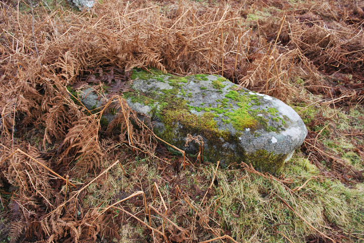
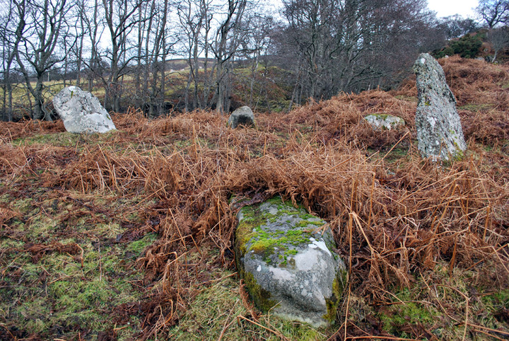
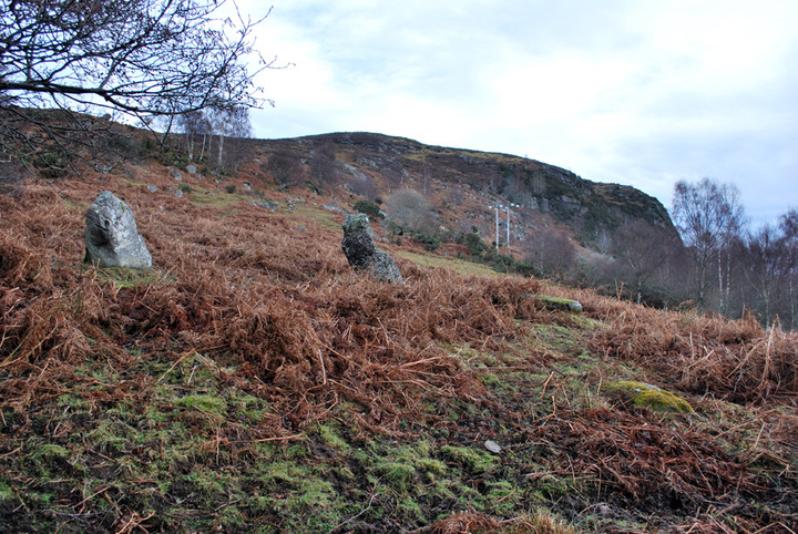
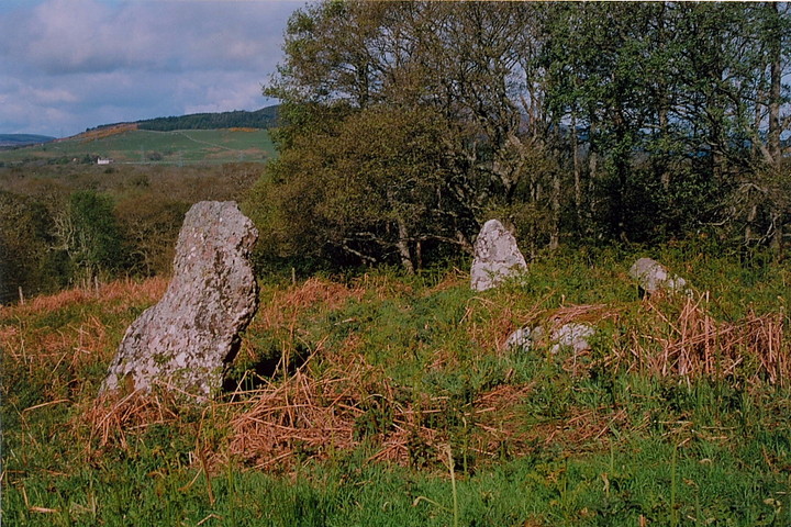
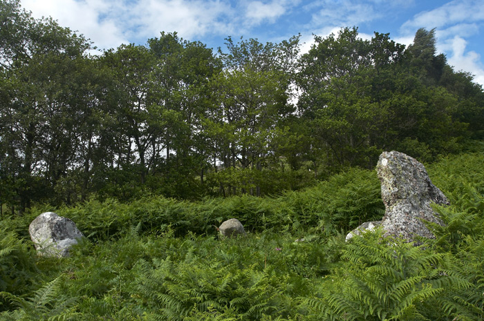
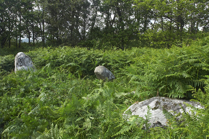
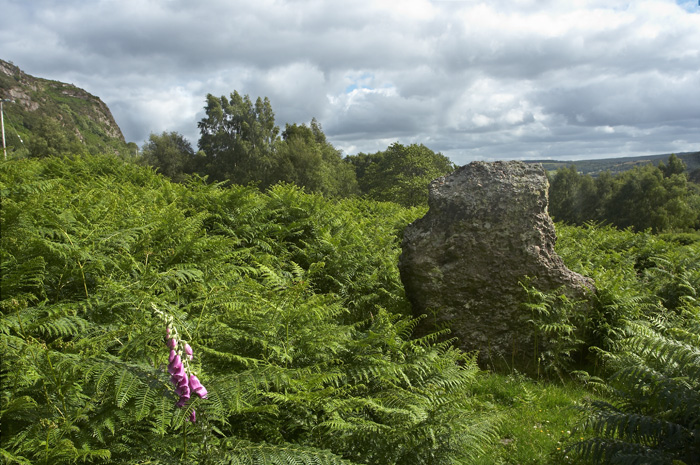
We had a bit of trouble finding this for some reason, even though we'd read here and had a map and know the road... Looking in a false location my hubby and son managed to get coated in cow dung hee hee (I can laugh, it wasn't me!). For others trying to find it the best advice I can give is... As previously mentioned it's about 3/4 - 1 mile along the A839 driving from the A9 at The Mound. Count gateways / laybys on the right-hand / North side of the road... You'll pass two almost-layby's which are clearly actually gateways - park in the *first proper no other use but as a layby* on that side. You can then either walk back along the road verge on the same side of the road, and enter the field through the gate (just a few metres around the bend of the road) *or* climb the small wire field fence to the side of the layby, follow the fence and there's a spot to ford the burn. You'll come out into the next field just below the circle. We visited in Winter, so there was very little bracken, which was great for actually seeing what's there. It also, I imagine, afforded us a much better view across the surrounding landscape, which has quite a lot of deciduous tree cover. There are seven obvious stones in the circle, which is just a few meters across. Two upright a couple of meters high, another two smaller upright stones / boulders, one fallen which would have been as tall as the larger stones, and two more visible low in the scrubby ground cover, partly covered. Another sizable stone lies a few meters down the slope where it appears to have tumbled. There's a gap in the circle directly above, so seems likely it belonged in the circle rather than being an outlying stone. If this stone is from the circle that would make 8, and there would then be an obvious gap for a missing 9th. There is a ridge a few meters above the circle, with a further, possibly 'placed' (rather than natural) stone on it - just visible from the circle with the low Winter ground cover. It *could* possibly be a tumbled boulder from the craggy hillside above, but it seems to be of a similar shape and alignment to one of the larger stones in the actual circle. From this point, even though very close to the circle, the view completely opens up, and through the tree coverage you are able to see out to Loch Fleet. |
 Posted by summerlands
6th February 2011ce Edited 6th February 2011ce |
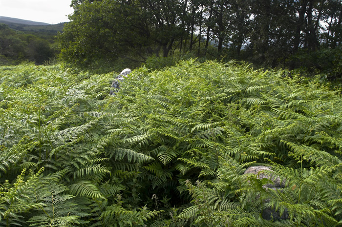
| Sited about three quarters of a mile down the A839 to Lairg from the A9 junction, on the Mound Rock, Aberscross is easily accessed being sited on a flat platform a short walk up the slope, however it's definitely one to visit when the bracken is down, in early July it was completely swamped. |
Posted by LivingRocks 25th July 2006ce Edited 25th July 2006ce |
Links |
|
Dornoch HistorylinksAberscross with very low ground cover. The photo is labelled 1930 (colour then?), but others in the same photographers collected dated up to the 1960s. |
Posted by summerlands 7th February 2011ce Edited 8th February 2011ce |
Highland Council HER Record |
Posted by summerlands 6th February 2011ce |