The Modern Antiquarian
Log in
|
Register
Home
Latest Posts
Forums
Maps
Help
Browse Sites
News
Blog
Contributors
The Books
Select
-
Belgium
Denmark
Eire
France
Germany
Greece
Italy
The Netherlands
Norway
Portugal
Republic of Malta
Spain
Sweden
Switzerland
United Kingdom
Scotland
Highland (Mainland)
Ben Freiceadain
Hillfort
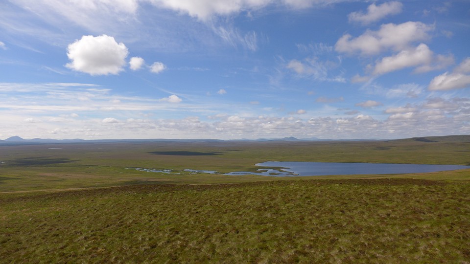
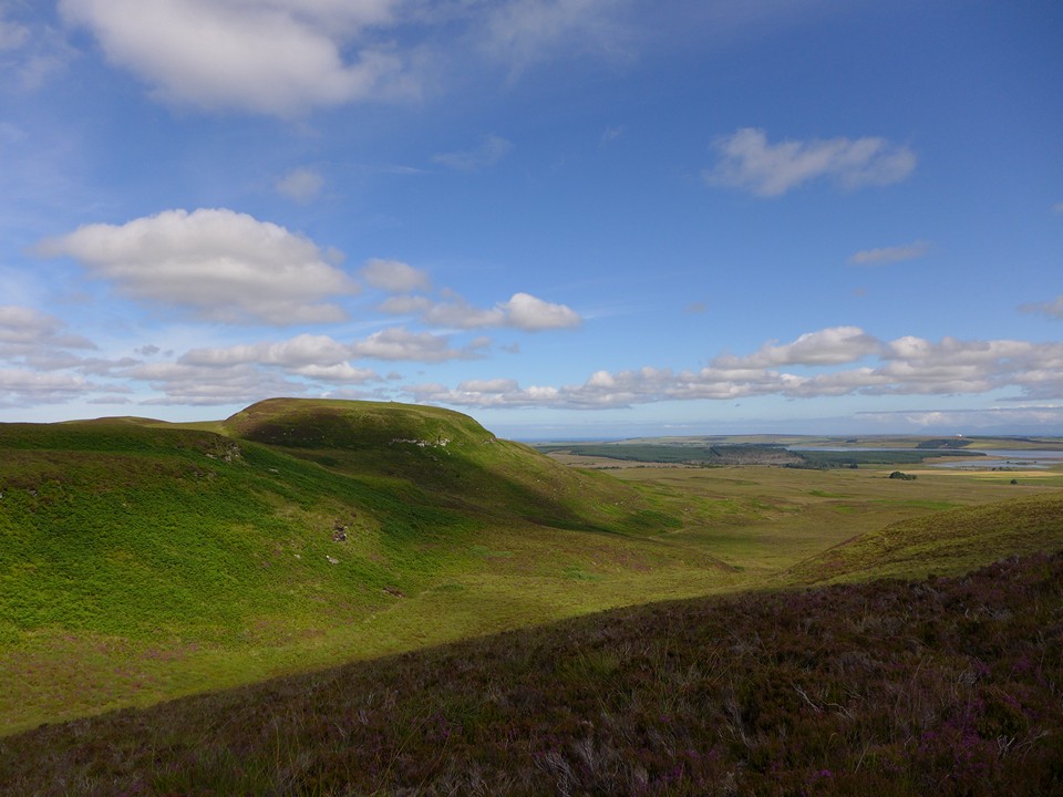
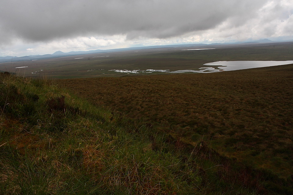
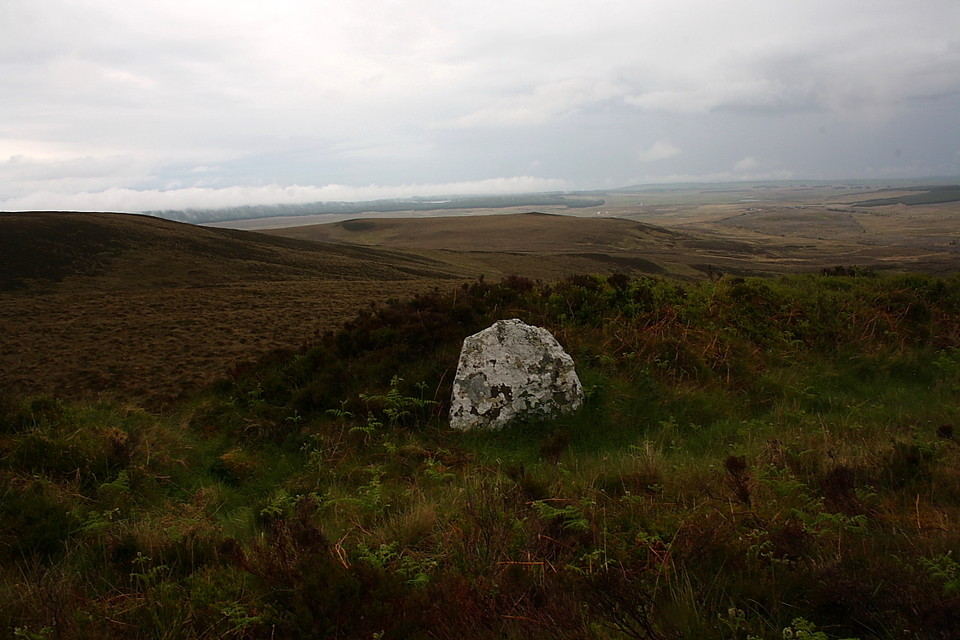
Ben Freiceadain (Hillfort) on The Modern Antiquarian, the UK & Ireland's most popular megalithic community website. 11 images, 1 fieldnote, plus information on many more ancient sites nearby and across the UK & Ireland.
Image © thelonious
Nearest Town:
Thurso (14km NNE)
OS Ref (GB):
ND059557 /
Sheets: 11, 12
Latitude:
58° 28' 46.28" N
Longitude:
3° 36' 49.86" W
Added by
Lianachan
Images (11)
Fieldnotes (1)
0 discussions
Start a topic
Show |
Hide
Web searches for Ben Freiceadain
Flickr
Google
Google Images
MAGIC
The Megalithic Portal
Bing
Stone Pages
Streetmap.co.uk
Wikipedia
Show map
(inline Google Map)
- Sites within 20 km -
-
Ben Freiceadain (0.1km NNW) (14 posts)
Torr Beag (0.64km NE) (9 posts)
Ben Dorrery (0.71km SSE) (4 posts)
Balnabeinn Hut Circle (0.72km ENE) (4 posts)
Torr Mor (0.76km NNE) (2 posts)
Torr Phadruig (0.85km ENE) (6 posts)
Dorrery (1.34km NE) (5 posts)
Dorrery (1.45km E) (8 posts)
Shurrey, Sithean Dubh (2.8km NW) (3 posts)
Shurrery Kirk (2.92km NW) (2 posts)
Carn Liath, Shurrery (3.22km WNW) (5 posts)
Port-an-eilein (3.6km NNW) (2 posts)
Carriside (3.79km N) (1 post)
Carriside (3.82km NNE) (5 posts)
Torr Ban Na Gruagaich (4.31km NNW) (5 posts)
Torr Ban Na Gruagaich (4.33km N) (1 post)
Aultan Broubster (4.43km NW) (6 posts)
Bridge of Broubster (4.47km NW) (4 posts)
Tulach Buaile Assery (4.49km NNW) (7 posts)
Broubster (5.24km NW) (6 posts)
Tulloch of Assery (6.24km N) (10 posts)
Tulach Lochain Bhraseil (7.74km E) (4 posts)
Tulach an Fhuarain (7.76km E) (2 posts)
Tulach Buaile a'Chroic (7.97km E) (6 posts)
Carn na Mairg (Carn Merk) (8.67km E) (11 posts)
Dirlot (9.55km ESE) (5 posts)
Clach Clais An Tuirc (10.03km WNW) (2 posts)
Hill of Shebster (10.07km WNW) (14 posts)
Achvarasdal (10.2km WNW) (11 posts)
The Sian (10.37km NW) (1 post)
Tulach Beag (10.41km E) (5 posts)
Ballone, Mybster (10.65km E) (5 posts)
Cnoc Freiceadain (10.66km NW) (28 posts)
Tormsdale Stone Rows (10.7km E) (1 post)
Tulach Mor (10.84km E) (12 posts)
Sordale Hill (11.05km ENE) (6 posts)
Gallow Hill (11.05km ENE) (8 posts)
Gallow Hill North (11.07km ENE) (4 posts)
Cnoc Freiceadain N (11.09km NW) (8 posts)
Creag Bhreac Mhor (11.26km NW) (1 post)
Upper Dounray (11.61km WNW) (1 post)
Cnoc na Ciste (11.62km ENE) (6 posts)
Sinclair's Sithean (12.57km ENE) (7 posts)
Thing's Va (12.67km N) (9 posts)
Cnoc Urray (12.96km WNW) (1 post)
Backlass (13.48km SSE) (5 posts)
Cnoc Na H-uiseig (13.51km WNW) (2 posts)
Sysa (14.17km NE) (3 posts)
Bell Mount (15.02km N) (2 posts)
Rangag West (15.94km ESE) (11 posts)
Holburn Head (16.57km NNE) (9 posts)
The Borg (16.6km WSW) (15 posts)
Carn Liath, Farr (16.78km WSW) (5 posts)
Trantlemore (16.79km WSW) (4 posts)
Upper Bighouse (16.93km W) (0 posts)
Stone Lud (Bower) (17.21km ENE) (3 posts)
East Murkle (17.34km NE) (1 post)
Loch Rangag (18.45km ESE) (13 posts)
Watten (18.52km E) (7 posts)
Loch Mor (18.6km W) (0 posts)
The Great U of Stemster (18.98km ESE) (37 posts)
Achkinloch (19.01km ESE) (8 posts)
- Add -
-
Add news
Add an image
Add fieldnotes
Add folklore
Add miscellaneous
Add a link
-
Add a site
Add a nearby facility
Add an alternative name/spelling
Images
(click to view fullsize)
Add an image
Fieldnotes
Add fieldnotes
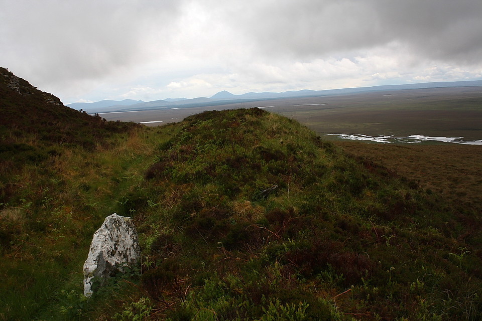
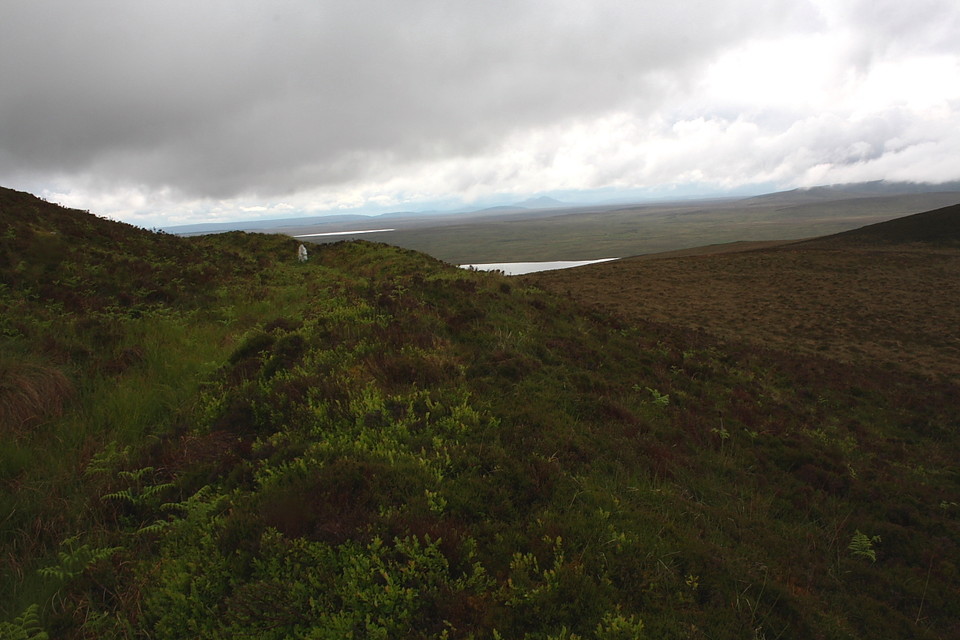
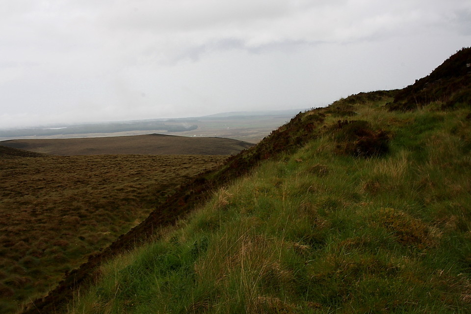
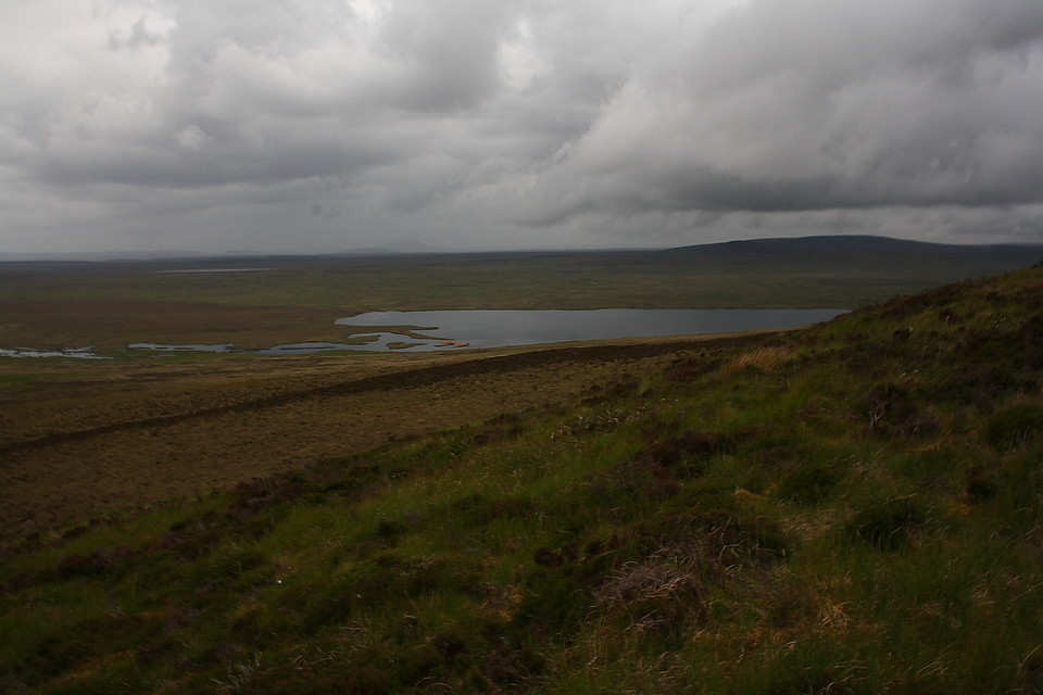
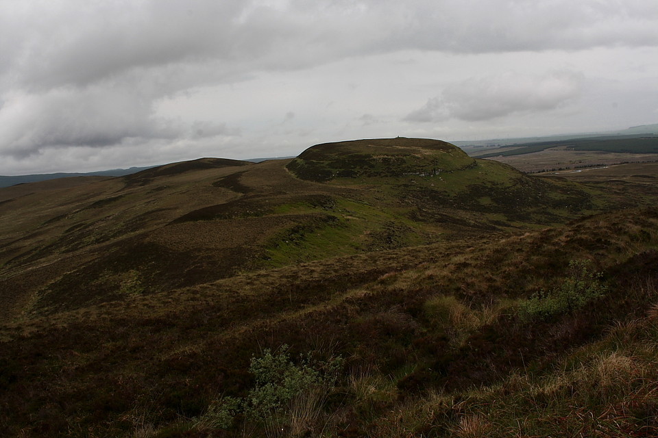
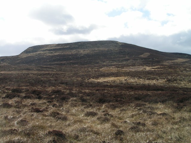
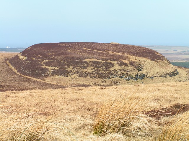
A short walk from the mast atop Ben Dorrery, although it's across heather - so avoid during tic season. This fort, also known as Buaile Oscar, covers a fairly large area and makes good use of natural rock defenses.
Comments (0)
|
Add a comment
|
Permalink
Posted by
Lianachan
24th April 2006ce