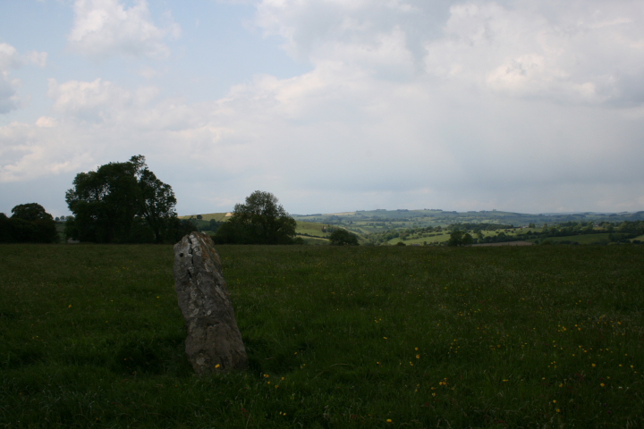
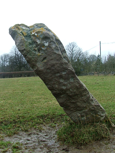
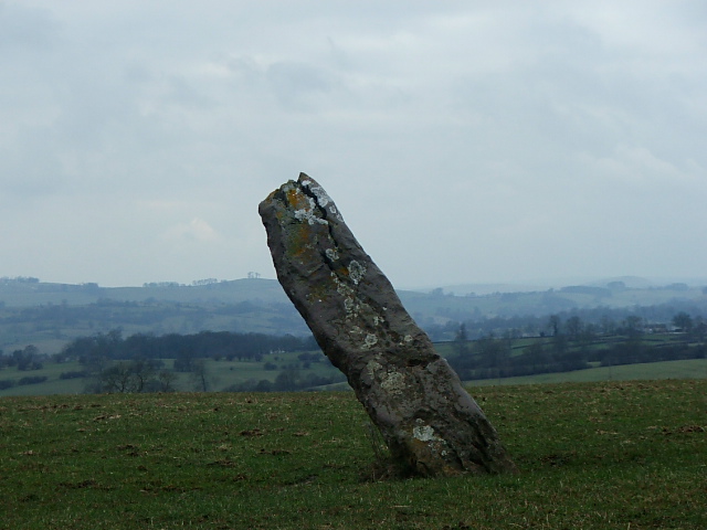
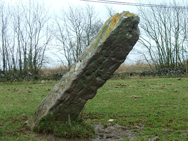
Another Derbyshire daytrip on another sunny day. We're visiting a couple of standing stones just outside Ashbourne, some of the closest ancient sites to where we live, but I never even knew they existed until recently. The Stoup was refreshingly easy to find, visible from the road, standing proud in its field, although leaning at such a dangerous angle it look as if it's about to keel over at any minute!
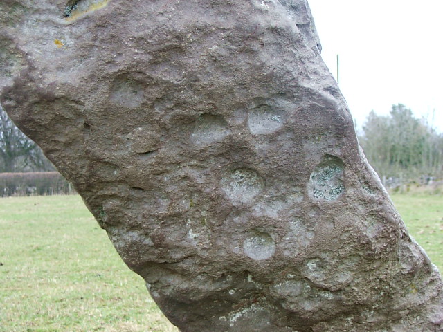
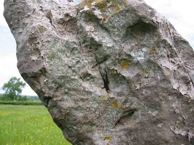
Cupmarks are clearly visible on one side of the stone, they look a little too regular to me to be natural, which only reinforces my belief that this is a Neolithic, rather than Saxon monument. Also interesting is the way that the incised cross is carved on the same side as the cupmarks, maybe the cupmarks were seen as having pagan symbolism even in Saxon times, and this was an attempt to ameliorate this?
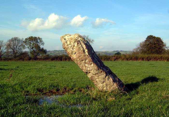
There is a lovely view out to the west, with the lean of the stone pointing towards the distant hills, and the meadow the stone stands in is dotted with flowers. A nice spot to sit and contemplate, if only the wind weren't so fierce, so time to press on to the pub in Cromford I think!
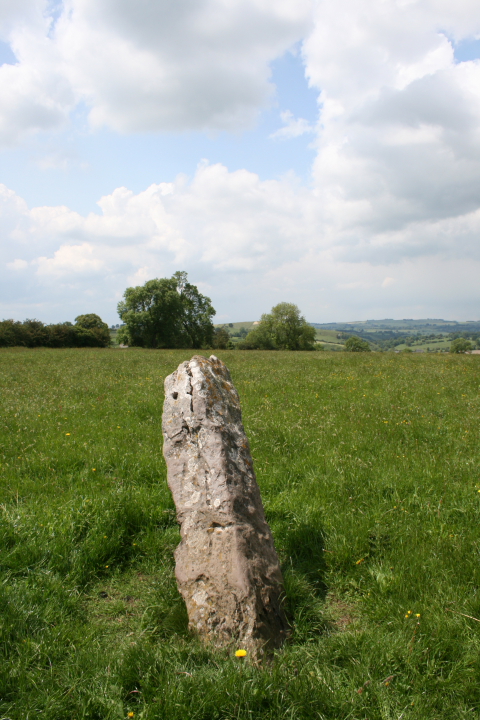
Situated close to the road,at the junction of the B5035 and the small road heading north to Brassington.Overlooking Carsington water the stone is about 6ft high but without it's bad lean would be considerably taller,the stone has a number of markings a small cross and a number of probably natural cupmarks.
A good stone with a good view to the west
In A.E & E.M Dodds' excellent book 'Peakland Roads and Trackways' they mention the stone as marking a change in direction along the Saxon track called the Old Portway.
The Kings Chair outcrop on the NE horizon pointing where to head next.
I've read elsewhere that the small cross may have been an attempt to christianise an ancient pagan stone...Although on the other hand the cross may indicate the stone's close proximity to the parish boundary and was included in the Rogationtide perambulations as elsewhere in the Peak.

 Posted by postman