Skip to content
Julian Cope
presents
The Modern
Antiquarian
Latest
Posts
Sites
Map
Blog
Forum
search
Search
⚠️
Sign in
more_horiz
Eire
County Tipperary
Knockcurraghbola Crowlands
Knockcurraghbola Crowlands (central)
Wedge Tomb
R941595
expand_more
Nearest town:
Borrisoleigh (11km NE)
OS reference:
R941595
OS sheet:
66
Latitude:
52° 41' 12.14 N
Longitude:
8° 5' 14.13 W
Added to TMA by
FourWinds
Images (2)
Topics (1)
Add
content
Images
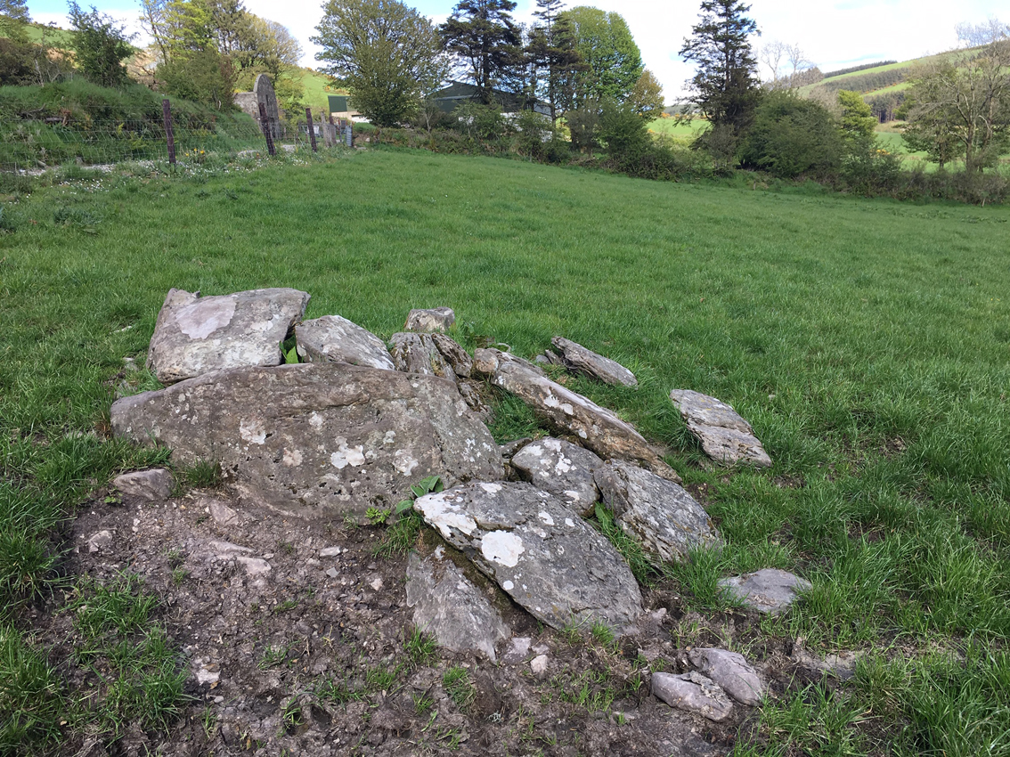
I’m surprised that these remains have survived.
Image credit: ryaner
ryaner
May 17, 2019
Sad remains of this tomb.
Image credit: ryaner
ryaner
May 17, 2019
Topics
This one isn't on the OS map is it?
3
bawn79
Aug 2006
Sites within 20km of
Knockcurraghbola Crowlands (central)
Knockcurraghbola Crowlands (west)
Wedge Tomb
•
0.1km WSW
photo
7
description
1
Knockcurraghbola Crowlands
Standing Stone / Menhir
•
0.22km E
photo
1
Knockcurraghbola Crowlands (east)
Wedge Tomb
•
0.28km ESE
photo
1
description
1
Knockcurraghbola Crowlands standing stone
Standing Stone / Menhir
•
0.4km ENE
photo
2
description
1
Graniera
Standing Stones
•
1.3km E
photo
2
description
1
Knockmaroe
Wedge Tomb
•
1.52km W
photo
2
description
1
Knockcurraghbola Commons
Wedge Tomb
•
1.86km NE
photo
20
description
2
Shevry
Standing Stones
•
2.69km ENE
photo
7
description
1
Shevry
Artificial Mound
•
2.7km ENE
photo
1
Knocknabansha
Wedge Tomb
•
2.92km W
photo
4
description
1
Reisk
Standing Stone / Menhir
•
2.94km W
description
1
Toorfiba
Standing Stone / Menhir
•
3.3km NNE
photo
2
description
1
Loughbrack
Wedge Tomb
•
3.4km WSW
photo
10
description
1
Cooga
Standing Stone / Menhir
•
3.84km ENE
photo
1
description
1
Cooga
Round Barrow(s)
•
3.84km ENE
photo
2
description
2
Glastrigan
Stone Row / Alignment
•
3.96km N
photo
12
description
1
Blackstairs
Standing Stone / Menhir
•
4.87km SSW
photo
2
description
1
Blackstairs
Cup Marked Stone
•
4.87km SSW
photo
3
description
1
Garracummer
Ring Cairn
•
5.72km SW
photo
7
description
1
Aughsullish NW
Wedge Tomb
•
6.59km WSW
photo
1
Knockshanbrittas (A)
Wedge Tomb
•
6.59km WSW
photo
6
Aughsullish SW
Wedge Tomb
•
6.71km WSW
photo
5
description
1
Glencarbry
Cairn(s)
•
7km SSE
description
1
Mauherslieve
Cairn(s)
•
7.09km W
photo
5
description
2
Mauherslieve
Sacred Hill
•
7.09km W
description
1
Goulmore
Standing Stones
•
7.99km W
photo
3
description
1
Foilycleara
Wedge Tomb
•
8.2km WSW
photo
2
description
1
Cureeny Commons
Wedge Tomb
•
8.29km WNW
photo
16
forum
1
description
1
Cooneen
Kerbed Cairn
•
8.4km NW
photo
2
description
1
Foilnamuck
Standing Stone / Menhir
•
8.72km NW
photo
4
description
1
Foilaclug
Wedge Tomb
•
9.07km SSW
photo
2
description
1
Baurnadomeeny
Cairn(s)
•
9.32km W
photo
2
description
2
Pallas Upper
Bullaun Stone
•
9.35km ENE
photo
3
description
1
Baurnadomeeny
Wedge Tomb
•
9.38km W
photo
36
forum
2
description
2
Foilnamuck
Wedge Tomb
•
9.38km NW
photo
9
forum
1
description
1
Baurnadomeeny
Standing Stone / Menhir
•
9.5km W
photo
5
description
1
Cooneen
Cairn(s)
•
9.57km NW
photo
7
description
1
Shanballyedmond
Court Tomb
•
9.89km WSW
photo
17
Reardnogy More
10.38km W
photo
2
description
1
Ballinacurra
Cairn(s)
•
10.41km NNW
description
1
Gortnageragh
Cairn(s)
•
11.02km SW
photo
1
description
1
Lackanagoneeny
Stone Row / Alignment
•
11.98km WSW
photo
2
description
2
Garrangrena Lower
Hillfort
•
12.35km NE
photo
1
description
1
Bauraglanna
Stone Circle
•
13.51km WNW
photo
6
description
3
Knockanora
Cairn(s)
•
13.56km NNE
photo
3
description
1
Cahernahallia
Artificial Mound
•
13.95km SW
photo
1
link
1
Cahernahallia
Bullaun Stone
•
13.95km SW
photo
1
Kilmoylan Upper
Standing Stone / Menhir
•
14.33km SW
photo
2
description
1
Ballinlough
Round Barrow(s)
•
16.04km NNE
photo
1
Ballinlough
Standing Stone / Menhir
•
16.04km NNE
photo
2
Ardmayle
Artificial Mound
•
17.63km ESE
photo
4
description
2
Donaskeagh
Standing Stone / Menhir
•
18.71km SSE
photo
1
description
1
Killawardy
18.92km NE
photo
2
description
1
Devilsbit Mountain
Christianised Site
•
18.92km NE
photo
3
forum
1
description
2
link
1
Garranbane
Wedge Tomb
•
19.25km WSW
photo
2
description
2
link
1
Clonalough
Standing Stone / Menhir
•
19.26km W
photo
1
description
1
Scraggeen
Standing Stones
•
19.33km WSW
photo
1
description
1
Knockalton Lower
Standing Stone / Menhir
•
19.62km NNW
photo
1
forum
2
Ballinree
Standing Stone / Menhir
•
19.98km ESE
photo
2
description
1
Ballinree
Artificial Mound
•
19.98km ESE
photo
1
description
1
Tuogh
Bullaun Stone
•
19.98km WSW
search
I’m looking for…
location_on
photo
ondemand_video
forum
description
link