From ‘The Pictorial History of England’ by Craik and MacFarlane (1846).
From ‘The Pictorial History of England’ by Craik and MacFarlane (1846).

Winter light on British Camp (far left skyline) and Midsummer Hill (right of centre skyline) hillforts, seen from Frith Hill a few miles to the west, below Bradlow Knoll.

Looking towards British Camp, right of centre, from Pinnacle Hill to the north. The prehistoric Shire Ditch stretches away from the viewpoint.

Islands in the clouds.

The view west from the motte.

Looking east. Only Bredon Hill on the left breaks the surface of the cloud.

Looking west towards the dark line of the Black Mountains on the horizon, floating above the temperature inversion.

The central part of the fort from the Millennium Hill section.

Looking south along the lower western ramparts. To the south, a temperature inversion fills the low ground all the way to Forest of Dean, only May Hill rising above it all.

21.3.2021 The uppermost ditch curves arrow like towards the equinox sunrise, were it to happen.

The upper ditch round the Motte

Looking south to the Millenium hill part of the fort.

Mint Choc ripple

I’ve been trying to get here for years, used the equinox as my eventual excuse.

The south end entrance looking east towards the tired equinox sun.

Holy breakthrough Batman is that the sun?

A fort truly staggering in scope and breadth. Probably.


The massively sculpted north end of the fort.

Rather moody skies over British Camp, from Pinnacle Hill.

Thunder rumbles and the storm breaks over Worcester. Nice and dry here though.

Looking northwest. The Clee Hills in Shropshire are the next big upland area, on the distant skyline. To the left is where I grew up in Herefordshire.

The southern annexe, with visitors showing off the enormous scale.


Looking into Worcestershire, over British Camp Reservoir.
One the western flank of the southern annexe, looking north.

Looking along the western flank of the northern extension towards the original central section of the hillfort.

The Malverns, with British Camp the centrepiece, dominate the western skyline of the Vale of Severn for huge distances around. Seen from Wistley Hill above Cheltenham, some 20 miles away.

27/03/2015 – British Camp

27/03/2015 – British Camp

First rate hillfort this.

Eastern ramparts.

The original fort seen from the southern extension.

The southern extension.

The northern annexe. The ridge of the Malverns stretches away into the haze.

The central, original part of the fort, seen from the northern extension.

Long zoom from another hillfort, Leckhampton Hill 20 miles to the SE.

View of British Camp from neighbouring Pinnacle Hill.
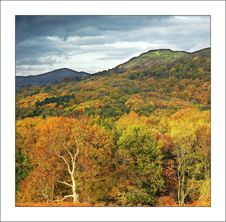
Autumn around Herefordshire Beacon

Looking approx west........

From the north.

Part of the bank and ditch, cut into the iron-hard igneous rock of the Malverns.

Looking south from The Citadel to the southern ramparts.

The central earthwork, seen from the southern ramparts.

Early morning sun catches the defences of British Camp. The view is to Worcestershire Beacon and the northern Malvern Hills with the Severn Plain on the right.

Looking Southwards over the earthwork at sunrise.

A telescopic view of the northern slopes of the Beacon, looking South from The Chase.
Note human figures walking to and from the summit, lending some idea of the gigantic scale of the earthwork.

British Camp’s defences rise behind the roofs of the neighbouring village of Colwall.

Early morning looking southwards (viewed from Pinnacle Hill). The distinctive clump of trees on May Hill are visible in the distance

Photoshopped image looking north from the Camp toward the Worcestershire Beacon with the fort itself on the left.

British Camp viewed from Marl Bank on the eastern side of the Malverns.

South-East bank and ditch, giving some impression of the still-impressive scale.

View NW towards South Shropshire from the Western slopes of British Camp. Titterstone Clee and Brown Clee are visible on the horizon.

The (between 1000 and 2000) original inhabitants of British Camp would have been sorely tested in the winter. It is conjectured that they lived in the surrounding valleys during these cold months.

View towards the mid-Malverns from British Camp. Note Shire Ditch running centrally along the facing hilltops.

British Camp at sunset. Malvern Chase. November 2005.

The ditches and banks of the hill fort harbour frost in the early morning November mists.

It’s difficult to give an idea of the scale of the place*. This zoom view (taken from the western slopes of Pinnacle Hill) gives an idea of the once awesome task to construct the defences. Now we have concrete steps to the summit.
*Note human figure.

View North towards the visible defences of British Camp. Taken from Midsummer Hill.

View from British Camp looking Southwards over Millenium Hill. The old defences juxtapose eerily with the light pollution from Tewkesbury and Gloucester on the horizon. Moonlight 11/11/04. 11:39pm.

The summit by moonlight. 11:31 pm – 11/11/05.

NE slope and ditches. June 21st 2005 sunrise.

21st June 2005, Solstice sunrise facing North.

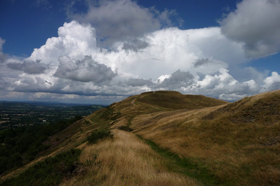
South West view of banks and ditches with walkers for scale. The entire fort is one gigantic sculpted wonder that encompasses two large hill tops and one smaller one.

Study of contours and scale. Note human figures at top left.

Early evening, looking north from southern ramparts.
How the powers of avarice move unseen . . . hadn’t realised that the British Camp had been under threat from the Coca-Cola conglomerate; happily the Environment Agency and English Nature have prevented them from destoying the Malverns (so far). Interestingly, they were attempting to use a Celtic well for extended production . . . more at:
avantgo.thetimes.co.uk/services/avantgo/article/0,,1419014,00.html
Visited 5.8.2017.
Three and a bit years on since my last visit, which was a claggy Easter day with visibility truncated by hazy mistiness. No such problems today, a rolling front of thunder has pushed its way up from the Black Mountains across Herefordshire, and the skies are clear and views are long in its wake.
No plan, just an entirely spontaneous diversion, jumping off a train at Hereford and catching a bus at Ledbury to emerge at the foot of the hill as the rain carries on to soak Worcester.
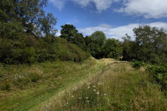
I decide to follow the lower rampart round the west side of the fort, which gives a great view of the ranks of earthworks climbing the flanks of the hillside, as well as beautiful unfolding panorama of Herefordshire. When I first came here in 2009, I hadn’t explored the Black Mountains, or Radnor Forest, and my memories of the Clee Hills were from my childhood. All of these are in clear view today, as well as the Cotswolds escarpment to the southeast, Bredon Hill to the east and the ridiculously ubiquitous May Hill to the south. Three English counties and quite a bit of Wales to admire then.
In the years since that first visit I have come to recognise these distant hills, and the Malverns ridge is the common landmark visible from where I grew up and where I live now. The fort itself overawed me when I first came, and this third visit does nothing to diminish the impression of what must be one of the finest hillforts in these islands. The presence of other visitors, tiny specks against the serried rows of banks and ditches, serves only to enhance the sense of wonder.
I spend an hour walking the perimeter and up to the top, before reluctantly deciding to continue my broken journey. The thunderheads have broken over Worcester, and magnificent rainbows over Bredon and Cleeve Hill will follow later. Sometimes England is really very lovely.
27/03/2015 – I drove down to Cornwall a few years back and remember looking across from the M5 and thinking the Malvern Hills looked a great place to visit. Finally made the trip on our little grand tour last week.
British Camp is such a famous site, it was great to get a chance to walk the ramparts. Luckily the weather was good and the views from the hill are very good. The hillfort is amazing, one of my favourites, I think. Would love to have spent more time there but Worcestershire Beacon and St Ann’s Well Cafe were calling. Time ain’t my friend sometimes.
Visited 14.2.14
After spending an enjoyable (if wet) afternoon in Great Malvern (Valentine treat!) it was time to head home but not before (of course) taking the opportunity of visiting a prehistoric site.
On this occasion it was time to visit the famous British Camp – last stand (possibly) of the even more famous Caradoc / Caractacus.
There is a handy car park (Pay and Display with information boards) on the A4104 and concrete paths running right up to the top of the Hillfort. The steeper sections are stepped.
The site is sign posted.
I made my way up alone as Karen has decided it was much more sensible to stay in the car. Luckily the rain had stopped although it was still quite windy. Despite the less than ideal weather you could still see for miles. On a good day the views must be fantastic. Flooded fields were easily seen in the distance. On a day like today it was not surprising to find that we were the only car parked in the car park and I was the only one visiting the Hillfort.
I knew I wouldn’t have time to walk around the full circumference of the site so decided I would make my way to the highest point and view the surroundings from there.
The Hillfort’s defences are certainly impressive – some of the best I have seen. The information stone on the way up states that this is one of the best preserved Hillforts in the country – I wouldn’t disagree. The outer ramparts are several metres high and the inner ramparts even higher and pronounced, although this may have been due to the later medieval ‘modifications’?
So far so good. It then all started to go horribly wrong!
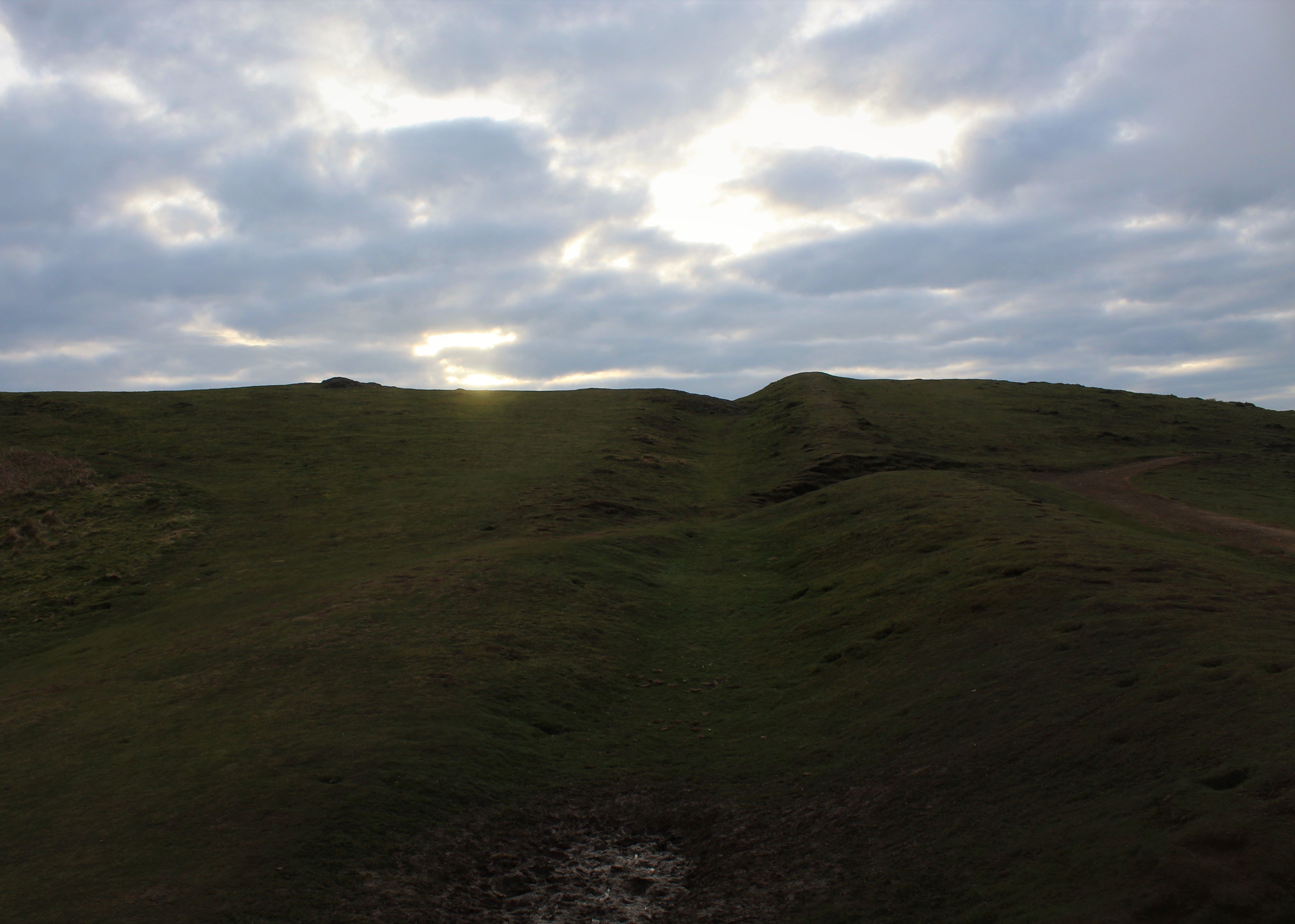
As I got about three quarters of the way up I was engulfed in mist/cloud and the visibility dropped to about 20 metres. Not only that but the wind increased to near gale force and to add insult to injury, it started to hail. It was difficult to stand and it felt like I was being sand-blasted by the hail. I nearly turned around but decided to push on to the summit. The higher I went the worse it got. The temperature dropped and I could feel my lungs getting colder, Due to the coldness and strength of the wind I was finding it quite difficult to breath. I thought I was going to have a heart attack!
I finally reached the top but could see little. I am sure that on a nice day the British Camp is somewhere you could easily spend several hours (paths also run around the top of the ramparts) but certainly not today. I quickly turned around and made my way back down the hill to the safety of the car. As on the way up, when I reached the lower outer defences, the wind eased and I was once again out of the cloud/mist. The hail stopped and I could again see for many miles.
When I arrived back at the car Karen looked at my wind-battered expression with a mixture of alarm and amusement.
‘Weather not so good up there then?’ she enquired
‘You wouldn’t believe what it was like!’ I gasped.
All in all the British Camp is an easy and great place to visit.
Just try to make sure you visit on a nice day!
Got off the train at Colwall (4.7.09) had a quick look at Colwall Stone – humph.
This amazing hilltop towers above the village. When I first saw it from the station, I must admit to being rather overawed.
After a fair walk south, coming up on to the Malverns at Hangmans Hill and approaching along Shire Ditch, this is a terrific structure. Certainly one of the most impressive hillforts I have visited. It stands, devoid of any covering vegetation (except grass) with amazing views in all directions, only the continuing ridge of the Malverns to the north being any match in height. It was a warm sunny day, but this must be a cold, exposed place in the winter months.
The original site was the central core of the fort as it is today, which has been further altered by having a motte built on it (sometimes referred to as “The Citadel”). The ramparts to the south and off at an angle to the north-east were added later to increase the interior area to about 12 hectares. That such a vast structure was constructed using primitive picks and moving the earth by hand is staggering. The rock of the Malverns is an iron-hard, igneous type, which would present a challenge even to modern digging equipment.
An interesting cave sits slightly to the south of the fort, supposedly the cave lived in by the giant associated with Colwall Stone. Just as the stone is not that impressive, he must have been a pretty small giant to live in this cave!
The British Camp has to be one of the first ancient monuments I can remember being taken to see as a child. I have very clear memories of playing with my sister on the side of the ramparts on a hot summer’s day, and can still visualise rolling down the grassy slopes. I think I was pretending to be a medieval archer, as my brain wasn’t able to compute anything much before the 13thC BCE timewise. I do remember feeling that it was an utterly awesome place, and very special. I believe I was about 14 yrs old, and hadn’t yet become obsessed with things megalithic.
I recall wondering why the British camped there when they had the whole of the country to camp in, and wondered how long ago they camped in the place, in what sort of tents, and why would they camp on something with so many banks? Seriously. I was an odd child, but that won’t surprise readers of this site.
Nine years later, I returned for a nostalgic visit, and can well remember approaching the British Camp from the opposite end of the Malverns. I was deeply impressed with it’s size and construction. Through the haze of an August afternoon, in hills covered with banks of rosebay willowherb, the ramparts of this phenomenal fort shimmered into view, huge, impressive, daunting, and glorious at the same time. We didn’t quite make the fort itself on that occasion; but that view on an English summer’s day, with Elgar’s music in my mind (he lived in Great Malvern), will stay with me for the rest of my life.
I’m surprised it hasn’t been covered in fieldnotes before, so do take a day out to visit (probably mid-week, to avoid the crowds), as it is wonderful. Jane, it would be a definite subject for a painting!
The British Camp in The Malvern Hills is another one of our stunning ‘world hills’. The view from the top is absolutely awesome. I remember once having scrambled to the top with the kids in a blue sky, crisp, clear, autumn day and looking down onto Jet Fighters as they boomed over the fields below.
What would our ancestors have thought of that?
Anyway, not only Elgar tramped this hillside, but also JRR Tolkien. The following is an extract from the cover notes of a recording of Tolkien, written by George Sayer.
‘He and I tramped the Malvern Hills which he had often seen during his boyhood in Birmingham or from his brother’s house on the other side of the Severn River Valley. He lived the book as we walked, for instance, sometimes comparing parts of the hills with the White Mountains of Gondor’.
I wonder if they ever bumbed into each other, Elgar whistling away and Tolkien deep in his elvish thoughts.
This fort is one of the traditional sites of the last stand of Caractacus, ‘King of the Britons’, against the invading Romans. He was also known as Caradoc. Having regrettably lost the fight he was taken with his family to Rome – but apparently not to the unpleasant fate you might imagine for him: it seems the Emperor respected his reputation and spared him.
(Reader’s Digest ‘Folklore Myths and Legends of Britain’)
According to Liam Rogers’ article on the Malverns at
whitedragon.org.uk/articles/malverns.htm
there is a spring on the north of British Camp called Pewtress Spring*, and this is where William Langland fell asleep and received his inspiration for ‘Piers Plowman’ (must have been the soothing white noise). This is a long alliterative poem second only to Chaucer’s Canterbury Tales in medieval literature.
In the first of eleven visions the narrator, called The Dreamer, similarly resting by a stream, looks down at the people below the Malvern hills and instructs them to follow a pilgrimage towards salvation and truth.
You can read the first part of the poem at Representative Poetry Online
eir.library.utoronto.ca/rpo/display/poem1226.html
(*now the Primeswell spring where, disappointingly, the evil empire CocaCola bottles Malvern Water from? guardian.co.uk/uk_news/story/0,,1357991,00.html )
A 360 degree panorama from the beacon.