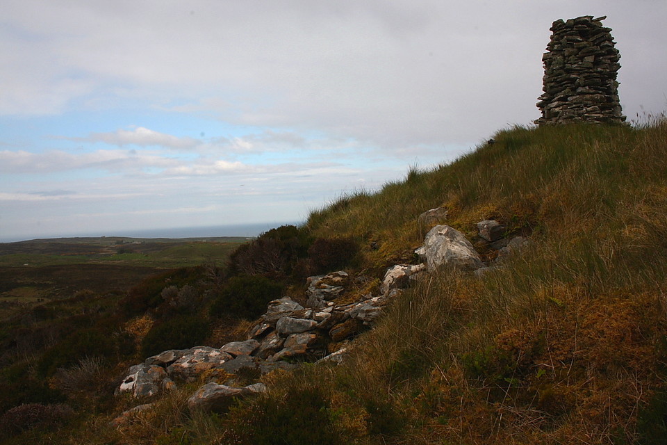
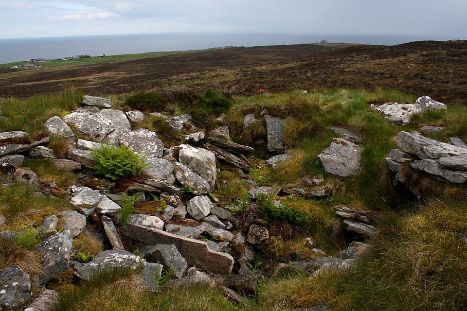
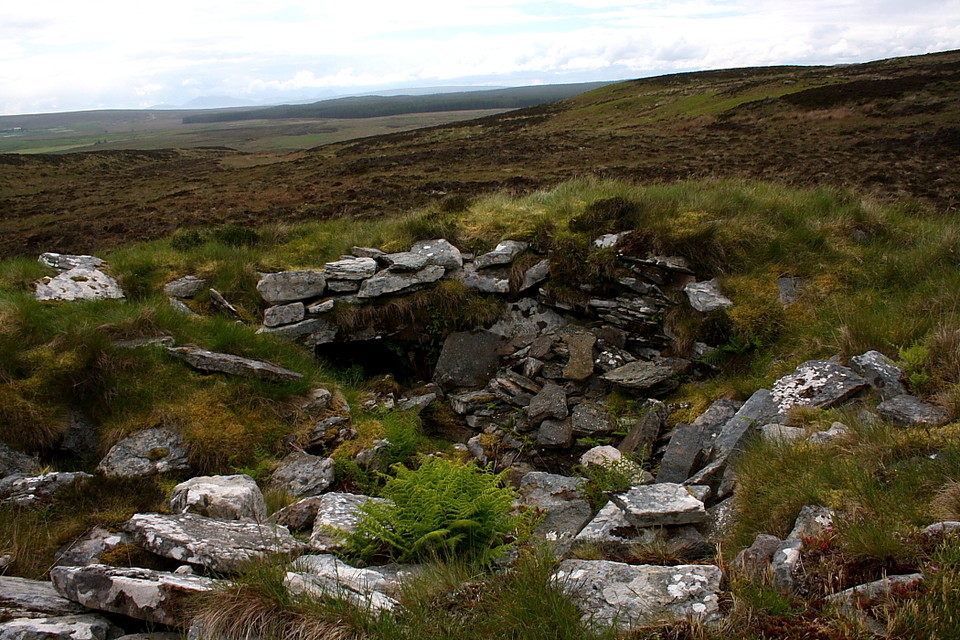
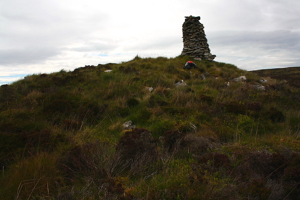
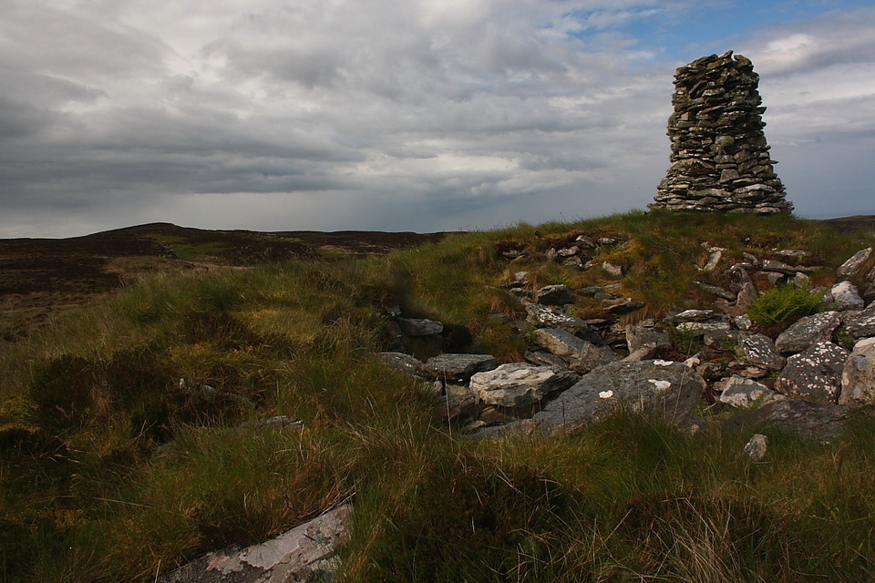
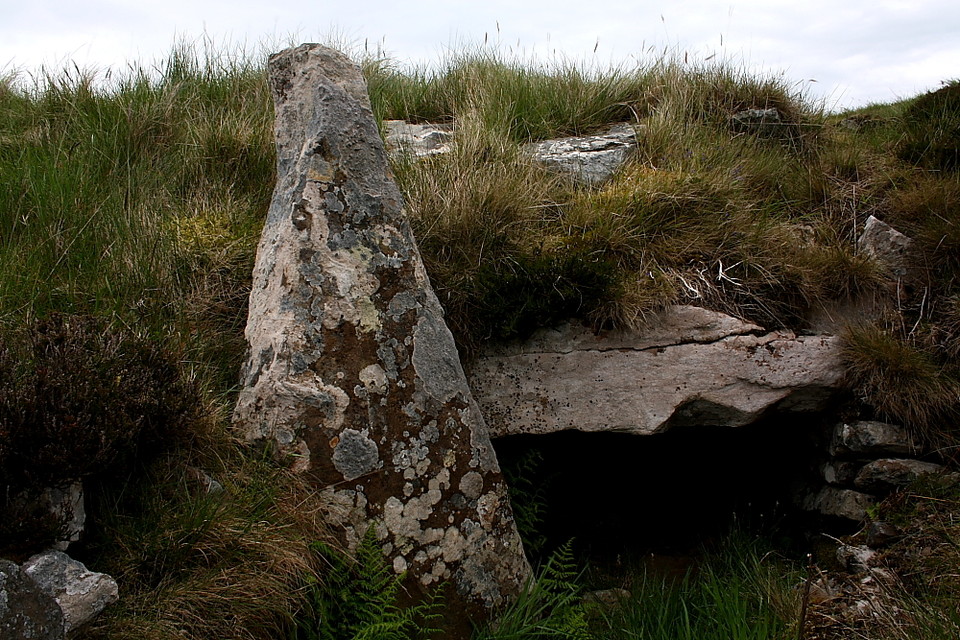
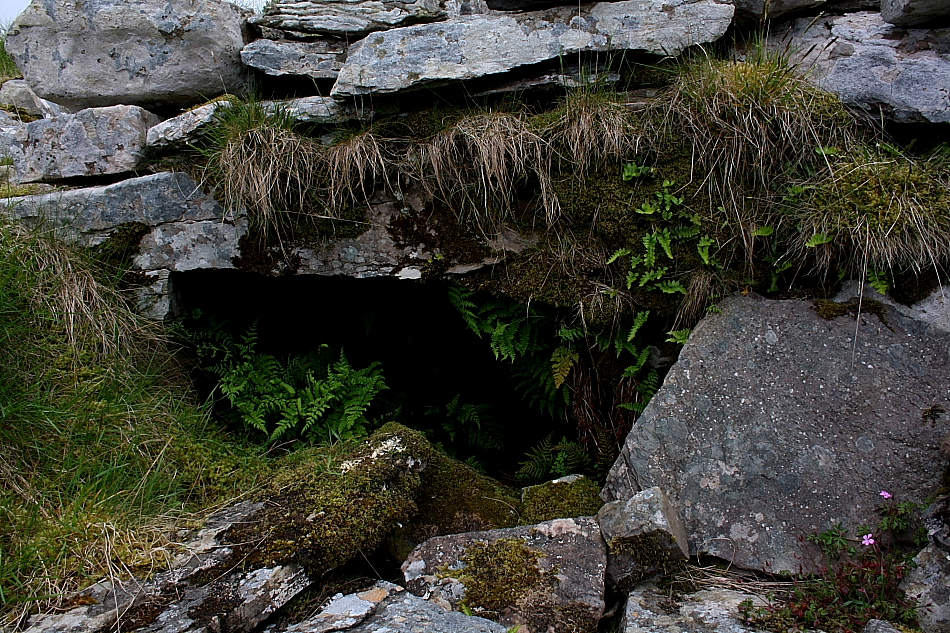
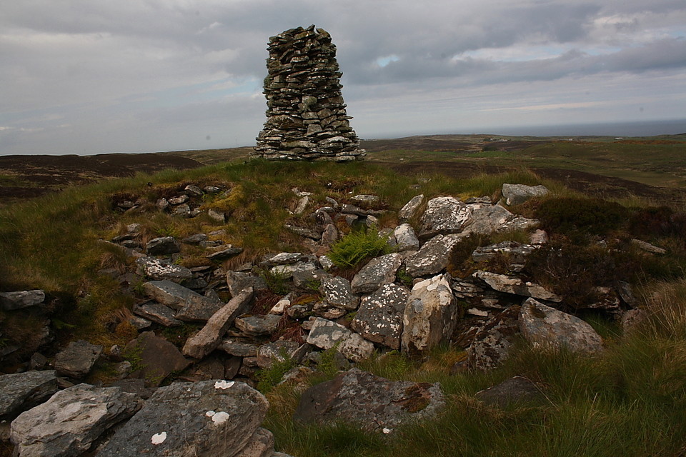
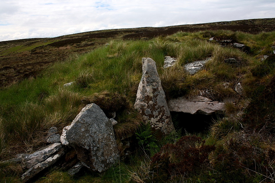
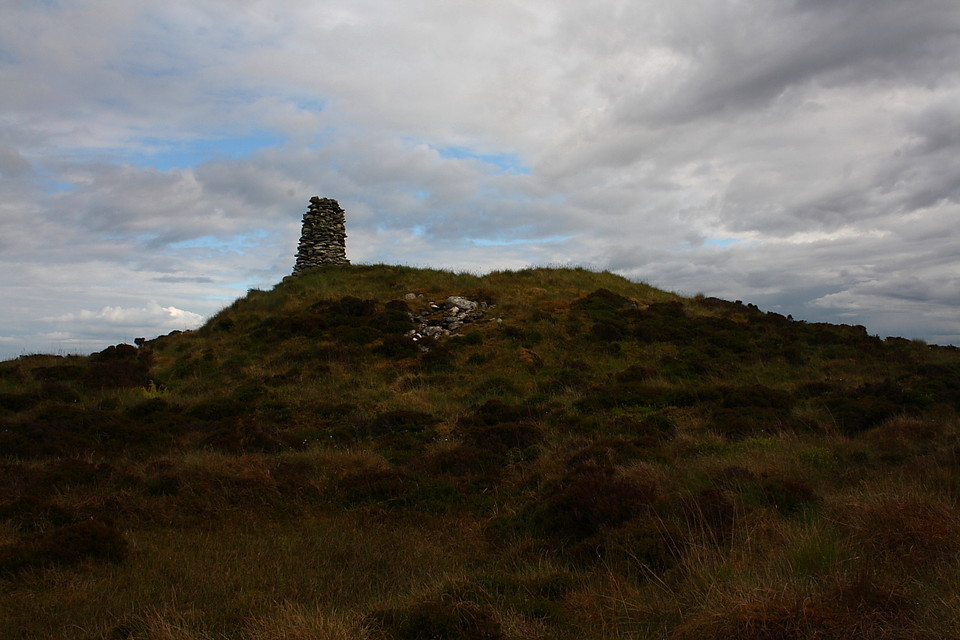
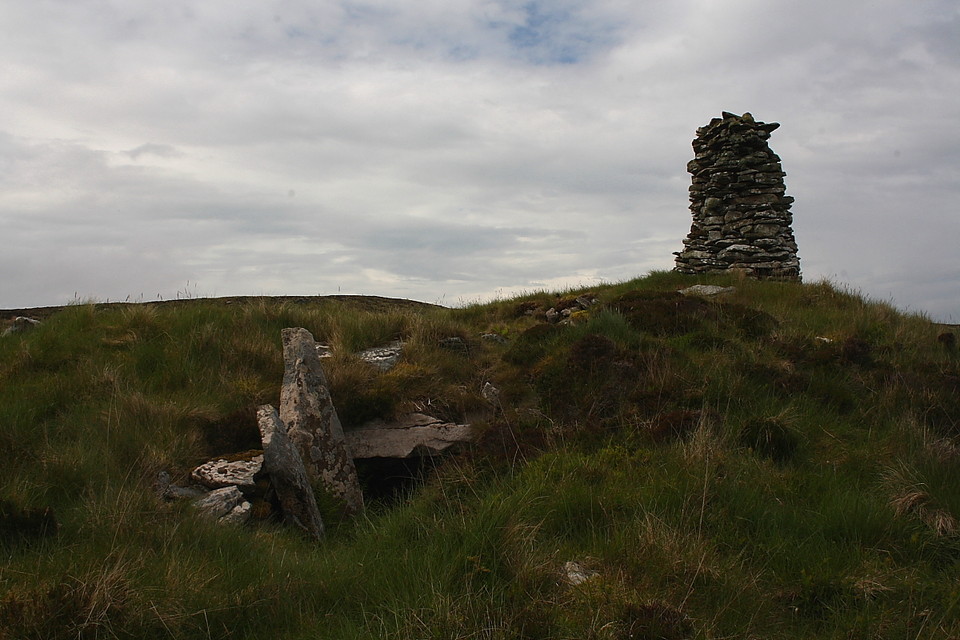
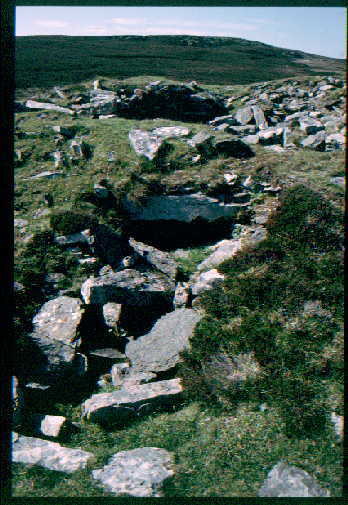
The Modern Antiquarian
Log in
|
Register
Home
Latest Posts
Forums
Maps
Help
Browse Sites
News
Blog
Contributors
The Books
Select
-
Belgium
Denmark
Eire
France
Germany
Greece
Italy
The Netherlands
Norway
Portugal
Republic of Malta
Spain
Sweden
Switzerland
United Kingdom
Scotland
Highland (Mainland)
Kenny's Cairn
Chambered Tomb
Kenny's Cairn (Cairn Hanach) (Chambered Tomb) on The Modern Antiquarian, the UK & Ireland's most popular megalithic community website. 13 images, 1 fieldnote, plus information on many more ancient sites nearby and across the UK & Ireland.
Image © Robert Gladstone
Also known as:
Cairn Hanach
Nearest Town:
Wick (11km NNE)
OS Ref (GB):
ND310408 /
Sheets: 11, 12
Latitude:
58° 21' 1.47" N
Longitude:
3° 10' 44.48" W
Added by
greywether
Images (13)
Fieldnotes (1)
0 discussions
Start a topic
Show |
Hide
Web searches for Kenny's Cairn
Flickr
Google
Google Images
MAGIC
The Megalithic Portal
Bing
Stone Pages
Streetmap.co.uk
Wikipedia
Show map
(inline Google Map)
- Sites within 20 km -
-
Garrywhin Stone Rows (0.42km NE) (5 posts)
Garrywhin (0.42km NE) (29 posts)
Garrywhin Cists (0.42km NE) (10 posts)
Garrywhin (0.63km NNE) (9 posts)
Watenan South (0.76km ENE) (7 posts)
Warehouse S (1.3km NW) (14 posts)
Bruan (1.31km S) (6 posts)
Warehouse N (1.48km NW) (8 posts)
Warehouse E (1.5km NNW) (10 posts)
South Yarrows S (2.37km NW) (16 posts)
South Yarrows Broch (2.6km NNW) (15 posts)
Loch of Yarrows Archaeological Trail (2.63km NNW) (1 post)
South Yarrows N (2.66km NW) (6 posts)
Hill O'Many Stanes (2.82km SW) (29 posts)
Borrowston (3.31km NE) (5 posts)
Thrumster Mains (4.72km NNE) (8 posts)
Gansclet (4.83km NE) (1 post)
Burn Of Swartigill (5.05km N) (3 posts)
Thrumster Little (5.68km NNE) (6 posts)
Camster Stone Row (5.81km W) (4 posts)
Grey Cairns of Camster (5.92km W) (81 posts)
Lower Camster (7.05km WNW) (9 posts)
Cirn of Humster (8.78km NE) (1 post)
Rumster (10.47km WSW) (3 posts)
Golsary (10.99km WSW) (5 posts)
Forse, Latheron (11.13km WSW) (6 posts)
Forse House (11.47km WSW) (1 post)
Forse House (11.92km WSW) (2 posts)
Wag of Forse (12.09km WSW) (9 posts)
Achkinloch (12.12km W) (11 posts)
The Great U of Stemster (12.19km W) (37 posts)
The Pap (12.47km NE) (1 post)
Loch Rangag (12.98km W) (13 posts)
Buldoo (13.1km WSW) (19 posts)
Elsay (13.49km NE) (3 posts)
Rangag West (13.88km W) (11 posts)
Ackergill Mains (14.08km NNE) (2 posts)
Guidebest (14.15km WSW) (15 posts)
Watten (15.04km NW) (7 posts)
Upper Latheron (15.61km WSW) (6 posts)
Knockinnon (16.57km WSW) (4 posts)
Houstry Broch (South) (16.64km WSW) (3 posts)
Minera (16.67km WSW) (6 posts)
Tiantulloch (16.74km WSW) (7 posts)
Burn of Houstry (17.37km WSW) (5 posts)
Cuag (17.4km WSW) (4 posts)
Buoldhu (17.57km WSW) (3 posts)
Tulach Mor (18.31km W) (12 posts)
Tormsdale Stone Rows (18.42km W) (1 post)
Dunbrae (18.58km WSW) (2 posts)
Dunbeath Broch (18.61km WSW) (15 posts)
Tulach Beag (18.72km W) (5 posts)
Ballone, Mybster (19.01km W) (5 posts)
Carn Liath (19.03km WSW) (13 posts)
Loedebest (19.04km WSW) (2 posts)
Loedebest Wood (19.27km WSW) (5 posts)
Cnoc Na Maranaich (19.31km WSW) (6 posts)
Cnoc Na Maranaich (19.33km WSW) (15 posts)
Balantrath (19.37km WSW) (4 posts)
Loedebest West (19.5km WSW) (8 posts)
- Add -
-
Add news
Add an image
Add fieldnotes
Add folklore
Add miscellaneous
Add a link
-
Add a site
Add a nearby facility
Add an alternative name/spelling
Images
(click to view fullsize)
Add an image
Fieldnotes
Add fieldnotes
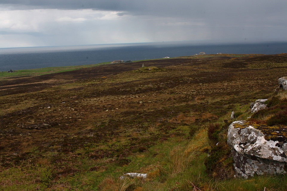
Can be reached from the Historic Scotland site of
Garrywhin
400m to the NE or by extending the
Loch of Yarrows Archaeological Trail
.
18m diameter round cairn with passage and chamber.
Comments (0)
|
Add a comment
|
Permalink
Posted by
greywether
10th December 2003ce