Skip to content
Julian Cope
presents
The Modern
Antiquarian
Latest
Posts
Sites
Map
Blog
Forum
search
Search
⚠️
Sign in
more_horiz
United Kingdom
England
Northern England
North Yorkshire
Reeth Strip Lynchets
Ancient Village / Settlement / Misc. Earthwork
SE019995
expand_more
Nearest town:
Richmond (15km ENE)
OS reference:
SE019995
OS sheet:
98
Latitude:
54° 23' 26.62 N
Longitude:
1° 58' 14.65 W
Added to TMA by
BrigantesNation
Images (3)
Add
content
Images
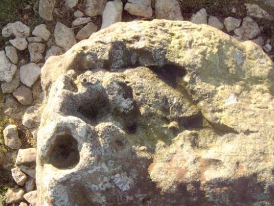
Image credit: BrigantesNation.com
B
BrigantesNation
Aug 17, 2003
Image credit: BrigantesNation.com
B
BrigantesNation
Aug 17, 2003
Image credit: BrigantesNation.com
B
BrigantesNation
Aug 17, 2003
Sites within 20km of
Reeth Strip Lynchets
Calverside Moor Neolithic Enclosure
Enclosure
•
0.41km NNE
link
1
Maiden Castle (Grinton)
Ancient Village / Settlement / Misc. Earthwork
•
1.36km SE
photo
19
forum
2
description
9
link
3
Castle, Nr Reeth
Enclosure
•
1.78km NE
photo
5
description
2
How Hill, Low Whita
Hillfort
•
2.08km WSW
photo
3
description
1
Grinton Round Barrow
Round Barrow(s)
•
2.23km E
photo
2
Harkerside Moor Circle
Stone Circle
•
2.48km ESE
photo
12
forum
1
description
4
Booze
Ancient Mine / Quarry
•
2.9km N
photo
3
description
1
Holgate
Cup and Ring Marks / Rock Art
•
6.71km NE
description
1
link
2
Cock Howe
Cup and Ring Marks / Rock Art
•
7.04km ENE
link
1
Frankinshaw Cairn
Cup Marked Stone
•
8.08km NE
photo
2
description
1
How Tallon
Stone Circle
•
8.36km NNE
photo
12
description
3
Osmonds Gill Cairn
Cup Marked Stone
•
8.64km NNE
photo
1
description
1
Thackwaite Beck
Stone Circle
•
8.81km SSW
description
1
Eel Hill
Cup and Ring Marks / Rock Art
•
8.88km NNE
photo
3
forum
1
description
3
Barningham Moor
Cup and Ring Marks / Rock Art
•
8.96km NNE
photo
28
forum
2
description
4
link
2
How Hill Swaledale
Hillfort
•
8.99km E
photo
1
Carperby
Stone Circle
•
9.54km SSW
photo
5
forum
1
description
2
link
1
Carperby B
Ring Cairn
•
9.63km SSW
photo
2
description
1
Osmonds Gill
Cup and Ring Marks / Rock Art
•
9.8km NE
photo
7
forum
1
description
2
Downholme
Carving
•
9.98km E
photo
2
description
1
Low Feldom Farm
Cup and Ring Marks / Rock Art
•
10.09km ENE
Stone Man
Round Barrow(s)
•
10.22km NE
description
1
Mudbeck
Stone Circle
•
10.44km WNW
photo
5
description
1
Mudbeck
Cup Marked Stone
•
10.44km WNW
photo
2
description
1
Gayles Moor
Cup and Ring Marks / Rock Art
•
11.85km NE
photo
25
description
2
link
2
Whitcliffe Scar
Ancient Village / Settlement / Misc. Earthwork
•
11.96km ENE
description
2
Castle Steads, Gayles
Hillfort
•
12.1km NE
photo
3
description
1
Castle Dykes, Wensleydale
Henge
•
12.73km SSW
photo
7
description
4
link
2
Aske Moor
Cup and Ring Marks / Rock Art
•
12.74km ENE
Aske Moor (Silver Hill)
Cup and Ring Marks / Rock Art
•
12.74km ENE
description
1
Bainbridge Camp
Hillfort
•
13.07km SW
photo
2
description
1
Dove Stones
Cup Marked Stone
•
13.1km SSW
description
1
Haw Beck Burnt Mounds
Burnt Mound / Fulacht Fia
•
13.1km SSW
photo
2
description
1
link
1
Burton Moor
Ancient Village / Settlement / Misc. Earthwork
•
13.43km SSE
photo
1
forum
1
link
1
Addlebrough
Cairn(s)
•
13.57km SW
photo
2
description
3
Devil’s Stone (Addlebrough)
Natural Rock Feature
•
13.7km SW
description
1
Bowes Barrows
Round Barrow(s)
•
14.18km NNW
description
1
Stony Raise (Addlebrough)
Cairn(s)
•
14.29km SSW
photo
2
description
4
link
1
The Ravensworth Stone
Cup and Ring Marks / Rock Art
•
14.75km ENE
photo
2
description
1
Castle Steads, Coverham
Hillfort
•
16.66km ESE
photo
2
link
1
Deepdale
Cup and Ring Marks / Rock Art
•
17.04km NNW
photo
6
forum
2
description
1
Flamstone Pin
Cairn(s)
•
17.05km ESE
description
1
Braithwaite Wood Hillfort
Hillfort
•
17.25km ESE
photo
3
description
1
link
1
Rey Cross
Stone Circle
•
17.44km WNW
photo
2
forum
1
description
4
link
1
Diana’s Well
Sacred Well
•
17.66km ESE
description
2
Gayle Camp
Enclosure
•
17.82km WSW
description
1
Loup’s Hill
Cup and Ring Marks / Rock Art
•
18.65km NW
photo
4
description
2
The Butter Stone
Standing Stone / Menhir
•
18.98km NNW
photo
3
description
3
Goldsborough Rigg
Cup and Ring Marks / Rock Art
•
19.26km NW
photo
8
description
2
Cotherstone Moor
Cup Marked Stone
•
19.46km NW
photo
4
description
2
search
I’m looking for…
location_on
photo
ondemand_video
forum
description
link