Towards Foel Drygarn across the site.

Towards Foel Drygarn across the site.

The huge block at the Coflein grid reference, referred to in the “misc” post. Presumably this is the Grey Stone of the Moor which gives the site its name.

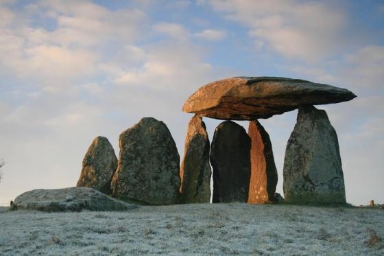
From this angle, there appears to be a curving bank of rubble, which the taller uprights fit into. Bottom of the shot is a slab set on edge which is very kerb-like. Although the triangular pointy stone looks as though it may be natural outcrop, that doesn’t preclude something like a ring cairn being built to incorporate it.

Looking northeast towards Foel Drygarn and Frenni Fawr. The pointy stone looks like a natural outcrop, but I couldn’t really make my mind up about the site as a whole.

The site viewed through zoom lens from on top of Foel Drygarn

Taken 15th April 2003: The site, looking south east towards the footpath that runs beside the forestry plantation.

Taken 15th April 2003: The stone, taken looking (approximately) north towards Foel Drygarn.

Taken 15th April 2003: On our way back from Bedd Arthur the sun had decided to show its face, so I took some more photos. This hot is taken from the north (or there abouts).
The big boulder in the distance, against the forestry plantation, is a good landmark when you’re trying to find the site because it’s right next to the footpath.

Taken 15th April 2003: On our way to Bedd Arthur I took this shot of the site from the north east. In the distance are some natural boulders, with Lou and the boys standing amongst them.
Visited 15th April 2003: When I visited this site I thought it was Carn Ferched, but now I’m more inclined to think it’s actually a standing stone called Maenllwyd y Rhos.
The site is relatively easy to find if you’re on the ridgeway path that runs along the Preseli range. There’s a large boulder by the footpath opposite the cairn, so if you’re not sure look out for this, then head north and you’ll get to it. It’s clearly visible from the footpath, so this technique should only be necessary in poor weather conditions.
I was surprised to find such large kerb stones in what I thought be a cairn, so I checked and double checked that I was in the right place. At the time I was suspicious of my own navigation because the Landranger map, which marks Carn Ferched, puts it further west than this site. I also had some grid references for Carn Ferched which I’d put in my GPS from Prehistoric Preseli by N.P. Figgis which didn’t match the site I was looking at.
It’s only a month later that I’ve realised that these stones are probably not Carn Ferched at all. My grid references exactly match a Cambria Archaeology record for Maenllwyd y Rhos (SN 15441 32906), which is listed as a possible standing stone. What little information I can find on Carn Ferched suggests it is a barrow like site, which certainly doesn’t describe the stones that I saw.
Whatever it actually is, I visited this site twice, once on the way to Bedd Arthur and once on our return. Same day, but very different light conditions. Well worth the tiny detour if you’re heading this way to Bedd Arthur, Carn Meini etc. Possibly a bit trickier to find coming from the direction of Moel Drygarn.
This is almost definitely a natural rock outcrop on the boundary between common heath and forestry. The site consists of a massive stone block, c.2m high x 3m wide x 3.5m long, originally recorded as a possible standing stone by the RCAHM in 1914, which lies in association with other outcropping rocks. Natural feature. N Cook PFRS 2004
Prehistoric Funerary & Ritual Sites Project Pembrokeshire 2003-2004 ( © DAT)


