The Modern Antiquarian. Stone Circles, Ancient Sites, Neolithic Monuments, Ancient Monuments, Prehistoric Sites, Megalithic MysteriesThe Modern Antiquarian


Craignarget Hill

Cairn(s)

<b>Craignarget Hill</b>Posted by markj99Image © Mark Johnstone
Also known as:
  • Craignarget

Nearest Town:Wigtown (17km ENE)
OS Ref (GB):   NX26365166 / Sheet: 82
Latitude:54° 49' 46.12" N
Longitude:   4° 42' 12.99" W

Added by markj99


Discussion Topics0 discussions
Start a topic


Show map   (inline Google Map)

Images (click to view fullsize)

Add an image Add an image
<b>Craignarget Hill</b>Posted by markj99 <b>Craignarget Hill</b>Posted by markj99 <b>Craignarget Hill</b>Posted by markj99 <b>Craignarget Hill</b>Posted by markj99 <b>Craignarget Hill</b>Posted by markj99 <b>Craignarget Hill</b>Posted by markj99 <b>Craignarget Hill</b>Posted by markj99 <b>Craignarget Hill</b>Posted by markj99 <b>Craignarget Hill</b>Posted by markj99 <b>Craignarget Hill</b>Posted by markj99

Fieldnotes

Add fieldnotes Add fieldnotes
Visited 02.04.23

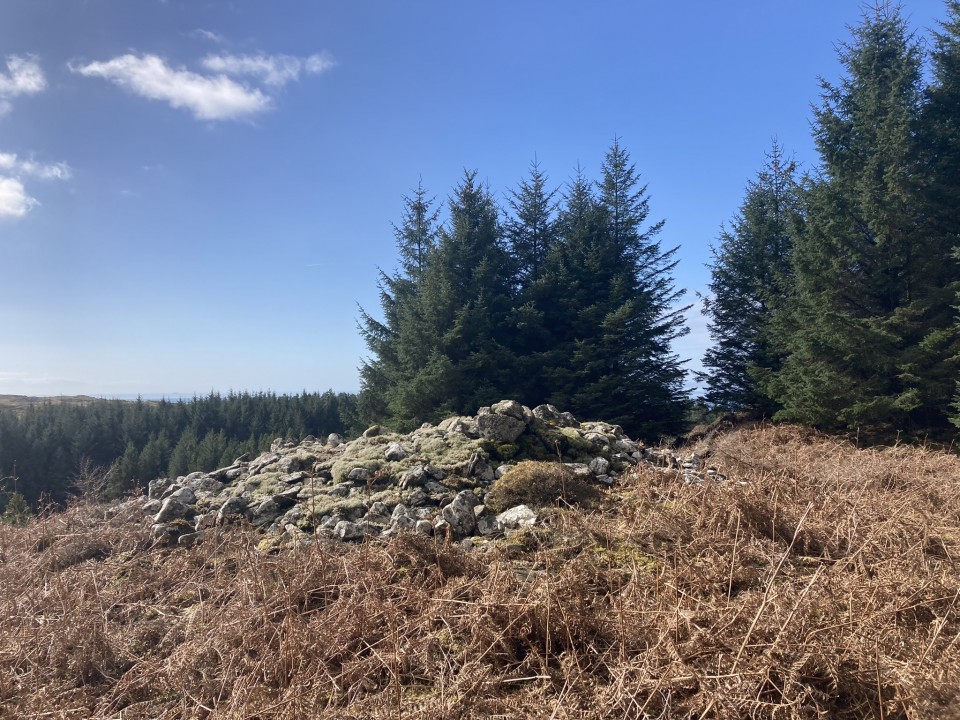
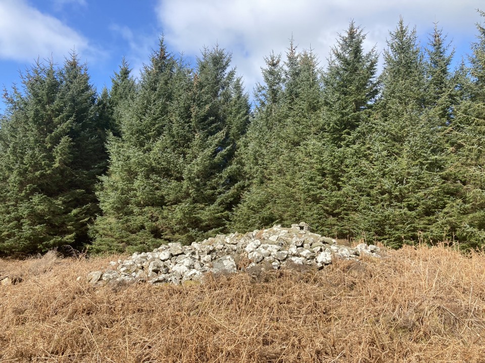
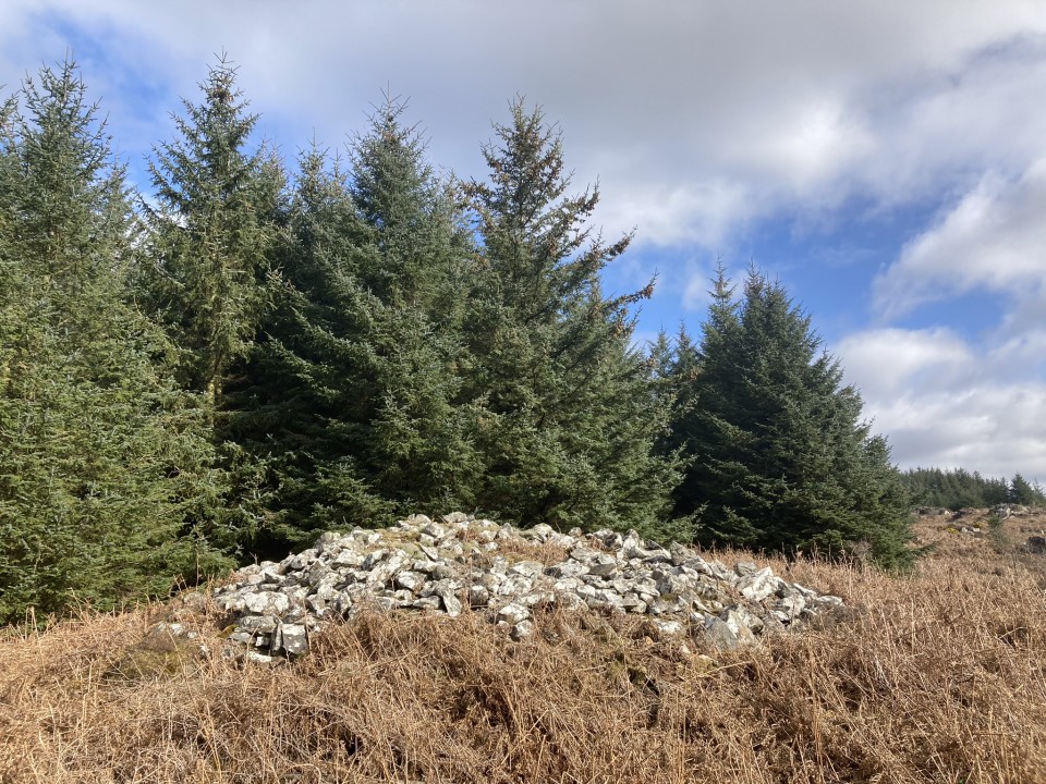
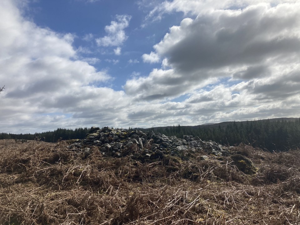
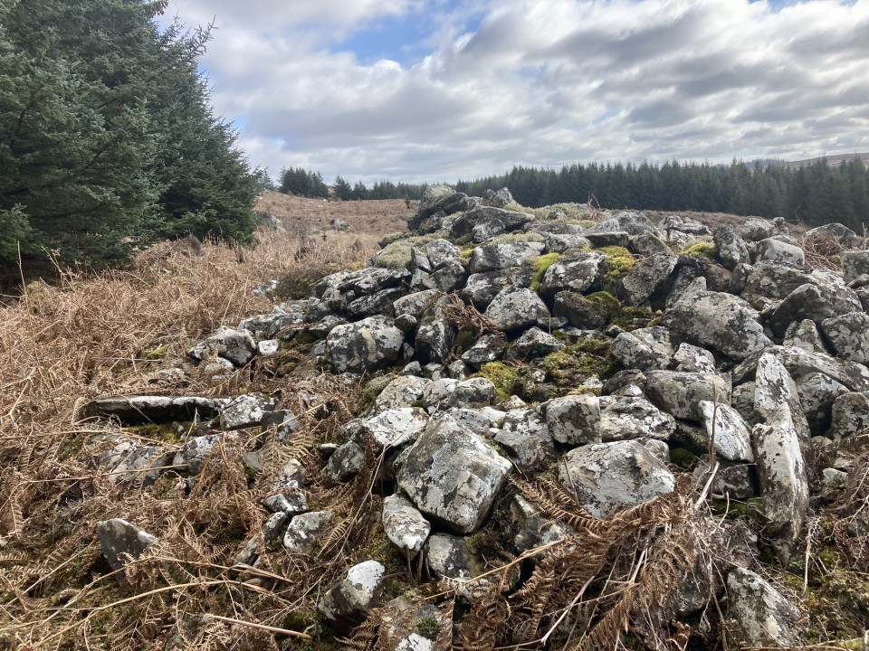
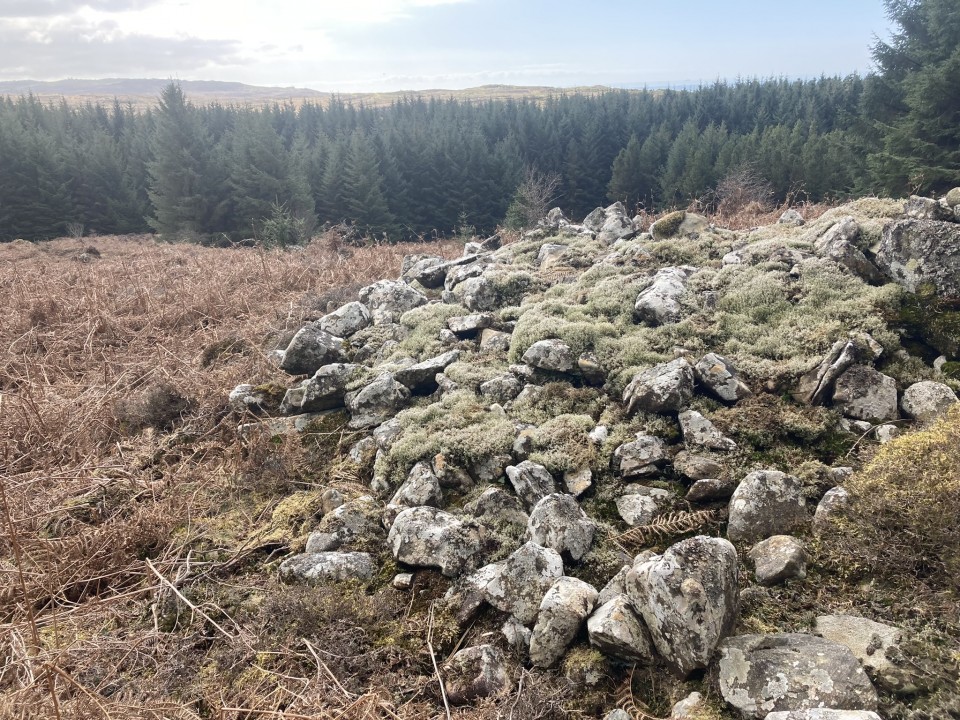
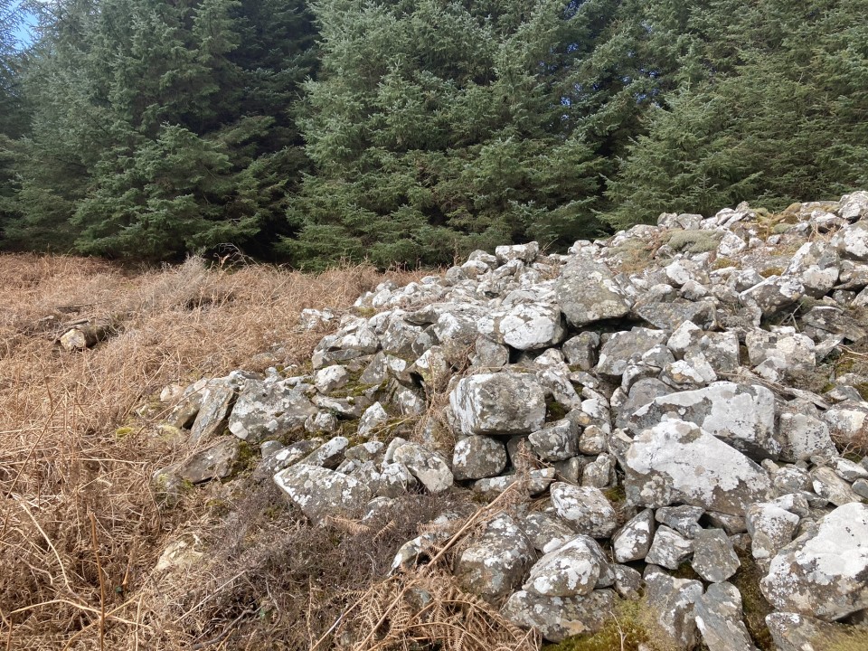
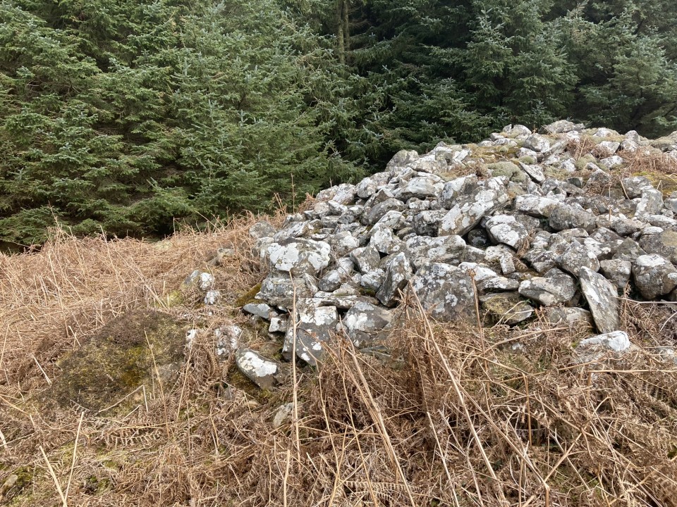
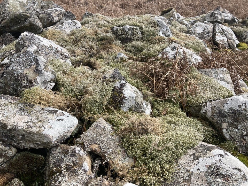
Craignarget Hill Cairn is a stony cairn on the S slope of Craignarget Hill c. 5 miles SE of Glenluce in Dumfries and Galloway It is situated 0.4 miles of the Rocks of the Garheugh (pronounced Garchy locally) on Luce Bay.
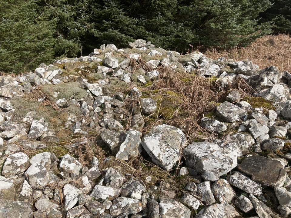
The cairn measures c. 10 yards in diameter reaching up to c. 5 feet high in the undisturbed N Arc. There is a carpet of moss on the N & E Arcs. The S half of the cairn has been extensively robbed leaving a hollow in the centre of the mound.
Canmore ID 62200 has further details of Craignarget Hill Cairn.
Posted by markj99
12th April 2023ce
Edited 12th April 2023ce